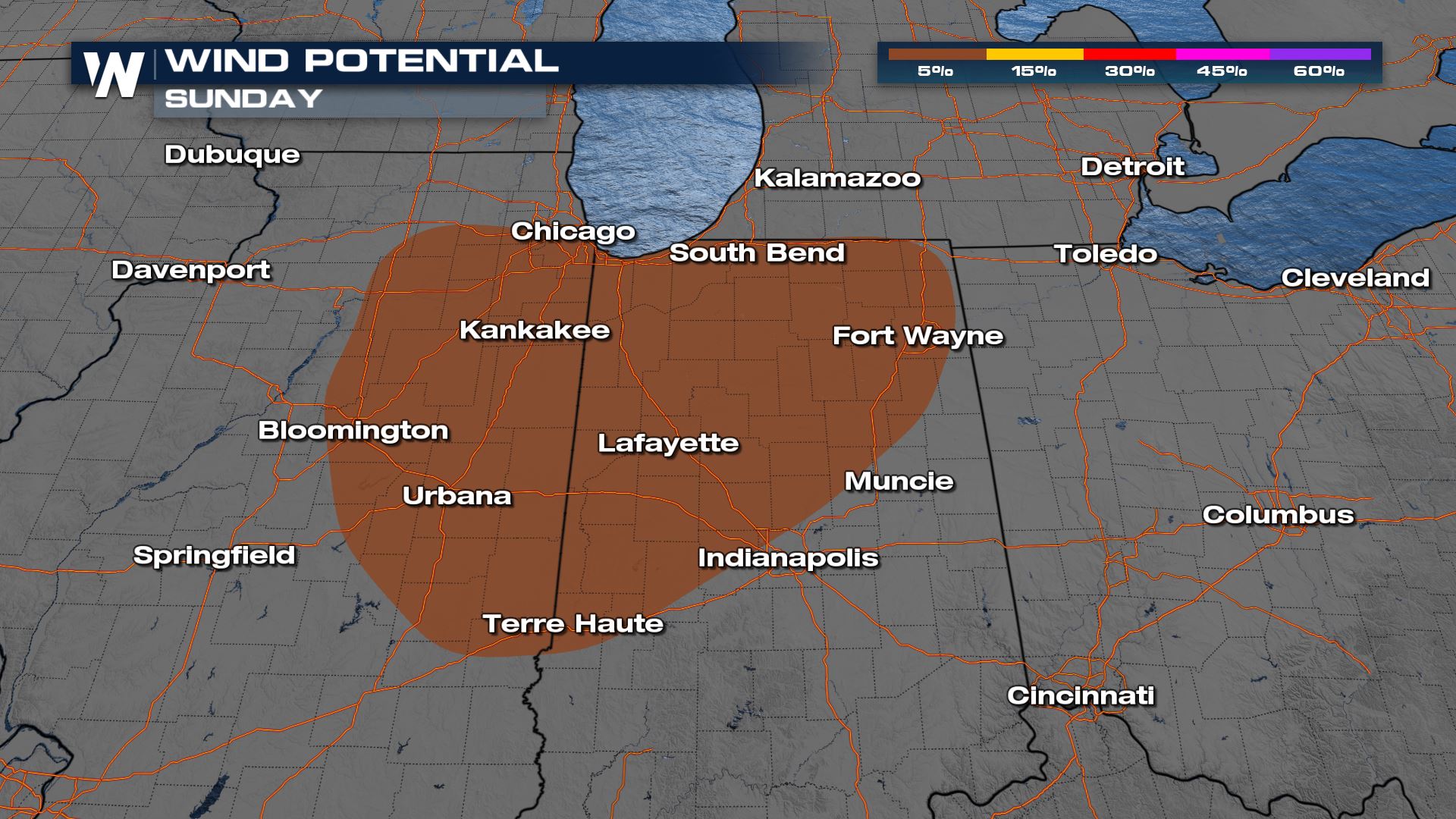
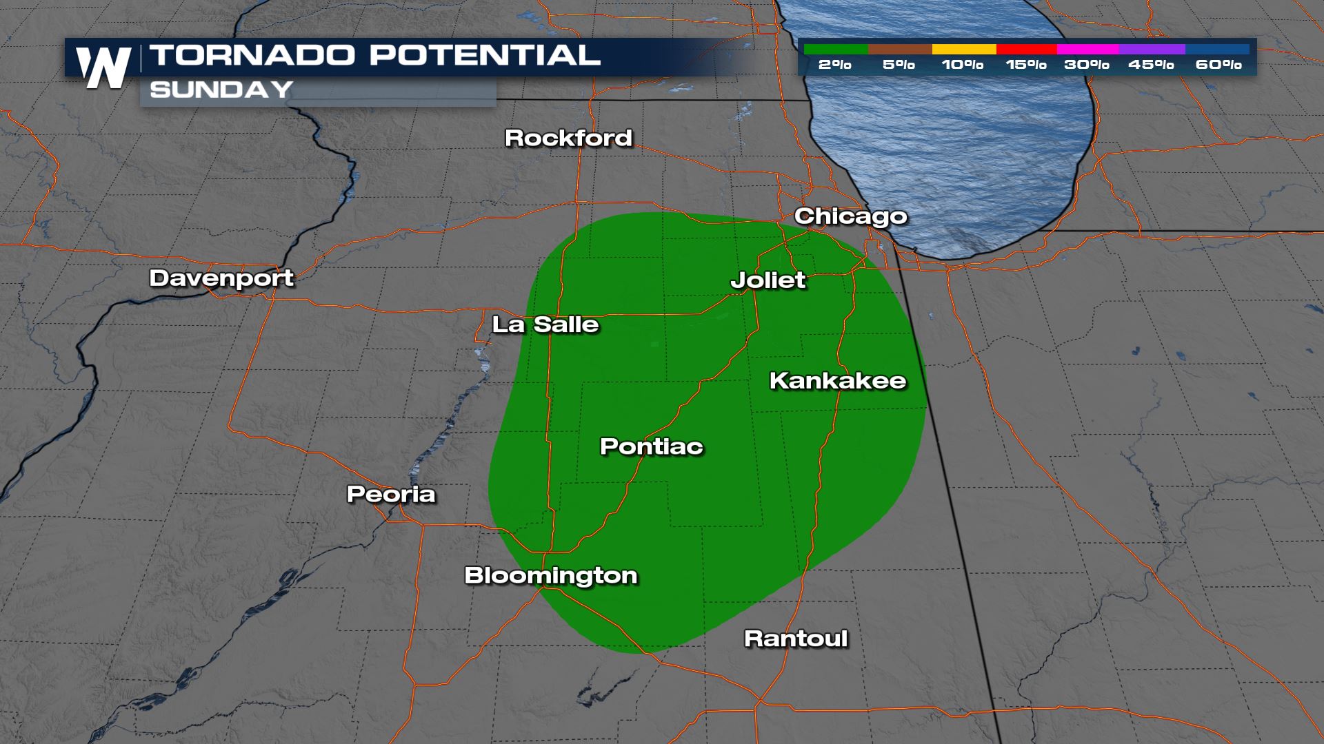
Strong Storms Target the Midwest Sunday
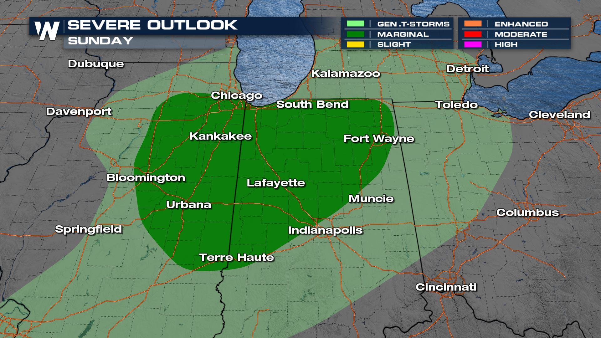
With the jet stream focused over the Midwest, the weather has been active across Illinois, Indiana, and Ohio. We have seen snowy conditions along with widespread severe weather. Wind reports in Pennsylvania and Ohio have been upwards of 60-70 mph on Saturday! Another quick-moving low-pressure system will help spark a few more storms Sunday through the Midwest. Damaging winds are our primary threat but we can't rule out an isolated tornado either.Another round of storms develops around an area cold front and low-pressure system, focused more into Indiana and Illinois with all modes of severe weather possible once again. Even if a storm does not reach severe criteria, heavy rain will still be a factor, along with gusty straight-line winds.
With multiple rounds of heavy rain expected, there is growing concern for flash flooding. As soils become more saturated, expect flash flooding to become possible around the Ohio River with 1-2 inches of rain. This additional rain, combined with already saturated soils, is what's prompting the elevated flood threat.
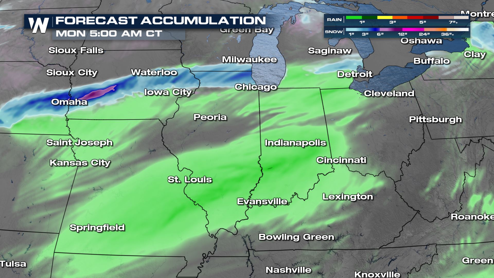
A Marginal (level 1 out of 4) risk of Excessive Rainfall has been added for areas of MO, IL, and IN.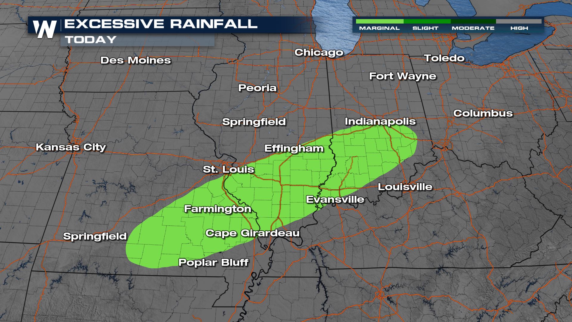
Stay with WeatherNation for the latest in the Severe and Rain forecast streaming 24/7.


