Strong Winds Creating Ground Blizzard in Montana
Special Stories
15 Feb 2018 7:47 PM
Strong winds have been creating widespread blowing and drifting snow in parts of northern and central Montana over the last 24 hours. Emergency travel only was advised earlier today, as many roads were closed due to white-out conditions and drifting snow.
https://twitter.com/NWSGreatFalls/status/964253340593991680
https://twitter.com/SteveLeitner2/status/964254735959146496
https://twitter.com/dennisbragg/status/963450316191485953
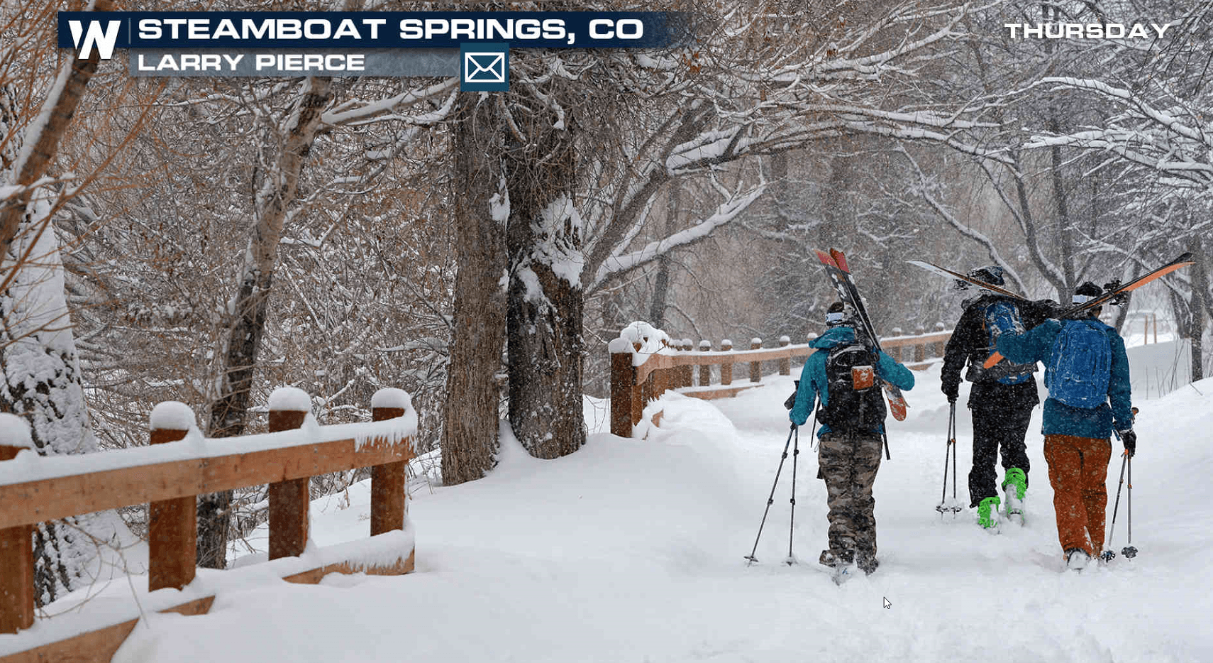
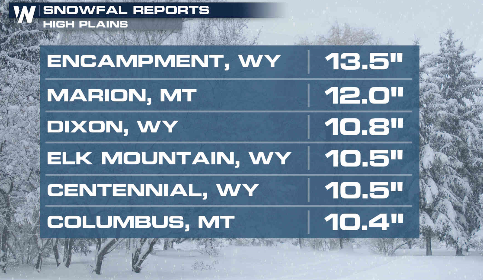
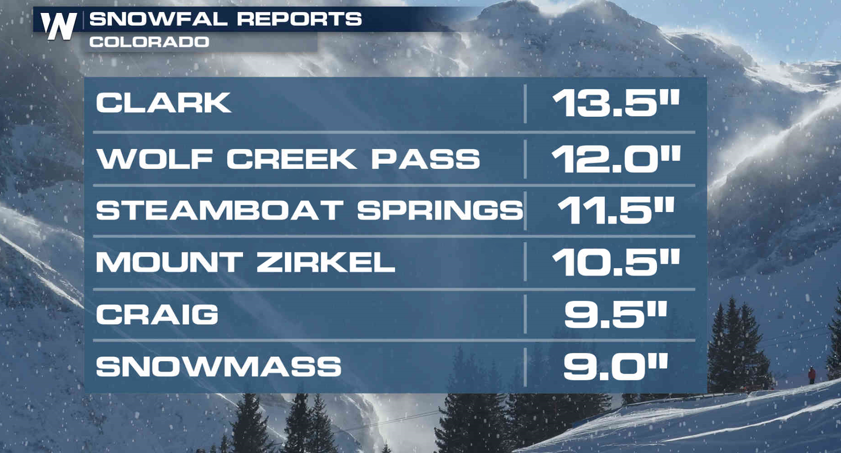
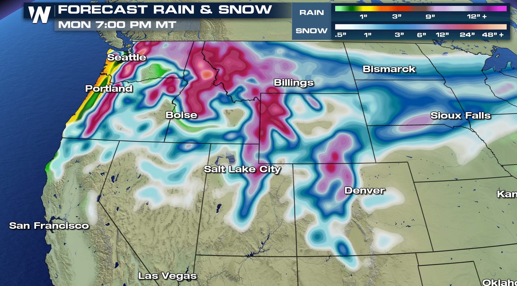
Along with the strong winds, some areas have seen significant snowfall accumulations. More than a foot has fallen in several areas from the High Plains to the Rockies.
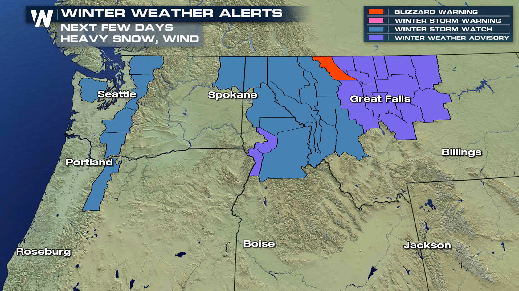
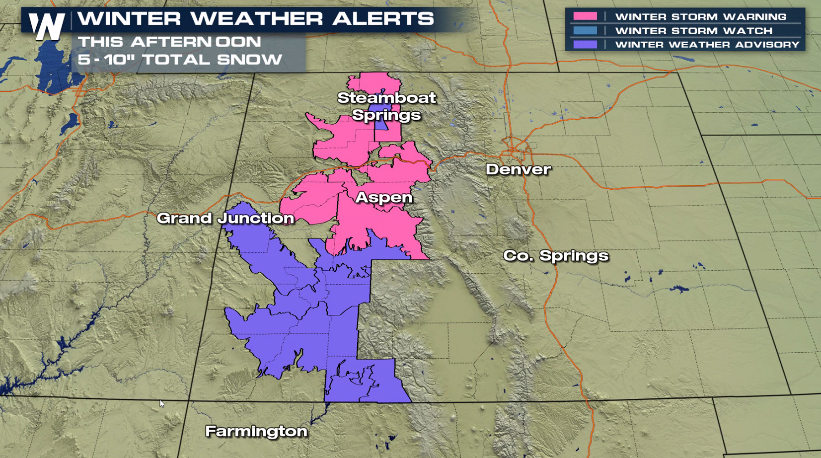
 Blizzard Warnings continue along the Rocky Mountain Front through Thursday morning, as wind gusts to 55 mph will create additional blowing and drifting snow. Winter Storm Watches extended into the Cascades, with Winter Storm Warnings in high country of Colorado. More snow is ahead for this weekend, with totals of 2 to 3 feet in the highest elevations.
 For WeatherNation: Meteorologist Mace Michaels
Blizzard Warnings continue along the Rocky Mountain Front through Thursday morning, as wind gusts to 55 mph will create additional blowing and drifting snow. Winter Storm Watches extended into the Cascades, with Winter Storm Warnings in high country of Colorado. More snow is ahead for this weekend, with totals of 2 to 3 feet in the highest elevations.
For WeatherNation: Meteorologist Mace MichaelsAll Weather News
More
Heavy Rain Returns to Texas This Weekend
It's been a week since the devastating floods
12 Jul 2025 3:10 AM

Medium Range Tropics Forecast Favors Gulf, CSU Updates Seasonal Forecast
While the Atlantic appears quiet, conditions
12 Jul 2025 3:05 AM

Elevated Tornado Risk Targets the Midwest Friday
Friday was another busy day with severe weath
12 Jul 2025 3:00 AM

Storms Return From the Front Range to Texas
Moisture is moving back into the Central and
12 Jul 2025 2:50 AM

Timeline: How Catastrophic Flooding Unfolded in Texas Hill Country
TEXAS - Catastrophic flooding devastated port
11 Jul 2025 10:00 AM

Severe Thunderstorms Expected Across the East Coast
The severe weather and flood threat continues
11 Jul 2025 2:35 AM

Ruidoso Flash Flooding - Record Crest for the Rio Ruidoso River
A slow-moving monsoonal thunderstorm develope
10 Jul 2025 1:55 AM