Strong Winds for Eastern Pennsylvania Tuesday
Special Stories
9 Apr 2019 5:07 AM
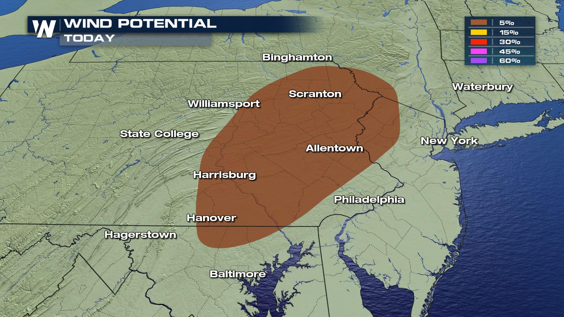
A fast moving cold front will bring increasing showers and storms across Eastern Pennsylvania. Cities like Scranton and Harrisburg will need to monitor the threat for wind speeds over 58 MPH. Here is the very latest.
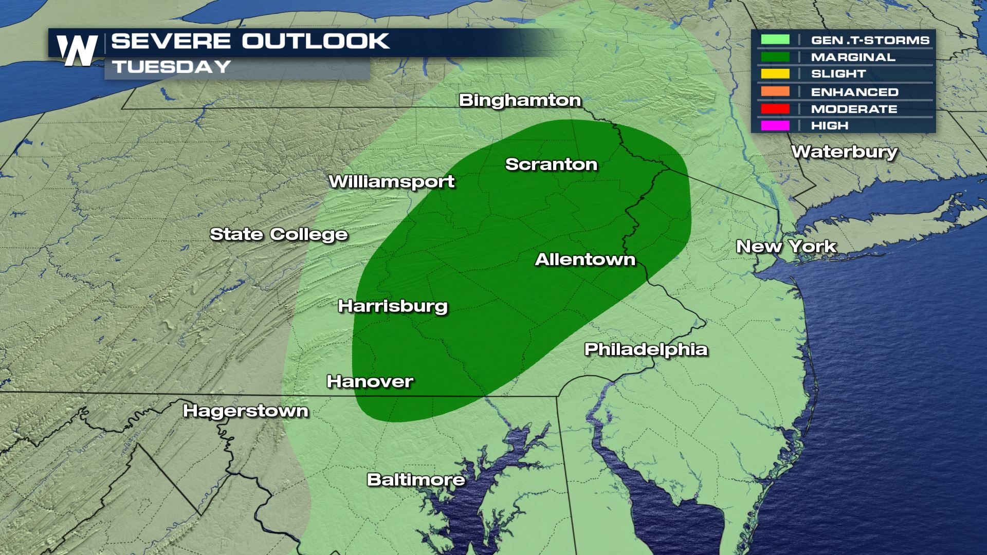 A Marginal risk of severe weather has be placed over these areas. This means isolated severe storms. The good news is that there will be a short window for storms, so don't worry about the severe risk lasting all day.
 The main risk will be damaging winds over 58 mph. The large hail and tornado threat won't be with today's storm chances.
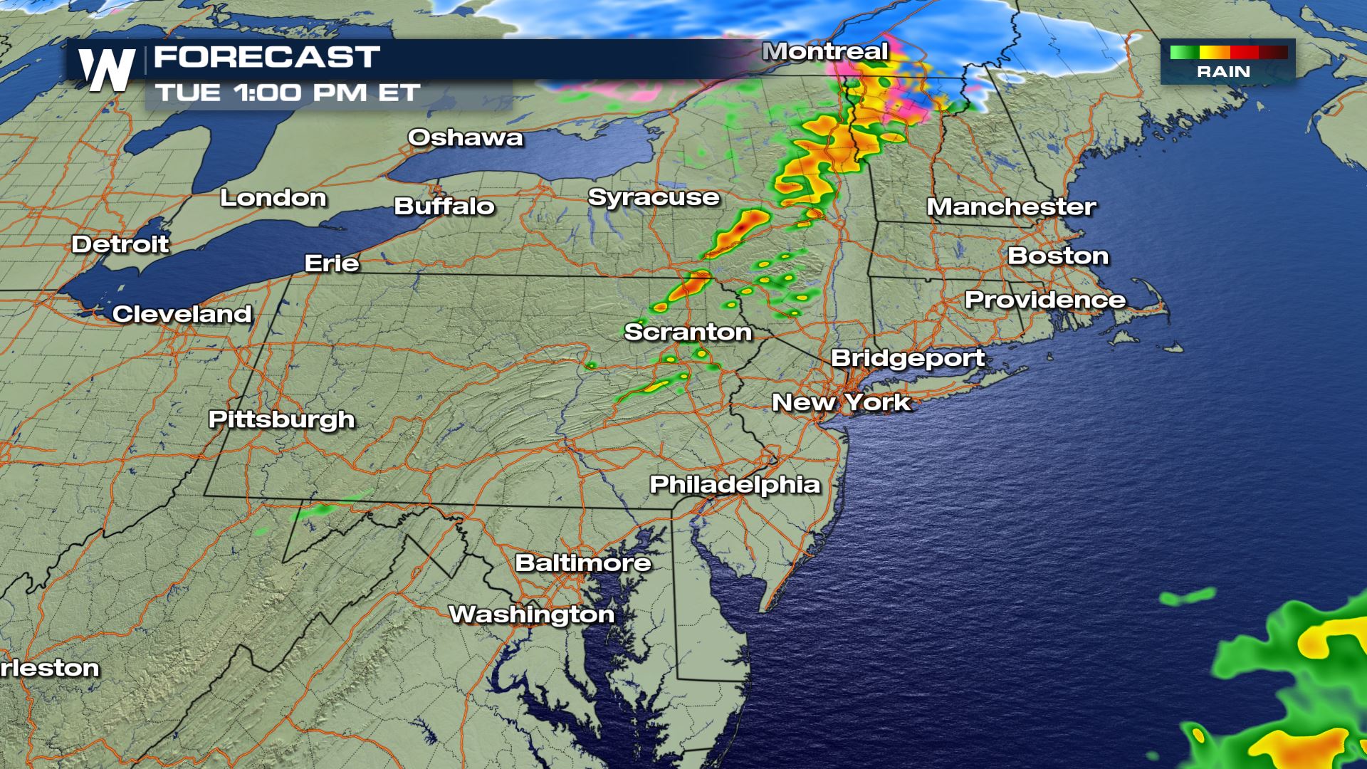
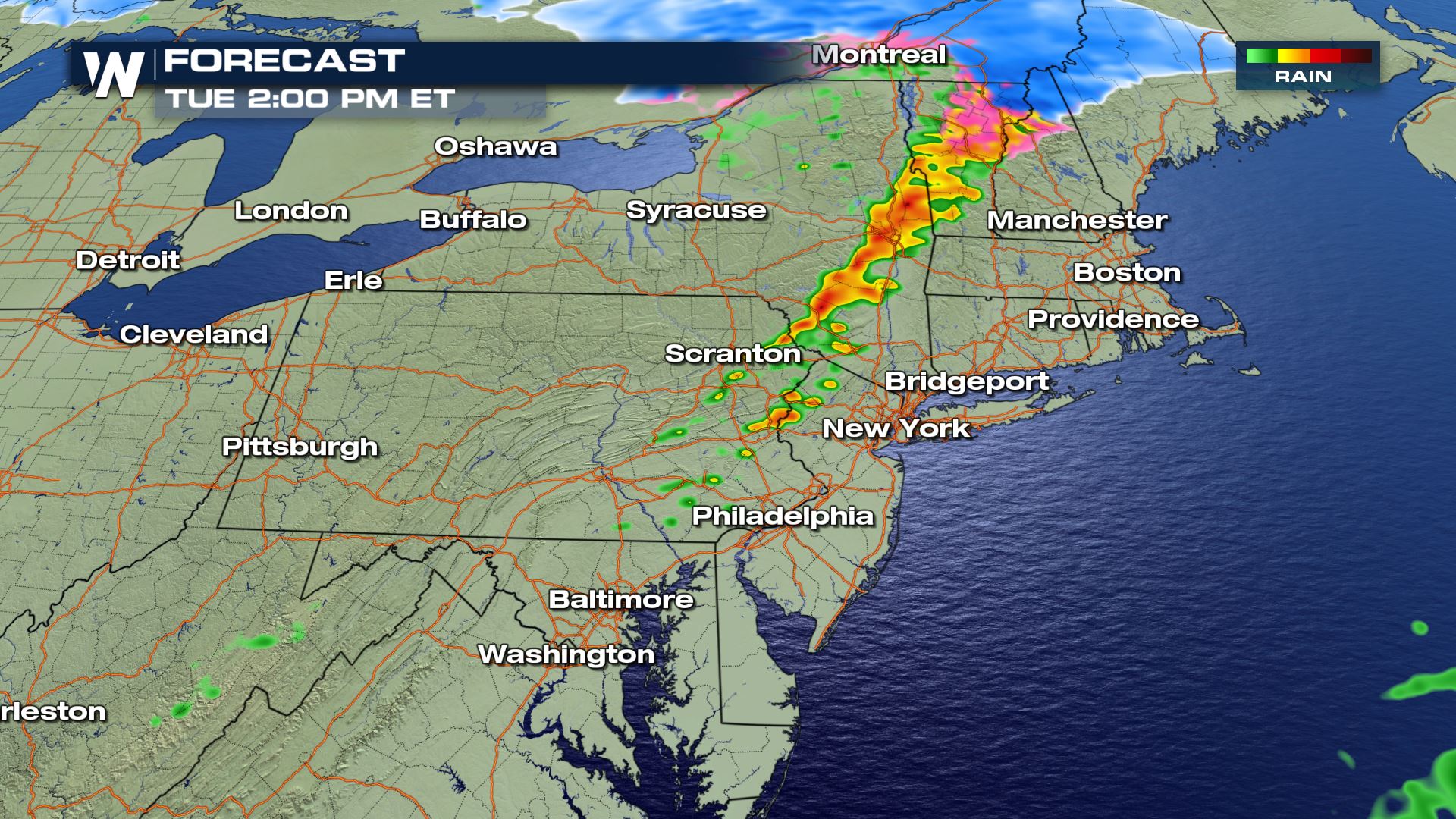
 The latest timing with our 3K forecast model is showing this being an early afternoon event. So from late morning into the afternoon is when the storm chances will be highest and the severe risk will be strongest.
Keep checking with WeatherNation for more severe weather updates!
The latest timing with our 3K forecast model is showing this being an early afternoon event. So from late morning into the afternoon is when the storm chances will be highest and the severe risk will be strongest.
Keep checking with WeatherNation for more severe weather updates!
Severe Outlook
A Marginal risk of severe weather has be placed over these areas. This means isolated severe storms. The good news is that there will be a short window for storms, so don't worry about the severe risk lasting all day.
Severe Risks
The main risk will be damaging winds over 58 mph. The large hail and tornado threat won't be with today's storm chances.
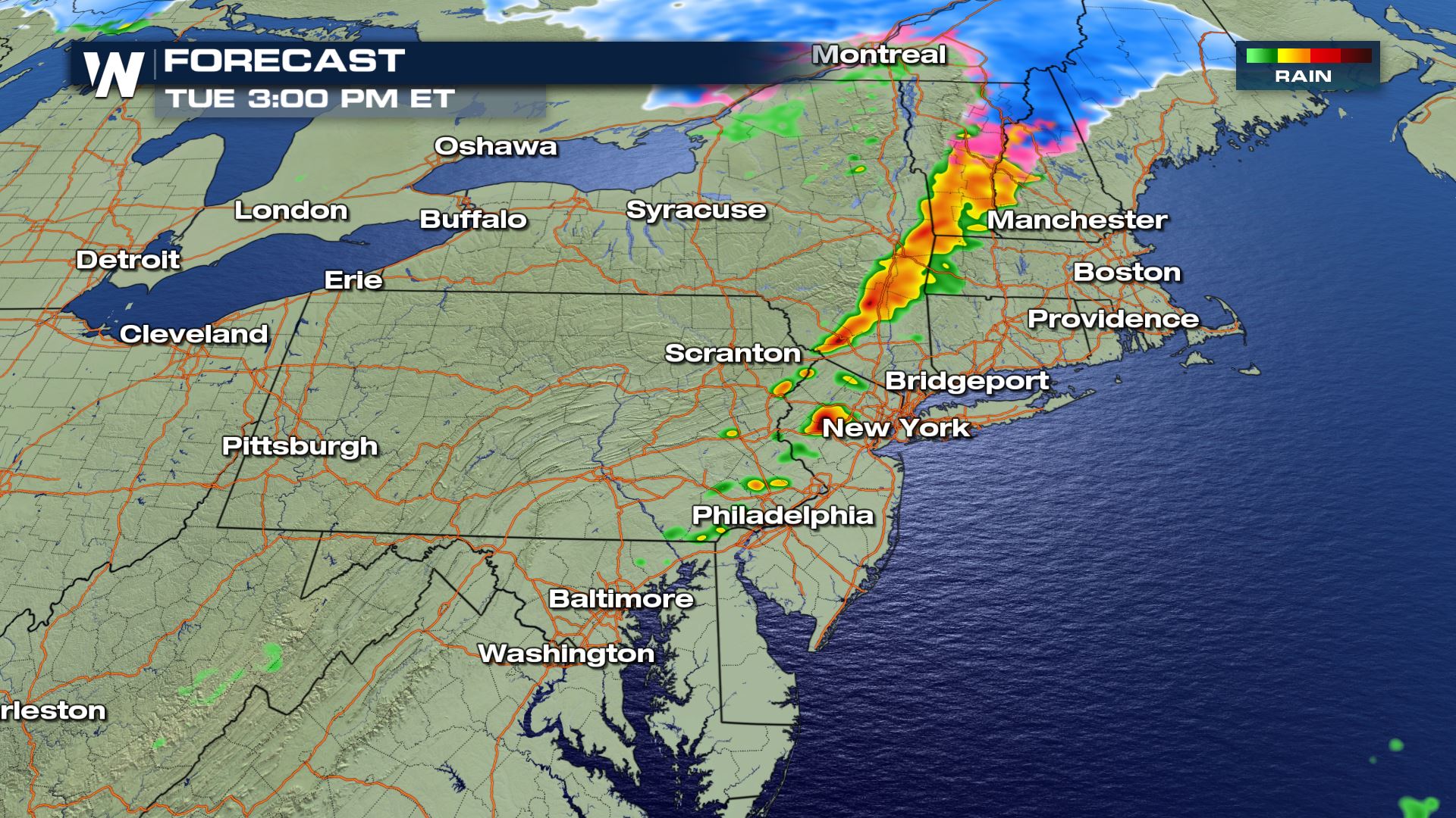
Forecast
The latest timing with our 3K forecast model is showing this being an early afternoon event. So from late morning into the afternoon is when the storm chances will be highest and the severe risk will be strongest.
Keep checking with WeatherNation for more severe weather updates!
All Weather News
More
Wildfire Outbreak in the Pacific Northwest
SPOKANE, WA - On Saturday, August 1st, the Ol
3 Aug 2026 1:55 AM

More Storms for the East Through Monday
A low-pressure system that moved through the
3 Aug 2026 1:50 AM


After Reaching Category 5, Genevieve Weakens in the Pacific
PacificGenevieve formed last Friday south of
3 Aug 2026 12:30 AM

Flooding, Severe Storms Target the Midwest Again
After an active week of storms across the nor
1 Aug 2026 1:40 AM

Flooding Risk Increases as Heavy Rain Targets the Tri-State Area
Tuesday, heavy rainfall moved across the Nort
30 Jul 2026 12:25 AM

Severe Weather: Energy From the Midwest Now in the Southeast
UPPER MIDWEST - Through Monday, dangerous tor
29 Jul 2026 10:30 PM