Severe Thunderstorms ongoing in the Upper Midwest

Special Stories
9 Aug 2020 2:15 PM
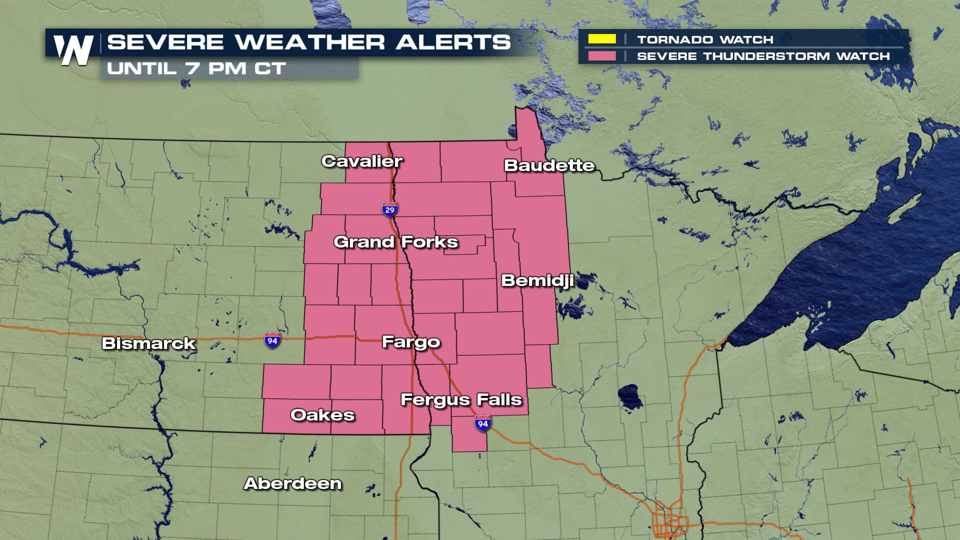
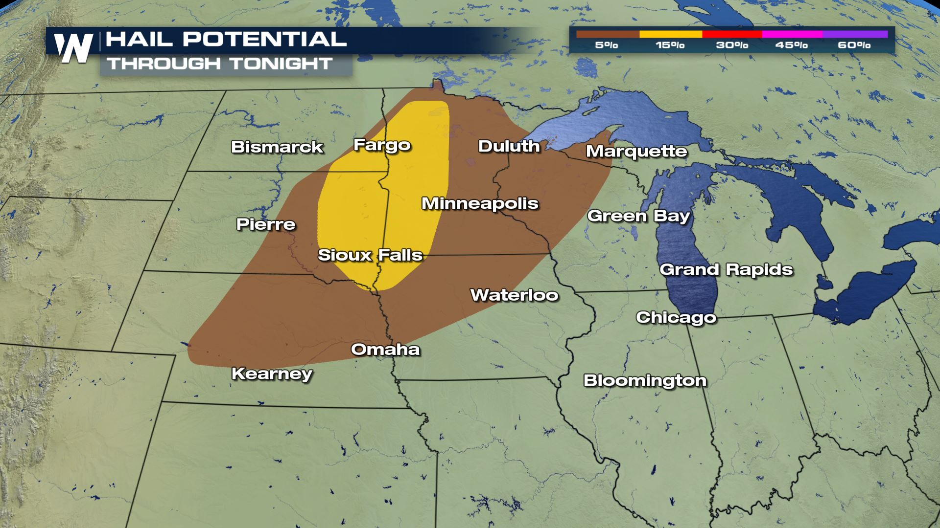
An quickly advancing cold front in the Upper Midwest will continue to strengthen thunderstorms throughout the rest of the afternoon and evening. A severe thunderstorm watch has been issued for eastern North Dakota and northwestern Minnesota until 7 PM CT Sunday for large hail up to 2" in diameter, damaging wind gusts up to 70 mph, and even a few tornadoes that may spin up along the squall line.
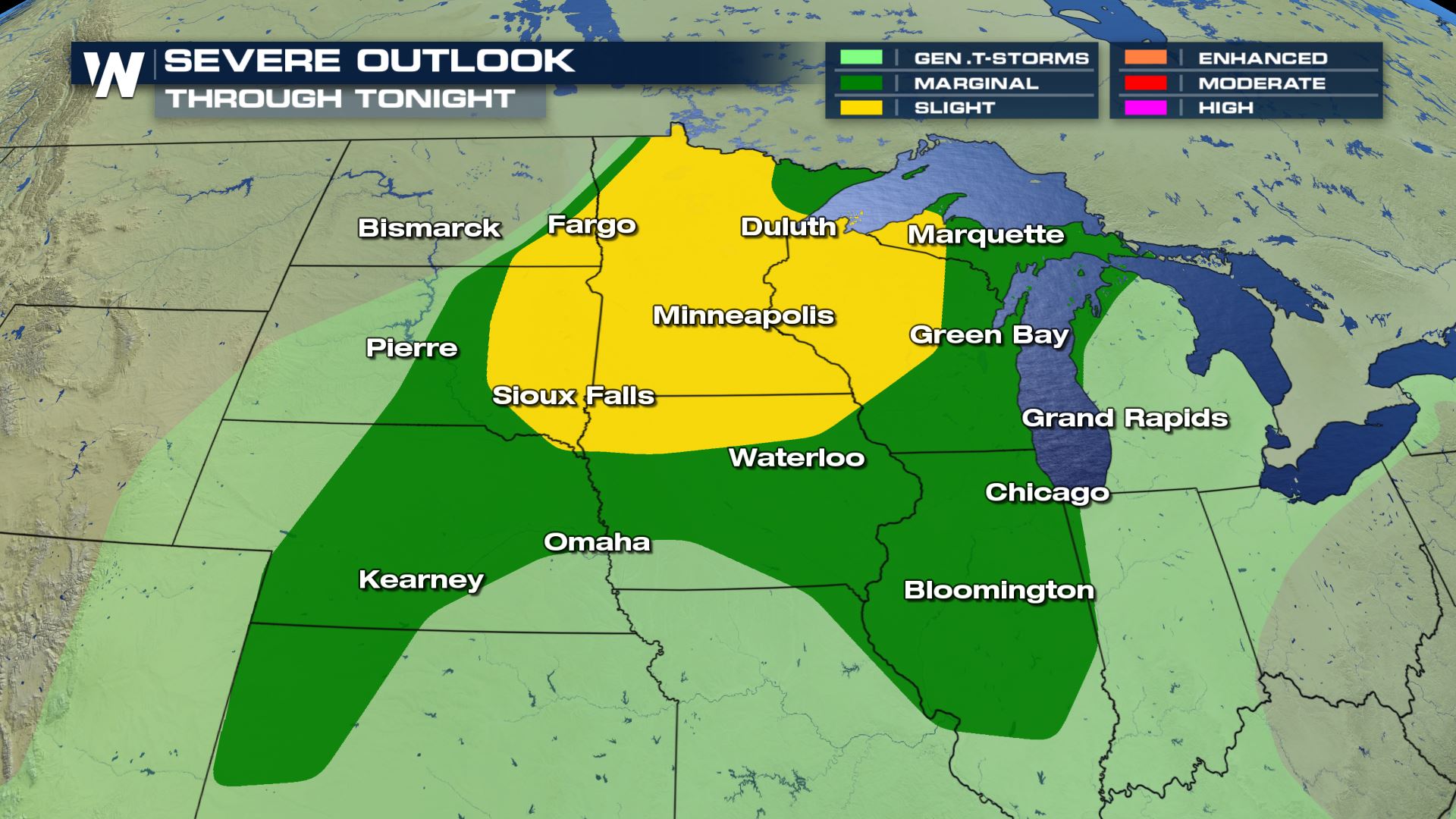 There is a large coverage area for today's severe threat. The highest risk for severe ranges from North Dakota, Minnesota into Wisconsin as this line of severe thunderstorm progresses east.
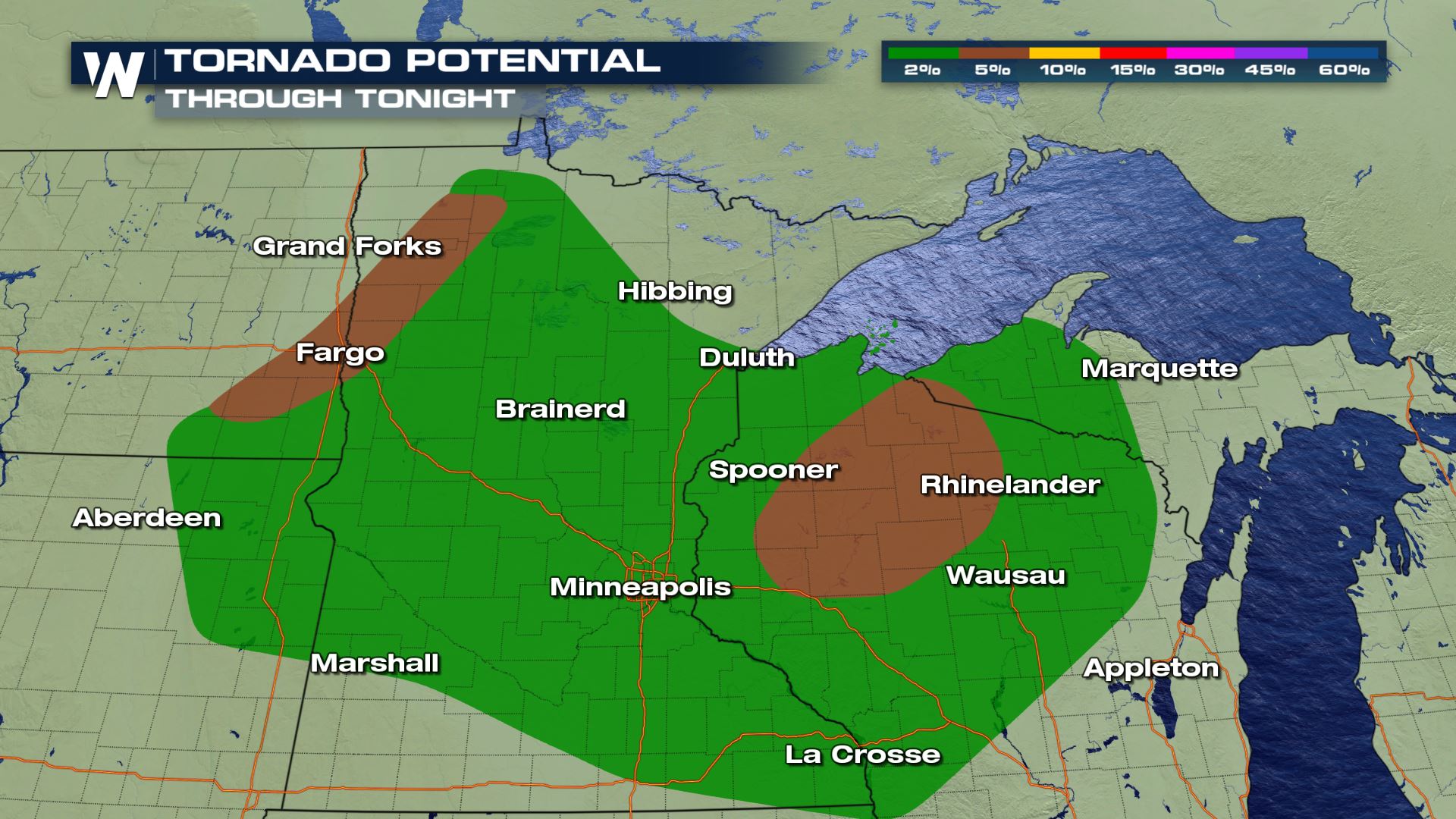
 All modes of severe weather will be in the forecast today and that includes the risk of some isolated tornadoes. The tornado risk will be strongest over Minnesota and Wisconsin.
Forecast
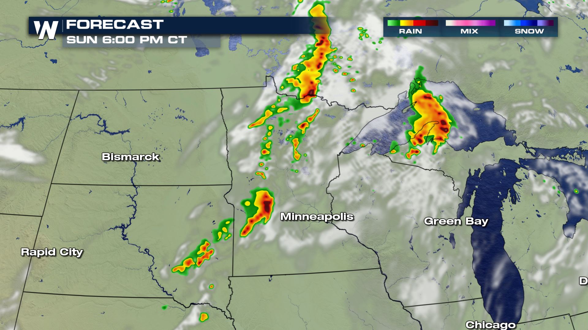
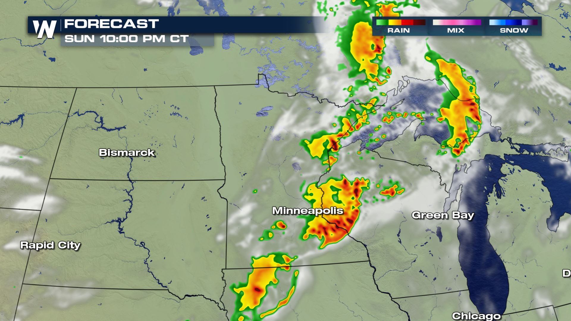
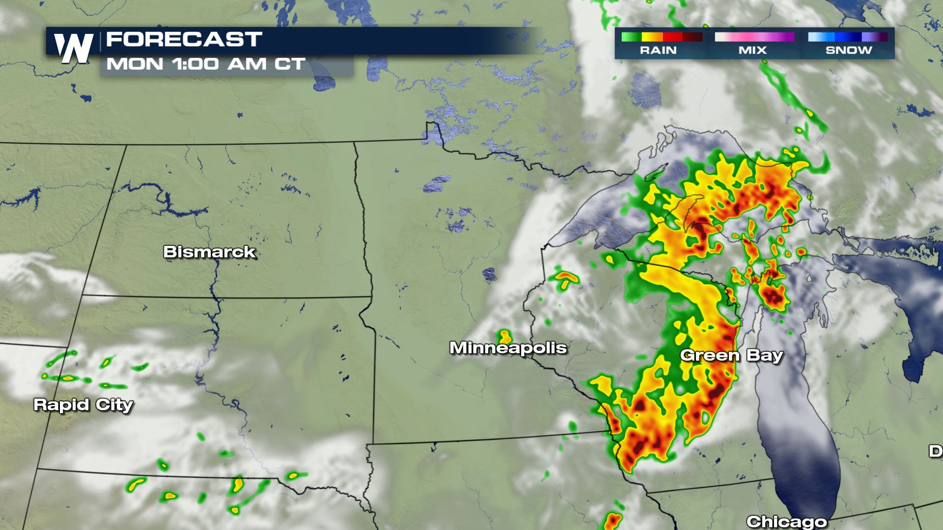 Our in house forecast model is forecasting severe storms pushing east into Indiana and Illinois through Monday. This will be a situation that you will want to have some way of getting severe alerts in case you have to take cover while you are sleeping.
Keep checking with WeatherNation for more updates on Sunday's severe weather chances.
Our in house forecast model is forecasting severe storms pushing east into Indiana and Illinois through Monday. This will be a situation that you will want to have some way of getting severe alerts in case you have to take cover while you are sleeping.
Keep checking with WeatherNation for more updates on Sunday's severe weather chances.
Severe Outlook
There is a large coverage area for today's severe threat. The highest risk for severe ranges from North Dakota, Minnesota into Wisconsin as this line of severe thunderstorm progresses east.
Severe Risks
The Storm Prediction Center has upgraded it's tornado probability for Minnesota through Wisconsin as seen below:
All modes of severe weather will be in the forecast today and that includes the risk of some isolated tornadoes. The tornado risk will be strongest over Minnesota and Wisconsin.
Forecast 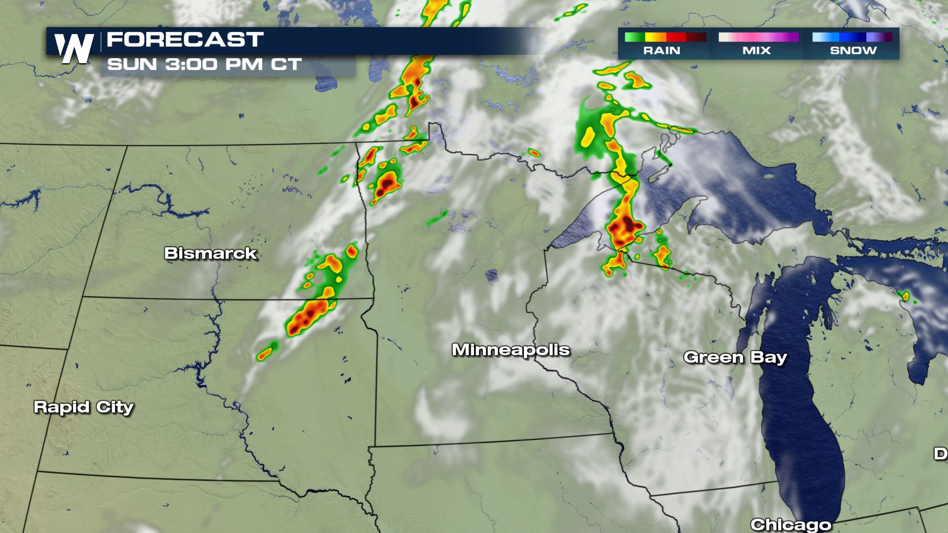
Our in house forecast model is forecasting severe storms pushing east into Indiana and Illinois through Monday. This will be a situation that you will want to have some way of getting severe alerts in case you have to take cover while you are sleeping.
Keep checking with WeatherNation for more updates on Sunday's severe weather chances.All Weather News
More
Severe Storms Target the Midwest This Weekend
Extreme heat will be a big story this week ac
26 Jul 2026 2:15 AM

Heat Wave Grips Central, Western U.S.
Are you over the summer heat yet? The heat al
26 Jul 2026 2:05 AM

Tropics: Fausto Heads to Hawaii; Genevieve Will Become a Major Hurricane
Atlantic BasinBertha has dissipated after mov
26 Jul 2026 2:00 AM


Southeast Flood Risk Lingers Near Stalled Front
A stalled boundary over the Southeast will ke
25 Jul 2026 10:55 AM

Another Round of Storms Targets the Northeast
Tuesday brought severe weather again across p
23 Jul 2026 1:15 AM

Another Round of Severe Weather for the Upper Midwest and Great Lakes
The upper-level low train continues to keep t
21 Jul 2026 1:45 AM