Sunday Severe Weather Update
Top Stories
27 Sep 2020 2:15 PM
The cold front that brought the severe storms to the Great Lakes on Saturday will also provide a chance for severe storms across Oklahoma and Missouri. Here is the very latest.
 Areas from the Red River Valley to Fort Smith, Arkansas to southwestern Missouri could see some intense storms later this afternoon and evening.
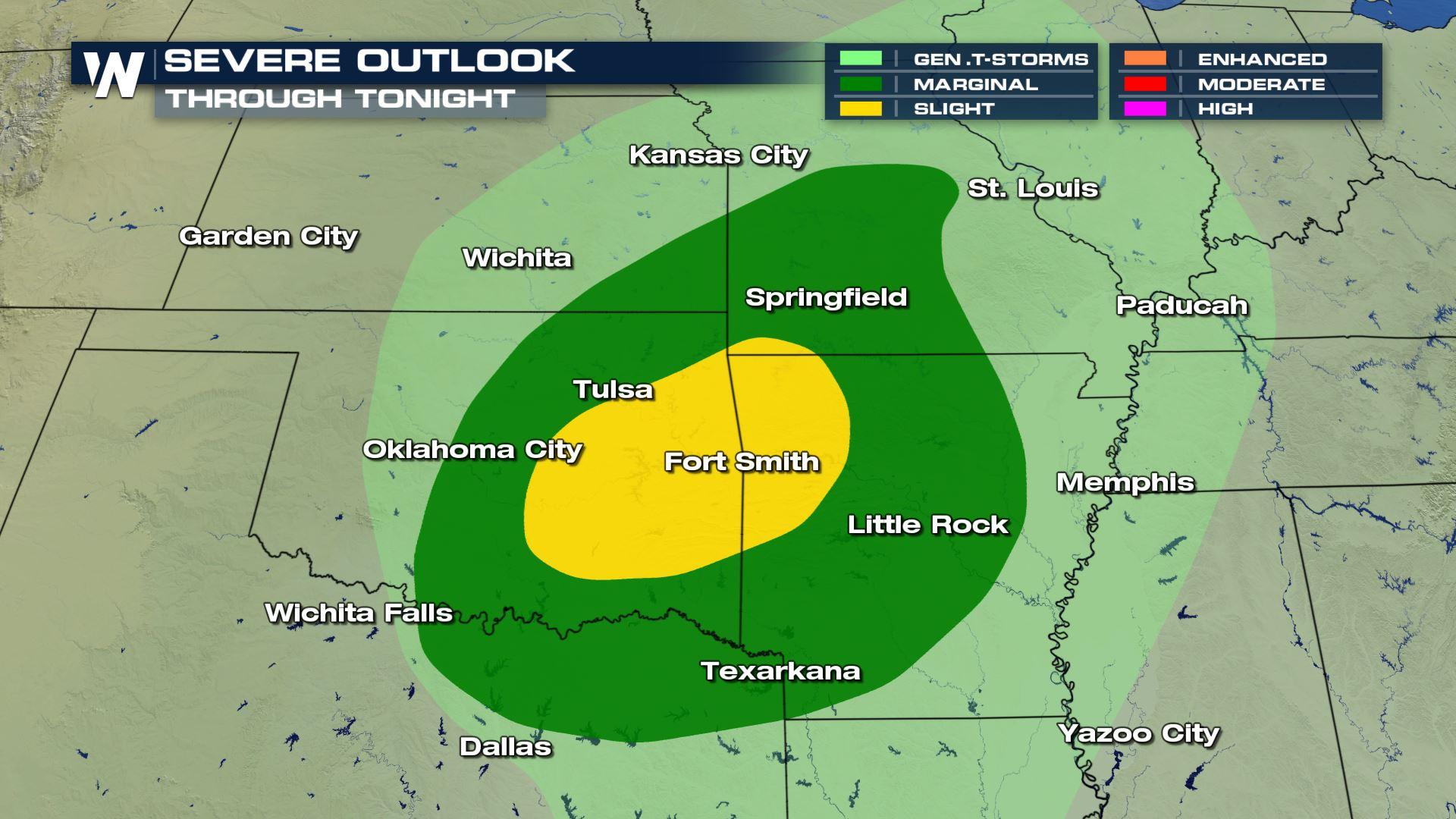
 If any storms turn severe, they could contain large hail and damaging winds. This risk includes cities like Oklahoma City, Springfield and Fort Smith. There is even a low threat for an isolated tornado.
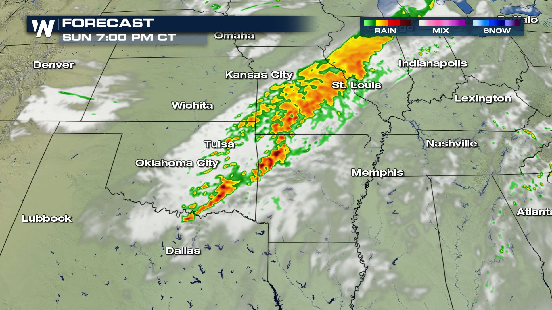
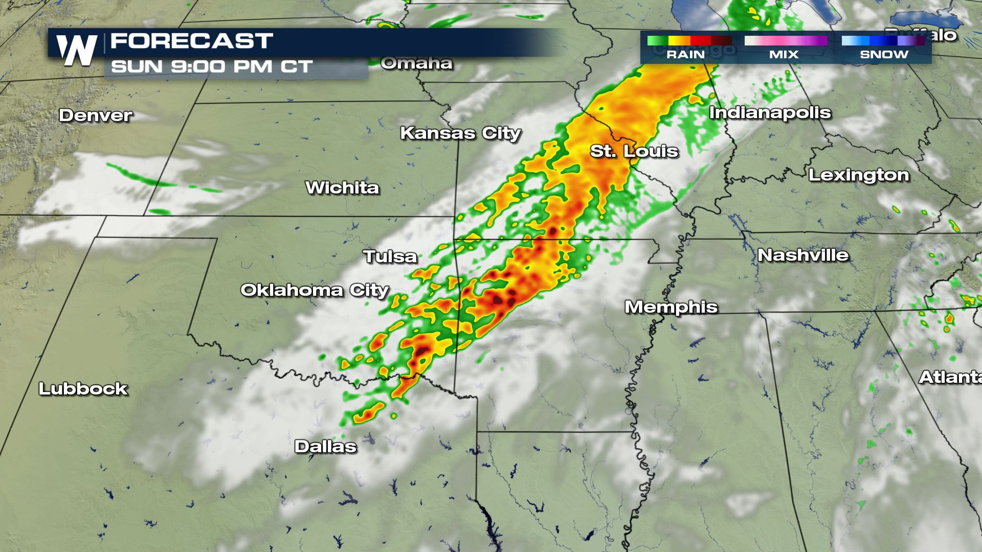 The timing for today's storms will be during the afternoon and evening hours. These storms have to potential to maintain their strength and keep moving east through the morning hours. Keep checking with WeatherNation for more updates on today's severe threat.
Severe Outlook
Areas from the Red River Valley to Fort Smith, Arkansas to southwestern Missouri could see some intense storms later this afternoon and evening.
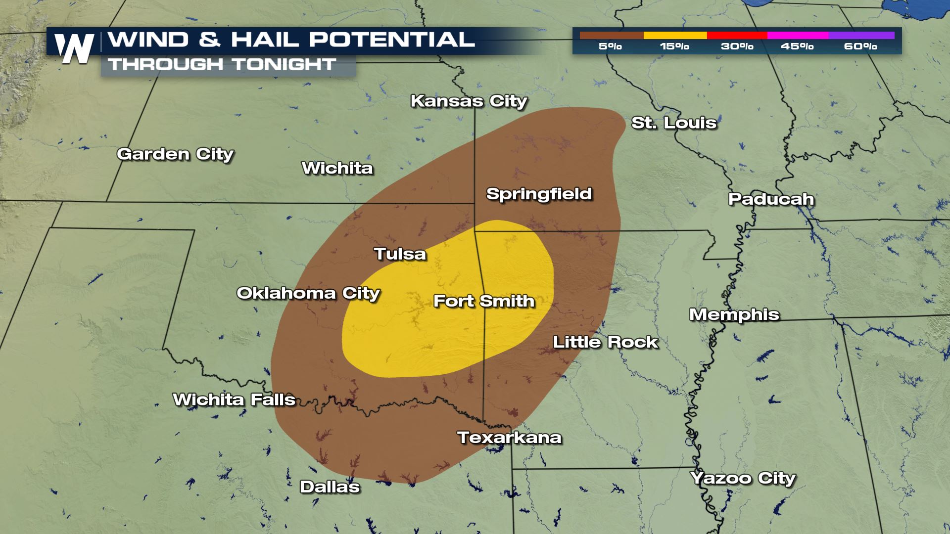
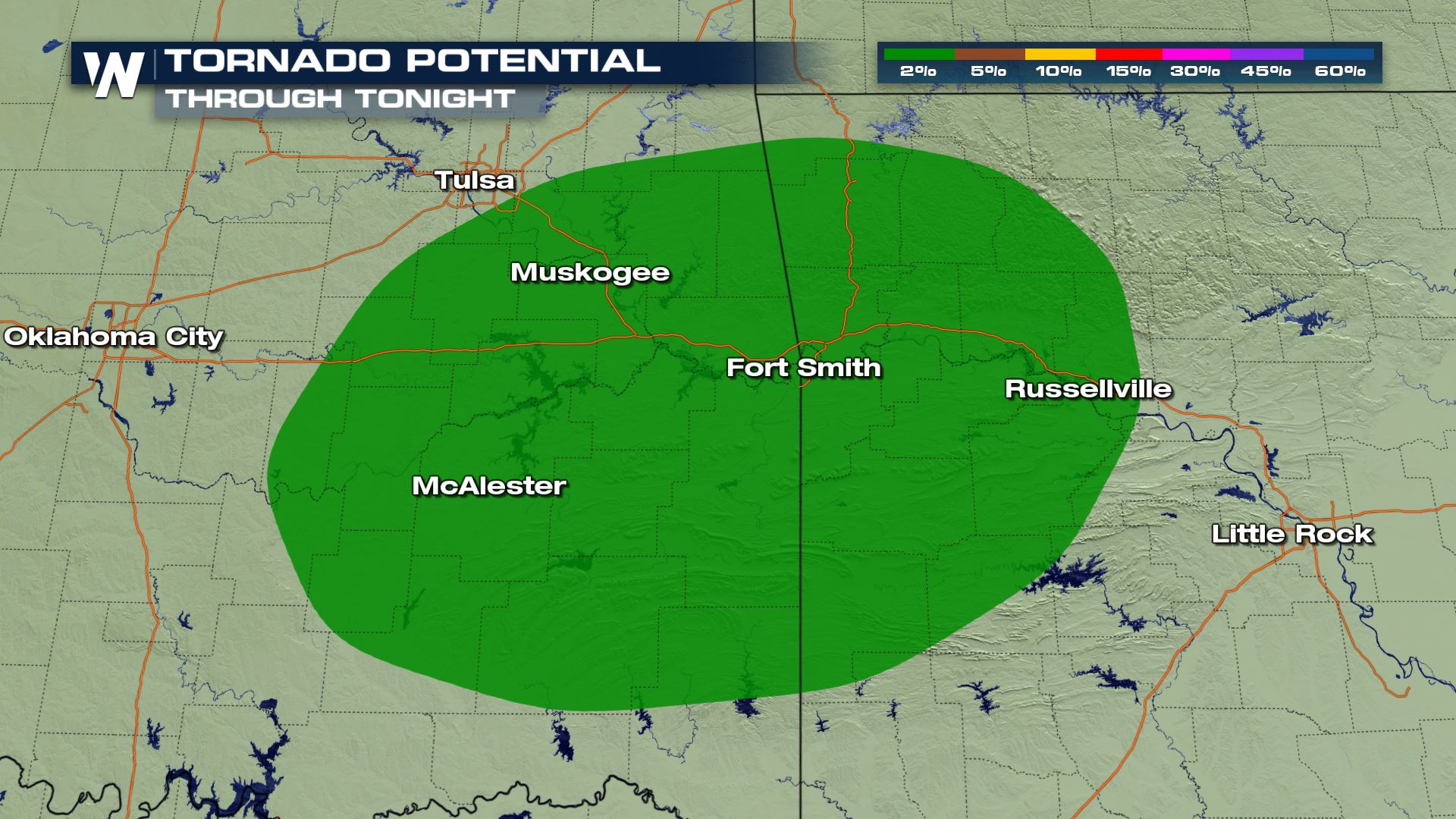
Severe Risks
If any storms turn severe, they could contain large hail and damaging winds. This risk includes cities like Oklahoma City, Springfield and Fort Smith. There is even a low threat for an isolated tornado.
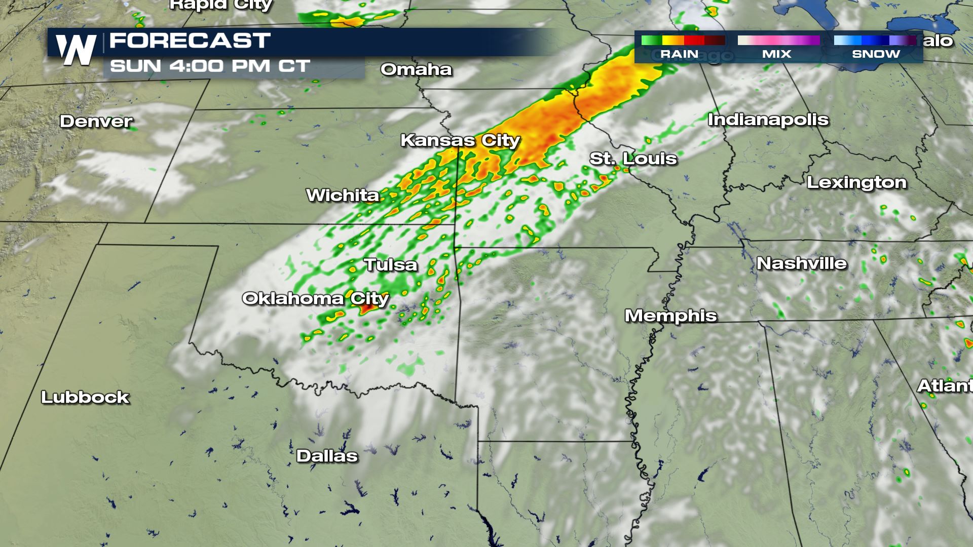
Forecast
The timing for today's storms will be during the afternoon and evening hours. These storms have to potential to maintain their strength and keep moving east through the morning hours. Keep checking with WeatherNation for more updates on today's severe threat.All Weather News
More
Wildfire Outbreak in the Pacific Northwest
SPOKANE, WA - On Saturday, August 1st, the Ol
3 Aug 2026 1:55 AM

More Storms for the East Through Monday
A low-pressure system that moved through the
3 Aug 2026 1:50 AM


After Reaching Category 5, Genevieve Weakens in the Pacific
PacificGenevieve formed last Friday south of
3 Aug 2026 12:30 AM

Flooding, Severe Storms Target the Midwest Again
After an active week of storms across the nor
1 Aug 2026 1:40 AM

Flooding Risk Increases as Heavy Rain Targets the Tri-State Area
Tuesday, heavy rainfall moved across the Nort
30 Jul 2026 12:25 AM

Severe Weather: Energy From the Midwest Now in the Southeast
UPPER MIDWEST - Through Monday, dangerous tor
29 Jul 2026 10:30 PM