Southeast Storms Overnight, Mid-Atlantic Tuesday

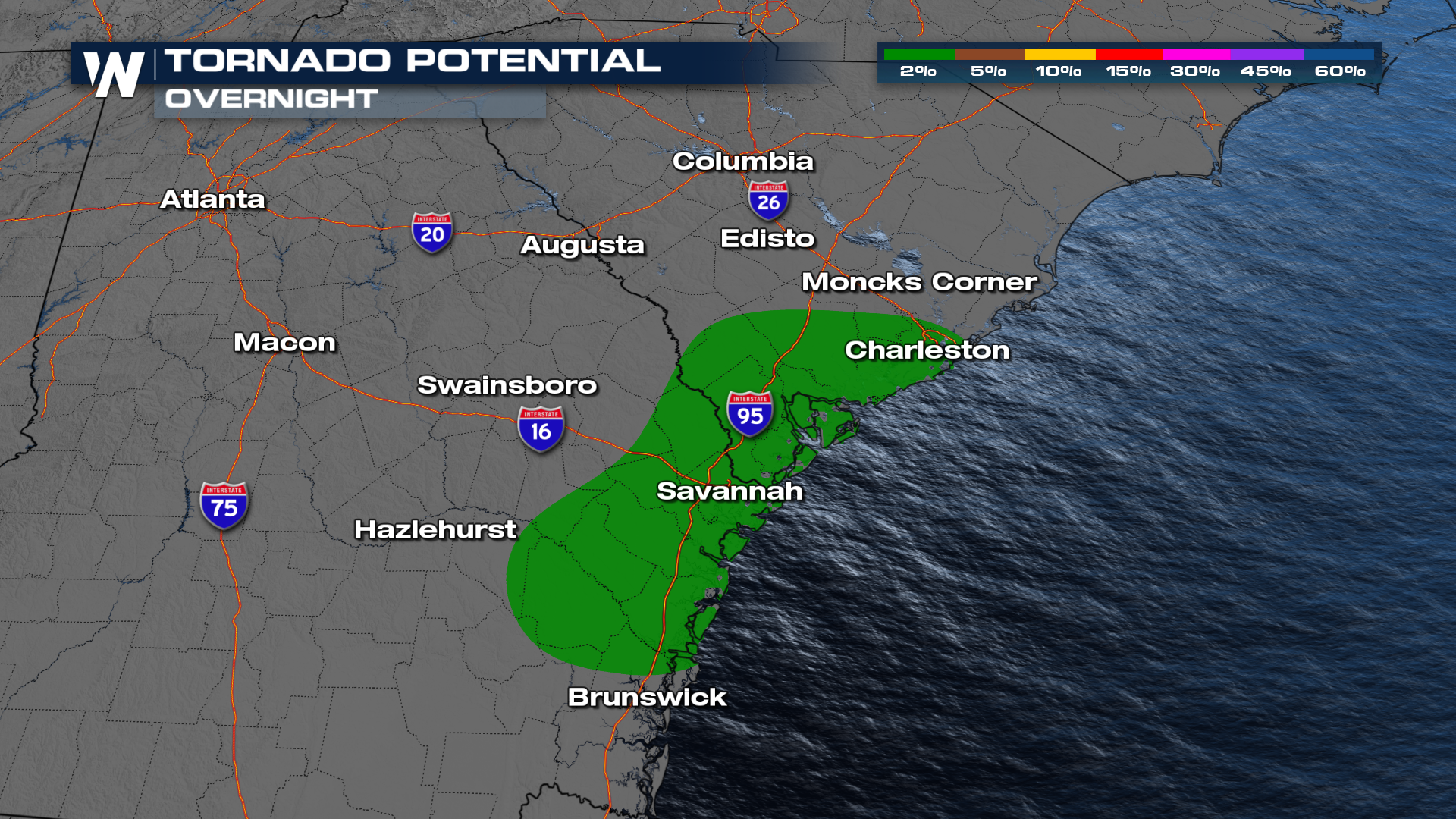
A cold front moving in and stalling out will keep the storm chances up across the Southeast U.S. overnight and linger into Tuesday. Around the Charleston-Savannah corridor, there is also an elevated risk for a tornado overnight.
 As we head into Tuesday, the SPC has issued a MARGINAL (level 1 out of 5) risk for severe storms for portions of North Carolina and Virginia including the Outer Banks. The storm threat remains fairly isolated on Tuesday and looks most promising during the peak of afternoon heating.
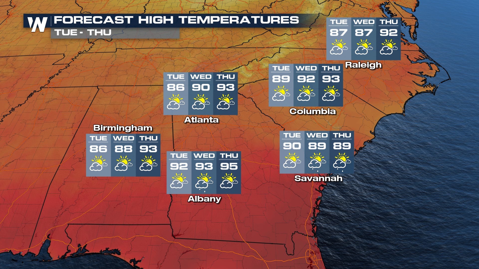
Temperatures will be warm and muggy closer to the Gulf Coast but the front helps to drop highs some on Tuesday back into the mid-80s in Atlanta and Birmingham. Highs remain in the 90s closer to I-10 through midweek with the highest opportunity for showers lingering in southern Georgia, closer to the tropical moisture present from Florida.