Three Tornadoes Confirmed in Wisconsin on Tuesday
Top Stories
27 Jun 2018 2:21 PM
Three EF-0 tornadoes touched down in southern Wisconsin on Tuesday, the National Weather Service (NWS) offices in Milwaukee and La Crosse confirmed on Wednesday.
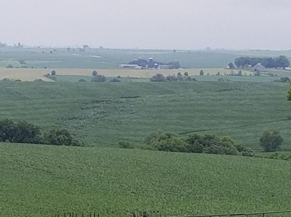
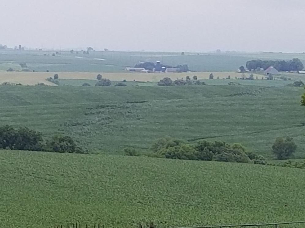
A pair of EF-0 twisters took place in southwestern Wisconsin's Lafayette County, while another took place in Grant County. According to WeatherNation affiliate WMTV in Madison, some damage was reported in the Lafayette County area, mainly in the form of downed trees and branches. The NWS La Crosse office said there wasn't any damage from the Grant County tornado. Below is a look at some crop damage, reported by Lafayette County Emergency Management:
 Maximum winds with one of the Lafayette County tornadoes was estimated to be around 70 miles-per-hour (MPH), another was estimated to have max winds 80 MPH. The Grant County twister had
max winds of 65 MPH.
According to the Storm Prediction Center's (SPC) official database, these were just the fifth, sixth and seventh tornado reports so far in 2018 in the state of Wisconsin.
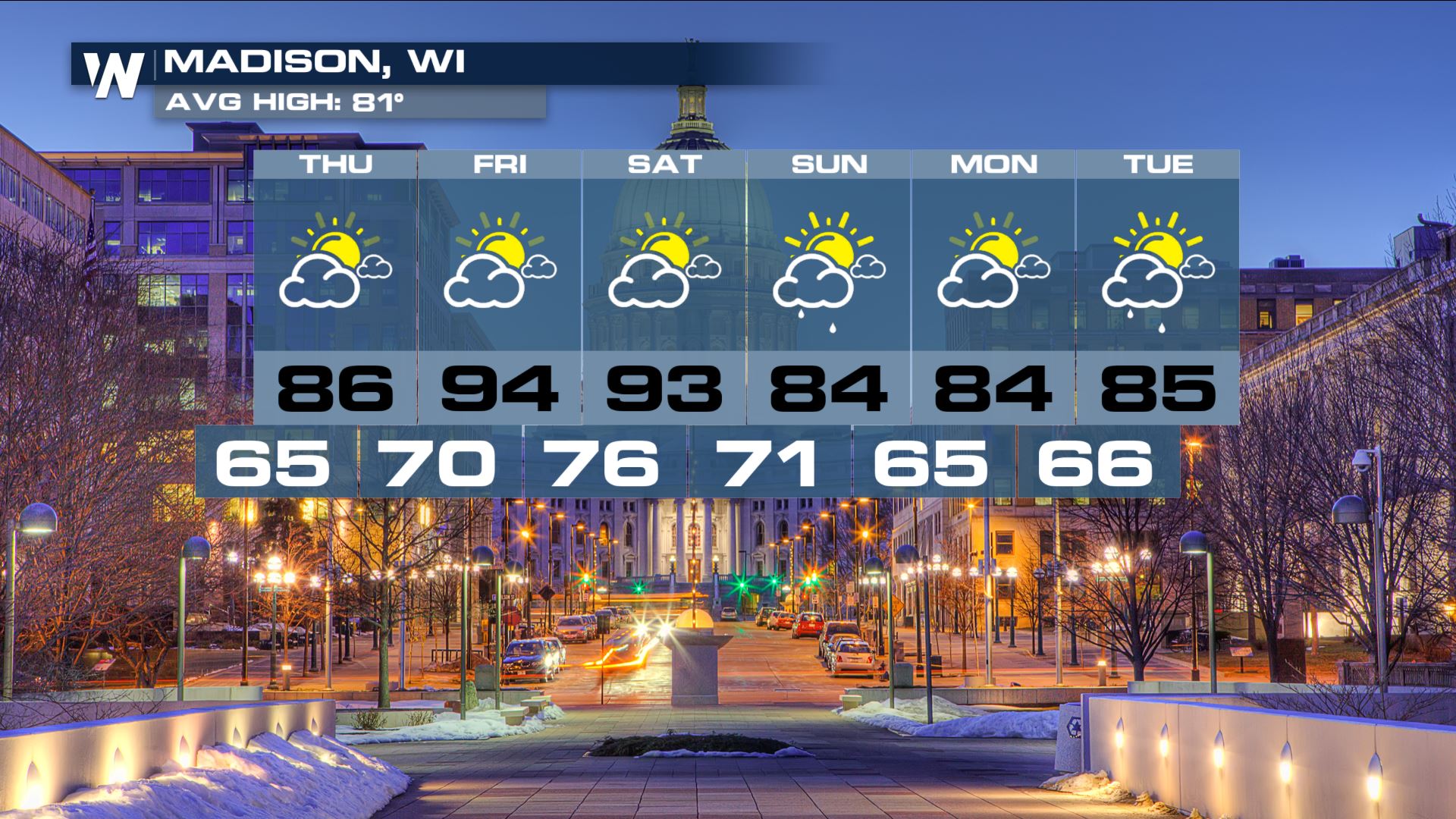
This may not be the end of the severe weather this week, however. More storms are in the forecast for southern Wisconsin on Friday and Saturday, although the area is expected to get at least a bit of a breather from consistent rounds of heavy rain that they've seen the last few weeks.
Maximum winds with one of the Lafayette County tornadoes was estimated to be around 70 miles-per-hour (MPH), another was estimated to have max winds 80 MPH. The Grant County twister had
max winds of 65 MPH.
According to the Storm Prediction Center's (SPC) official database, these were just the fifth, sixth and seventh tornado reports so far in 2018 in the state of Wisconsin.
This may not be the end of the severe weather this week, however. More storms are in the forecast for southern Wisconsin on Friday and Saturday, although the area is expected to get at least a bit of a breather from consistent rounds of heavy rain that they've seen the last few weeks.
 Stay with WeatherNation for the latest.
For WeatherNation: Meteorologist Chris Bianchi
https://twitter.com/i/status/1011795667897864193
Stay with WeatherNation for the latest.
For WeatherNation: Meteorologist Chris Bianchi
https://twitter.com/i/status/1011795667897864193
Maximum winds with one of the Lafayette County tornadoes was estimated to be around 70 miles-per-hour (MPH), another was estimated to have max winds 80 MPH. The Grant County twister had
max winds of 65 MPH.
According to the Storm Prediction Center's (SPC) official database, these were just the fifth, sixth and seventh tornado reports so far in 2018 in the state of Wisconsin.
This may not be the end of the severe weather this week, however. More storms are in the forecast for southern Wisconsin on Friday and Saturday, although the area is expected to get at least a bit of a breather from consistent rounds of heavy rain that they've seen the last few weeks.
Stay with WeatherNation for the latest.
For WeatherNation: Meteorologist Chris Bianchi
https://twitter.com/i/status/1011795667897864193All Weather News
More
Another Cold Morning Before Things Warm Back Up
Across portions of the Ohio Valley through th
19 Oct 2026 1:00 AM

Pattern Change for the West This Week
Looking ahead through this week, a big low pr
19 Oct 2026 12:50 AM

Several Fires Break Out in SoCal Amid Santa Ana Wind Event
Santa Ana winds helped several fires grow qui
19 Oct 2026 12:45 AM

Tropics: Champi Bears Down on Guam, Pacific Staying Active
Isaias ended the late-season streak of no hur
19 Oct 2026 12:35 AM

Nor'Easter Riles up the Waves This Week
SETUPAn upper-level low is in the process of
19 Oct 2026 12:30 AM

Severe Risk Diminishing Saturday Morning for the Northeast
Severe Storm PotentialSevere risk is decreasi
16 Oct 2026 10:20 AM

Flooding & Severe Storms Persist in the Southern Plains
Extreme rainfall has been hitting areas of Te
16 Oct 2026 2:00 AM