Thunderstorms Possible Across the South

Special Stories
7 Jan 2018 10:32 AM
We are transitioning from talking about winter weather and below average temperatures to a warm up with thunderstorms across the south.
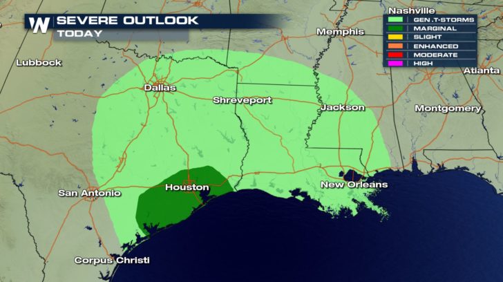
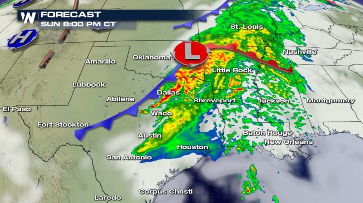 The Storm Prediction Center has a general thunderstorm risk across eastern Texas and into Louisiana and southern Mississippi but also a marginal risk near the Houston area. A low pressure system swings through bringing clouds and taps into the Gulf of Mexico moisture. Instability will lead to rumbles of thunder but as the line develops, an isolated strong to severe storm will be possible.
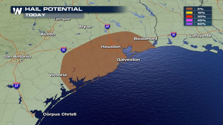
 The cold front could storms with pea sized hail and gusts up to 30 to 40 mph.
 The low continues with showers and storms overnight into Louisiana and Mississippi. Any light sleepers, may have a difficult time sleeping tonight across the Gulf Coast.
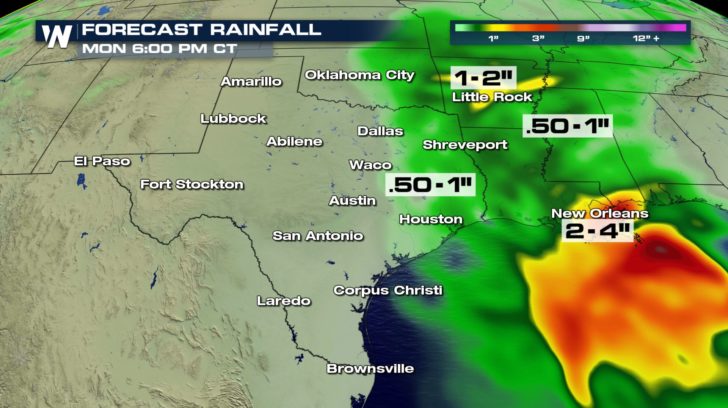
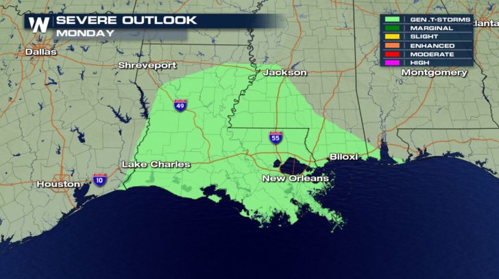 Now, generally, rain won't be too impressive but coastal Louisiana and Mississippi could pick up several inches of liquid precipitation into Monday evening.
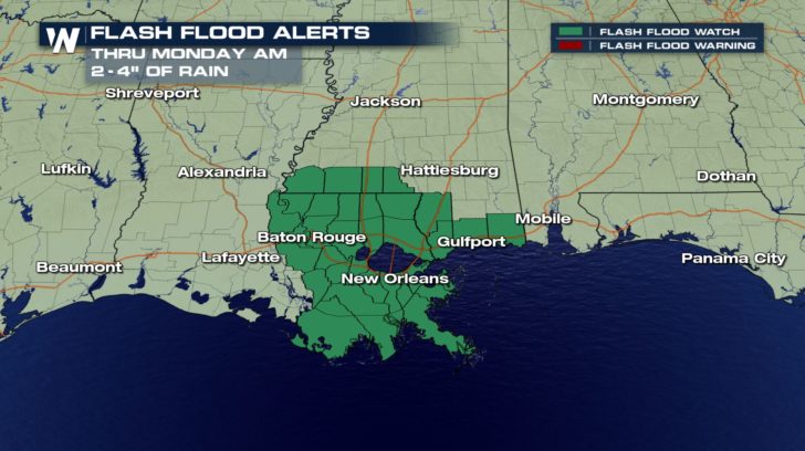
 All that rain in a short period of time could lead to flash flooding. The National Weather Service has Flash Flood Watches in place for that exact reasoning.
 For WeatherNation, Meteorologist Kate Mantych
The Storm Prediction Center has a general thunderstorm risk across eastern Texas and into Louisiana and southern Mississippi but also a marginal risk near the Houston area. A low pressure system swings through bringing clouds and taps into the Gulf of Mexico moisture. Instability will lead to rumbles of thunder but as the line develops, an isolated strong to severe storm will be possible.
The cold front could storms with pea sized hail and gusts up to 30 to 40 mph.
The low continues with showers and storms overnight into Louisiana and Mississippi. Any light sleepers, may have a difficult time sleeping tonight across the Gulf Coast.
Now, generally, rain won't be too impressive but coastal Louisiana and Mississippi could pick up several inches of liquid precipitation into Monday evening.
All that rain in a short period of time could lead to flash flooding. The National Weather Service has Flash Flood Watches in place for that exact reasoning.
For WeatherNation, Meteorologist Kate MantychAll Weather News
More
Severe Threat Marches East This Afternoon
UPPER MIDWEST - Through Monday, dangerous tor
28 Jul 2026 4:25 PM

Tropics: Fausto Heads towards Hawaii; Genevieve Cat 4 Hurricane
PacificTropical Storm Fausto continues to tra
28 Jul 2026 4:20 PM


Southeast Flood Risk Lingers Near Stalled Front
A stalled boundary over the Southeast will ke
25 Jul 2026 10:55 AM

Another Round of Storms Targets the Northeast
Tuesday brought severe weather again across p
23 Jul 2026 1:15 AM

Another Round of Severe Weather for the Upper Midwest and Great Lakes
The upper-level low train continues to keep t
21 Jul 2026 1:45 AM