Tornado Risk Along the Florida Coast Tuesday

Top Stories
14 May 2019 4:50 AM
A cold front will bring strong to severe storms to Florida on Tuesday. Areas in southeastern Florida could see some rotation for an isolated tornado risk. Waterspouts will also be possible in the areas. Here is the very latest.
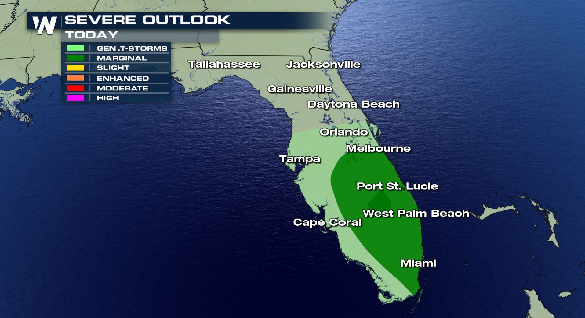 A marginal risk of severe weather over southeast Florida means some isolated storms could turn severe today. Eastern beaches will need to watch the sky closely and have a safety plan in place if storms turn severe.
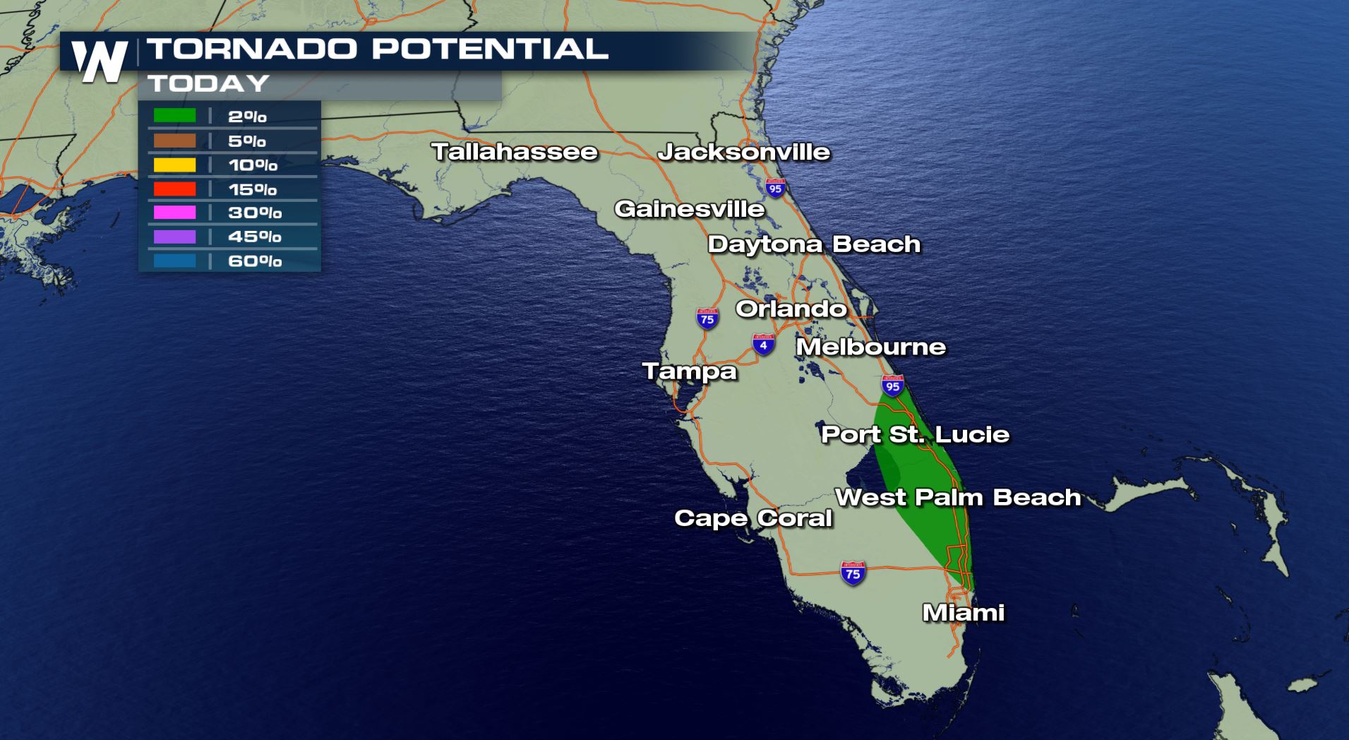 A 2% tornado risk is possible for a small area in southeastern Florida. This includes Port St. Lucie and West Palm Beach. Any storms that move through this area will have some rotation for a tornado risk.
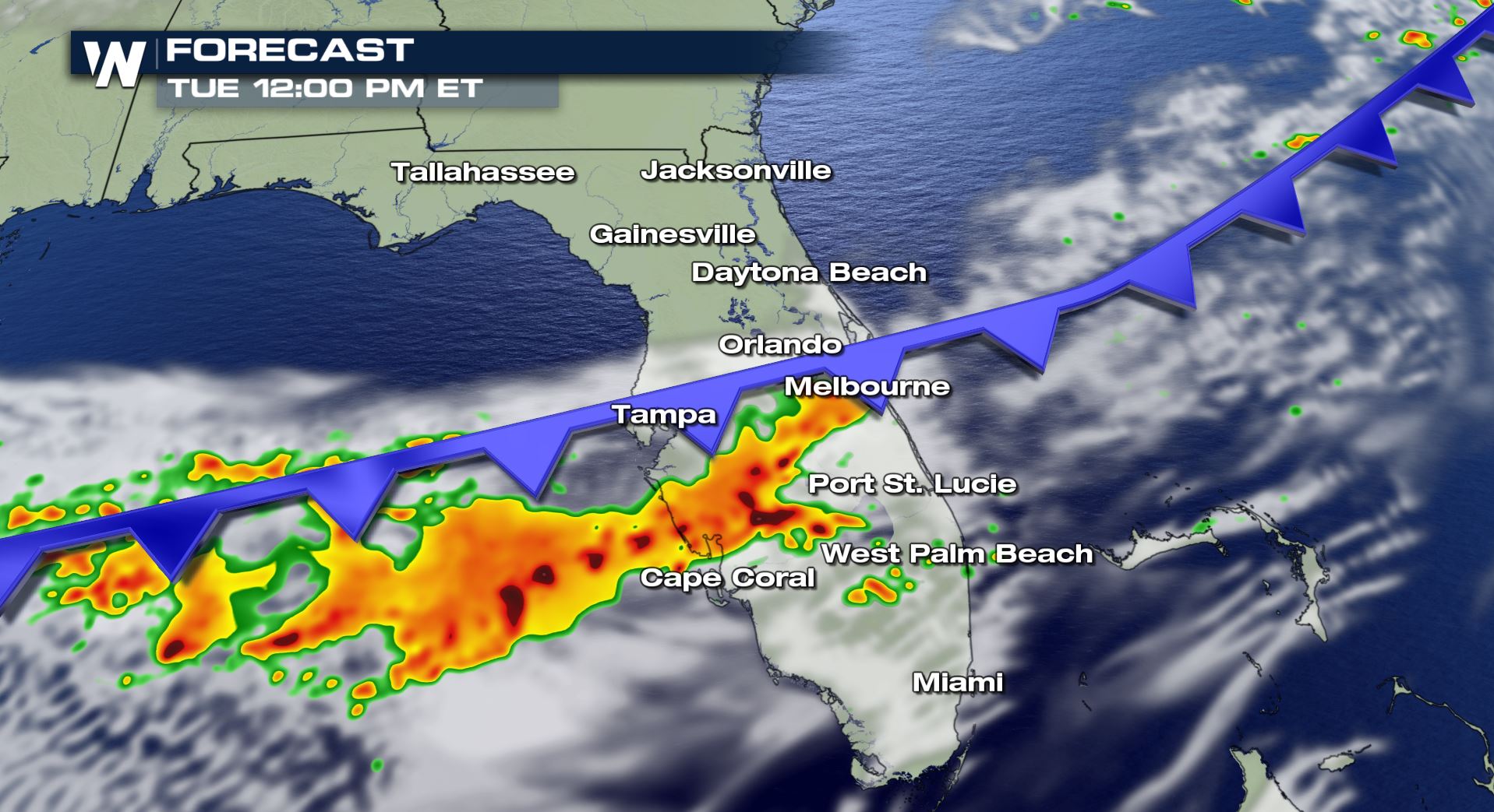
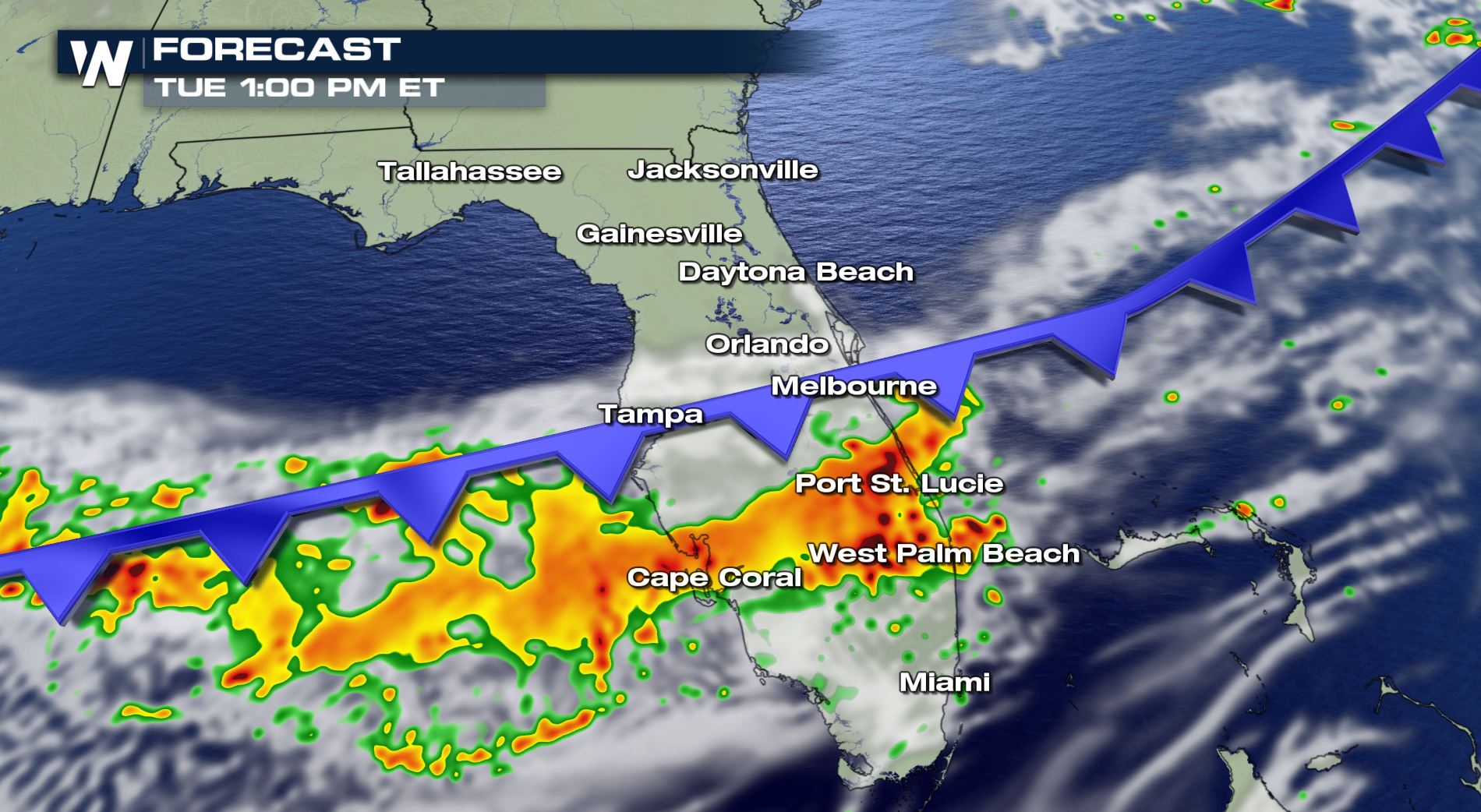
 Here is the latest timing of today's storms. Expect stormy conditions across these areas from the late morning into the early afternoon. We still could see an isolated storm or two late Tuesday over deep south Florida, but those storms should be below severe limits. Stay tuned to WeatherNation for more updates!
Severe Outlook
A marginal risk of severe weather over southeast Florida means some isolated storms could turn severe today. Eastern beaches will need to watch the sky closely and have a safety plan in place if storms turn severe.
Severe Risks
A 2% tornado risk is possible for a small area in southeastern Florida. This includes Port St. Lucie and West Palm Beach. Any storms that move through this area will have some rotation for a tornado risk.
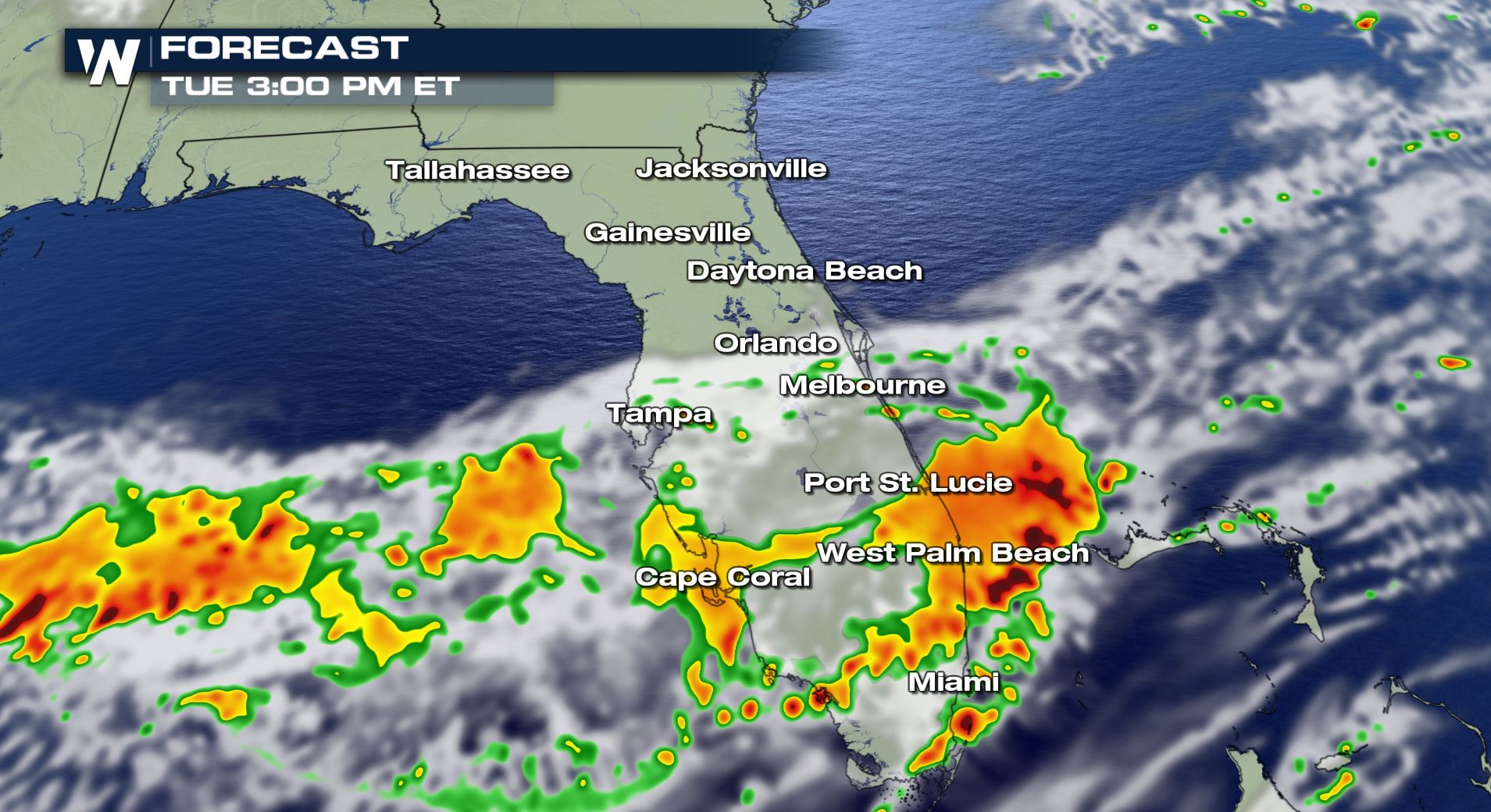
Forecast
Here is the latest timing of today's storms. Expect stormy conditions across these areas from the late morning into the early afternoon. We still could see an isolated storm or two late Tuesday over deep south Florida, but those storms should be below severe limits. Stay tuned to WeatherNation for more updates!All Weather News
More

More Storms for the East Through Monday
A low-pressure system that moved through the
3 Aug 2026 12:20 PM


After Reaching Category 5, Genevieve Weakens in the Pacific
PacificGenevieve formed last Friday south of
3 Aug 2026 12:30 AM

Flooding, Severe Storms Target the Midwest Again
After an active week of storms across the nor
1 Aug 2026 1:40 AM

Flooding Risk Increases as Heavy Rain Targets the Tri-State Area
Tuesday, heavy rainfall moved across the Nort
30 Jul 2026 12:25 AM