Tornado Risk Tuesday Morning for North Carolina

Special Stories
13 Nov 2018 2:38 AM
A low pressure system pushing towards the Mid-Atlantic will bring strong winds and rotating thunderstorms to eastern North Carolina this morning. This means the risk of severe storms will be possible through Sunrise Tuesday morning. Here is the latest.
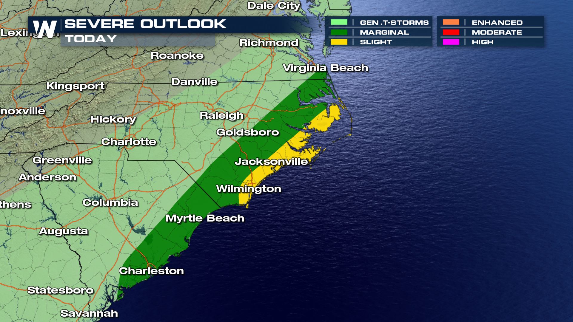 A Marginal to Slight risk of severe weather is already in place for the coasts of South and North Carolina. The higher tornado risk will be located in North Carolina.
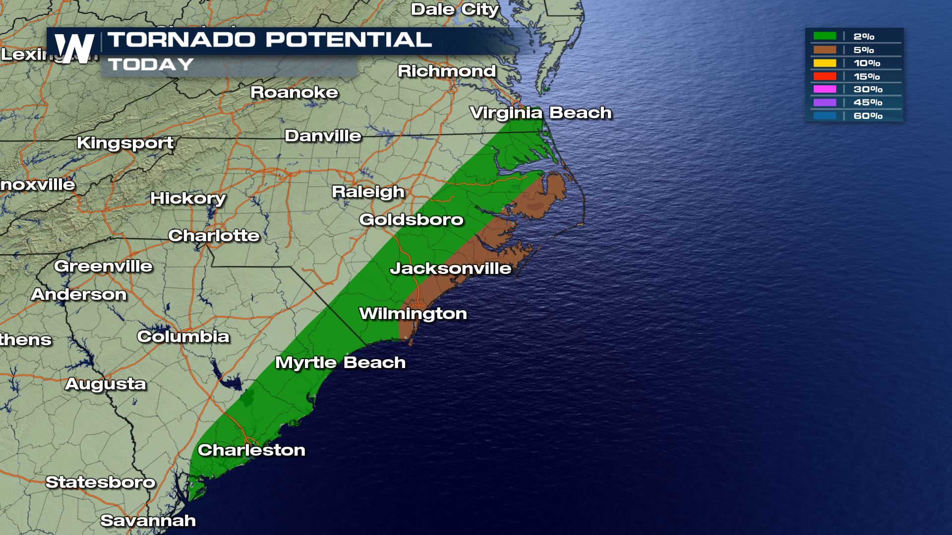
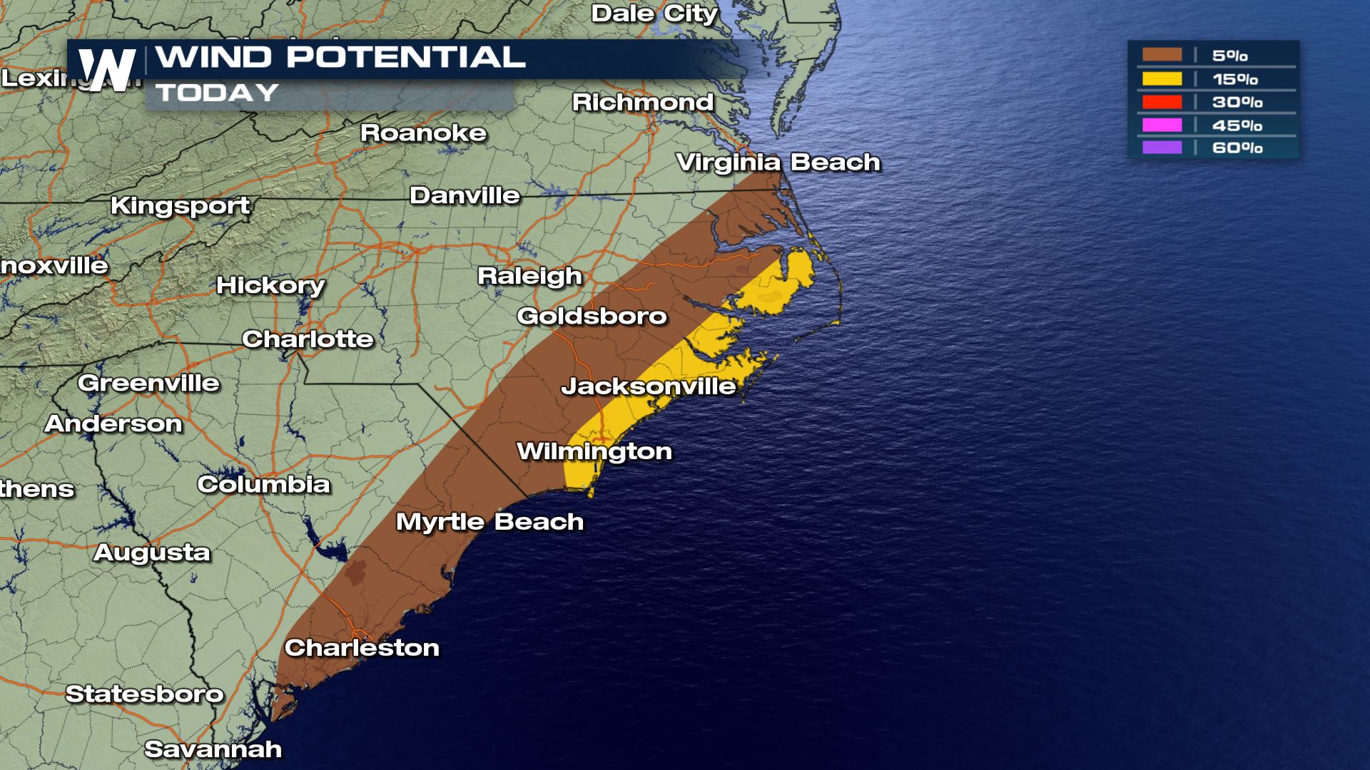 This will be more than likely a wind and tornado event. The hail potential is there with the forecast, but any hail that falls should be less than 1" in diameter.
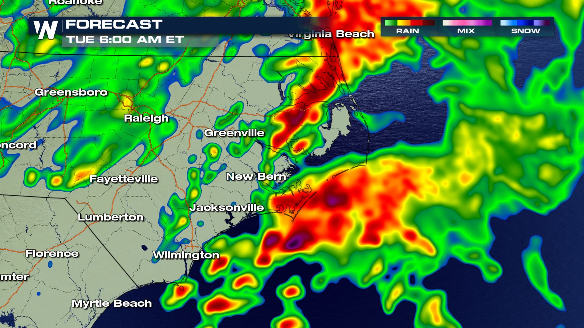
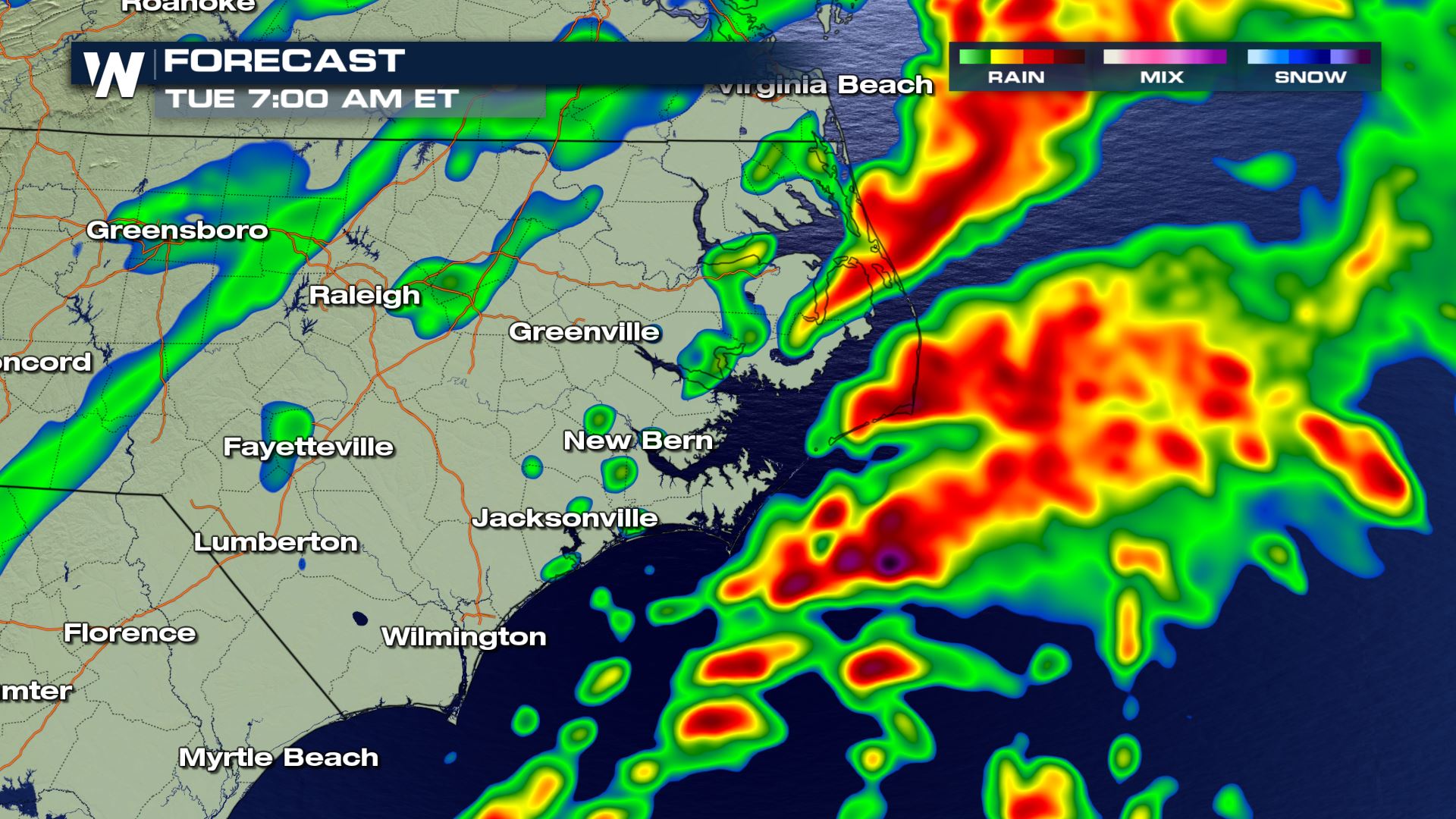 The strongest storms will be impacting the region before sunrise this morning. Most of the storms will be out in the Atlantic later this morning. Keep it tuned to WatherNation for more updates.
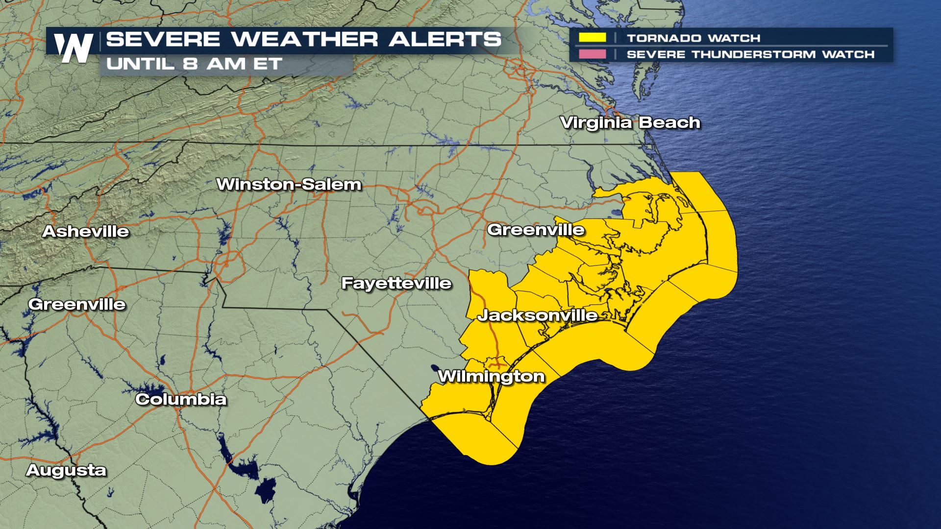
Tornado Watch
Severe Outlook
A Marginal to Slight risk of severe weather is already in place for the coasts of South and North Carolina. The higher tornado risk will be located in North Carolina.
Severe Risks
This will be more than likely a wind and tornado event. The hail potential is there with the forecast, but any hail that falls should be less than 1" in diameter.
Forecast
The strongest storms will be impacting the region before sunrise this morning. Most of the storms will be out in the Atlantic later this morning. Keep it tuned to WatherNation for more updates.
All Weather News
More


More Storms for the East Sunday and Monday
A low-pressure system crashing through the Mi
2 Aug 2026 2:20 AM

After Reaching Category 5, Genevieve Weakens in the Pacific
PacificGenevieve formed on last Friday south
2 Aug 2026 1:30 AM

Flooding, Severe Storms Target the Midwest Again
After an active week of storms across the nor
1 Aug 2026 1:40 AM

Flooding Risk Increases as Heavy Rain Targets the Tri-State Area
Tuesday, heavy rainfall moved across the Nort
30 Jul 2026 12:25 AM

Severe Weather: Energy From the Midwest Now in the Southeast
UPPER MIDWEST - Through Monday, dangerous tor
29 Jul 2026 10:30 PM