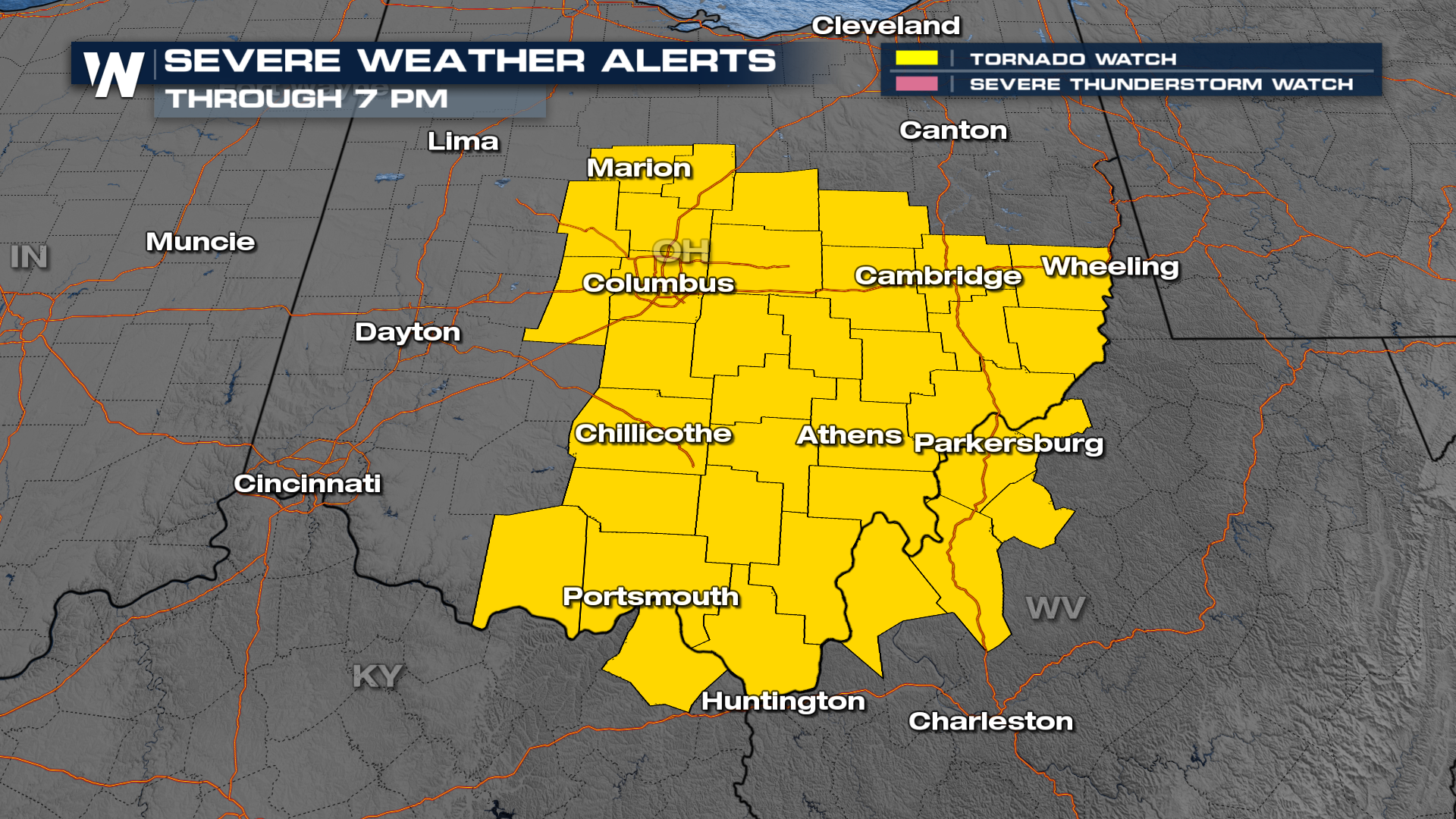
Tornado Watch in Effect for the Midwest
Top Stories
27 Feb 2023 10:45 PM
A TORNADO WATCH is in effect for central Indiana and Ohio this evening as strong storms move through.
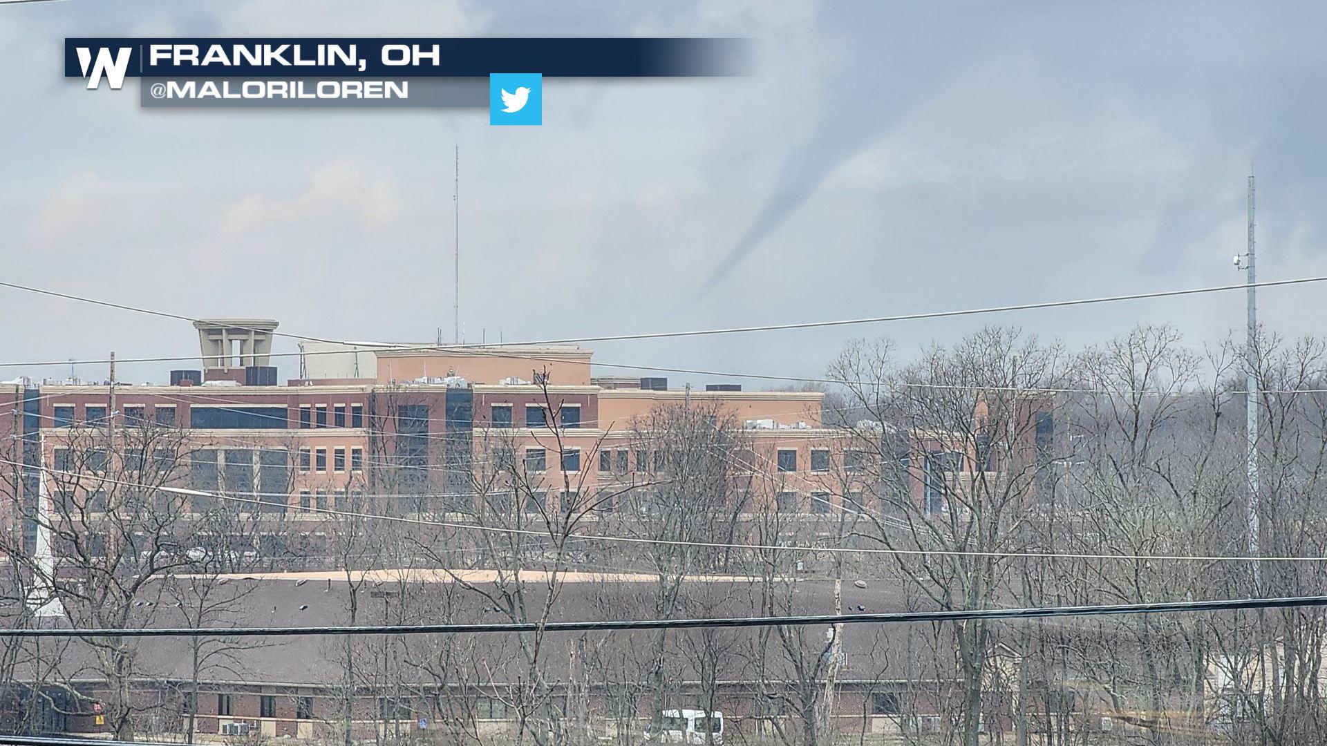
We have already seen numerous severe weather warnings today - please take all alerts very seriously as storms have a history of damaging winds and tornadoes. A funnel was spotted in Franklin, OH earlier today (above). All modes of severe are in play with the strongest risk being damaging winds and tornadoes.
 Showers and storms are continuing to move through the Midwest this early evening before this becomes a heavy rain and snow event in the Northeast.
Behind the area of low pressure will be very gusty winds - wind alerts cover much of the eastern United States.
 More updates are coming up all day on WeatherNation.
All Weather News
More
East Gears Up for Stormy, Wet Weekend
A low pressure system crashing through the Mi
1 Aug 2026 11:35 AM


Flooding, Severe Storms Target the Midwest Again
After an active week of storms across the nor
1 Aug 2026 1:40 AM


After Reaching Category 5, Genevieve Weakens in the Pacific
PacificFausto is now a post-tropical cyclone.
31 Jul 2026 1:30 AM

Flooding Risk Increases as Heavy Rain Targets the Tri-State Area
Tuesday, heavy rainfall moved across the Nort
30 Jul 2026 12:25 AM

Severe Weather: Energy From the Midwest Now in the Southeast
UPPER MIDWEST - Through Monday, dangerous tor
29 Jul 2026 10:30 PM