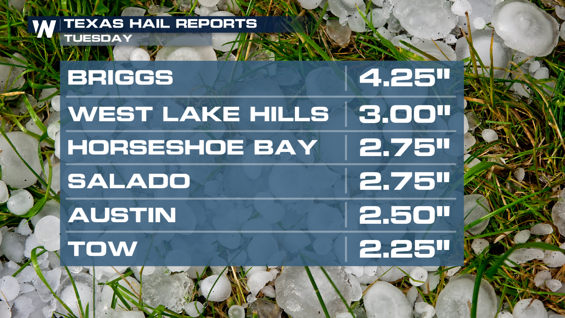
Grapefruit Hail in Texas Tuesday, Wind Damage in Mississippi
TEXAS - Storms have dumped multiple inches of rain, which has led to flash flooding from Texas to Mississippi. Storms are now pushing into Louisana with power outage numbers growing following strong storms. For the latest details on the severe threat Wednesday click here. A Flash Flood Emergency was issued in Kirbyville about 2 hours northeast of Houston overnight. Flash Flood Emergencies are issued when catastrophic flash flooding is ongoing.
Strong storms in Texas have produced hail up to tennis ball in size as they blew through parts of Texas Tuesday. Softball-sized hail was produced west of the I-35 corridor outside of Austin, TX with egg-sized hail in the city of Austin itself!
 Check out this supercell east of the Austin area on Tuesday evening - multiple rounds of storms hit the Lone Star state
A tornado was confirmed in Katy, TX just west of Houston early Wednesday morning, producing damage in the city. It was rated as an EF-1. Thankfully, no injuries were reported at this time.
 Strong storms were also present in Louisana and Mississippi on Tuesday night with an "observed" tornado just west of Jackson, MS before 9 PM local time.
Thankfully the tornado threat didn't materialize in the city, but the strong winds associated with the line of storms blew down trees in Vicksburg, MS stalling traffic and landing on a semi. Storm surveys in the coming days will determine if a tornado touched down or if the damage was a result of straight-line winds.