Tropical Storm Amanda Forms
Special Stories
31 May 2020 3:45 AM
The first tropical storm of the Eastern Pacific Hurricane season formed early Sunday morning, after becoming the second tropical depression of the season Saturday afternoon.
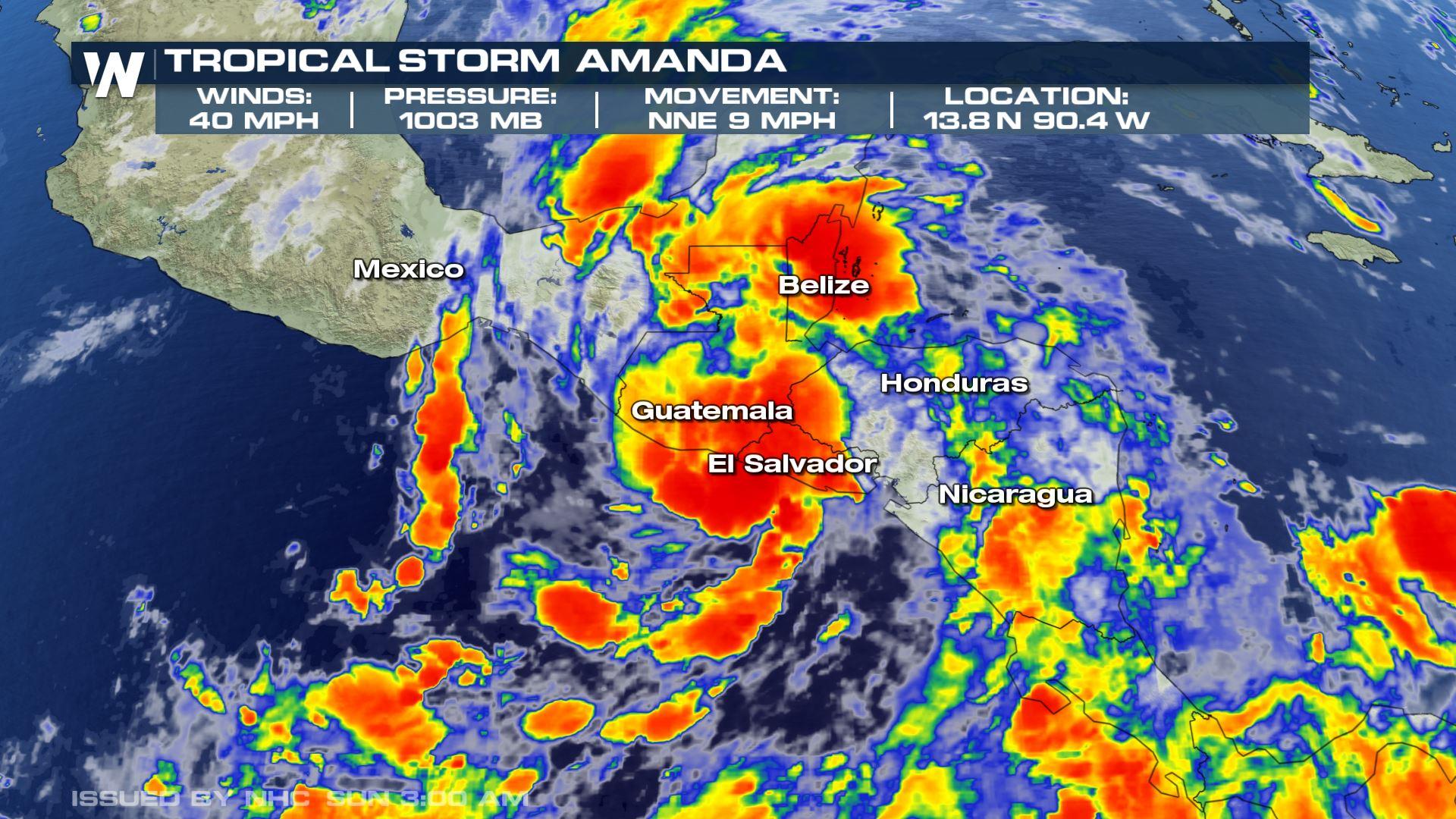
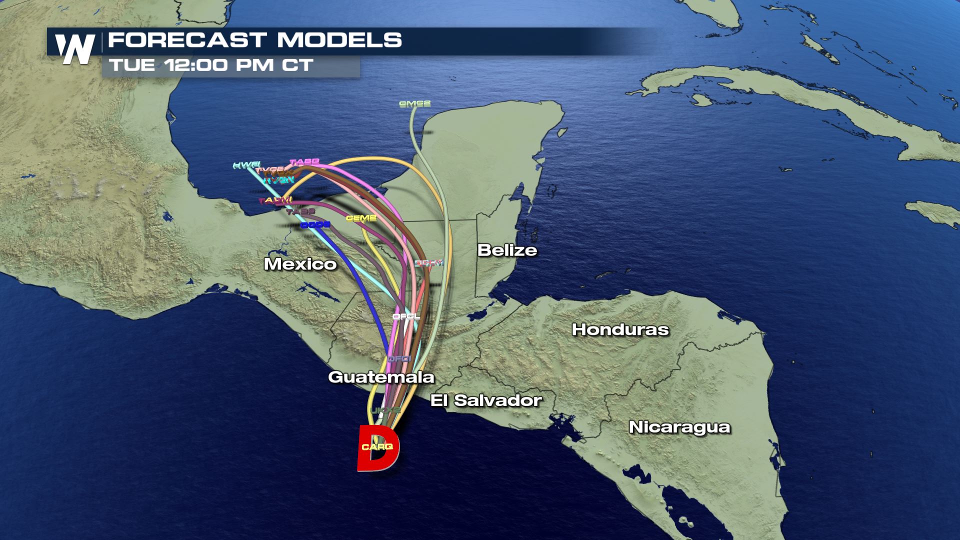
 Tropical Storm Amanda is moving onshore near Port San Jose, Guatemala. Maximum sustained winds were 40 miles per hour and the storm movement was north-northeast at 9 mph. The central minimum pressure was estimated to be 1003 millibars and for those tracking at home, the coordinates were 13.8 North, 90.4 West.
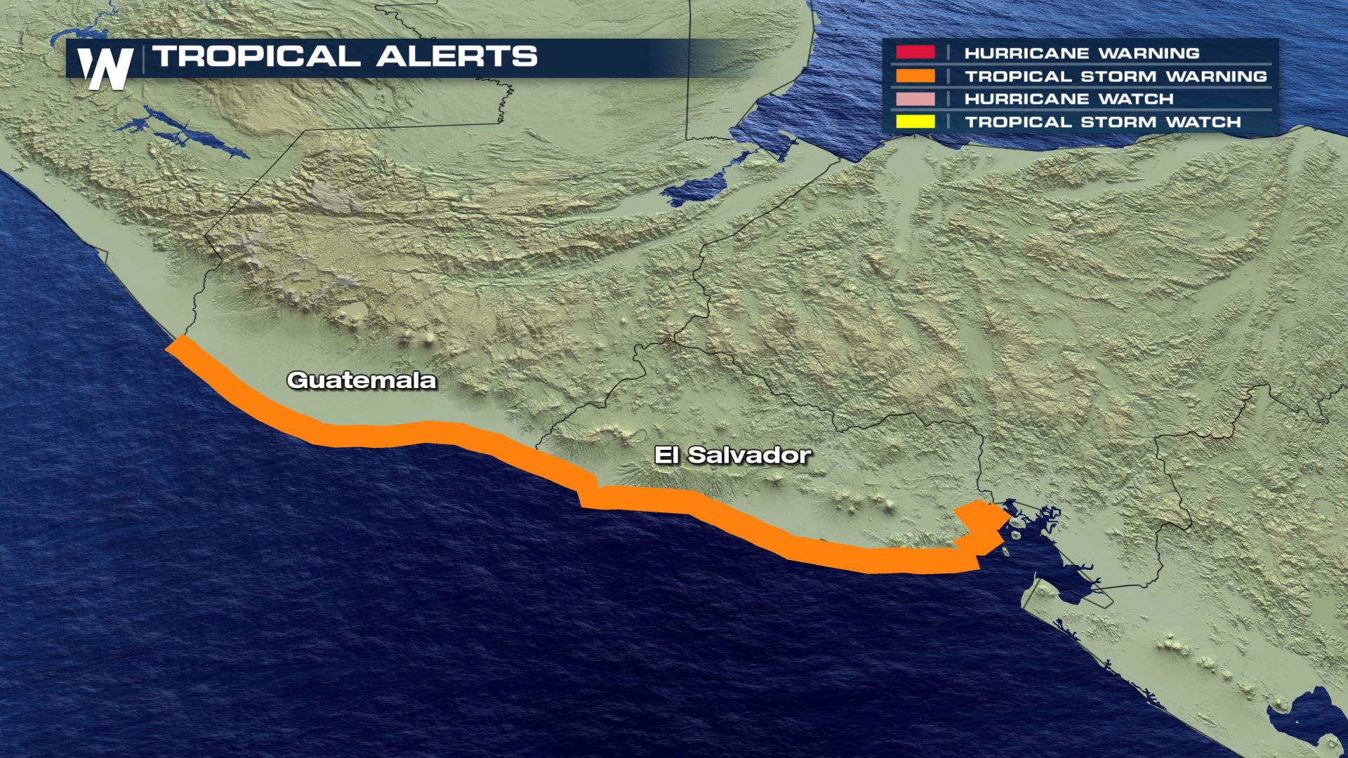 The governments of El Salvador and Guatemala have issued Tropical Storm Warnings for the entire coastlines. That means tropical storm conditions are expected somewhere within the warning area within the next 12-24 hours. Interests in southern Mexico and Honduras should monitor the progress of this system.
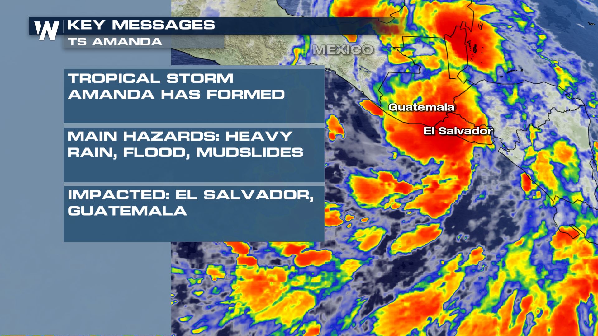
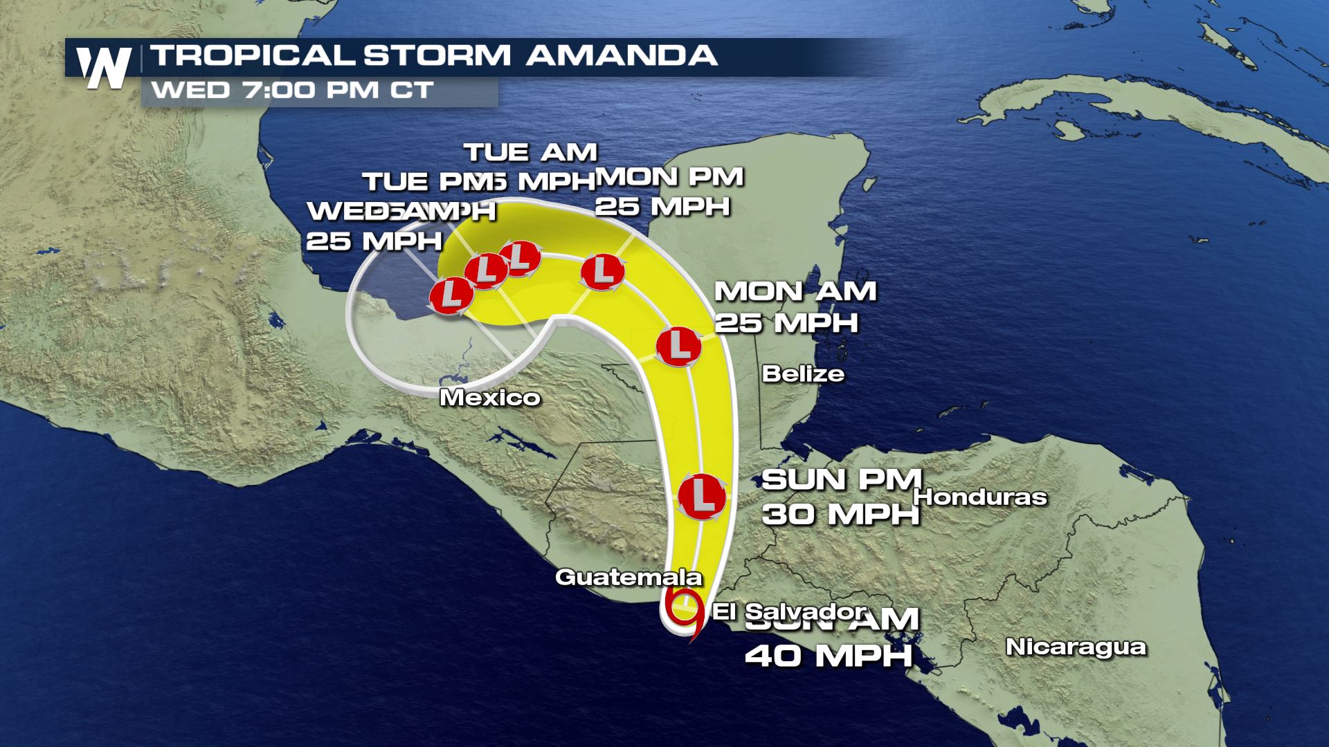
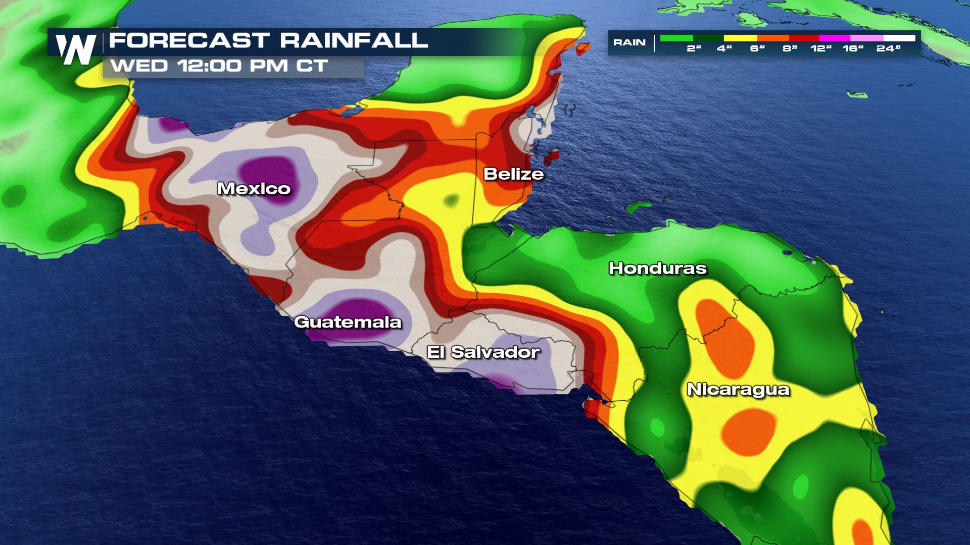 Tropical Storm Amanda is expected to move north across Guatemala Sunday. Heavy rainfall is the primary threat. The storm expected to produce total rain accumulations of 10-15 inches over El Salvador, southern Guatemala, and western Honduras. Isolated maximum amounts of 20 inches are possible in El Salvador and southern Guatemala, capable of producing life-threatening flash flooding and mudslides. Rain accumulations of 5 to 10 inches will be possible over northwest Nicaragua, Belize and the Mexican states of Chiapas, Tabasco, Veracruz, and Oaxaca.
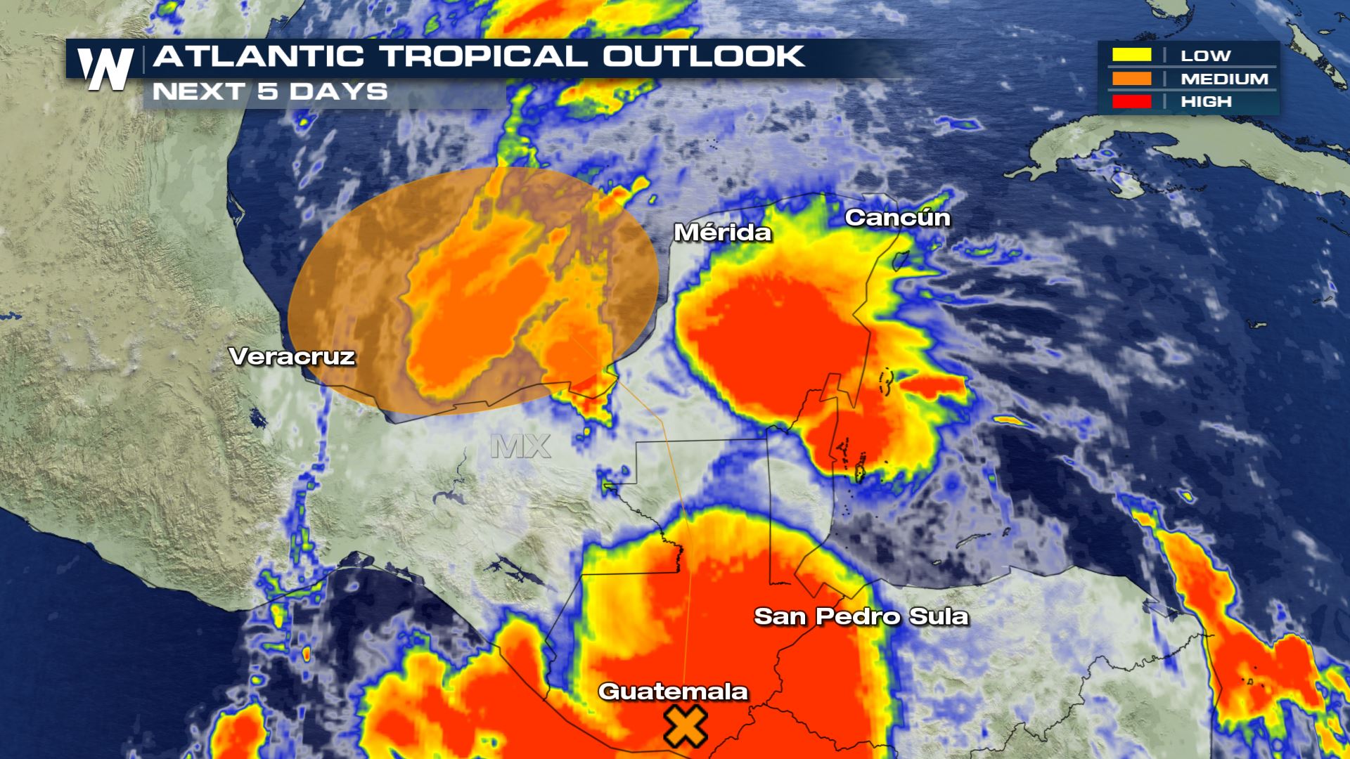 The moisture associated with this tropical cyclone is expected to move north through the coming days. In a few days, leftover energy/moisture from this system may try to form in the far southern Gulf of Mexico. Stay with us for that part of the story, as we will update you with the latest tropical outlooks.
Tropical Storm Amanda is moving onshore near Port San Jose, Guatemala. Maximum sustained winds were 40 miles per hour and the storm movement was north-northeast at 9 mph. The central minimum pressure was estimated to be 1003 millibars and for those tracking at home, the coordinates were 13.8 North, 90.4 West.
The governments of El Salvador and Guatemala have issued Tropical Storm Warnings for the entire coastlines. That means tropical storm conditions are expected somewhere within the warning area within the next 12-24 hours. Interests in southern Mexico and Honduras should monitor the progress of this system.
Tropical Storm Amanda is expected to move north across Guatemala Sunday. Heavy rainfall is the primary threat. The storm expected to produce total rain accumulations of 10-15 inches over El Salvador, southern Guatemala, and western Honduras. Isolated maximum amounts of 20 inches are possible in El Salvador and southern Guatemala, capable of producing life-threatening flash flooding and mudslides. Rain accumulations of 5 to 10 inches will be possible over northwest Nicaragua, Belize and the Mexican states of Chiapas, Tabasco, Veracruz, and Oaxaca.
The moisture associated with this tropical cyclone is expected to move north through the coming days. In a few days, leftover energy/moisture from this system may try to form in the far southern Gulf of Mexico. Stay with us for that part of the story, as we will update you with the latest tropical outlooks.All Weather News
More

Flooding, Severe Storms Target the Midwest Again
After an active week of storms across the nor
31 Jul 2026 11:15 PM


After Reaching Category 5, Genevieve Weakens in the Pacific
PacificFausto is now a post-tropical cyclone.
31 Jul 2026 1:30 AM

Flooding Risk Increases as Heavy Rain Targets the Tri-State Area
Tuesday, heavy rainfall moved across the Nort
30 Jul 2026 12:25 AM

Severe Weather: Energy From the Midwest Now in the Southeast
UPPER MIDWEST - Through Monday, dangerous tor
29 Jul 2026 10:30 PM