Watching a System off the East Coast for Tropical Development
Top Stories
26 Aug 2019 4:13 AM
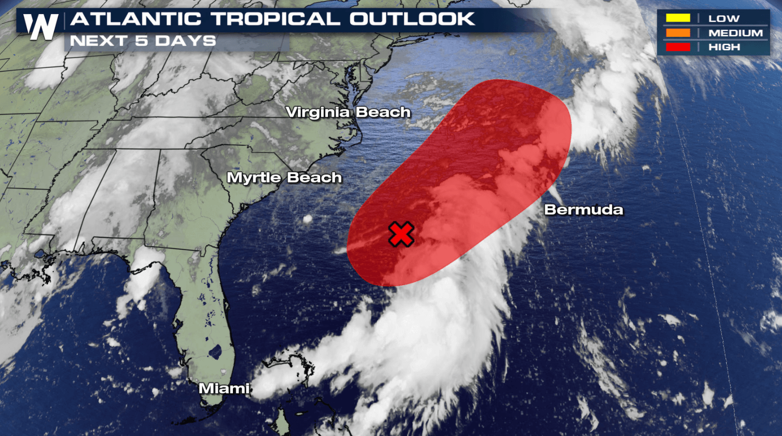
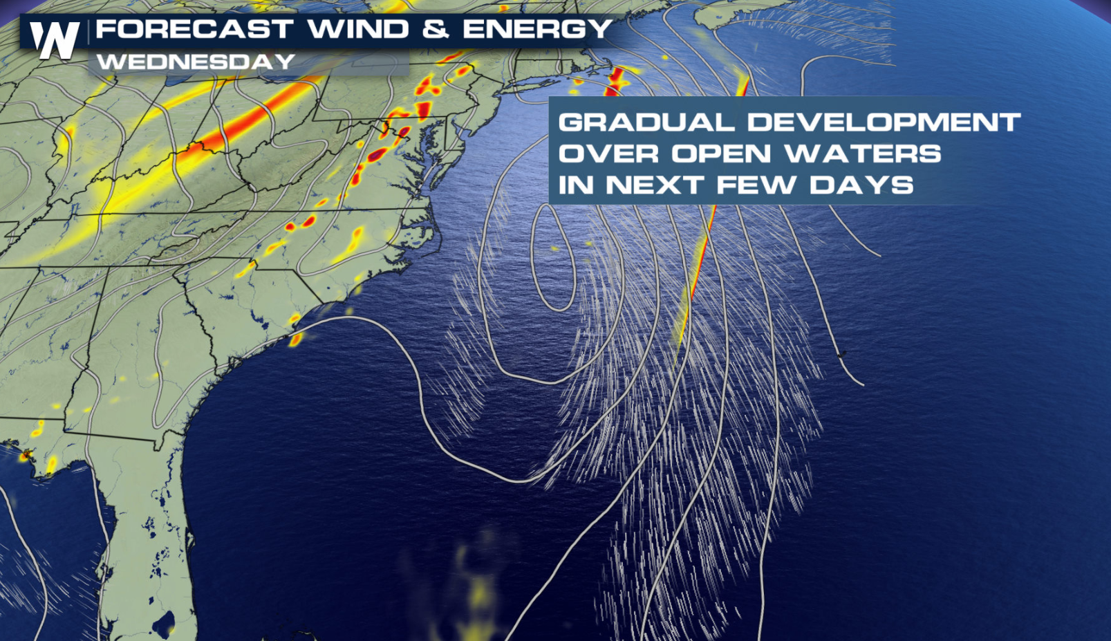
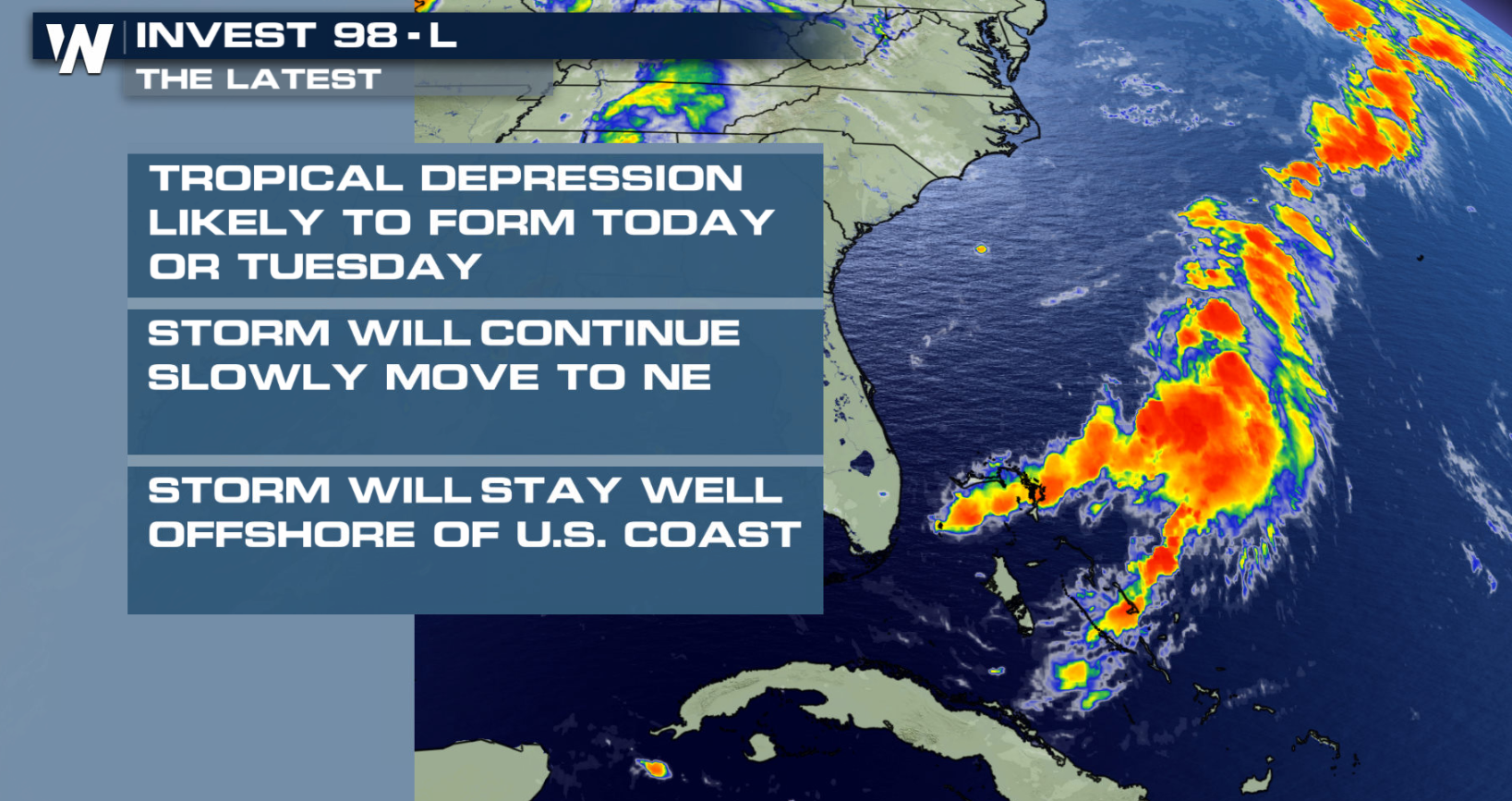
A low pressure in the Atlantic Ocean off the East Coast will continue to strengthen over the next few days. This system is likely to develop form into the next tropical depression.
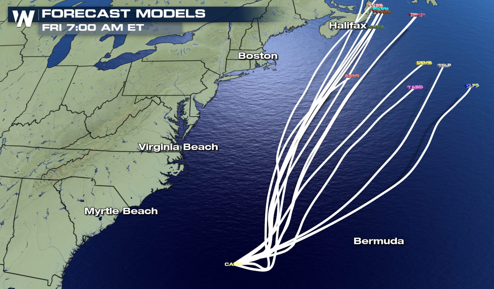 The low will continue to move to the north-northeast across an environment that is conducive for tropical development. Models are in good agreement on the potential path as Jet Stream winds steer 98-L to the east. The good news is that it looks like this system will stay well off the East Coast.
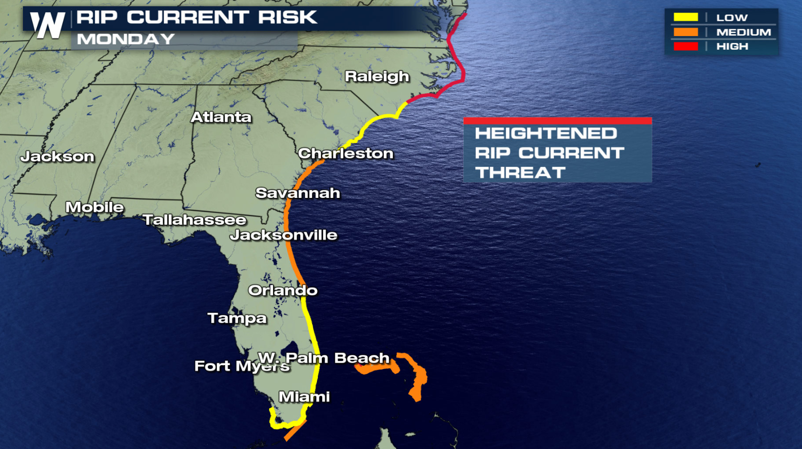
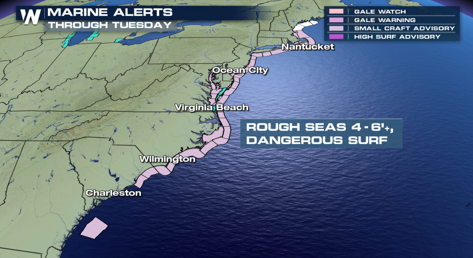
 While there will not be any direct impacts from Invest 98-L, the coastal Carolinas will see some indirect impacts. The primary concern will be rough surf and dangerous rip currents.
 Be sure to stay with WeatherNation as we continue to track the activities in the Tropics. For more on Tropical Storm Dorian in the Atlantic, read this.
 For WeatherNation, Meteorologist Kate Mantych.
The low will continue to move to the north-northeast across an environment that is conducive for tropical development. Models are in good agreement on the potential path as Jet Stream winds steer 98-L to the east. The good news is that it looks like this system will stay well off the East Coast.
While there will not be any direct impacts from Invest 98-L, the coastal Carolinas will see some indirect impacts. The primary concern will be rough surf and dangerous rip currents.
Be sure to stay with WeatherNation as we continue to track the activities in the Tropics. For more on Tropical Storm Dorian in the Atlantic, read this.
For WeatherNation, Meteorologist Kate Mantych.All Weather News
More

Flooding, Severe Storms Target the Midwest Again
After an active week of storms across the nor
1 Aug 2026 1:40 AM


After Reaching Category 5, Genevieve Weakens in the Pacific
PacificFausto is now a post-tropical cyclone.
31 Jul 2026 1:30 AM

Flooding Risk Increases as Heavy Rain Targets the Tri-State Area
Tuesday, heavy rainfall moved across the Nort
30 Jul 2026 12:25 AM

Severe Weather: Energy From the Midwest Now in the Southeast
UPPER MIDWEST - Through Monday, dangerous tor
29 Jul 2026 10:30 PM