Wednesday and Thursday Severe Weather Outlooks
Special Stories
9 Jul 2019 4:26 PM
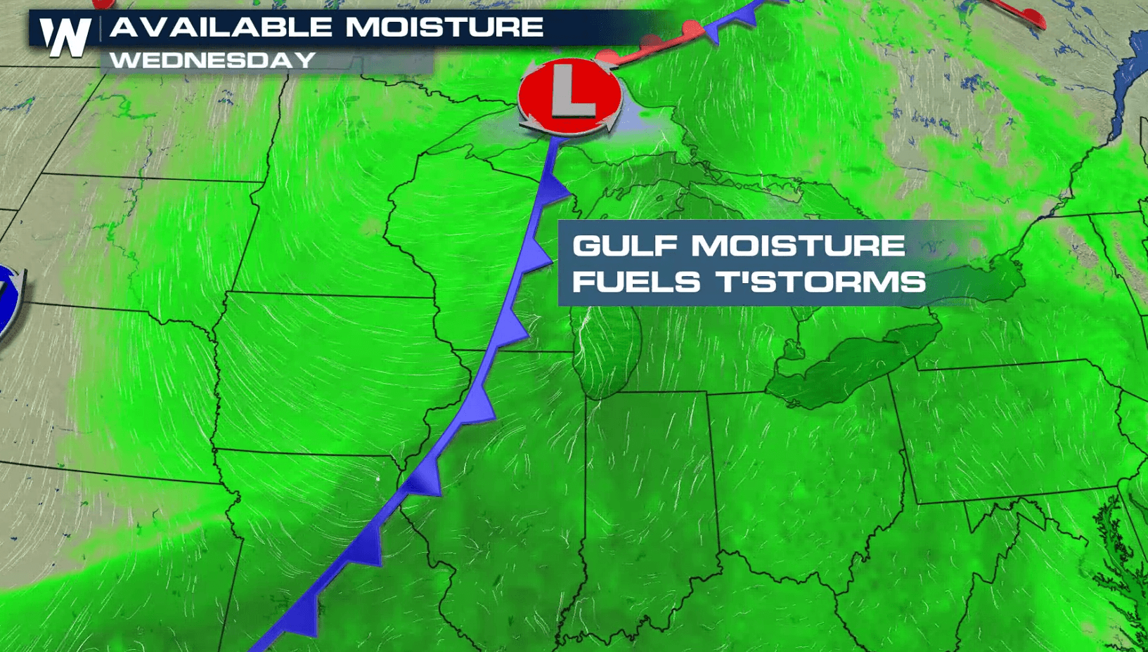
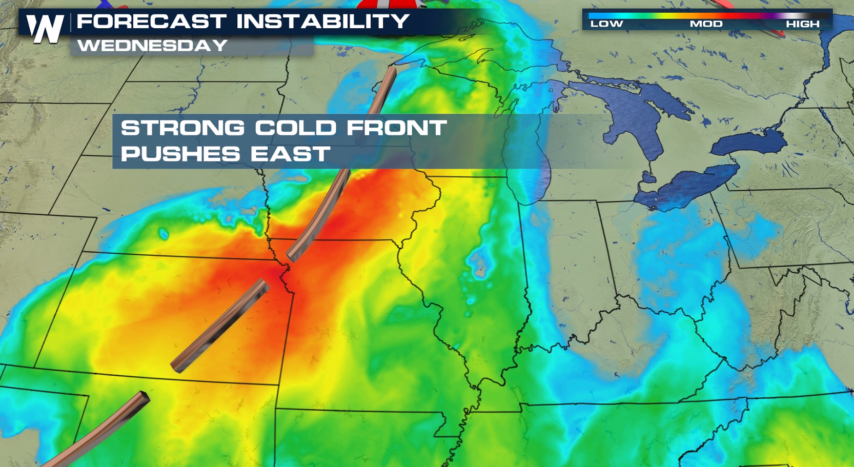
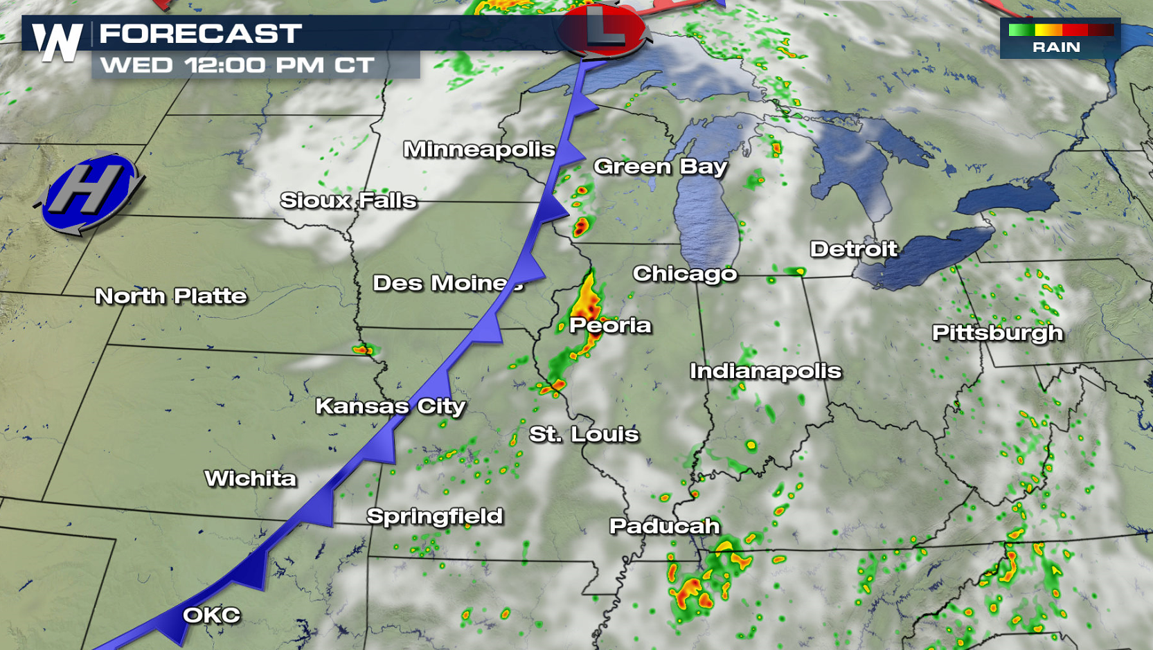
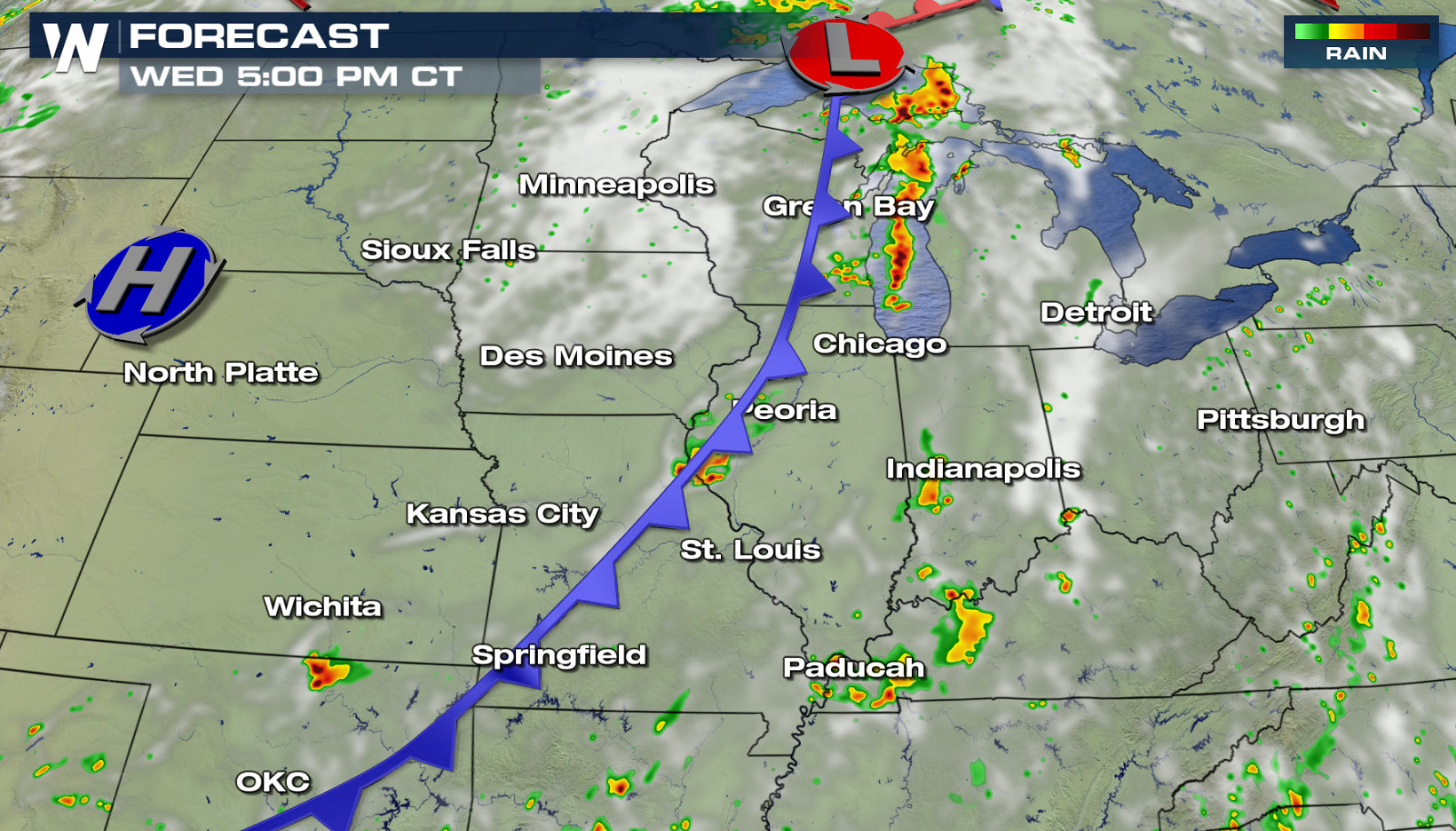
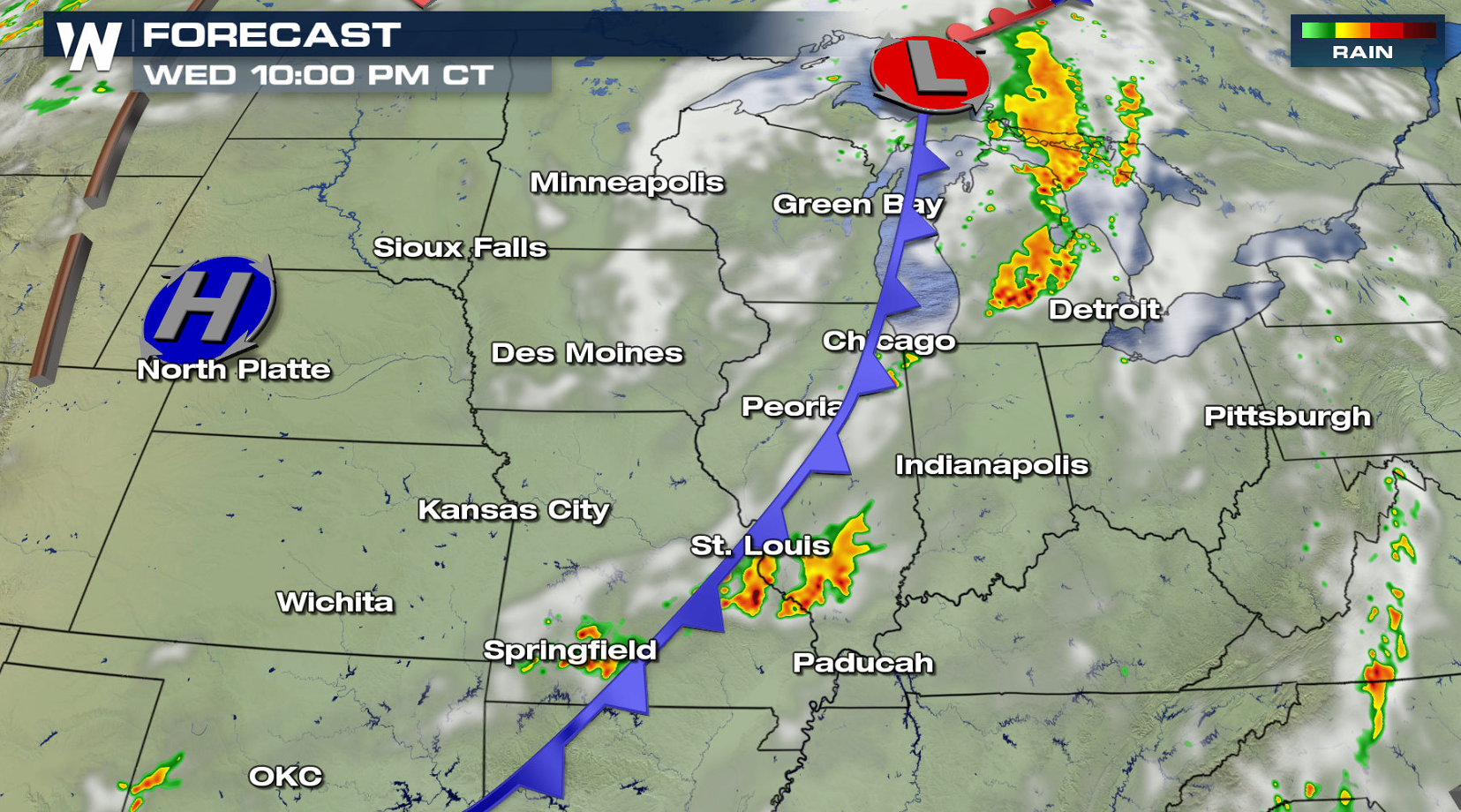
The threat for severe thunderstorms will push into the Great Lakes and Ohio Valley for Wednesday. A strong cold front will push across the region, interacting with warm temperatures and high humidity. Energy aloft will interact with the instability, creating thunderstorms with large hail, damaging wind, and a few tornadoes.
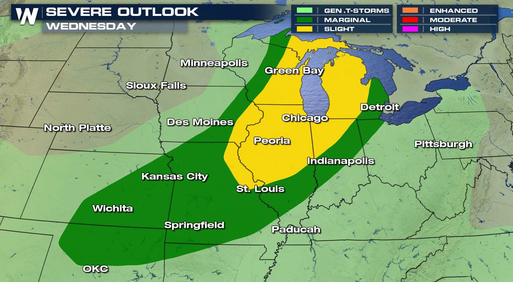
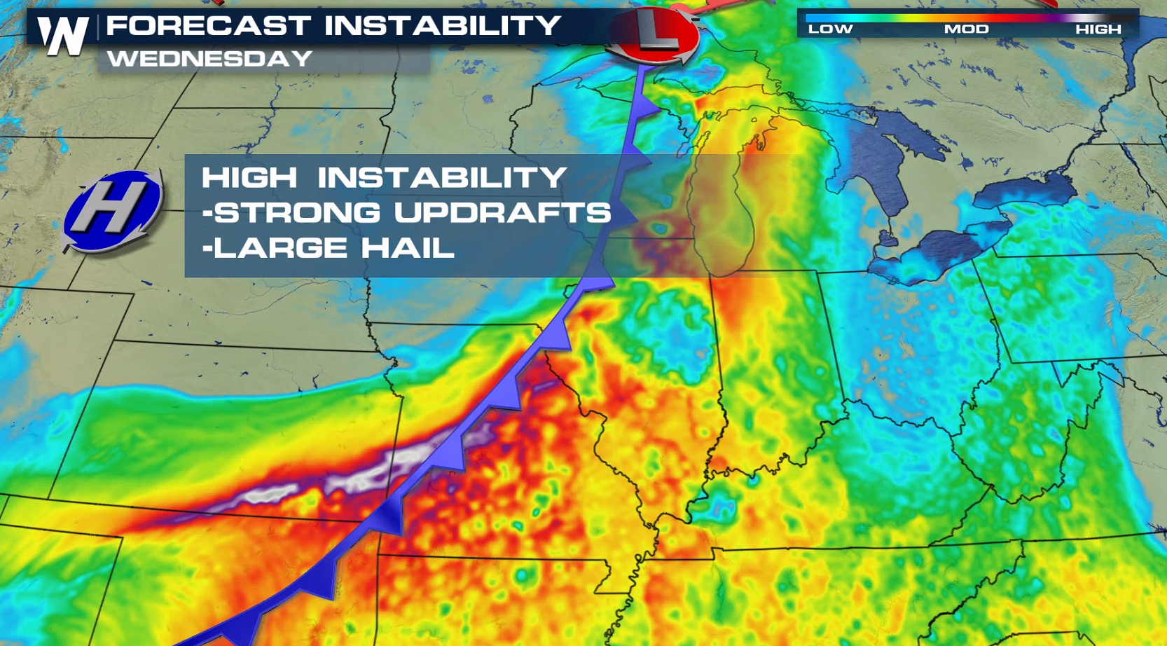 Isolated severe storms will likely develop in the afternoon ahead of the cold front from the Upper Peninsula of Michigan to Missouri. Storms will expand across Wisconsin, Lower Michigan and the Ohio Valley into the evening.
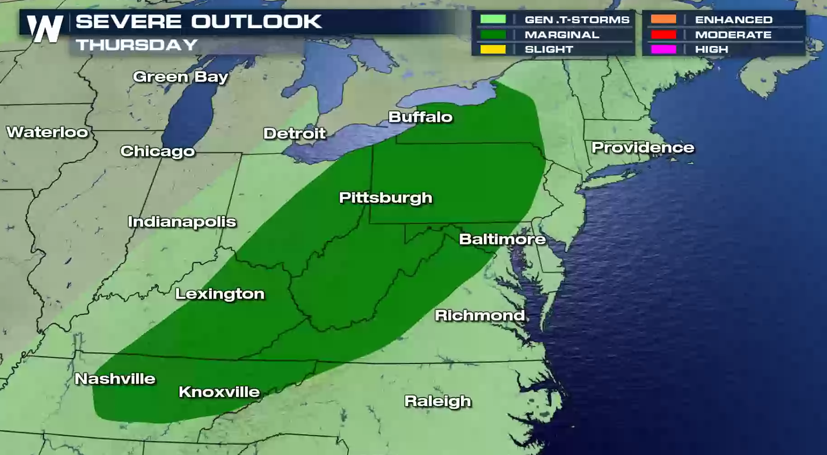
 On Thursday, there is a marginal risk for severe thunderstorms from the Northeast into the Tennessee Valley. Overall coverage is expected to be less with lower instability, but some storms will likely be intense in the late afternoon and evening.
 For WeatherNation: Meteorologist Mace Michaels
Isolated severe storms will likely develop in the afternoon ahead of the cold front from the Upper Peninsula of Michigan to Missouri. Storms will expand across Wisconsin, Lower Michigan and the Ohio Valley into the evening.
On Thursday, there is a marginal risk for severe thunderstorms from the Northeast into the Tennessee Valley. Overall coverage is expected to be less with lower instability, but some storms will likely be intense in the late afternoon and evening.
For WeatherNation: Meteorologist Mace MichaelsAll Weather News
More
East Gears Up for Stormy, Wet Weekend
A low pressure system crashing through the Mi
1 Aug 2026 11:35 AM

Flooding, Severe Storms Target the Midwest Again
After an active week of storms across the nor
1 Aug 2026 1:40 AM


After Reaching Category 5, Genevieve Weakens in the Pacific
PacificFausto is now a post-tropical cyclone.
31 Jul 2026 1:30 AM

Flooding Risk Increases as Heavy Rain Targets the Tri-State Area
Tuesday, heavy rainfall moved across the Nort
30 Jul 2026 12:25 AM

Severe Weather: Energy From the Midwest Now in the Southeast
UPPER MIDWEST - Through Monday, dangerous tor
29 Jul 2026 10:30 PM