Storms in Florida Today
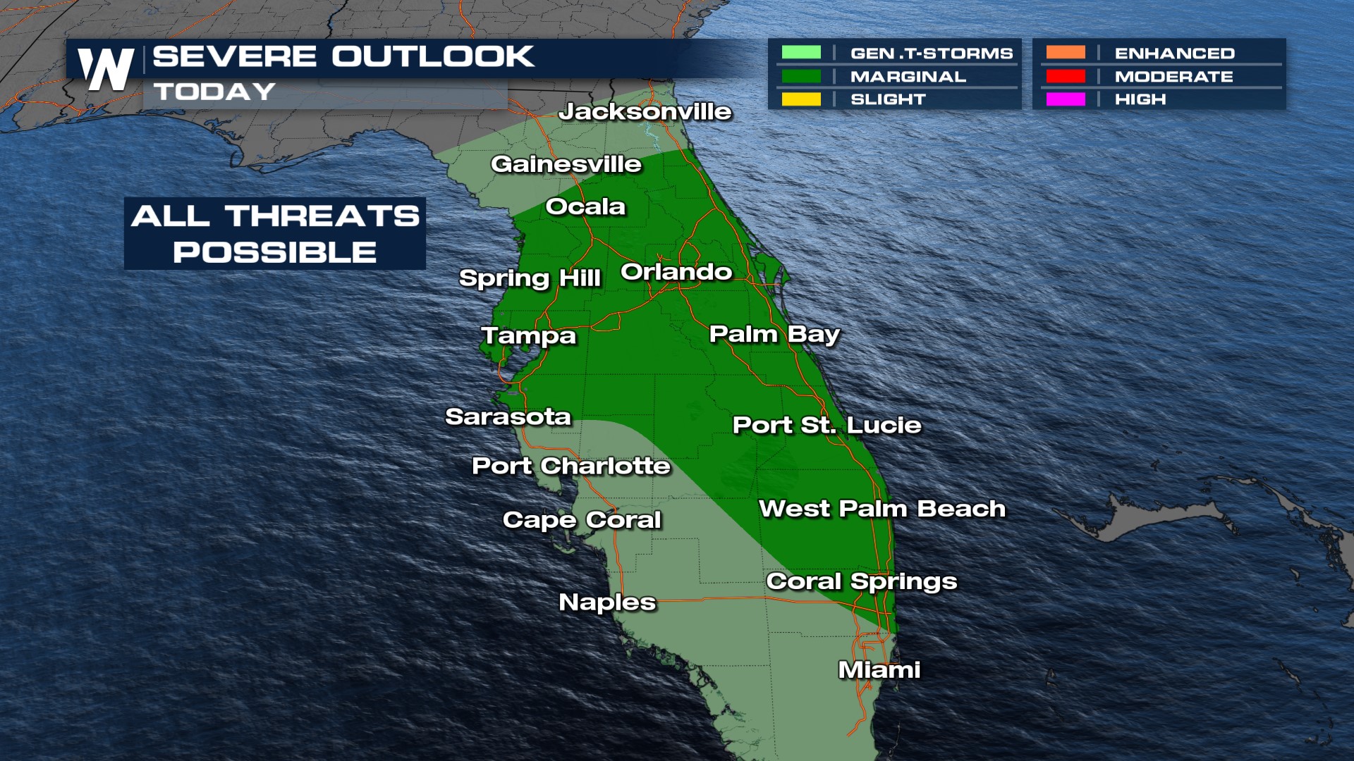
The end of last week was active across the Southeast with numerous tornadoes, massive hail, and damaging winds across Arkansas, Tennessee, Mississippi, and Alabama. The front involved in the recent severe weather has stalled close to the Gulf Coast and storm chances remain into the upcoming week. That new low and cold front will keep a rainy and soggy pattern for the I-75 and I-95 corridor in Florida on Monday.

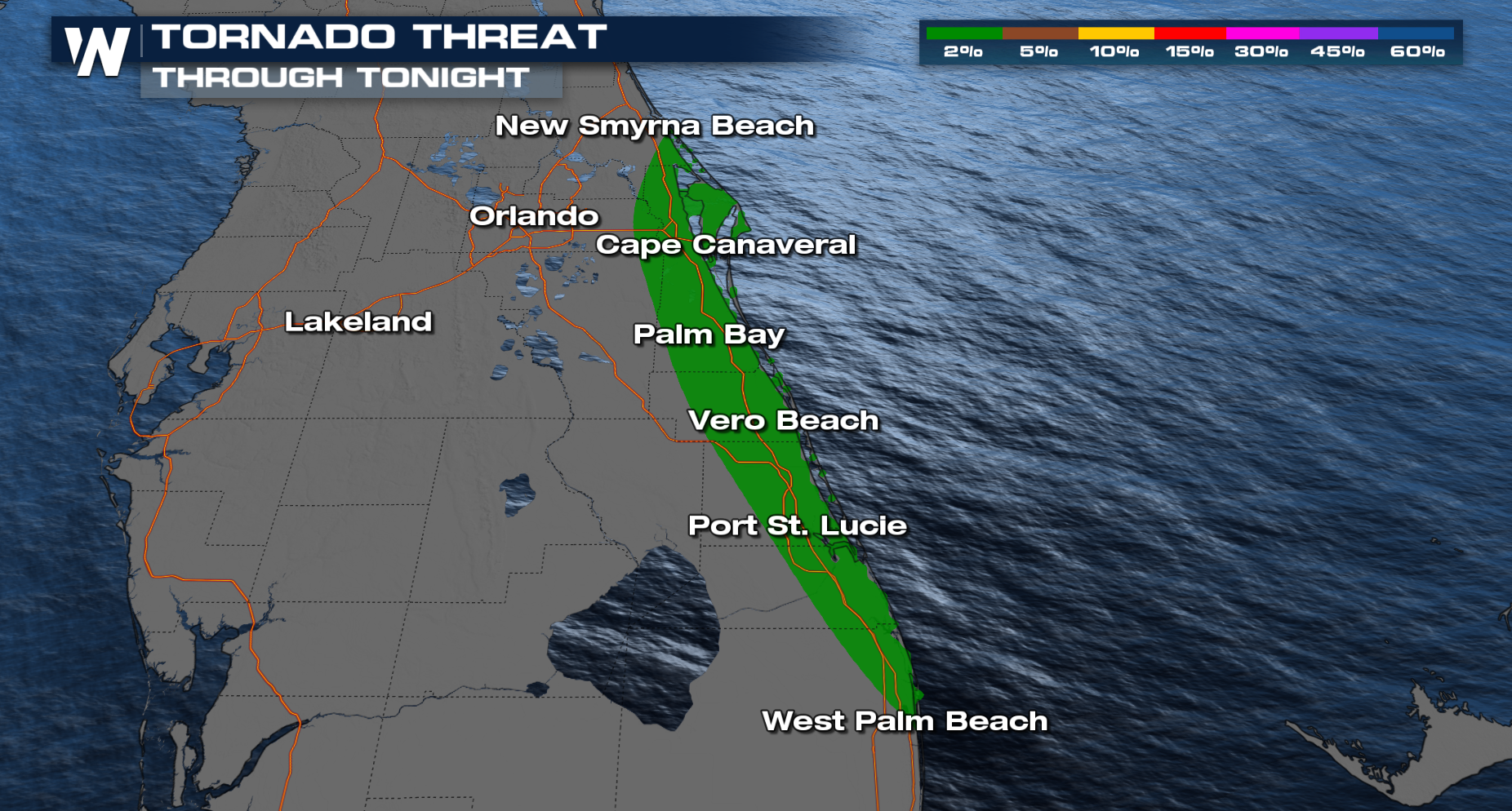
Florida will see scattered strong to severe storms throughout the day. Damaging winds and large hail will be the main threat for Monday, with an isolated tornado possible. Waves of precipitation will remain focused along the stalled-out boundary and another incoming cold front. Make sure you pay attention to your weather alerts and please take them seriously.
As mentioned before, damaging winds and pockets of large hail are the primary threats with today's risk, but a few isolated tornadoes could spin up. Areas from Port St. John, through Palm Bay, Vero Beach, and reaching towards West Palm Beach have the highest chance of seeing enough rotation for a tornado to form.
