Snow to Start the Weekend in the Midwest
Special Stories
22 Jan 2021 9:00 AM
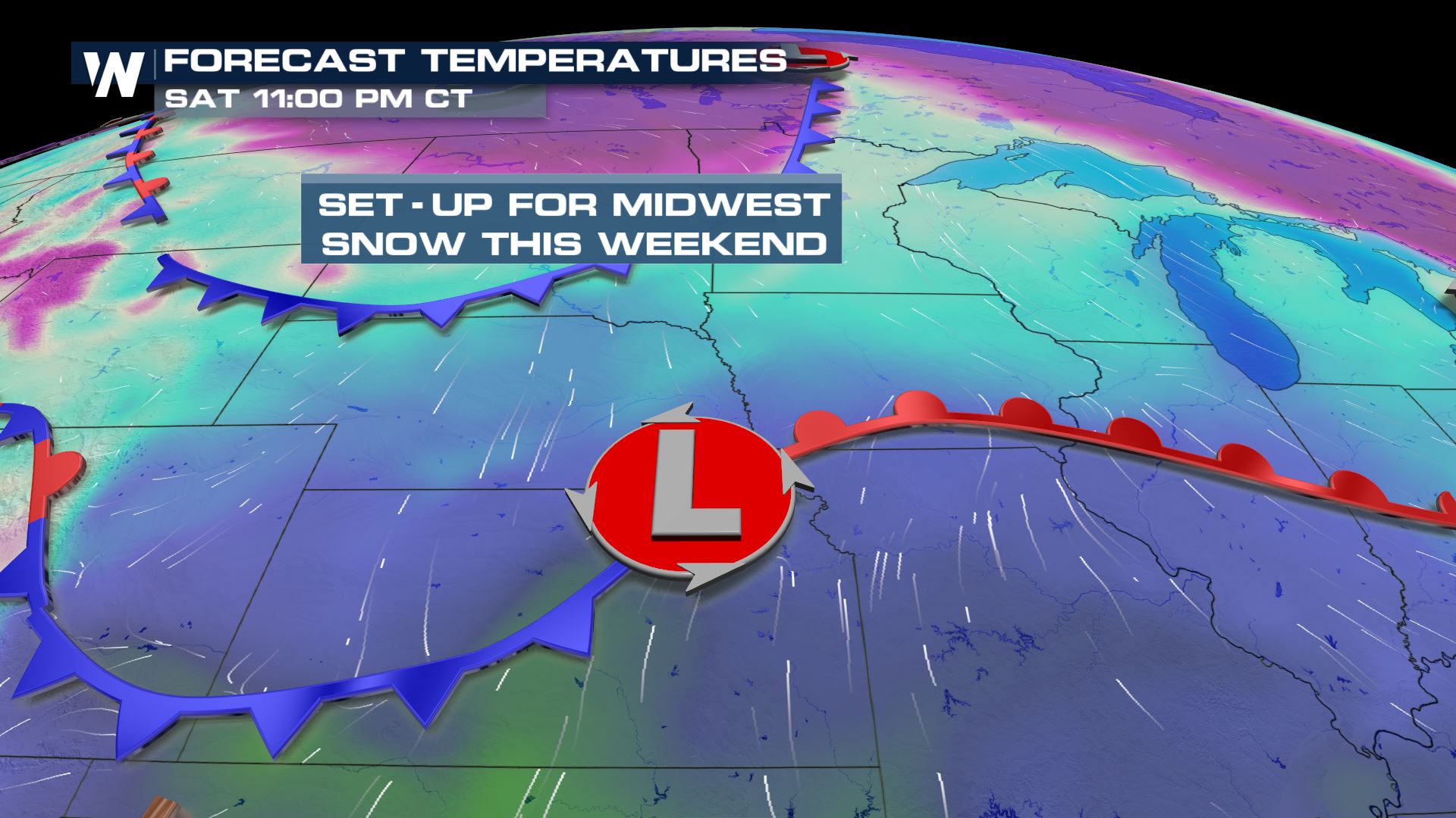
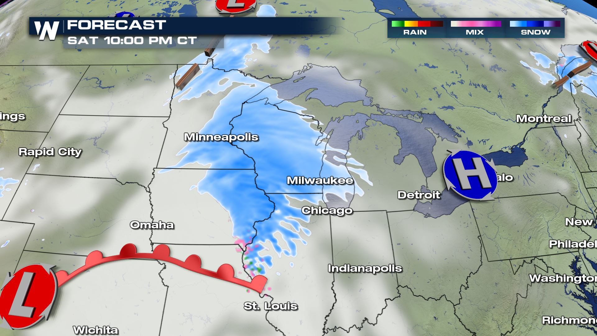
Waves of arctic air moving into the High Plains continue over the next few days. A Saturday clipper, along with a secondary low pressure system, will produce lift and bring enough moisture to stream widespread snow into areas of the Midwest.
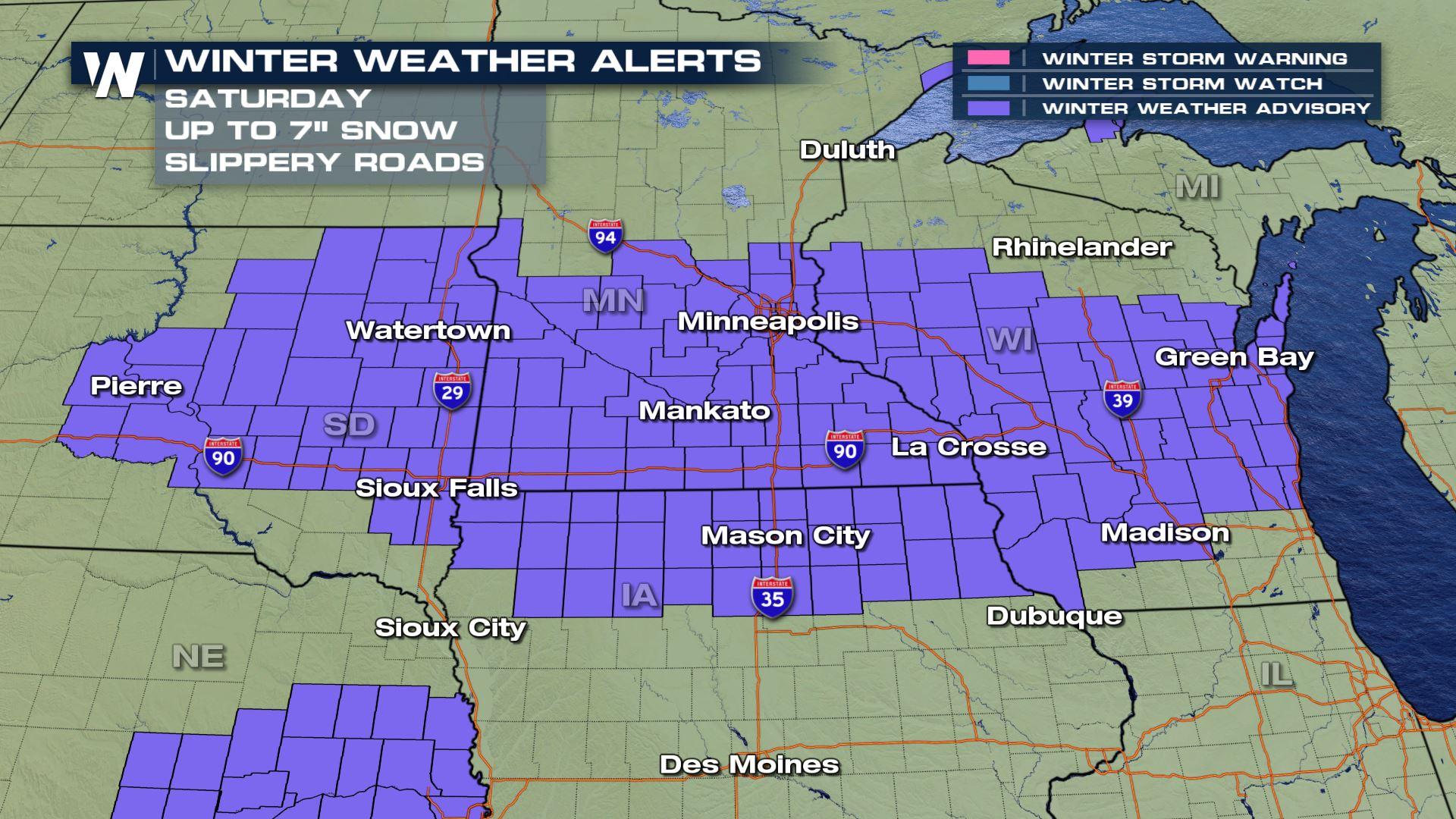
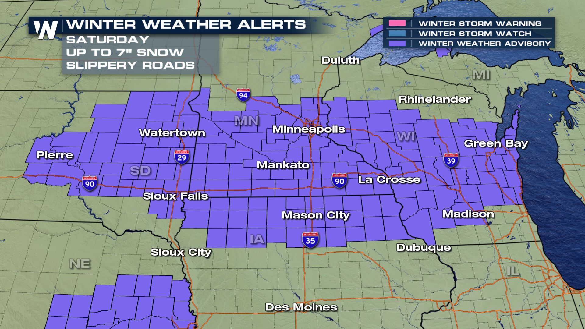
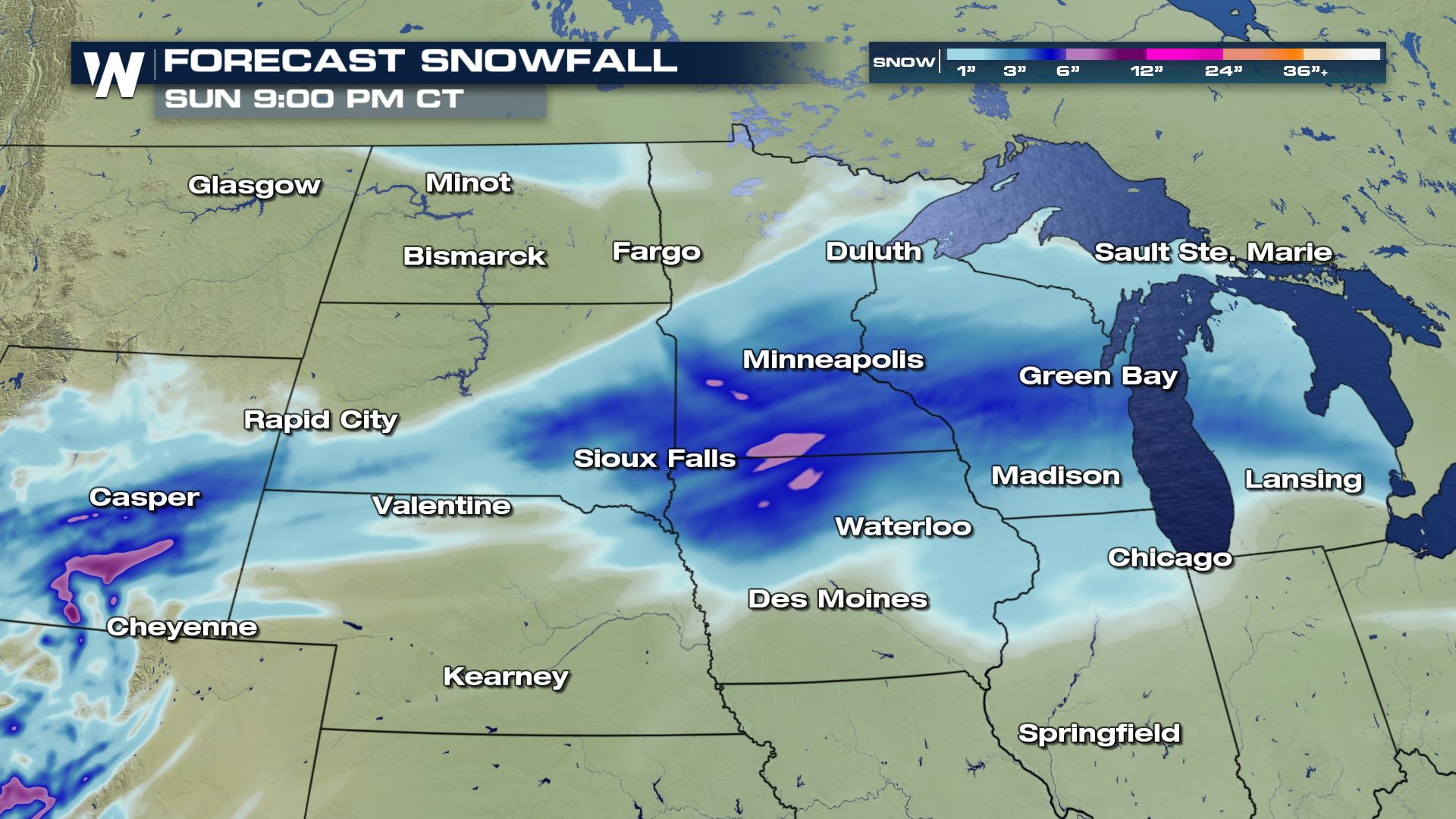
 Winter weather alerts have been issued in South Dakota, Minnesota, Wisconsin and northern Iowa. Several inches of snow are expected, with a few areas around 6".
 Areas of eastern Nebraska may also get up to an inch of snow and ice accumulaiton of up to 0.1" through the rest of Saturday. While this won't cause widespread travel impacts, a few secondary roads, bridges and overpasses may become slick from ice buildup.
The snowfall will become more widespread by Saturday afternoon into the Plains and upper Midwest. This could produce some quick accumulations with cold, January air over the region.
Areas of eastern Nebraska may also get up to an inch of snow and ice accumulaiton of up to 0.1" through the rest of Saturday. While this won't cause widespread travel impacts, a few secondary roads, bridges and overpasses may become slick from ice buildup.
The snowfall will become more widespread by Saturday afternoon into the Plains and upper Midwest. This could produce some quick accumulations with cold, January air over the region.
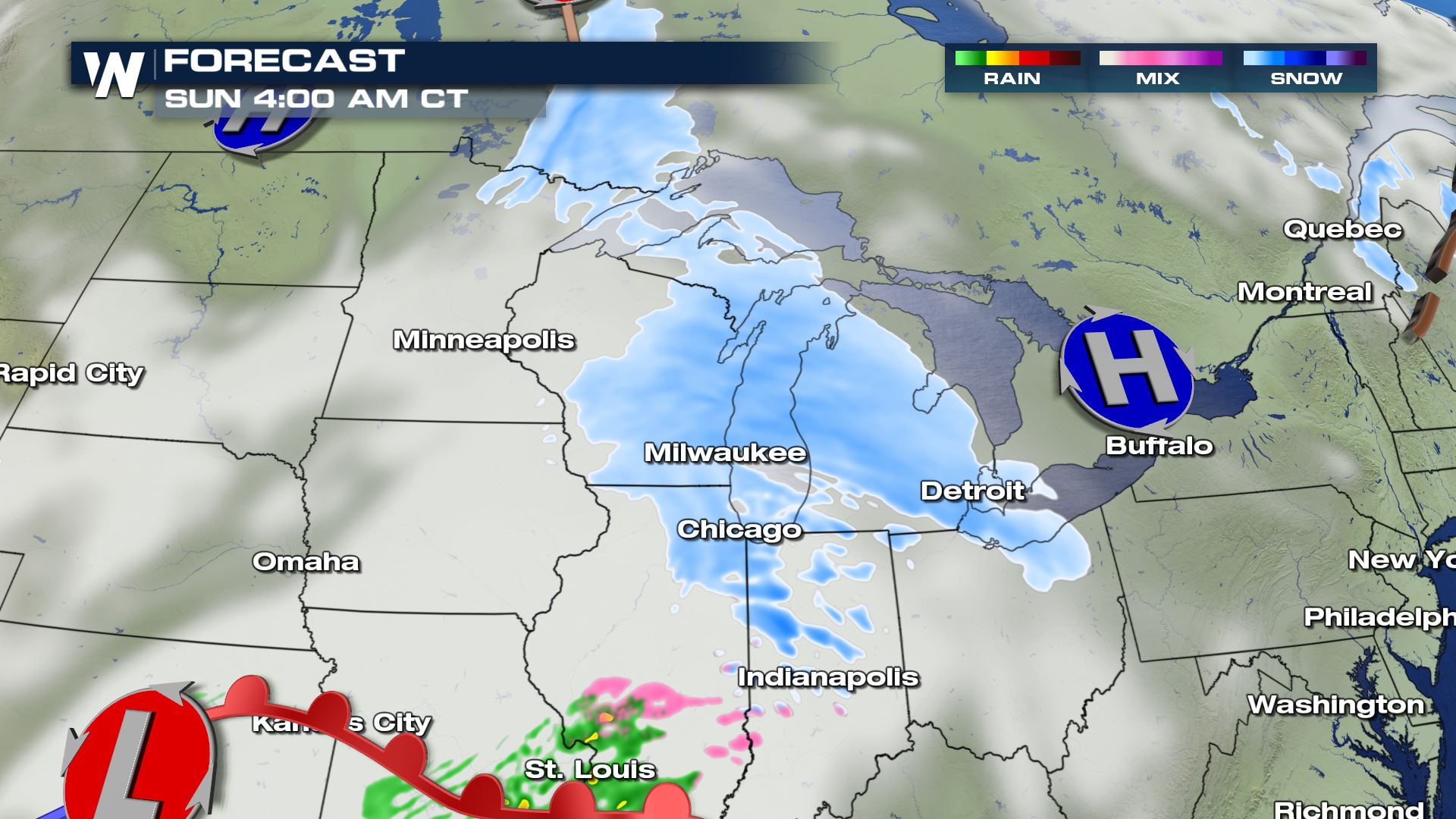
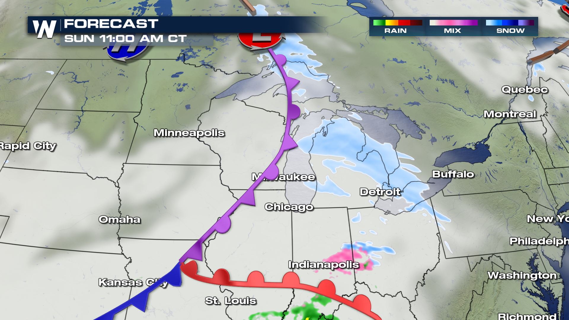
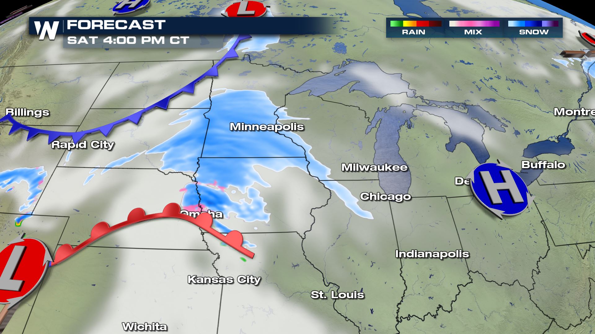 By Saturday night and Sunday, the snow will be moving into the Great Lakes and out of the Midwest. Heavy snow bands are possible in some spots but moisture will decrease as the system moves east. By Sunday afternoon the snow will be lighter as it moves across Michigan. High pressure returns to the region as cold air dives further south.
 3" to 6" of snow is expected in the alert areas, with localized totals around 8". This will lead to travel impacts.
 Keep checking back with WeatherNation for forecast updates throughout the weekend.
Winter weather alerts have been issued in South Dakota, Minnesota, Wisconsin and northern Iowa. Several inches of snow are expected, with a few areas around 6".
Areas of eastern Nebraska may also get up to an inch of snow and ice accumulaiton of up to 0.1" through the rest of Saturday. While this won't cause widespread travel impacts, a few secondary roads, bridges and overpasses may become slick from ice buildup.
The snowfall will become more widespread by Saturday afternoon into the Plains and upper Midwest. This could produce some quick accumulations with cold, January air over the region.
By Saturday night and Sunday, the snow will be moving into the Great Lakes and out of the Midwest. Heavy snow bands are possible in some spots but moisture will decrease as the system moves east. By Sunday afternoon the snow will be lighter as it moves across Michigan. High pressure returns to the region as cold air dives further south.
3" to 6" of snow is expected in the alert areas, with localized totals around 8". This will lead to travel impacts.
Keep checking back with WeatherNation for forecast updates throughout the weekend.All Weather News
More
Warmer Than Average: Above-Normal Temperatures Across the Central U.S. This Week
WHAT TO EXPECTA ridge of high pressure linger
24 Oct 2026 12:35 AM

SW Low Moves East, Brings Flood Threat to the Plains
A powerful low pressure system has been movin
23 Oct 2026 8:40 PM

Hurricane Vance Strengthens In The Pacific
After becoming a hurricane Friday, Vance quic
23 Oct 2026 8:30 PM


Several Fires Break Out in SoCal Last Week Amid Santa Ana Wind Event
Santa Ana winds helped several fires grow qui
19 Oct 2026 1:25 PM

Another Cold Morning Before Things Warm Back Up
Across portions of the Ohio Valley through th
19 Oct 2026 10:15 AM

Severe Risk Diminishing Saturday Morning for the Northeast
Severe Storm PotentialSevere risk is decreasi
16 Oct 2026 10:20 AM