Atmospheric River Hits the West Coast this Weekend
Rounds of storms and cold temperatures have led to a memorable start to 2024 on the West Coast, including a multi-day ice storm around portions of Washington and Oregon. While the arctic air has faded, the active jet stream will continue to bring rounds of rain and snow to the West Coast this week, but temperatures are much warmer for the end of this week compared to last, which means most areas will see rain, with snow confined to the highest elevations.
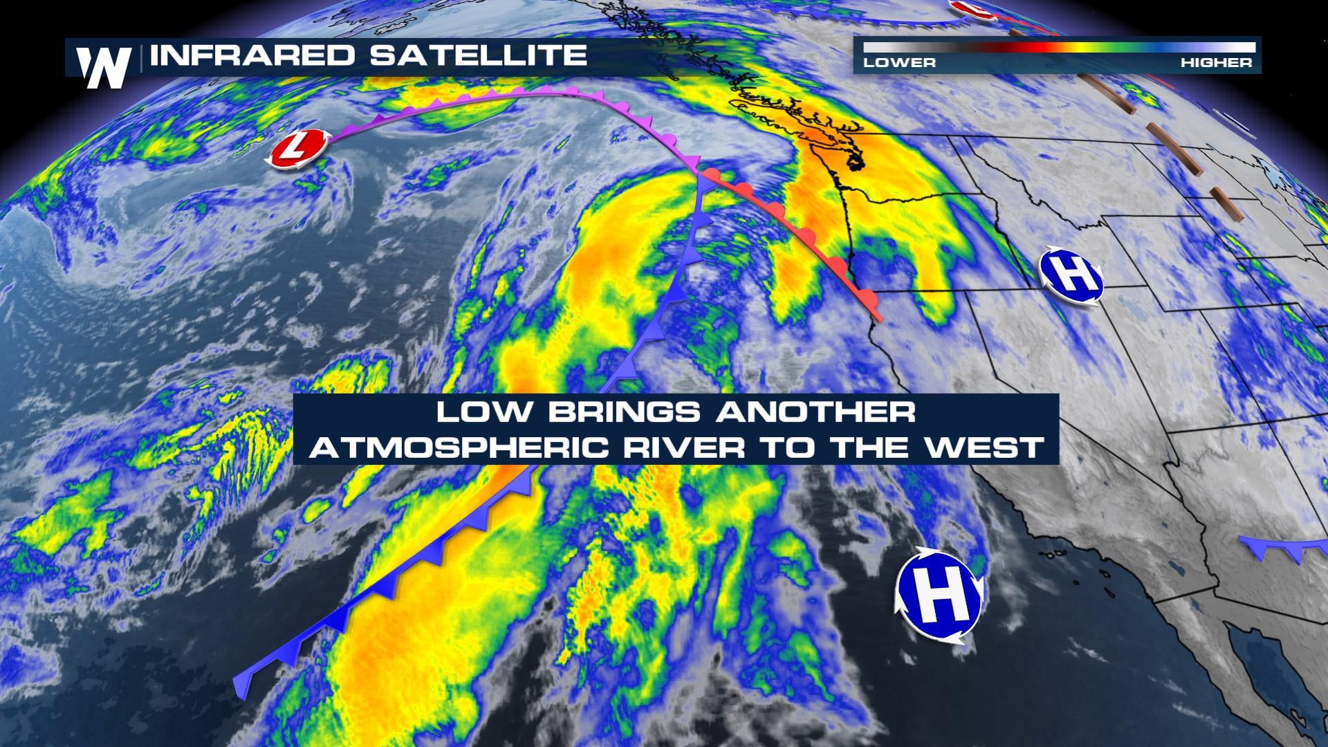
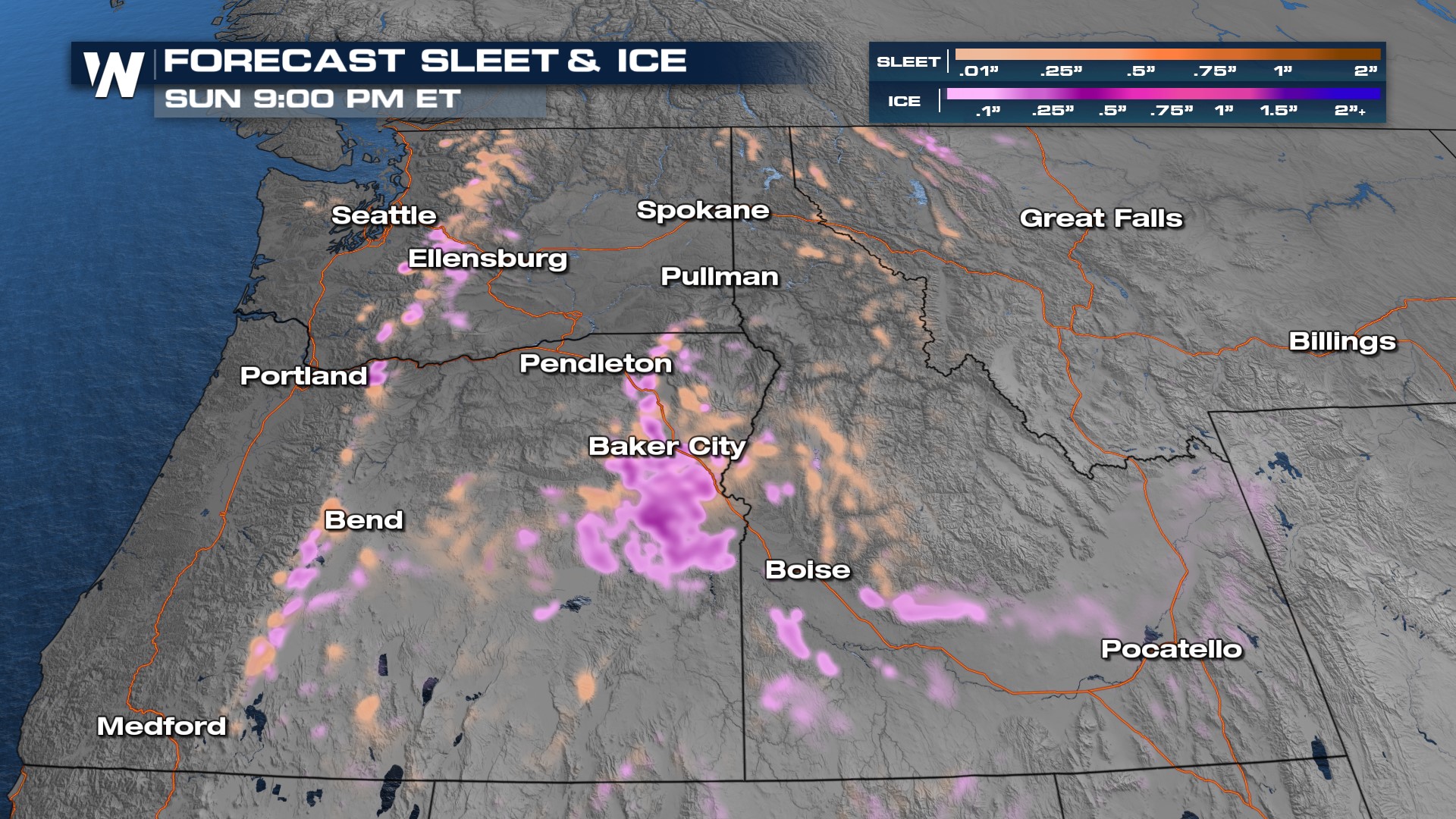
 This weekend looks to be unsettled across the Pacific Northwest. Moisture continues to stream onshore through the weekend and temperatures will warm, eliminating snow potential from all but the highest peaks. Ice is a concern for the Snake River Valley of Idaho and eastern Oregon including Baker City and Pendleton. Yet another storm system arrives Monday with more rain possible.
Rainfall will come in rounds, with the foothills picking up upwards of 3-5" for the coast and foothills of Oregon, and Washington. This will increase the flood threat, through Sunday. Due to the warmer temperatures, snowmelt will also contribute to the flood risk. Upwards of 7" of rain is possible in pockets!
 As mentioned above, there is the threat for ice, this time around eastern Washington. We could see up to a 0.10" of ice which may cause tree limbs to break and localized power outages.
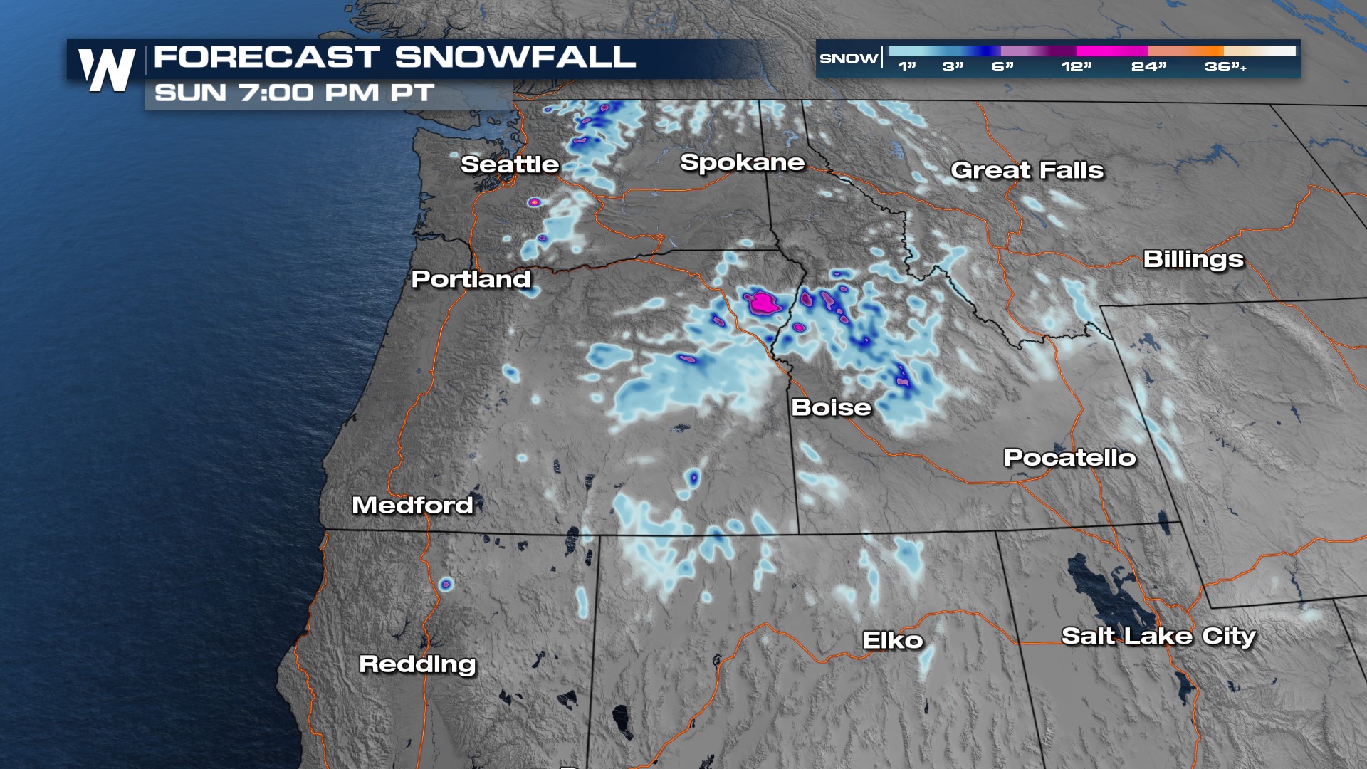
 Snow levels are expected to hover around 6,000 feet most of the week (location dependent) which means higher passes will still likely see slowdowns. Check chain controls and your road status before driving into higher elevations, as there will be heavy snow at times. Winter weather alerts are in effect for the spine of the Cascades as a result.