Wildfire Question and Answer Session with the Storm Prediction Center
Fire weather forecaster Nick Nauslar of NOAA’s Storm Prediction Center answered questions about the close relationship between weather and wildfire and how meteorologists create timely forecasts that help guide firefighters on the ground.
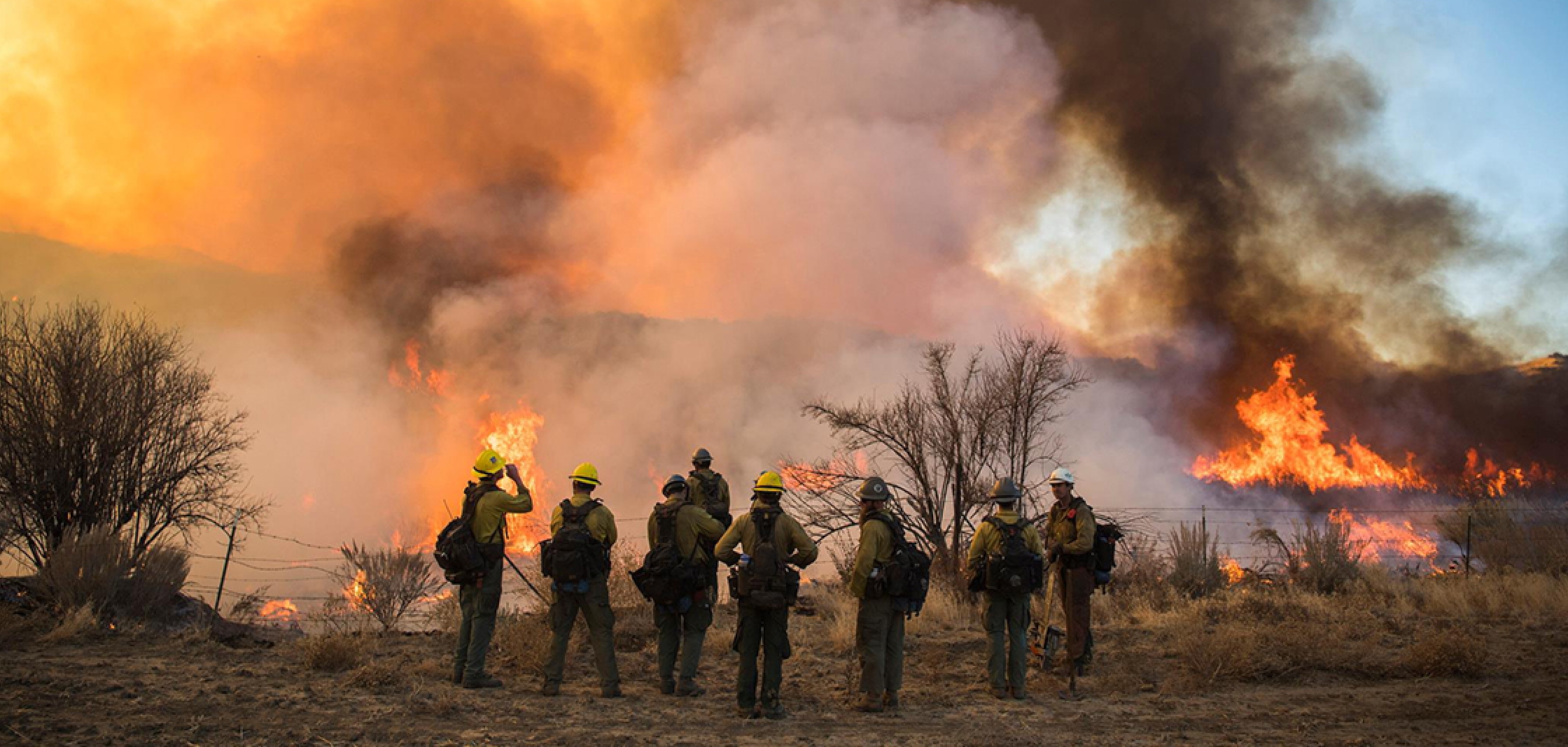
[As of August 28, there were 89 U.S. wildfires currently burning on approximately 2 million acres of private, state, tribal, and federal land. Nearly 20,000 interagency fire personnel, including about 450 crews, 1,000-plus engines, 160 helicopters and 24 airtankers are deployed to wildfires. Photo from U.S. Forest Service via Facebook page.]
Q: What does the term fire weather mean?
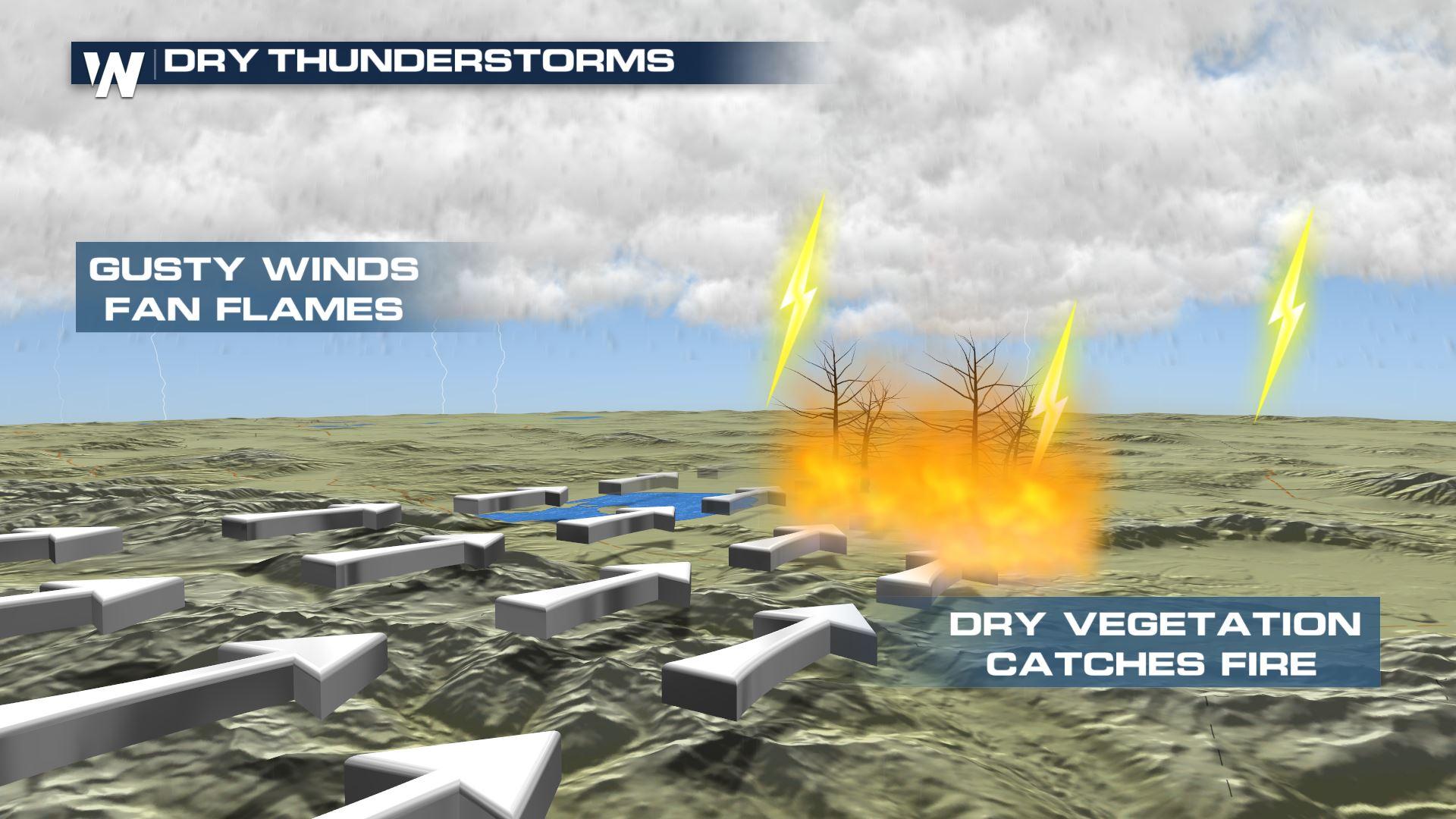
Nick Nauslar: Well, the easy answer is: Any sort of weather that ignites and/or helps spread fire. Stronger winds; low, relative humidity; unstable atmospheric conditions; and thunderstorms all fall under the umbrella of fire weather.
Q: How does the weather start wildfires and help them spread?
NN: Lightning striking a tree and igniting it is the most common weather cause for wildfires. Strong winds can also cause power lines to spark, which can ignite wildfires if there is dry brush and grass nearby.
Fires spread in hot, dry, and windy conditions. Warmer temperatures and lower relative humidity make the fuels more receptive to ignition. Stronger winds supply oxygen to fire, preheating the fuels in the path of the fire, and transport embers ahead of the flaming front. When hot, dry, and windy conditions occur simultaneously, wildfires can spread quickly.
Q: Does the opposite occur? Do fires create weather?
NN: Good question. Large fires create their own weather quite often, but it is rare that the fire-generated weather affects downstream areas.
In April, the Mallard Fire in the Texas Panhandle started a pyrocumulonimbus, a severe thunderstorm that produced 1-inch hail. Then on July 26, a large fire vortex — a larger, more intense fire whirl — associated with the Carr Fire developed near Redding, California, caused damage equivalent to an EF-3 tornado with estimated winds up to 143 mph.
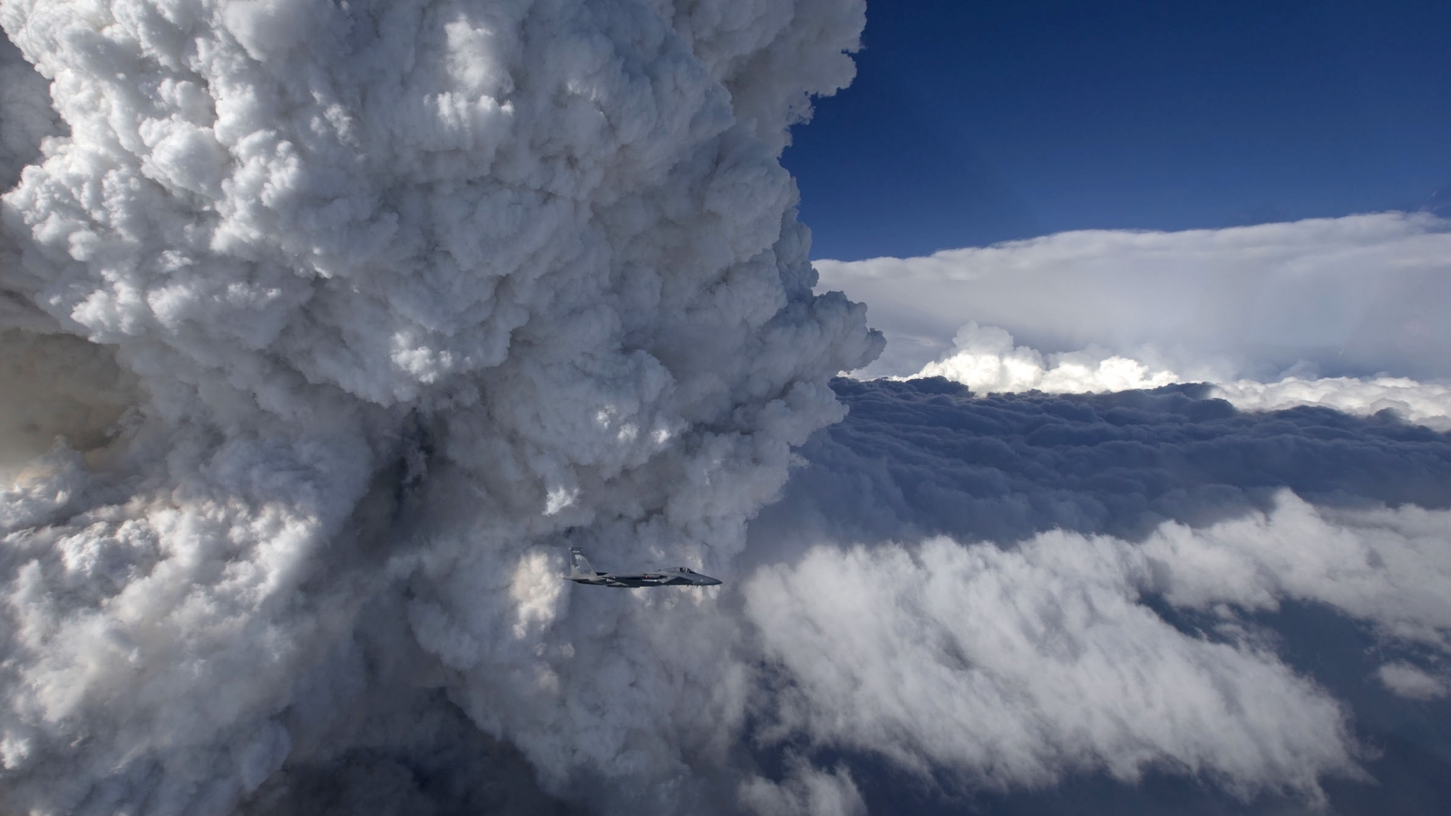
[Wildfires can that makes their own weather: A pyrocumulonimbus cloud develops above the Oregon Gulch fire in 2014, as a National Guard plane flies past in the foreground. From James Haseltine, Oregon Air National Guard.]
Q: Meteorologists like you at the NOAA Storm Prediction Center are better known for your tornado forecasts. How do you predict fire weather?
NN: Fire weather is related to severe weather because they both involve thunderstorms. SPC forecasters examine winds, relative humidity, and the potential for thunderstorms with little to no rain — so-called dry thunderstorms — across the continental United States.
We categorize areas as having elevated, critical, or extremely critical fire weather risk, and identify locations where isolated and scattered dry thunderstorms may occur. This information is used by local National Weather Service forecast offices and by incident meteorologists who provide life-saving localized forecasts and live, in-person weather briefings to firefighters.
Q: You worked in the fire community before joining NOAA’s Storm Prediction Center. How does your experience help you?
NN: I was fortunate to work as fire logistics dispatcher, fire meteorologist and wildland firefighter for the U.S. Forest Service and Bureau of Land Management during several summers I spent in the West. These experiences gave me unique perspectives on how the fire community works and what they need. Learning local weather and fire patterns in different geographic areas help me refine my own fire weather outlooks.
Edited for WeatherNation by Meteorologist Mace Michaels


