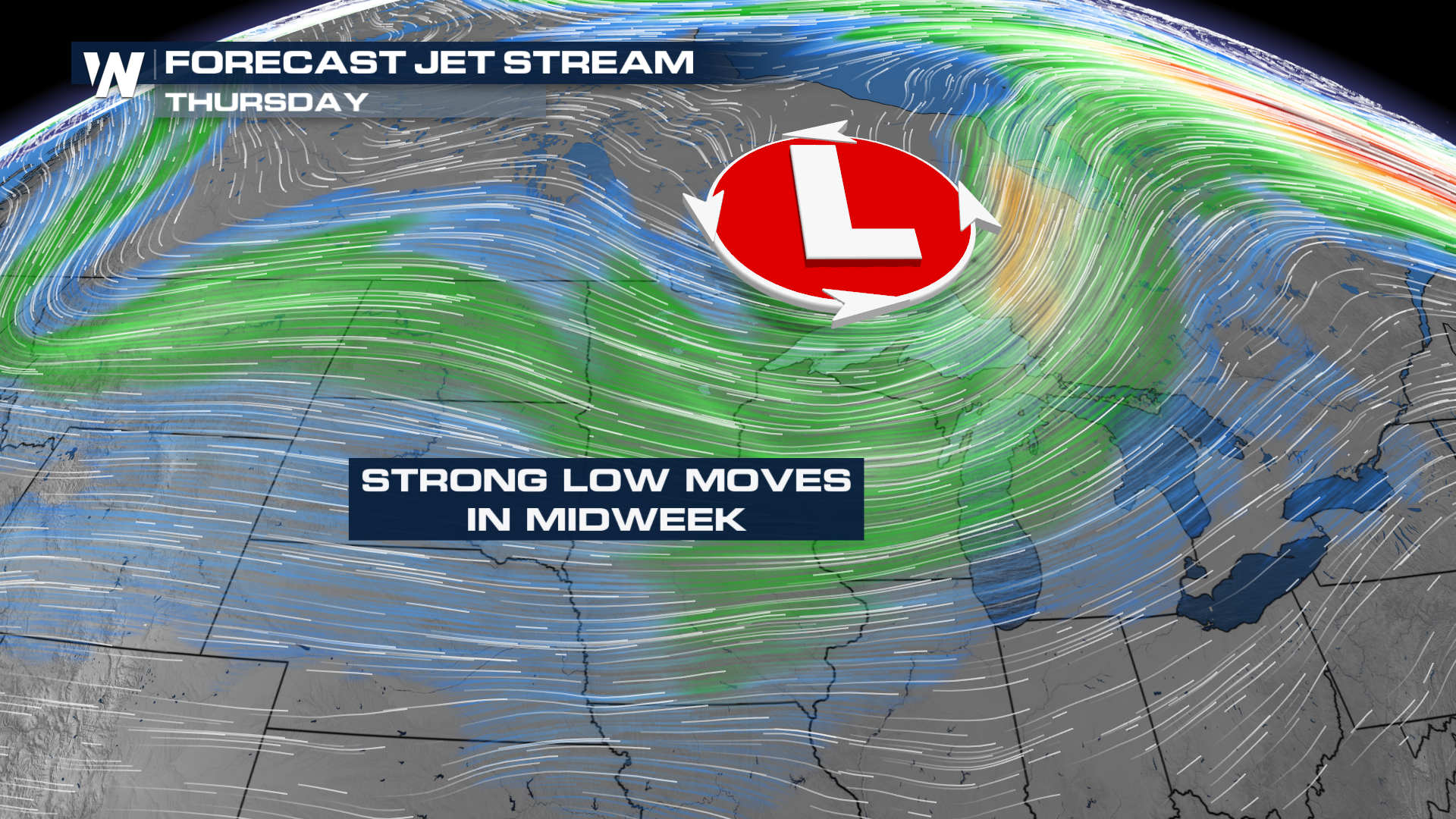
Windy System Blows in Midweek

If it's not a foot and a half of snow in the Dakotas, a lot of these systems have been tossing decorations and trash cans alike. Here comes another one.
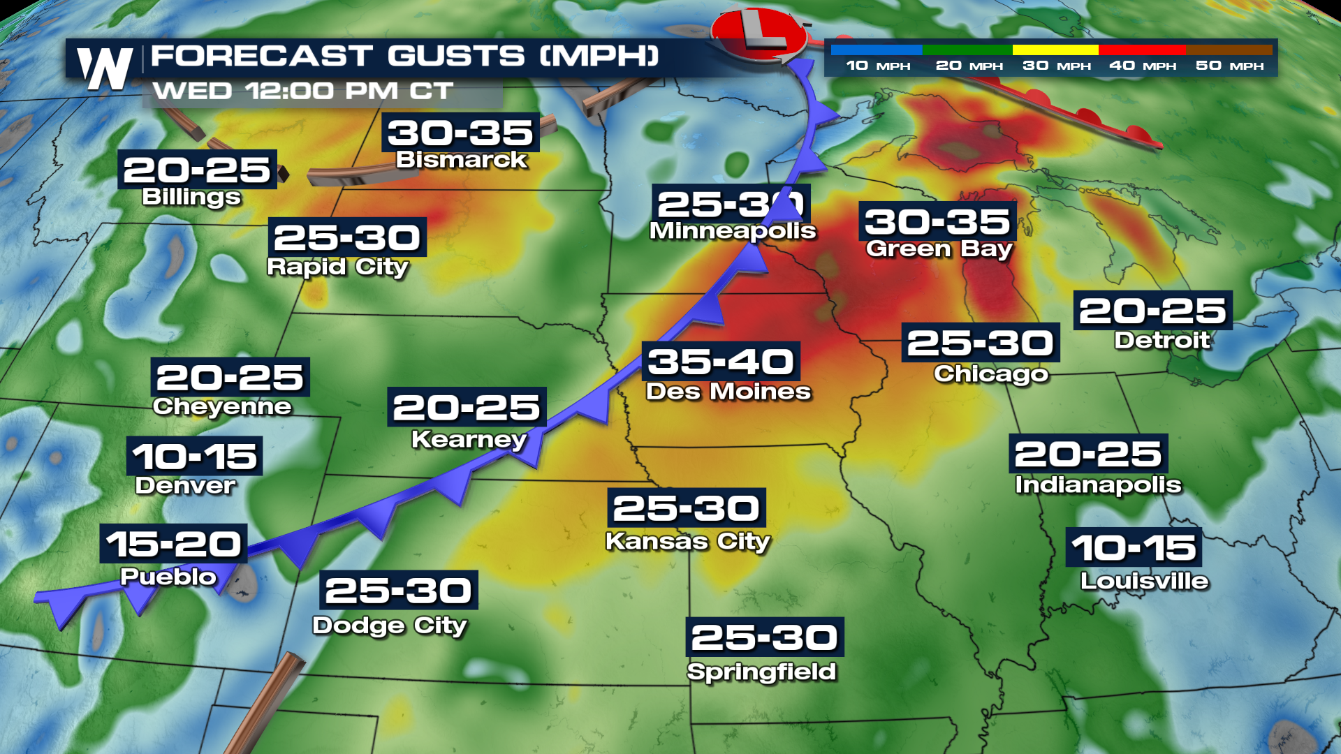
WIND
A lot of wind energy with this trough of low pressure, which will be the biggest impact out of the next few days. Wind alerts cover quite a bit of real estate in Montana, where winds could gust as high as 90 mph in the highest elevations! Wednesday looks like the windiest day in the Upper Midwest.
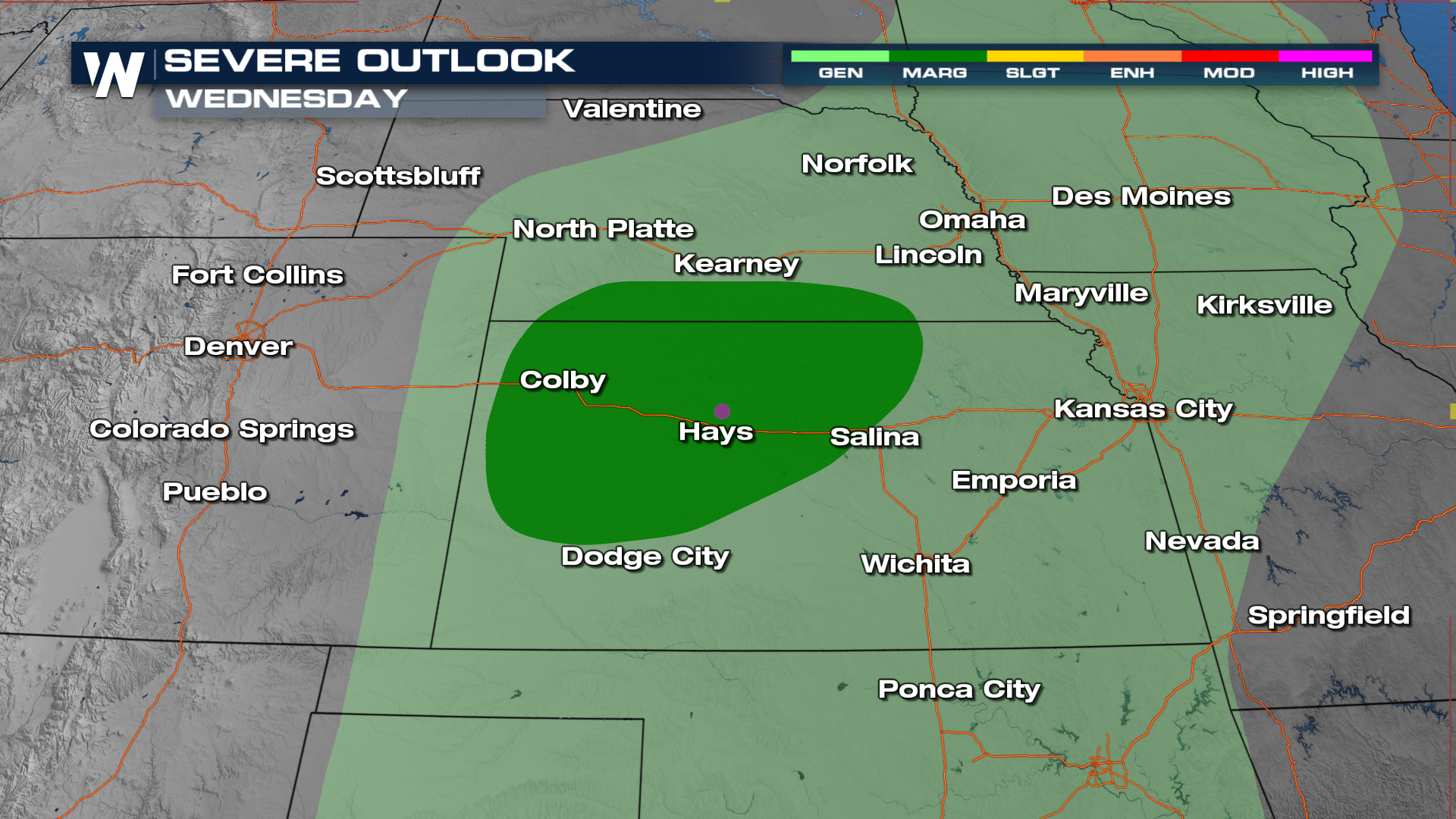
 SEVERE
That front will be the focus of what could be a few severe chances. Right now, Wednesday looks like the best bet, with slightly better thunderstorm coverage. Storms look to fire around the front and move into slightly colder temperatures north of it. The biggest concern right now will be large hail. The Storm Prediction Center is circling portions of Kansas and Nebraska with the highest threat.
PRECIP
As this system sets up, there will still be cold air in the vicinity of this shot at rain. The warm air could be slow to build in, which would bring in a threat of freezing rain back to northern Wisconsin and Michigan. Right now, the threat appears limited since temperatures will gradually warm, but one worth watching.


