Winter Weather Continues in the Plains
Special Stories
24 Jan 2020 8:00 AM
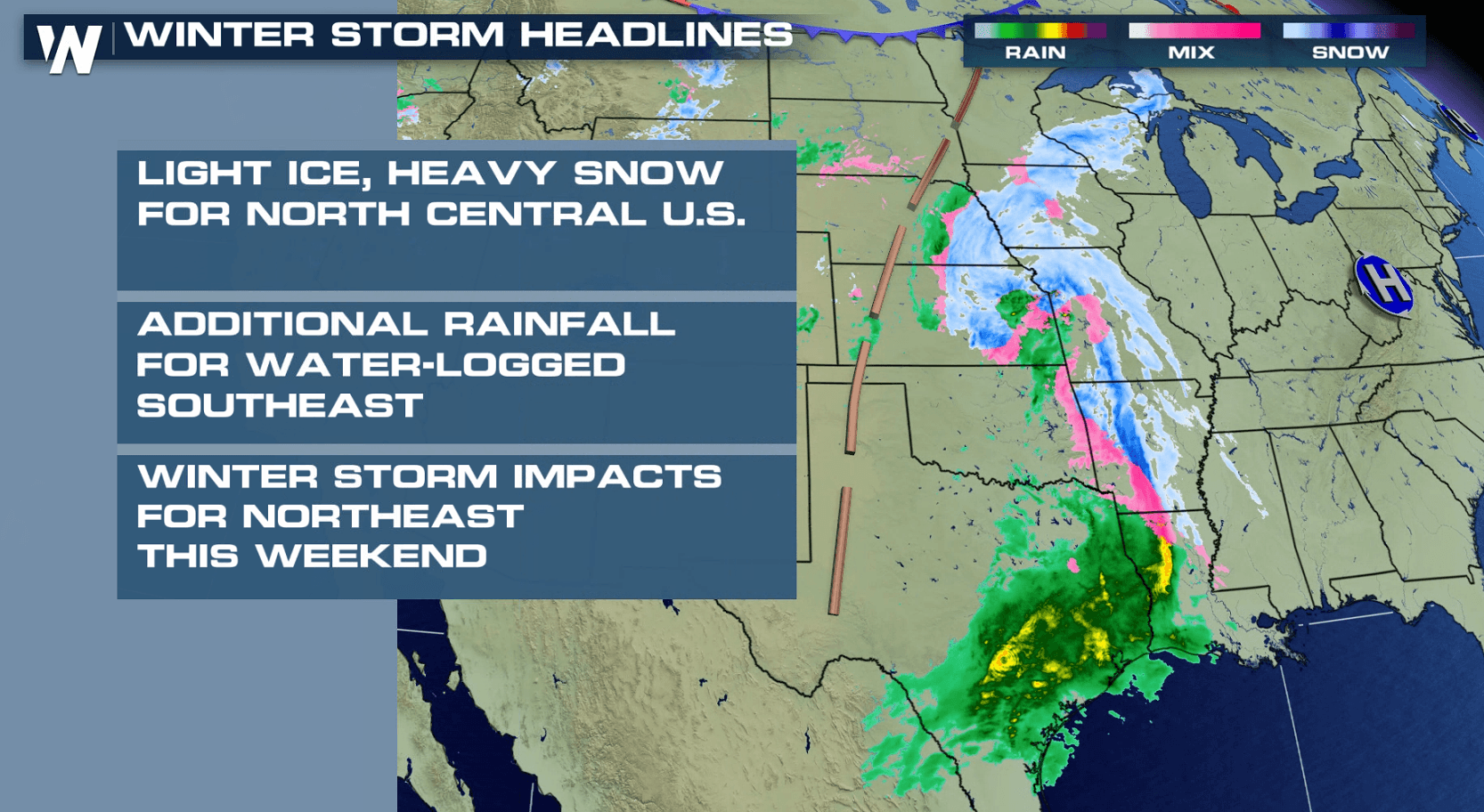
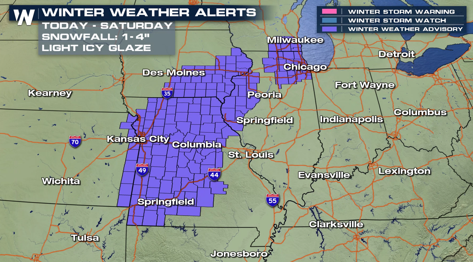
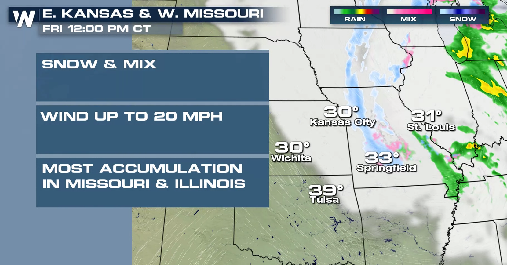
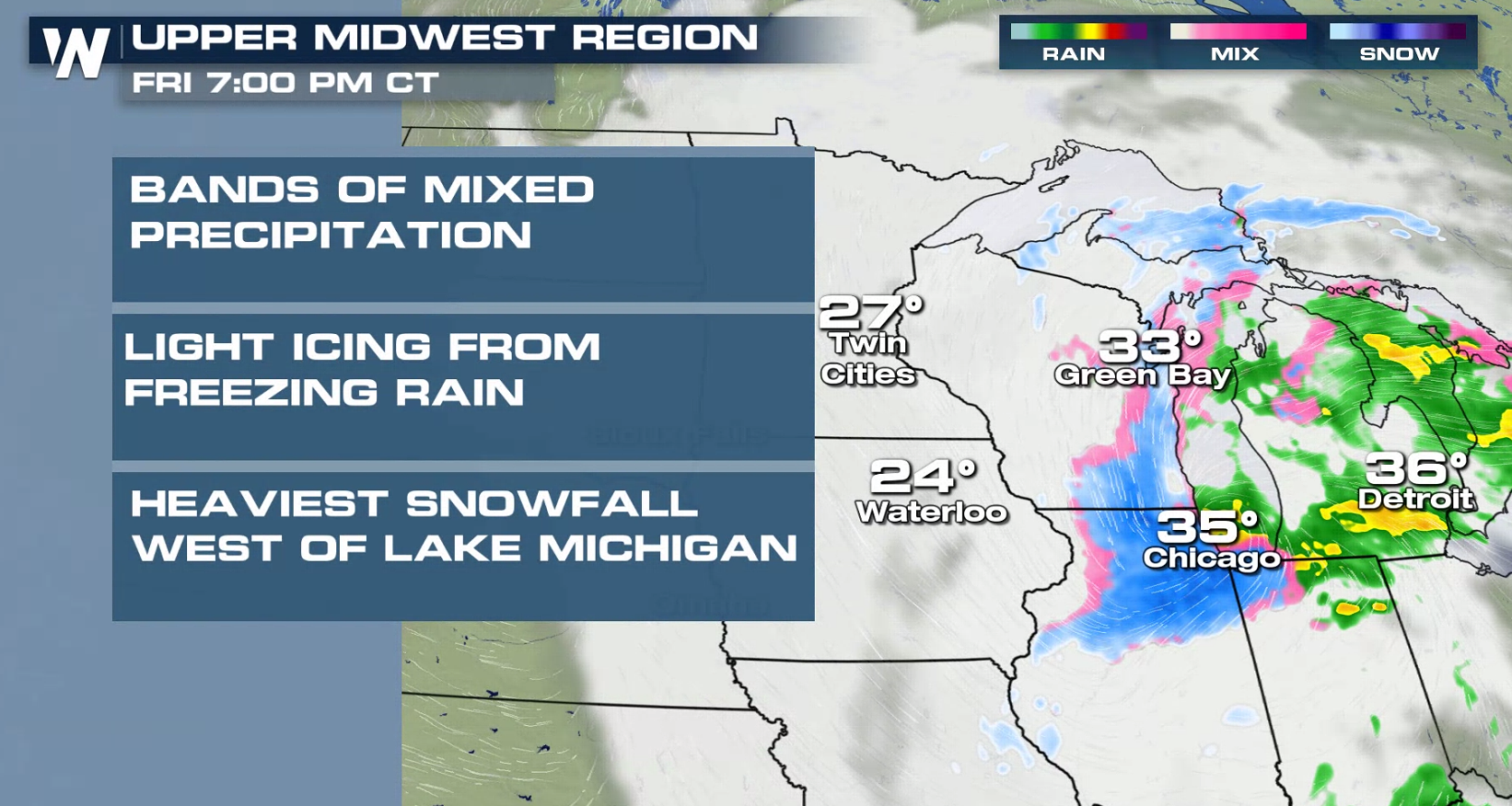
Wintry weather has returned to the Plains with an extended period of snow, mixed with rain and ice for some areas. Winter Weather Advisories continue from Wisconsin to Kansas. Up to 6" of snow is possible, along with the potential for a glaze of ice.
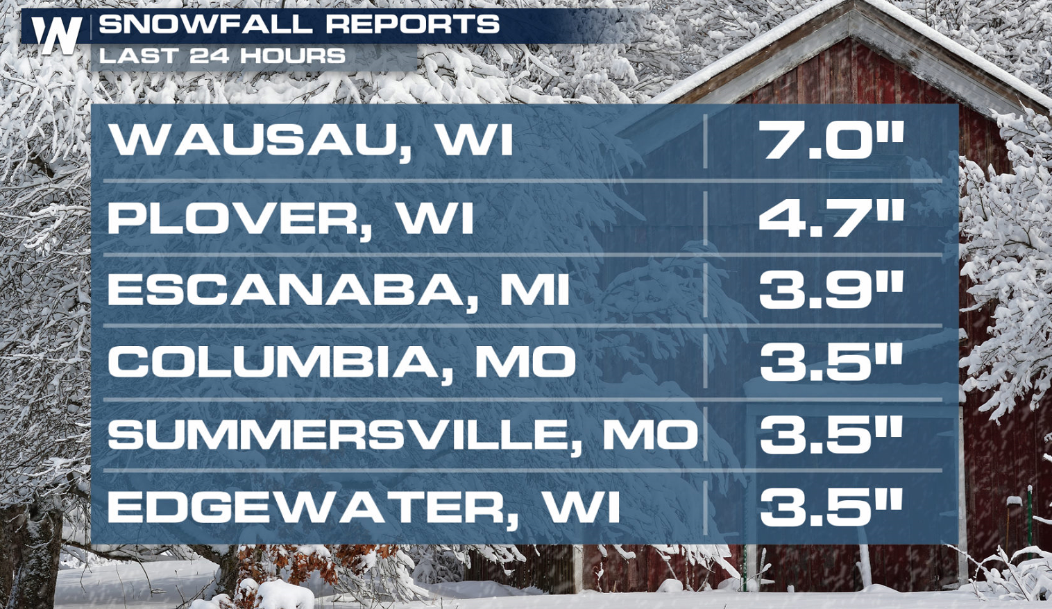
 Heavy snow has already accumulated from Michigan to Missouri since Wednesday. A half a foot has fallen in some areas.
 With strong Jet Stream energy over the region, humidity has been pulled northward from the Gulf of Mexico. Snow and ice will continue to develop as the moisture moves into cold air.
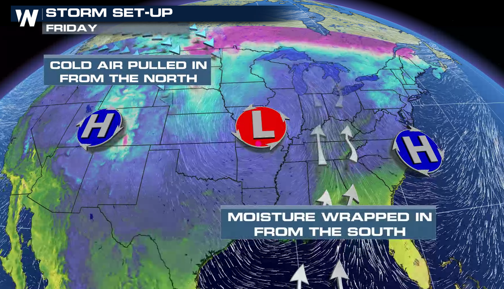
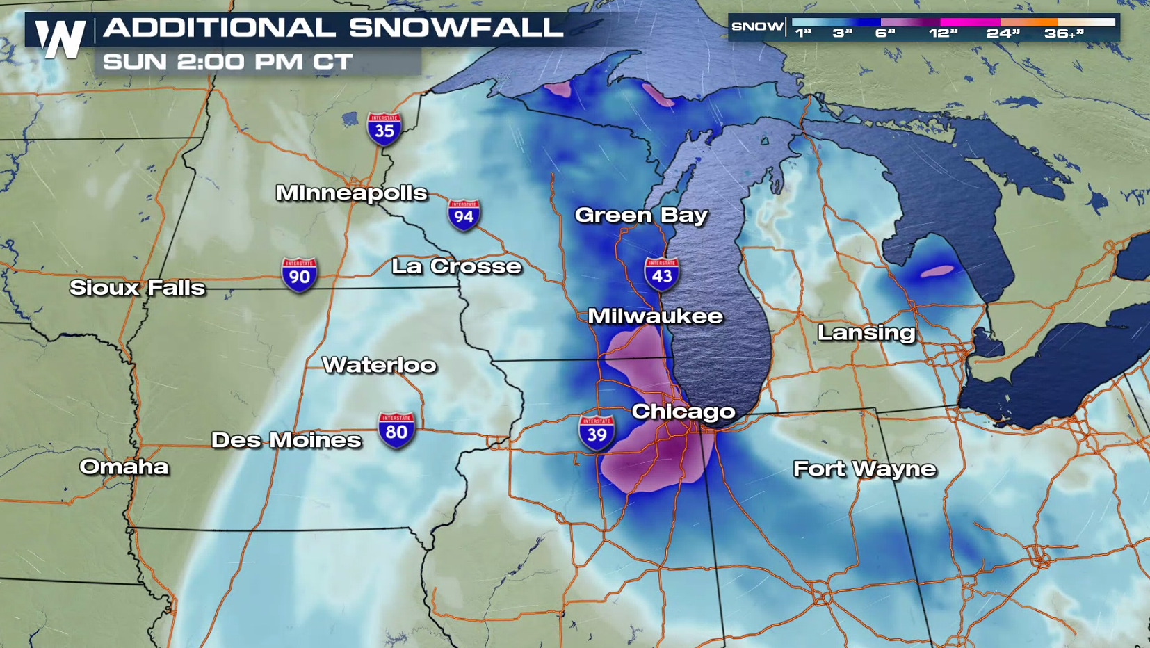
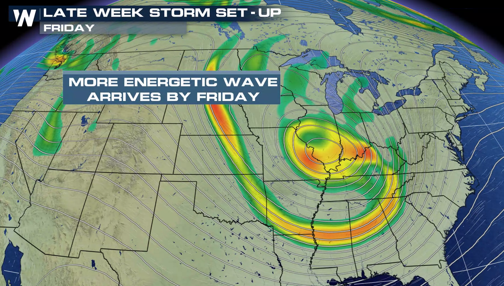 The area of low pressure will move slowly from the Plains to the Ohio Valley. Pockets of snow and ice will move through the Plains and Western Great Lakes into Saturday.
 WeatherNation will keep you updated on-air and online with the latest information as this storm moves through the Plains.
Heavy snow has already accumulated from Michigan to Missouri since Wednesday. A half a foot has fallen in some areas.
With strong Jet Stream energy over the region, humidity has been pulled northward from the Gulf of Mexico. Snow and ice will continue to develop as the moisture moves into cold air.
The area of low pressure will move slowly from the Plains to the Ohio Valley. Pockets of snow and ice will move through the Plains and Western Great Lakes into Saturday.
WeatherNation will keep you updated on-air and online with the latest information as this storm moves through the Plains.
All Weather News
More
Wildfire Outbreak in the Pacific Northwest
Conditions have been incredibly dry out west.
2 Aug 2026 1:30 PM

After Reaching Category 5, Genevieve Weakens in the Pacific
PacificGenevieve formed on last Friday south
2 Aug 2026 1:25 PM

More Storms for the East Sunday and Monday
A low-pressure system crashing through the Mi
2 Aug 2026 1:25 PM


Flooding, Severe Storms Target the Midwest Again
After an active week of storms across the nor
1 Aug 2026 1:40 AM

Flooding Risk Increases as Heavy Rain Targets the Tri-State Area
Tuesday, heavy rainfall moved across the Nort
30 Jul 2026 12:25 AM

Severe Weather: Energy From the Midwest Now in the Southeast
UPPER MIDWEST - Through Monday, dangerous tor
29 Jul 2026 10:30 PM