Wintry Weather on the Way for the Tennessee Valley Tuesday
Special Stories
9 Dec 2019 5:01 AM
A strong cold front moving across the Southeast will bring shower and thunderstorm chances, but with lingering precipitation behind the cold front there will be enough cold air to provide a wintry weather chance into the Tennessee Valley. Ground temperatures could be too warm for major accumulation on the roads, but elevated surfaces could see a few inches of snow and ice accumulation. Here is the very latest.
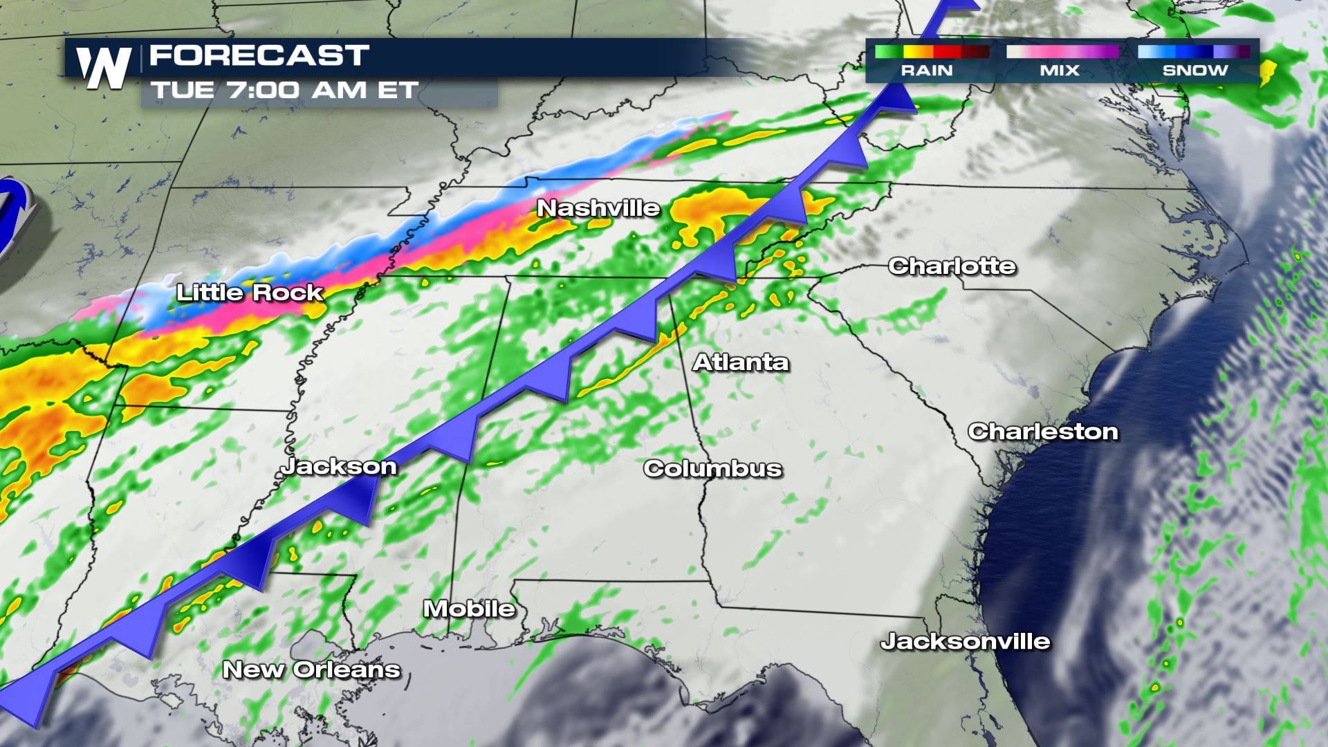
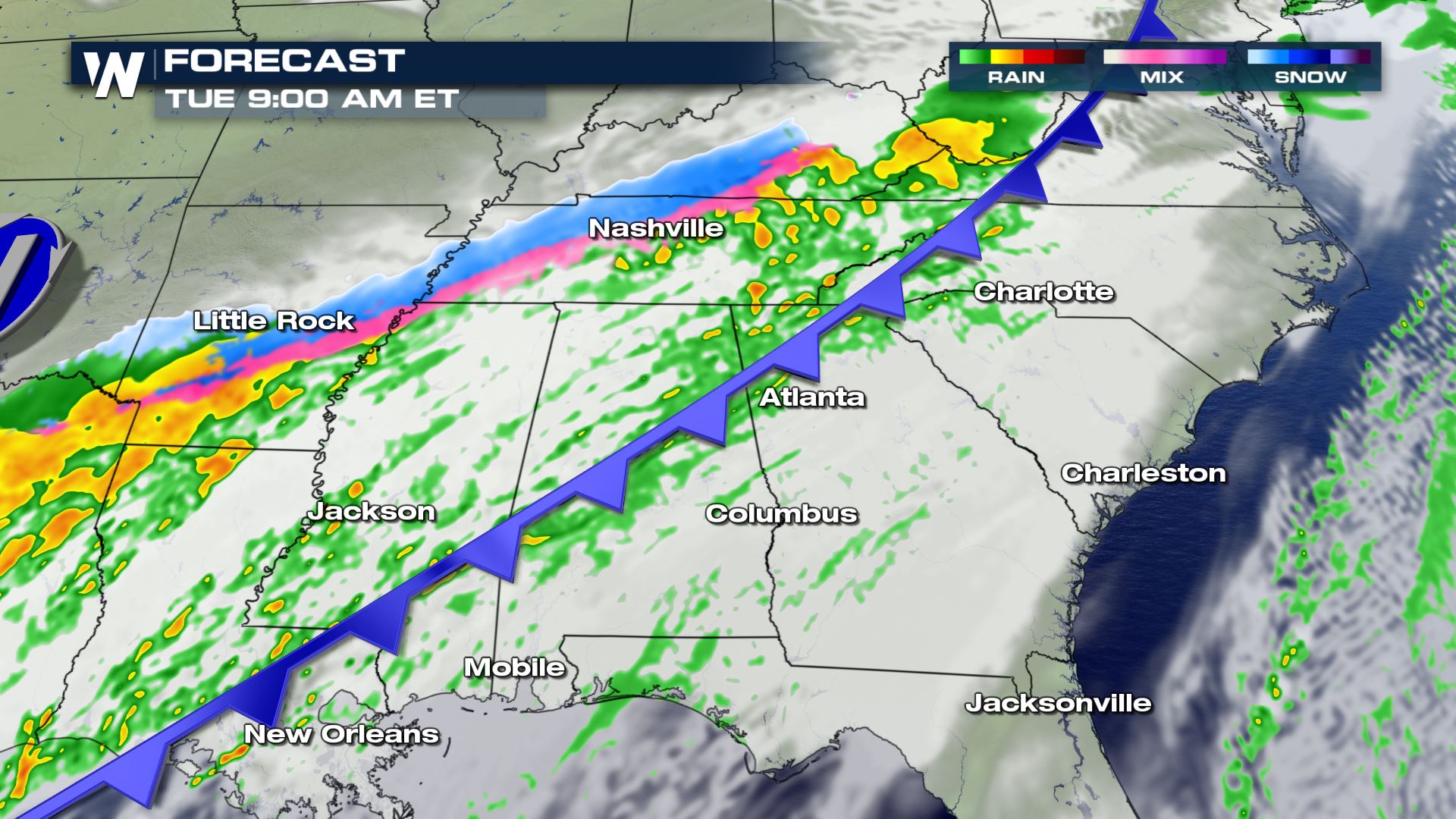
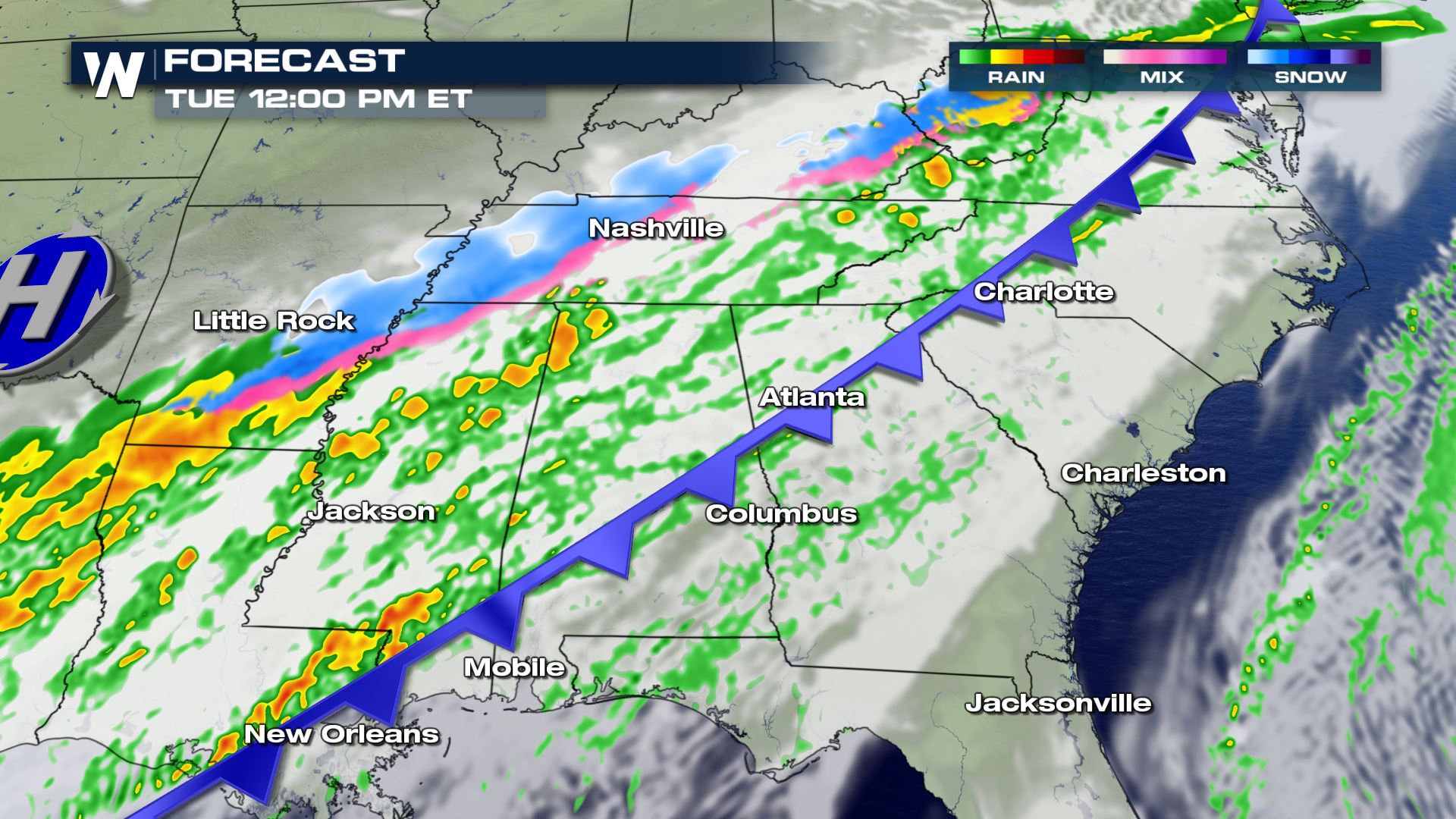
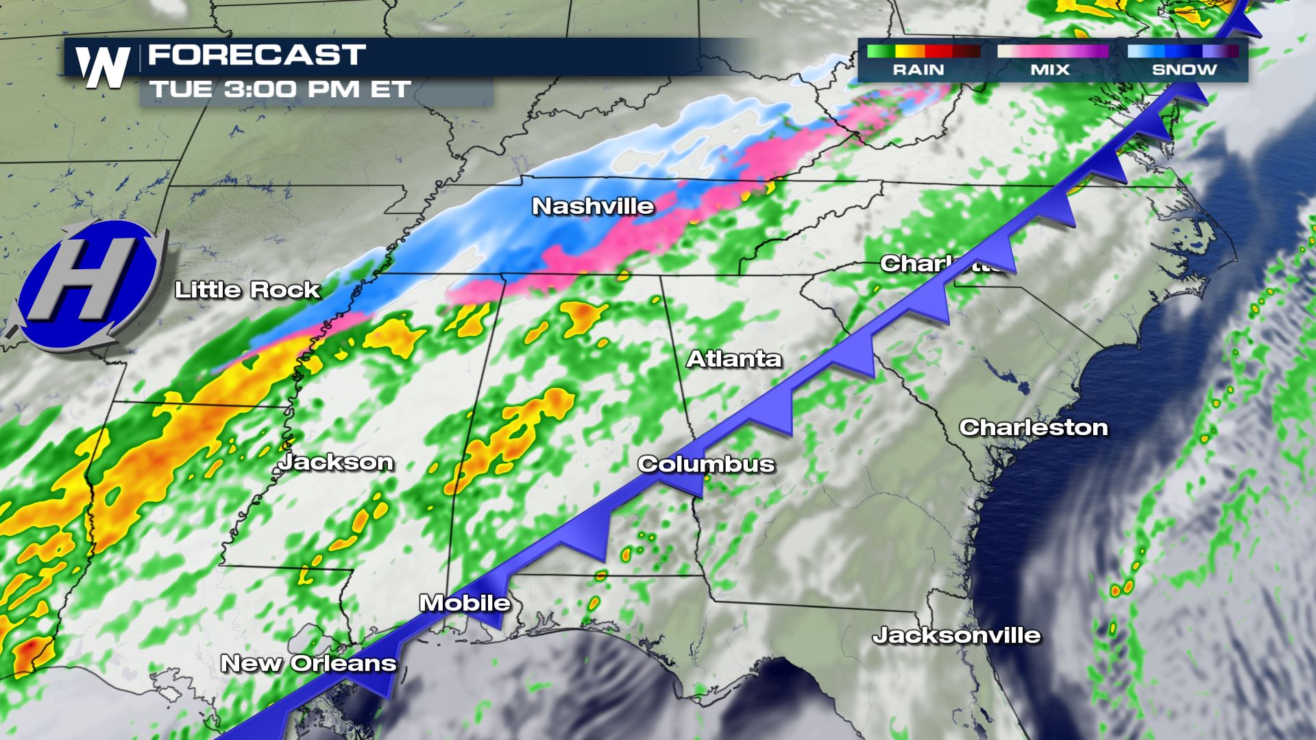
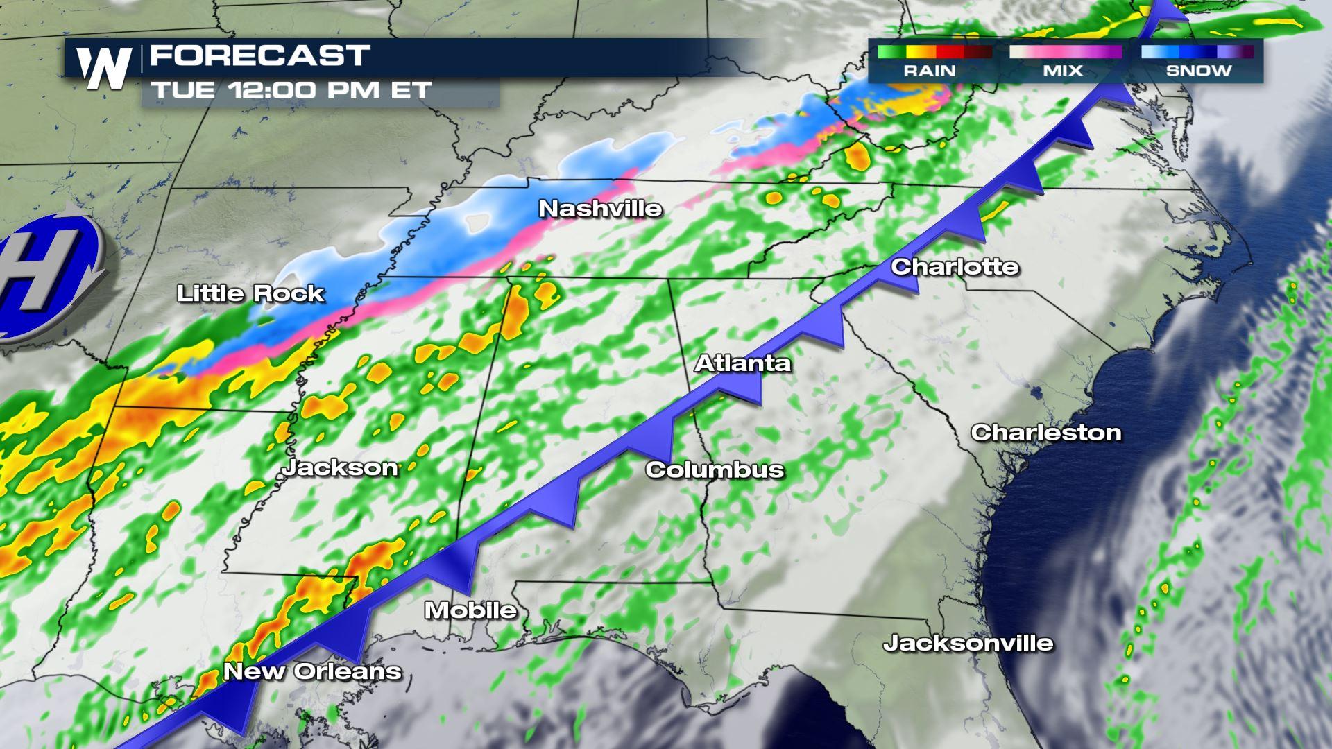
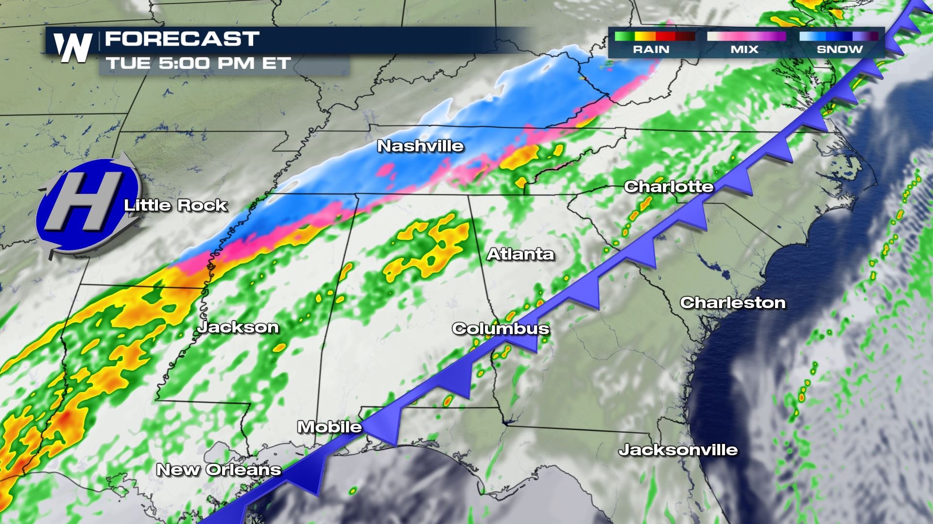 The cold air will catch up to the the precipitation by early Tuesday and change the rain to sleet and snow. There will likely be a lot of bounce back between rain, sleet and snow all morning and all afternoon for areas of Arkansas, Mississippi and Tennessee.
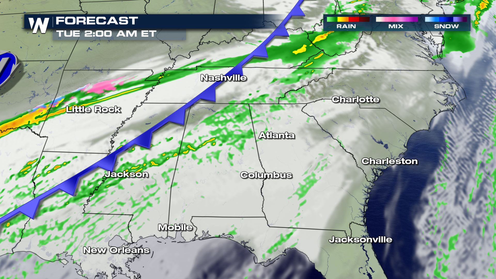
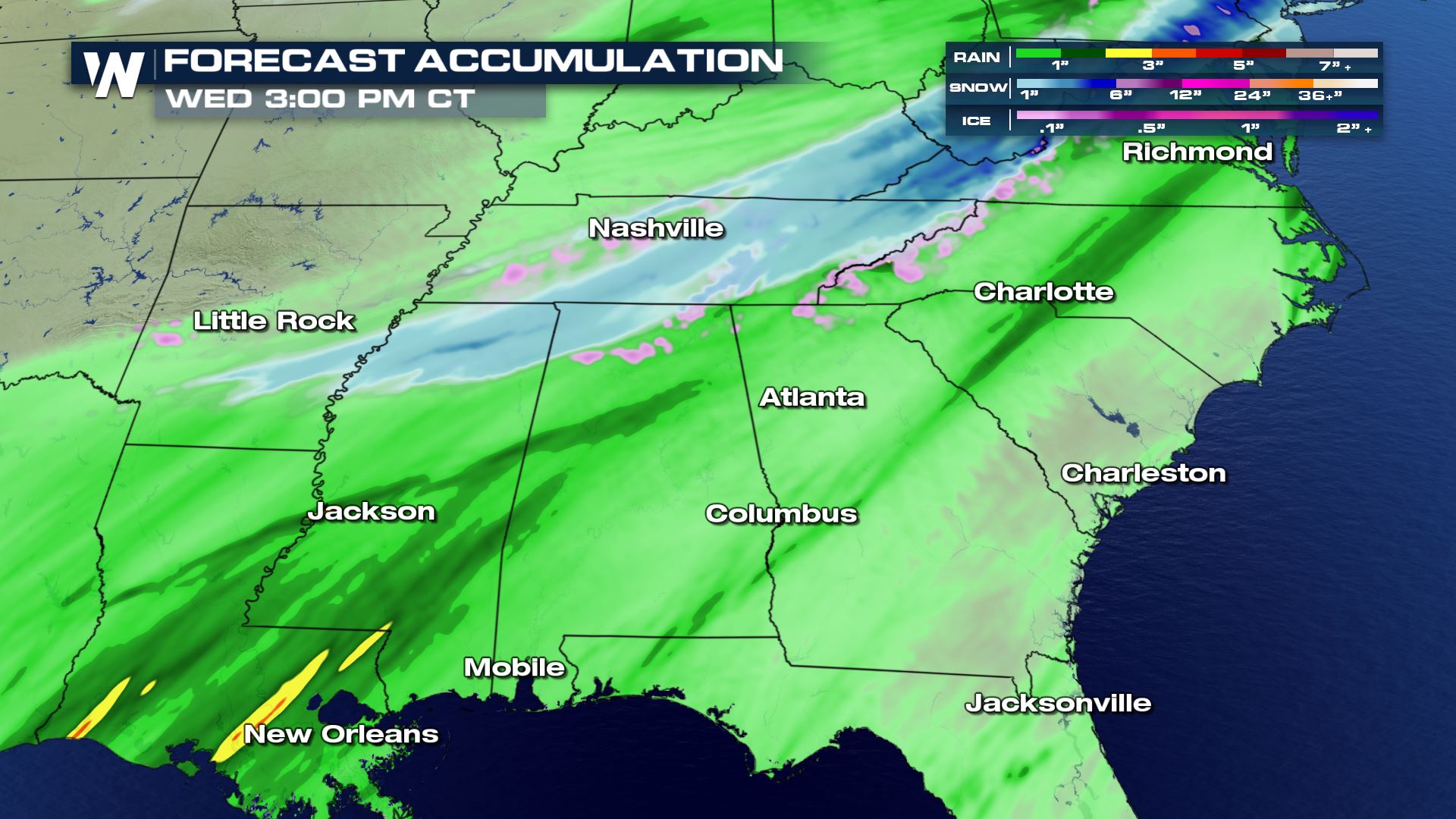 Our accumulation forecast is showing the potential for 1 to 2 inches of snowfall from Mississippi to Virginia. Ground temperatures will likely be too warm for any major travel issues, but elevated surfaces and bridges and overpasses could have some minor issues.
Keep checking back with WeatherNation for all of the very latest weather updates.
Our accumulation forecast is showing the potential for 1 to 2 inches of snowfall from Mississippi to Virginia. Ground temperatures will likely be too warm for any major travel issues, but elevated surfaces and bridges and overpasses could have some minor issues.
Keep checking back with WeatherNation for all of the very latest weather updates.
Forecast
The cold air will catch up to the the precipitation by early Tuesday and change the rain to sleet and snow. There will likely be a lot of bounce back between rain, sleet and snow all morning and all afternoon for areas of Arkansas, Mississippi and Tennessee.
Potential Accumulation
Our accumulation forecast is showing the potential for 1 to 2 inches of snowfall from Mississippi to Virginia. Ground temperatures will likely be too warm for any major travel issues, but elevated surfaces and bridges and overpasses could have some minor issues.
Keep checking back with WeatherNation for all of the very latest weather updates.
All Weather News
More
Flooding Risk Increases as Heavy Rain Targets the Tri-State Area
Tuesday, heavy rainfall moved across the Nort
30 Jul 2026 12:25 AM


Genevieve Down to a Category 2 Hurricane
PacificFausto is now a post-tropical cyclone.
30 Jul 2026 12:00 AM

Severe Weather: Energy From the Midwest Now in the Southeast
UPPER MIDWEST - Through Monday, dangerous tor
29 Jul 2026 10:30 PM


Southeast Flood Risk Lingers Near Stalled Front
A stalled boundary over the Southeast will ke
25 Jul 2026 10:55 AM

Another Round of Storms Targets the Northeast
Tuesday brought severe weather again across p
23 Jul 2026 1:15 AM