Major Spring Storm Continues With Rain & Snow For the Rockies

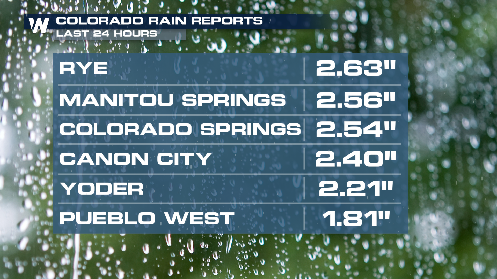
Looking at the rain from a glass half full lens, the Four Corners has received beneficial rain and snow over the last several days. Rain and Snow totals have already started piling in for Colorado. In the past 24 hours the highest totals for rain have been over 2.50 inches for Rye and Denver has seen over an inch of rainfall.
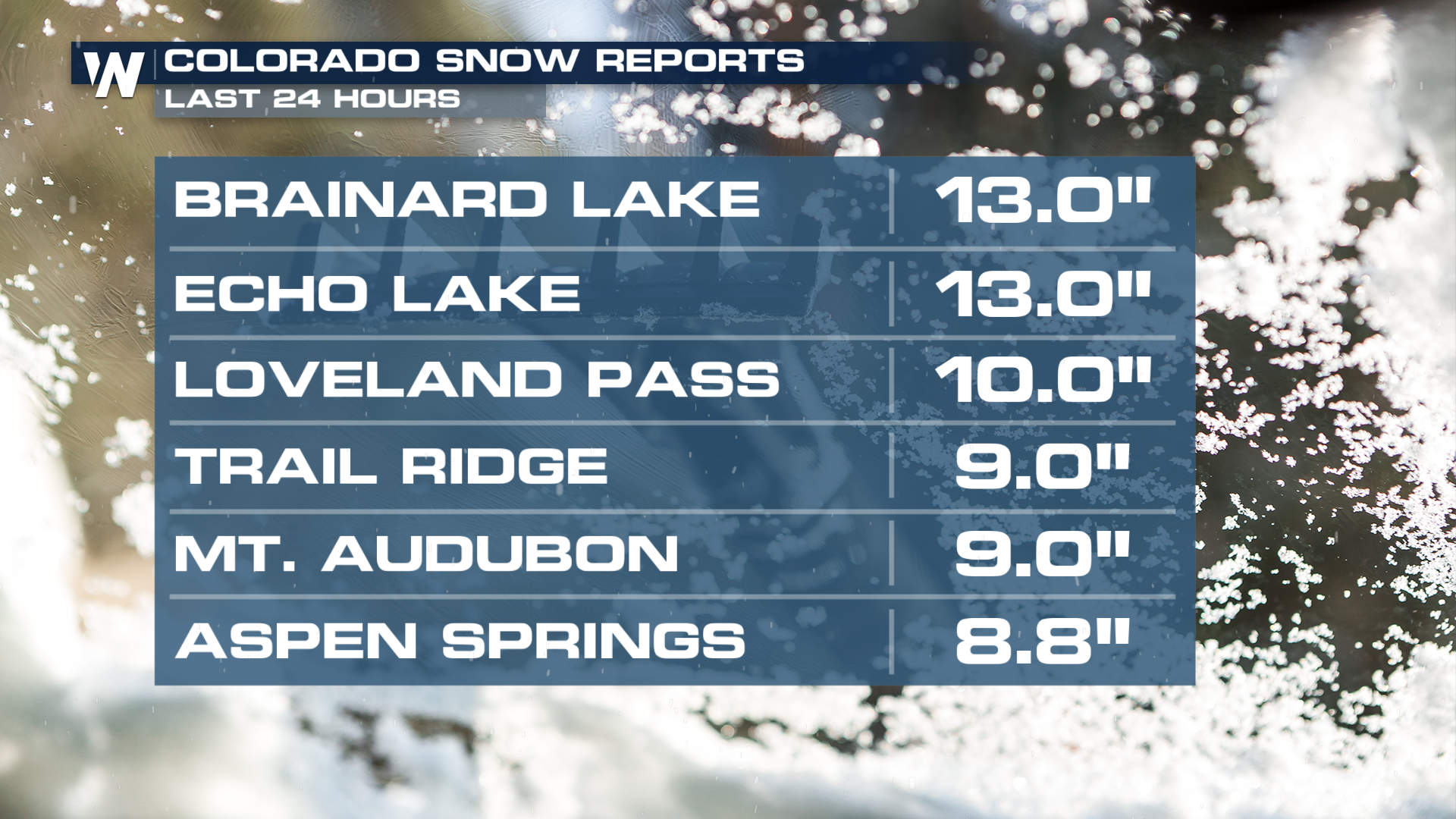
 The rain is not the only factor. So far, Colorado has seen over half a foot of snow, and totals will be on the rise Wednesday.
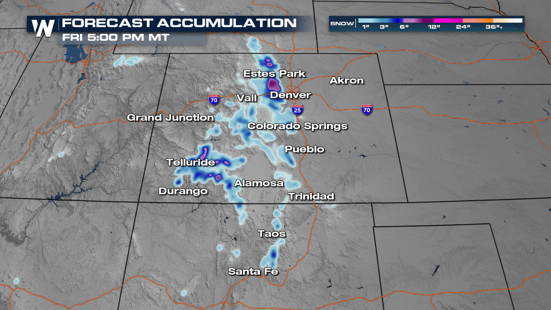
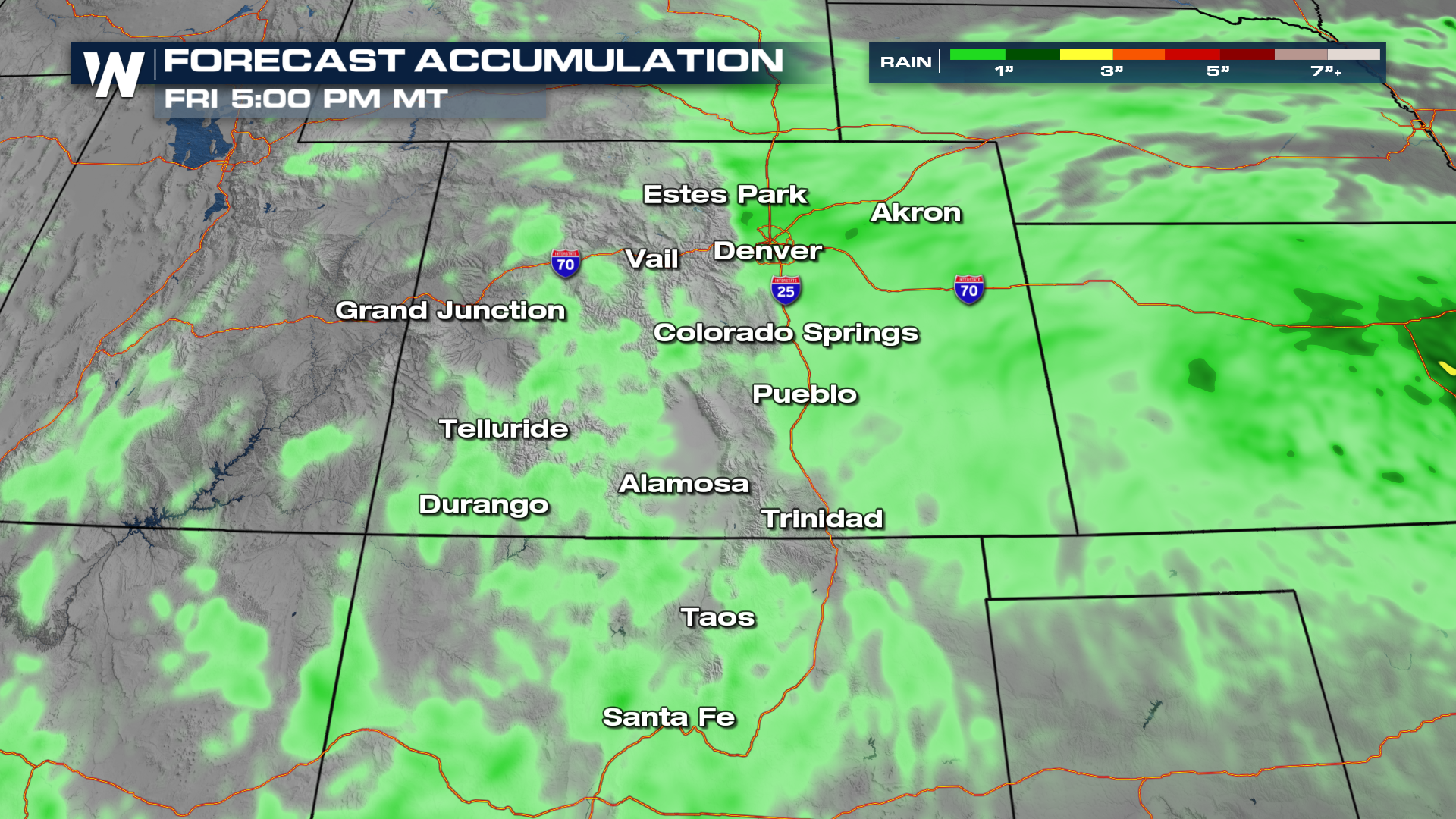
Clouds and rain will linger through mid-morning before another round of rain will move through in the afternoon. This slow moving storm system will also deliver a big cool-down. The temperature will drop by 10-20 degrees (or more). The heaviest snow across the Colorado Rockies will continue through Wednesday for elevations 8000 ft+, along with heavy rainfall in the foothills, front range, and plains.
This event could bring in some much-needed snow for the higher terrains to keep the ski resorts open a little while longer across parts of the Rockies. Snow totals will likely reach 2' in the high peaks of the Colorado Rockies. Pikes Peak under a Winter Storm Warning with up to 4 feet by early Wednesday. Late-season winter storms can pose a significant risk to hikers and outdoor recreationists unprepared for winter conditions.
The soaking rain is another issue, as well. Some areas will be picking up 1-3 inches of rain along the I-25 corridor. Parts of southeastern CO could see isolated flooding with these showers. The mountains will keep afternoon shower chances throughout the weekend, while the rest of the areas will start to dry out.
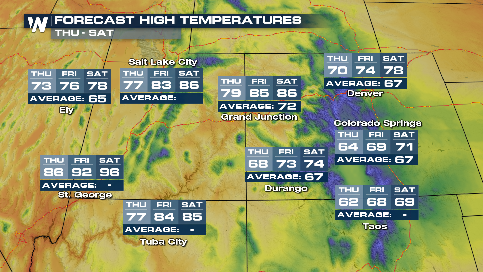
After Wednesday, temperatures will start to warm back up. The area will dry out as a ridge of high pressure moves in. By the end of the week areas in the Four Corners can see temperatures 80 degrees and higher with plenty of sunshine.
Stay with WeatherNation for the latest.


