Boomerang Moisture from Invest 93L Returns to Gulf Coast

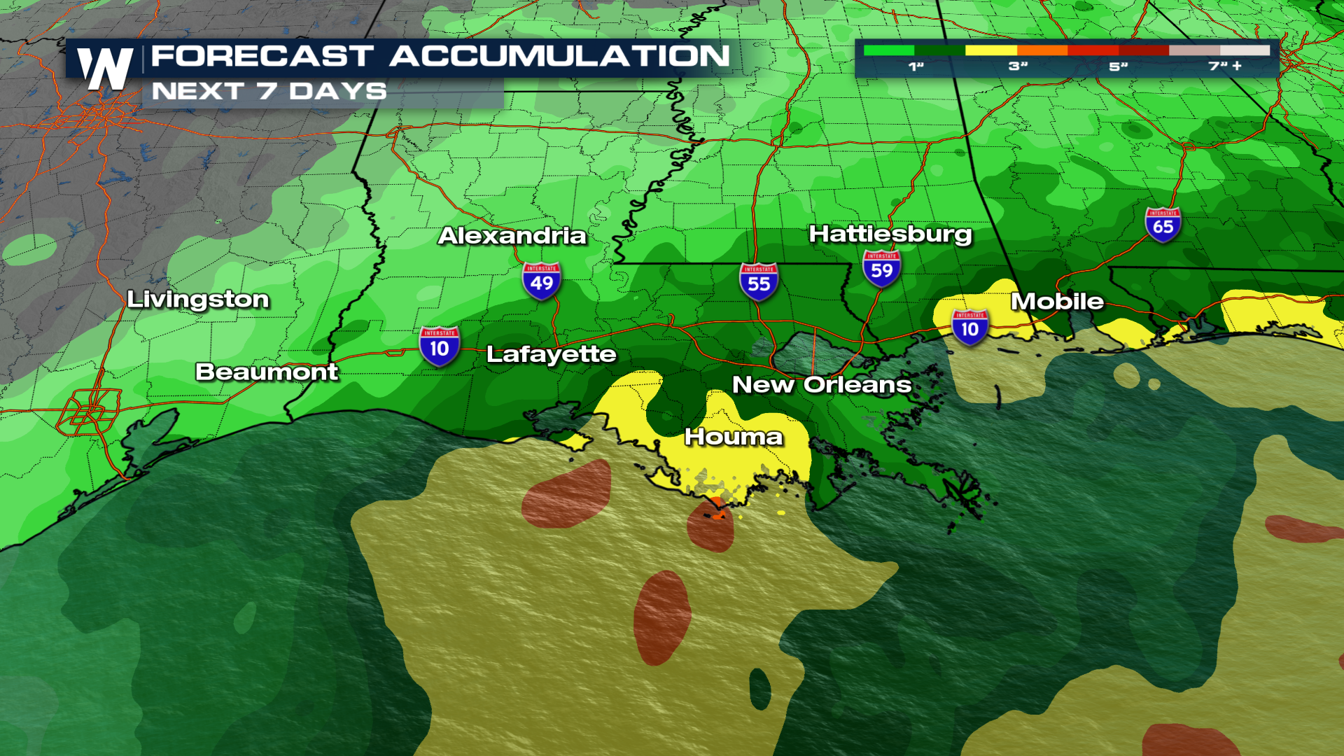
Leftover moisture from the ghost of Invest 93L is coming back! It will loop back around the Gulf Coast with heavy rain sliding down I-10 throughout the week. Some places could see 3-7 inches of rainfall, which could lead to some localized flooding.
Timing
On Tuesday the showers will favor the southeast. But this is the continuation of the wet pattern. Think torrential, slow-moving showers and storms. If you get caught under one of these downpours, expect ponding on the roadways and some minor flash flooding.
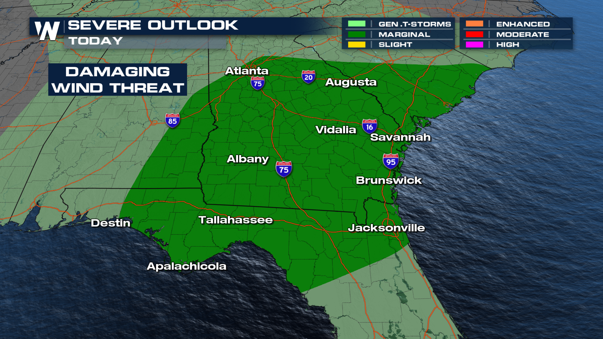
Some of these storms could be severe, with damaging winds being the biggest concern.
Towards the second half of the week, the old remains of 93-L will once again pick on Louisiana. That will bring back flooding concerns farther west on I-10. The biggest worry is in the southern parishes of Louisiana.
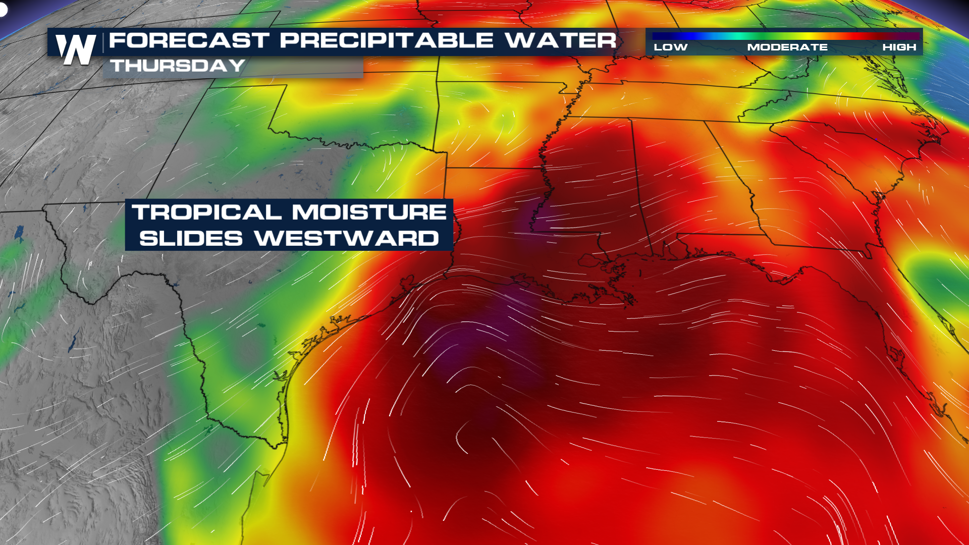
If any of the heavier rain moves onshore, some areas could be talking about 3-5 inches of rainfall, with Thursday looking like the day with the heaviest rain.