Flood Threat Down South Helping Drought Conditions

What To Expect:
With an active pattern in store for the south, more rainfall is expected headed into the mid-to-late week. There's no secret that there's plenty of rich moisture down here. It'll only serve to make those rain and thunderstorm chances greater.
Timing:
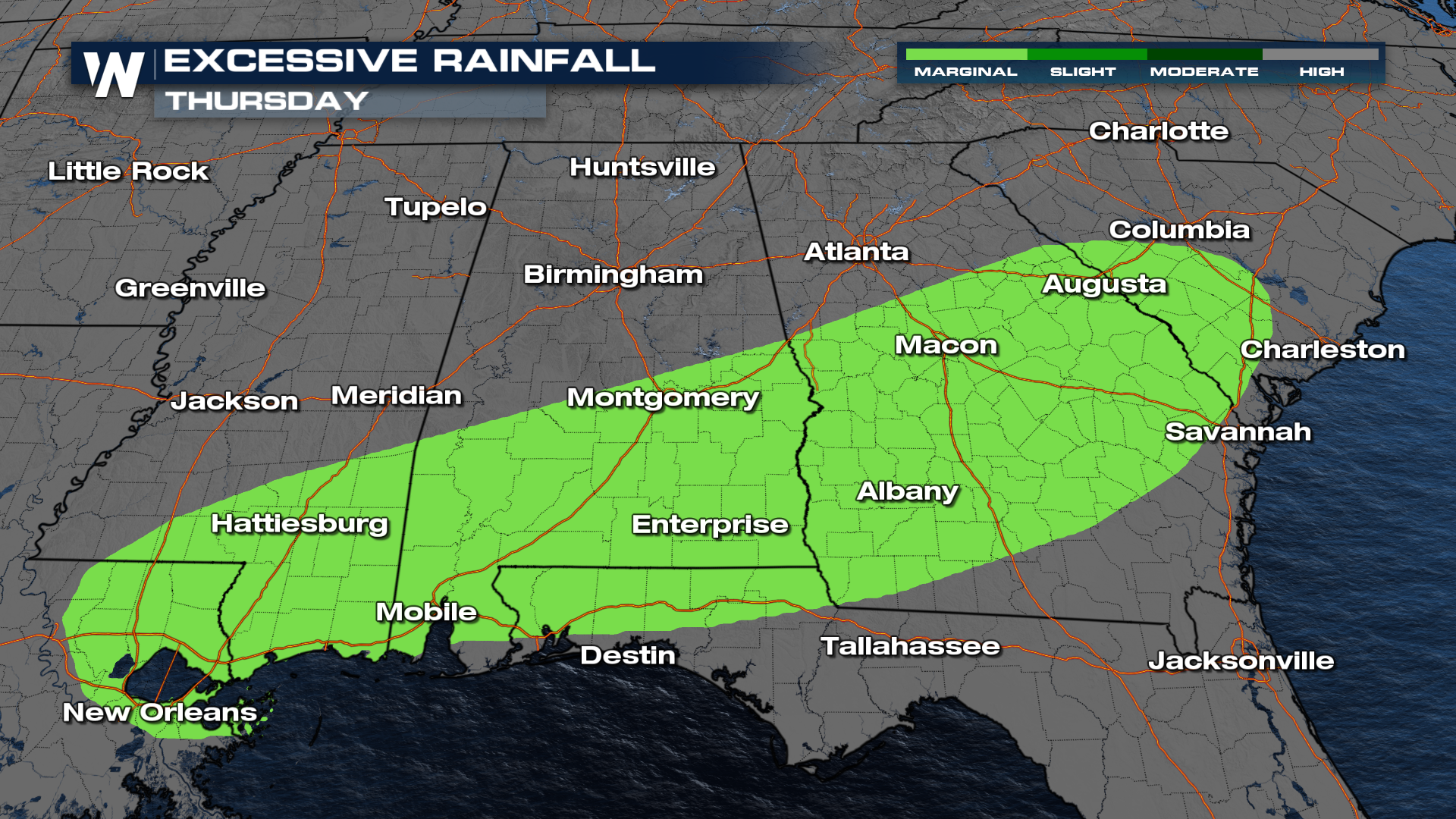
This front will be in no hurry to get on out of the South. This will likely result in multiple rounds of rain that will come in waves throughout your Wednesday and Thursday.
By the time we hit the weekend, we can see totals toppling over 3-4" across the South.
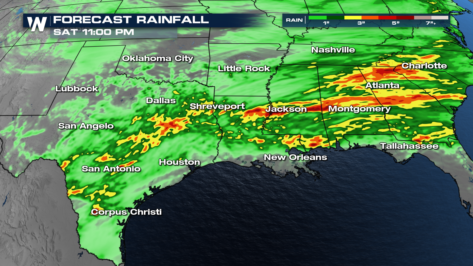
The flood threat will also accompany all this rain. The main spots to watch will be the Deep South through Wednesday and Thursday.
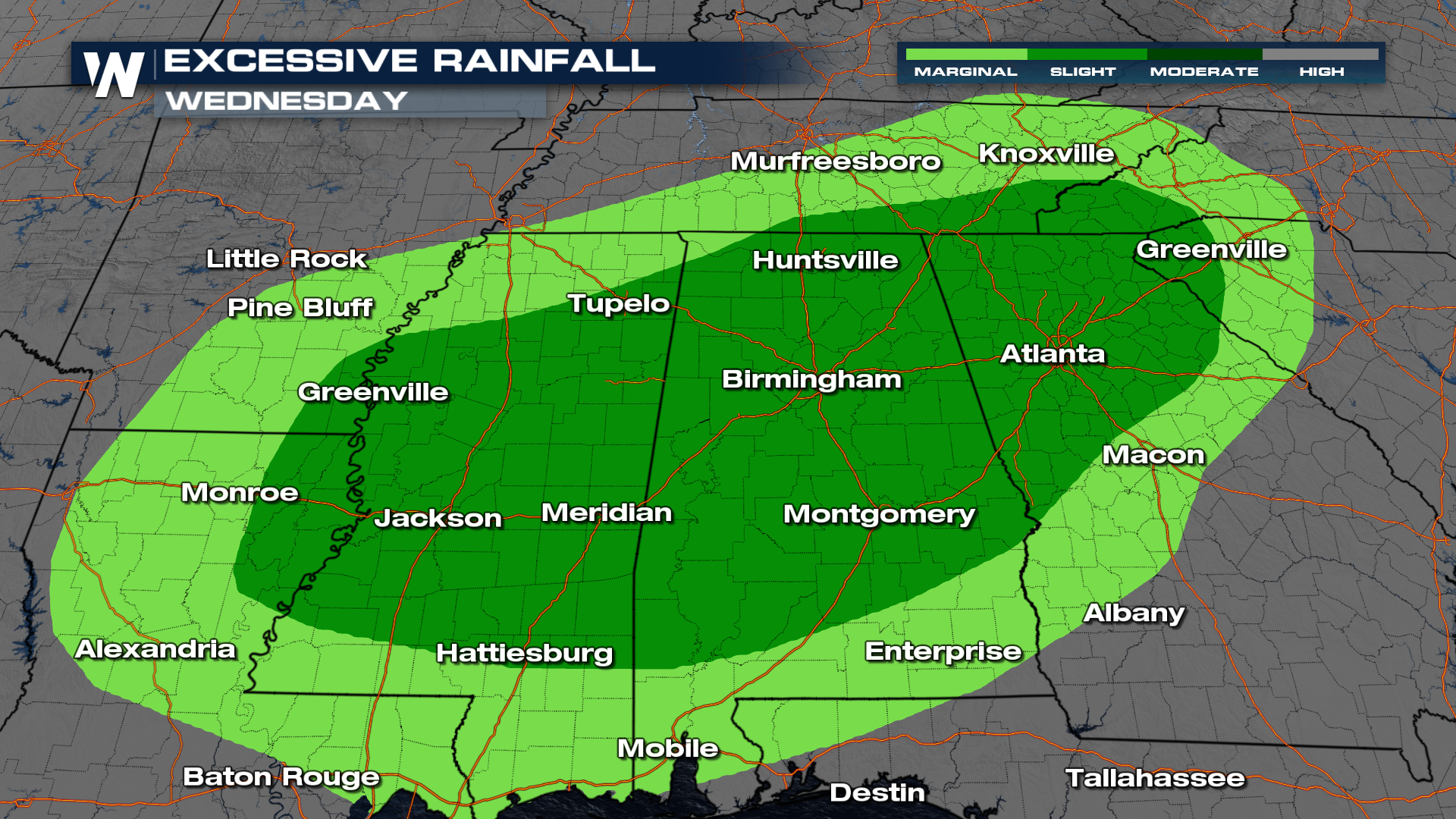
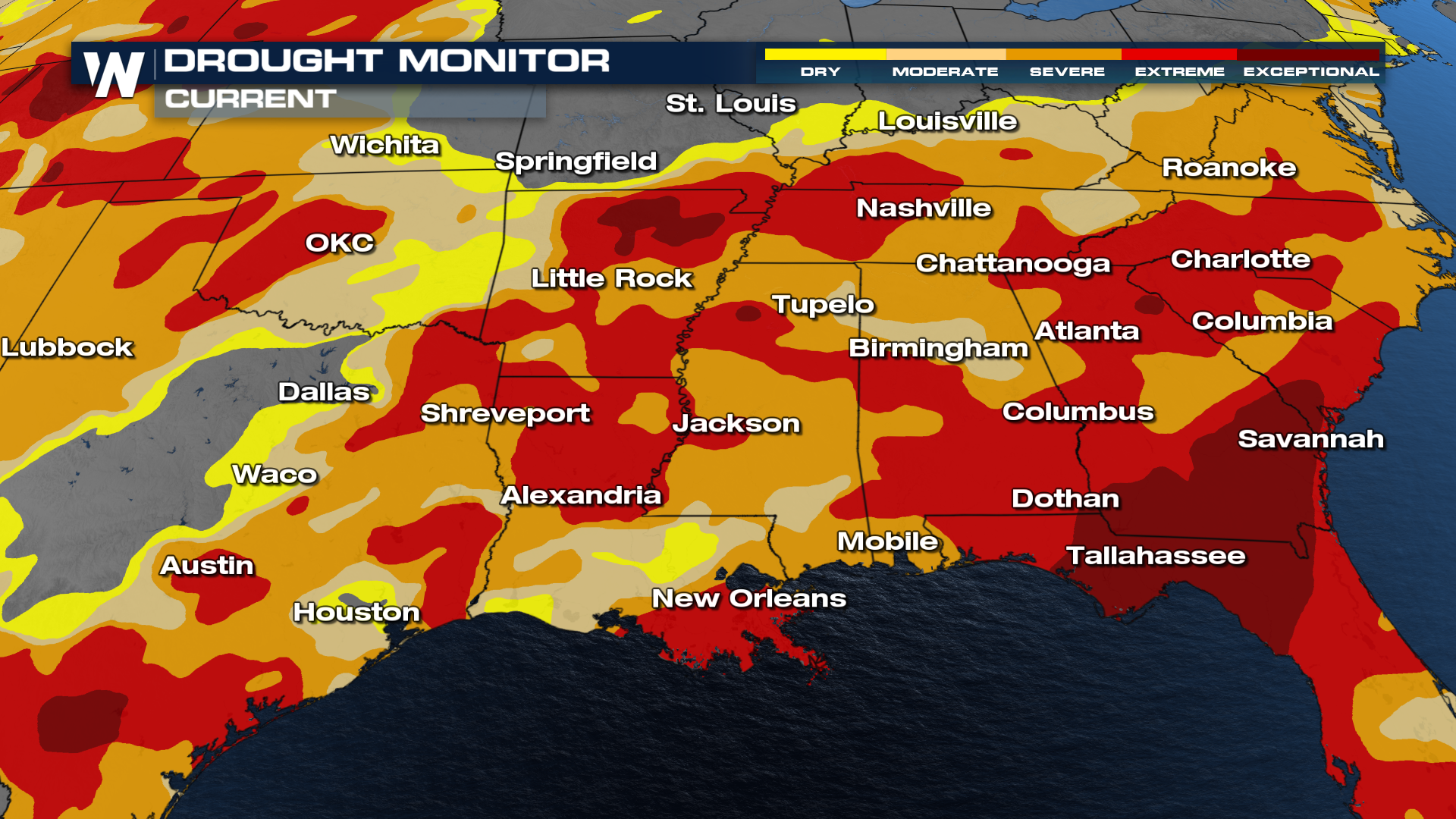
Considering how dry things have been across the south, all of this rainfall is going to be to our benefit. We have to be careful, however, of how fast we pick up some of these totals.
Stay tuned to WeatherNation, as we track all this rainfall into the end of the work week!


