Isolated Severe Storms for the South Tuesday
Top Stories
15 Oct 2019 4:23 AM
A stationary front situated over the Southern U.S. will be the focus for heavy rain, but some isolated severe storms will be possible as well. A cold front sweeping across the Plains will also contribute to a chance of severe weather over Texas, Oklahoma and Arkansas. Here is the latest severe forecast.
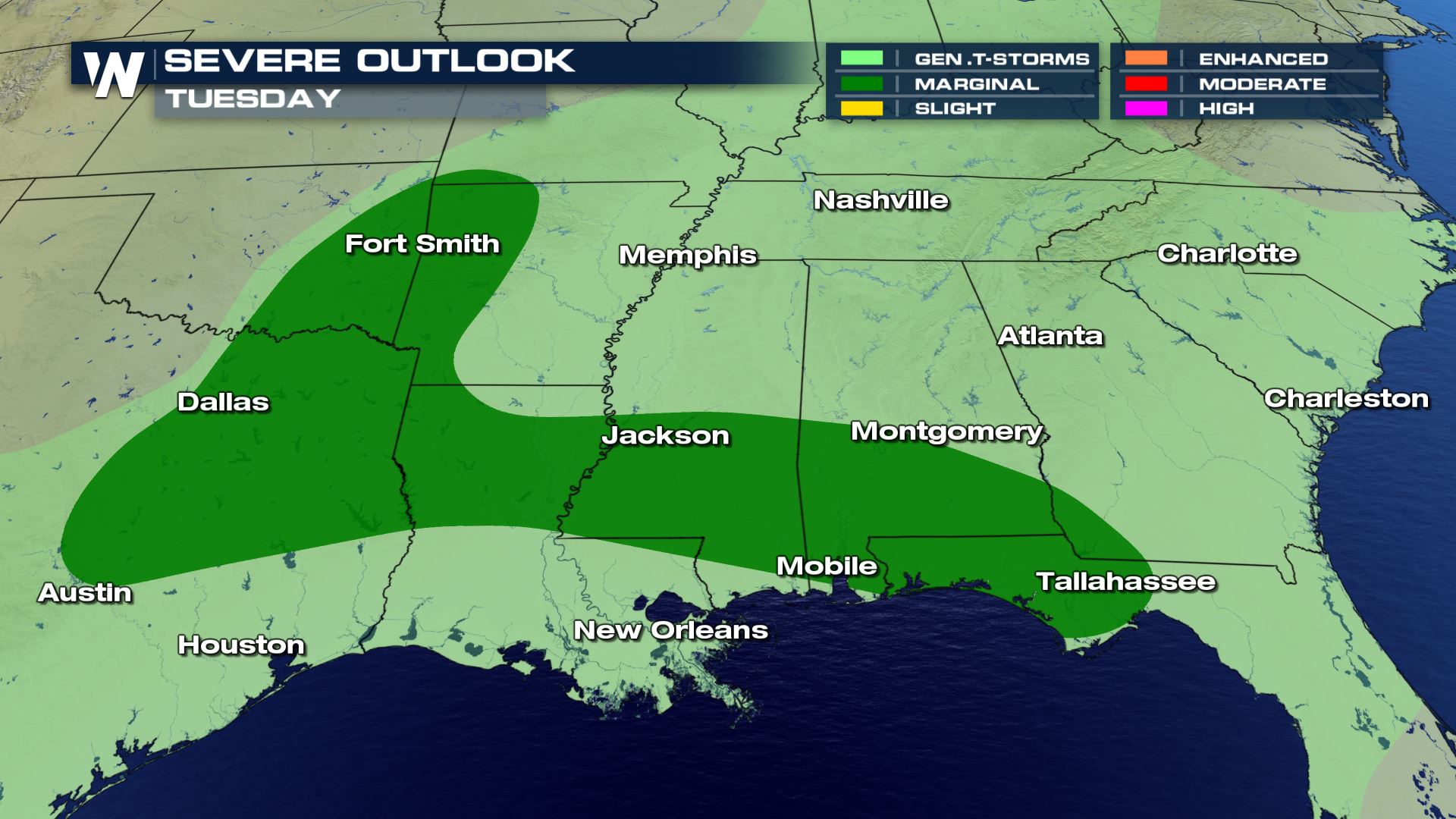 A large portion of the South is under a Marginal severe risk today. This means an isolated risk for hail, damaging winds and large hail. Areas closer to the Gulf Coast will likely only deal with a damaging wind risk. Parts of Texas, Oklahoma and Arkansas will also have a risk of tornadoes and large hail. These severe risks are going to be isolated so most of the region will not have severe storms. You will want to be weather aware all day in these areas.
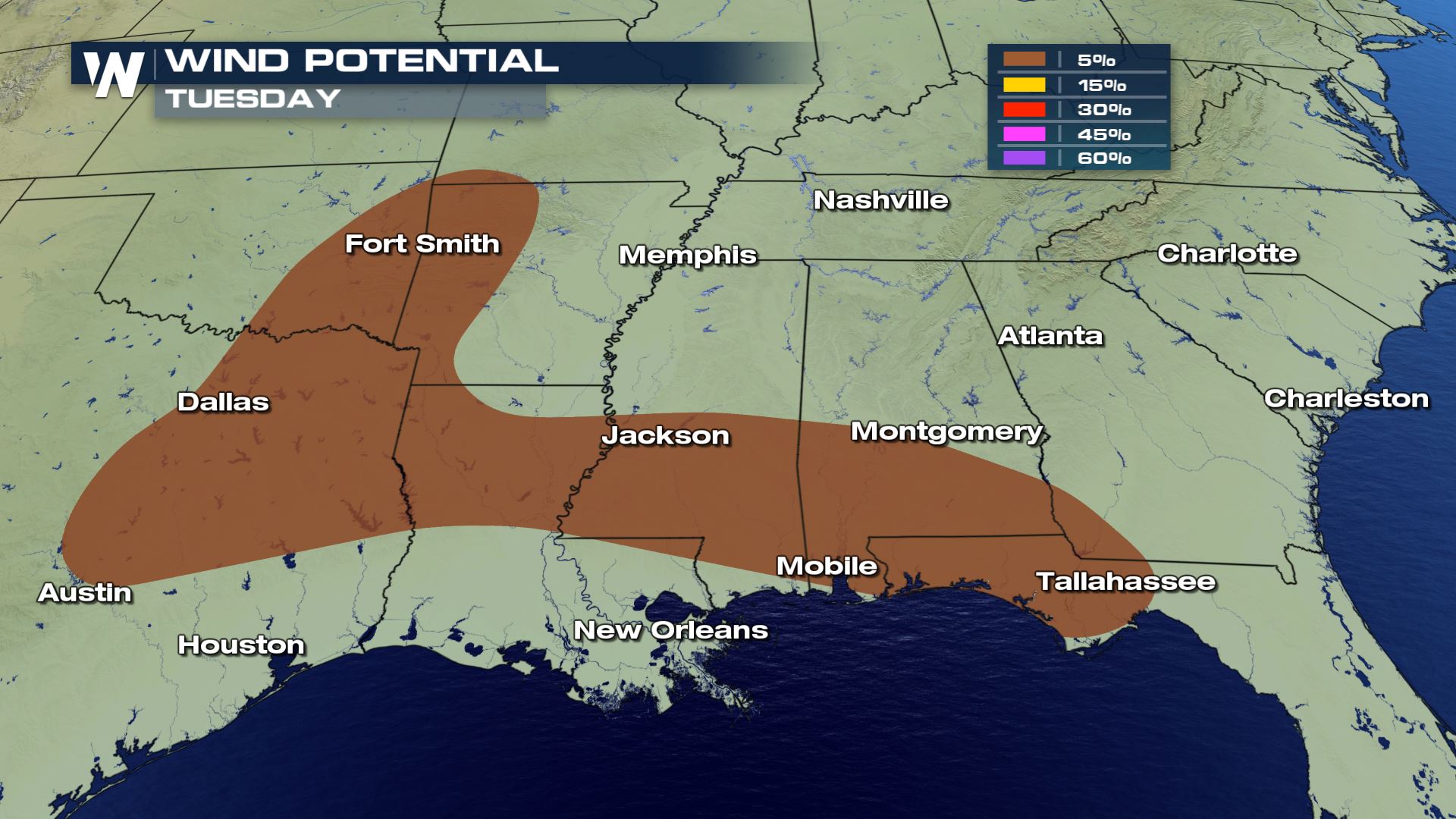
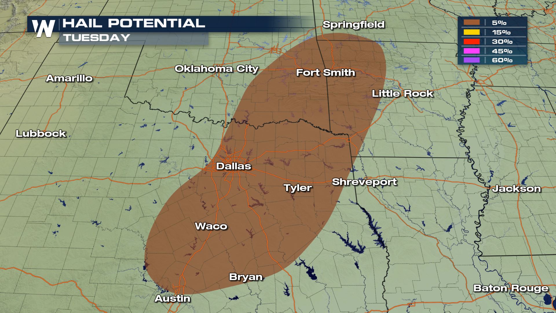
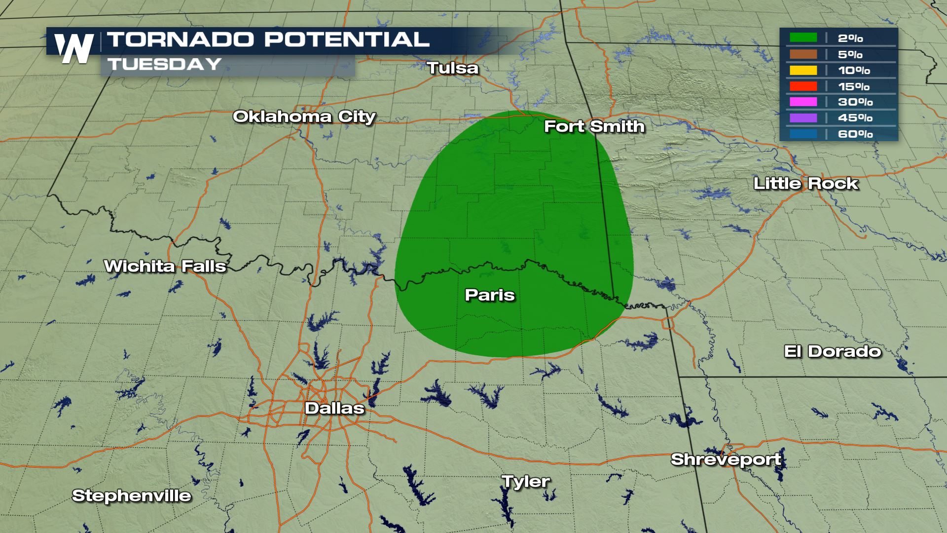 All modes of severe weather are in the forecast today. This won't be a major severe event as the severe risks are going to be isolated in nature. The tornado risk will only be for the Red River Valley.
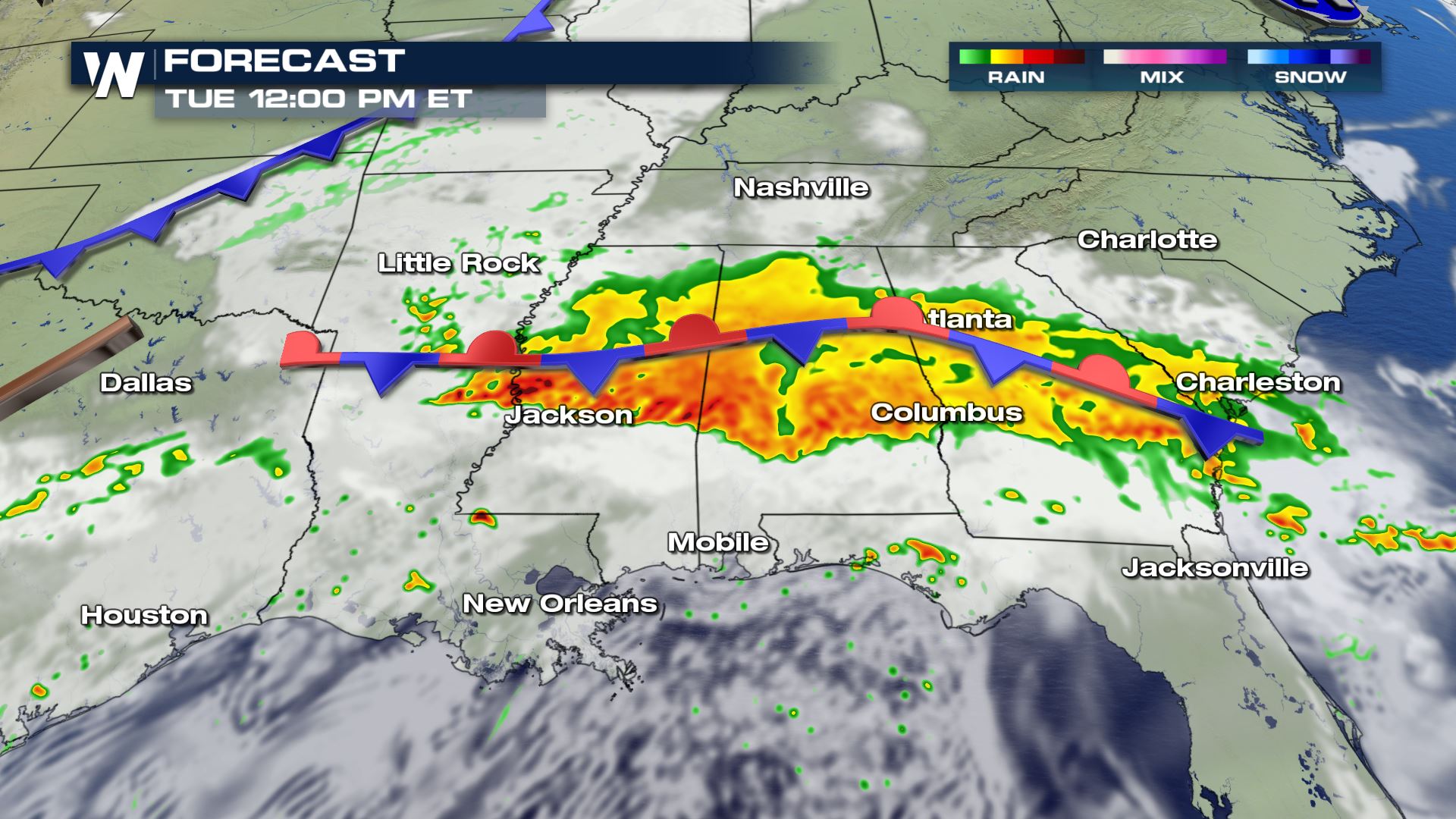
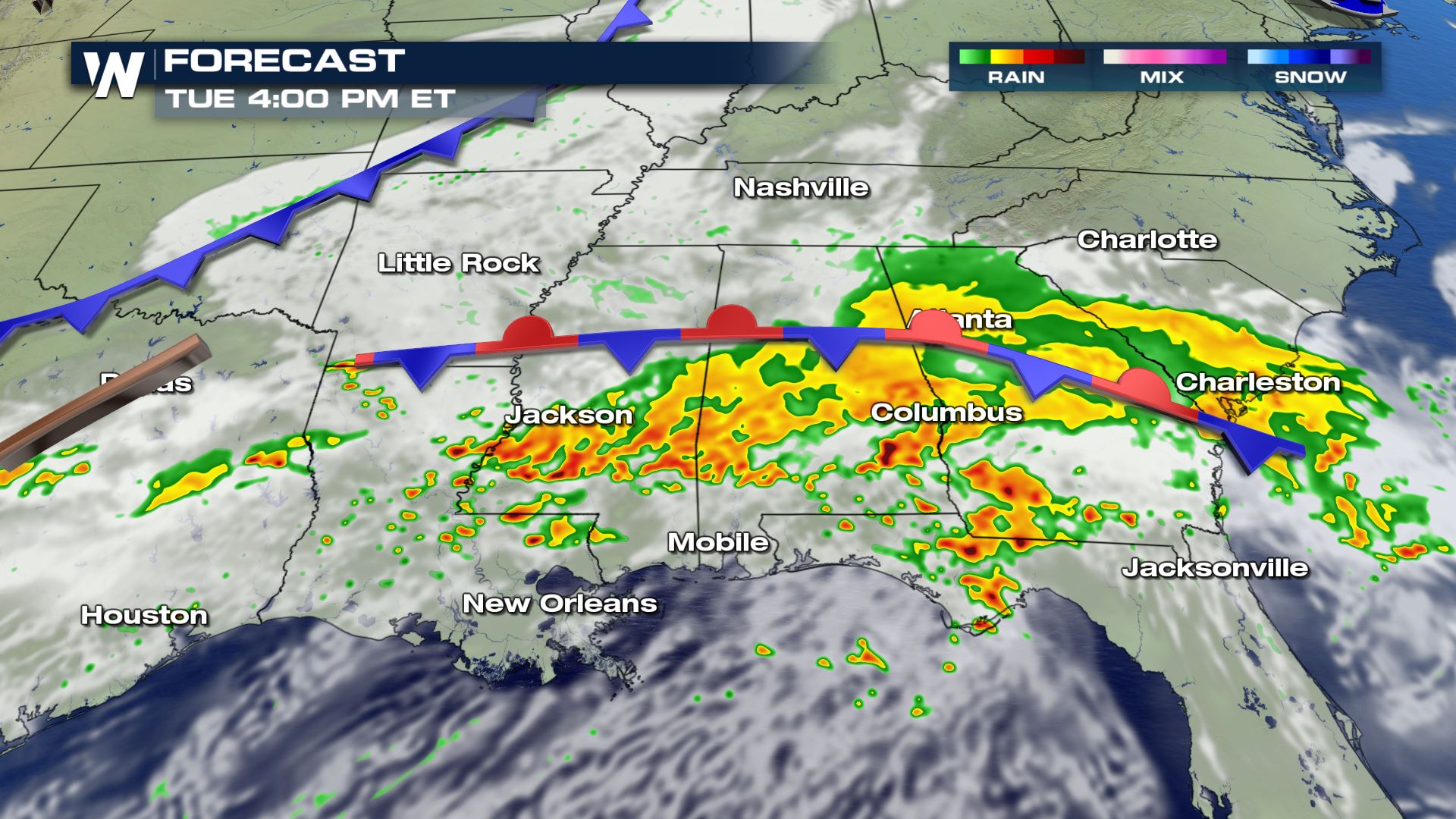
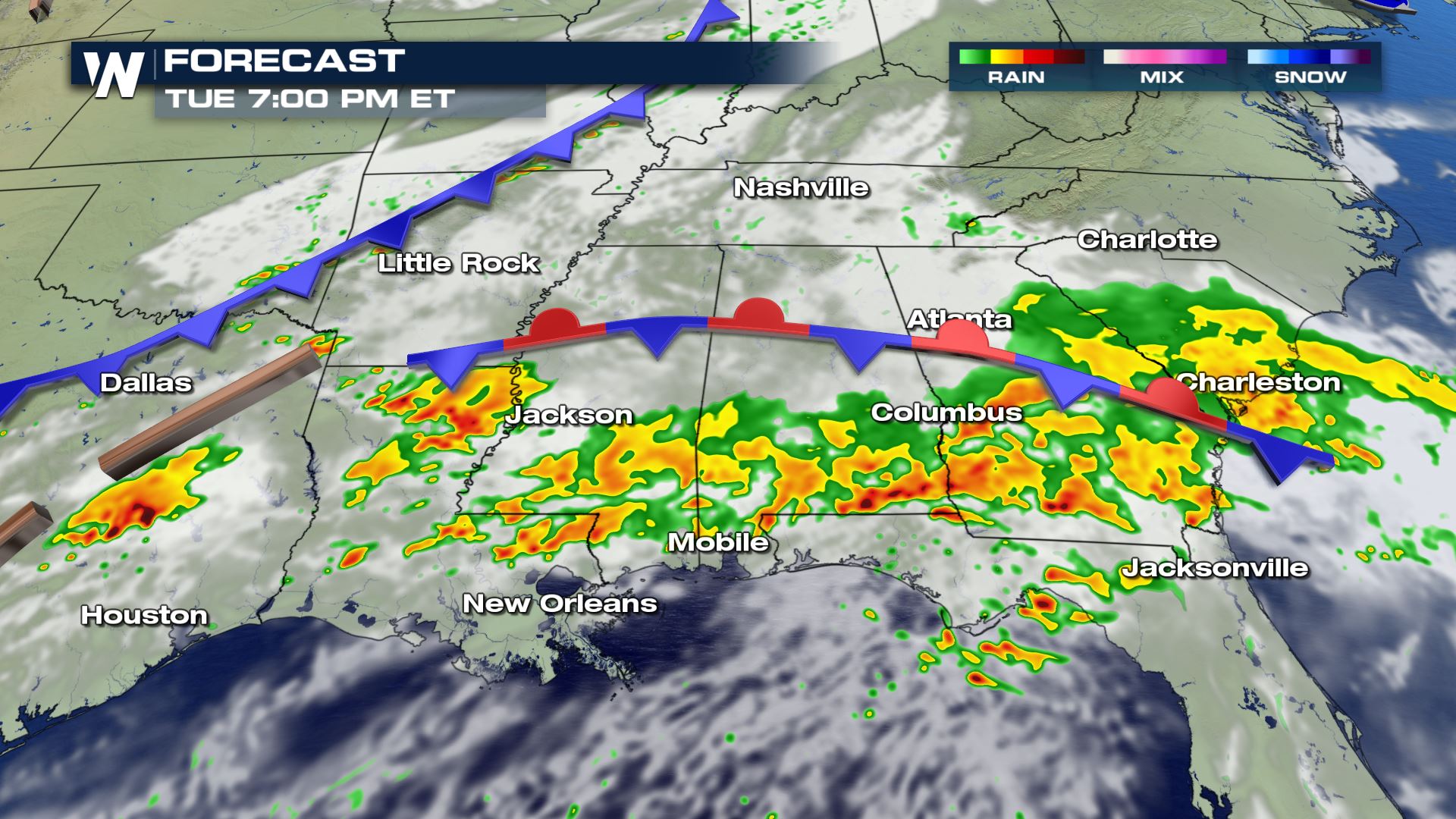
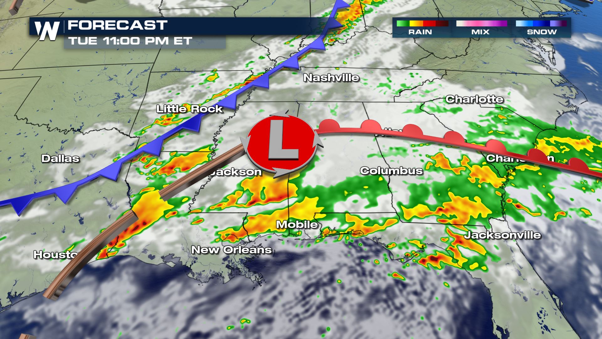 Today's heavy rain and storms will be an all day event. Anywhere from eastern Texas to the Atlantic Coast will see heavy storms bringing the risk of flash flooding. The timing for the severe weather will be more for the afternoon and evening, but we can't rule out an isolated severe storm Tuesday morning.
Keep checking with WeatherNaiton for more updates. Don't forget you can stream us 24/7...here is how you can do it--->Streaming Information
Severe Outlook
 A large portion of the South is under a Marginal severe risk today. This means an isolated risk for hail, damaging winds and large hail. Areas closer to the Gulf Coast will likely only deal with a damaging wind risk. Parts of Texas, Oklahoma and Arkansas will also have a risk of tornadoes and large hail. These severe risks are going to be isolated so most of the region will not have severe storms. You will want to be weather aware all day in these areas.
Severe Risks


 All modes of severe weather are in the forecast today. This won't be a major severe event as the severe risks are going to be isolated in nature. The tornado risk will only be for the Red River Valley.
Forecast


 Today's heavy rain and storms will be an all day event. Anywhere from eastern Texas to the Atlantic Coast will see heavy storms bringing the risk of flash flooding. The timing for the severe weather will be more for the afternoon and evening, but we can't rule out an isolated severe storm Tuesday morning.
Keep checking with WeatherNaiton for more updates. Don't forget you can stream us 24/7...here is how you can do it--->Streaming Information
Today's heavy rain and storms will be an all day event. Anywhere from eastern Texas to the Atlantic Coast will see heavy storms bringing the risk of flash flooding. The timing for the severe weather will be more for the afternoon and evening, but we can't rule out an isolated severe storm Tuesday morning.
Keep checking with WeatherNaiton for more updates. Don't forget you can stream us 24/7...here is how you can do it--->Streaming InformationAll Weather News
More