Severe Storm Chances Wednesday from Arizona to Texas
Special Stories
6 Nov 2019 4:47 AM
The heavy snow chances across the North have been getting a lot of attention over the past few days, but to the south of this system the risk of severe weather and heavy rain will be possible. Areas from eastern Arizona to western Texas will have a risk of severe storms during the afternoon and evening. Strong upper-level winds and increasing tropical moisture will allow for heavy rain, isolated large hail, damaging winds and a few tornadoes. The severe threat will begin to diminish late this evening. Here is the very latest severe forecast.
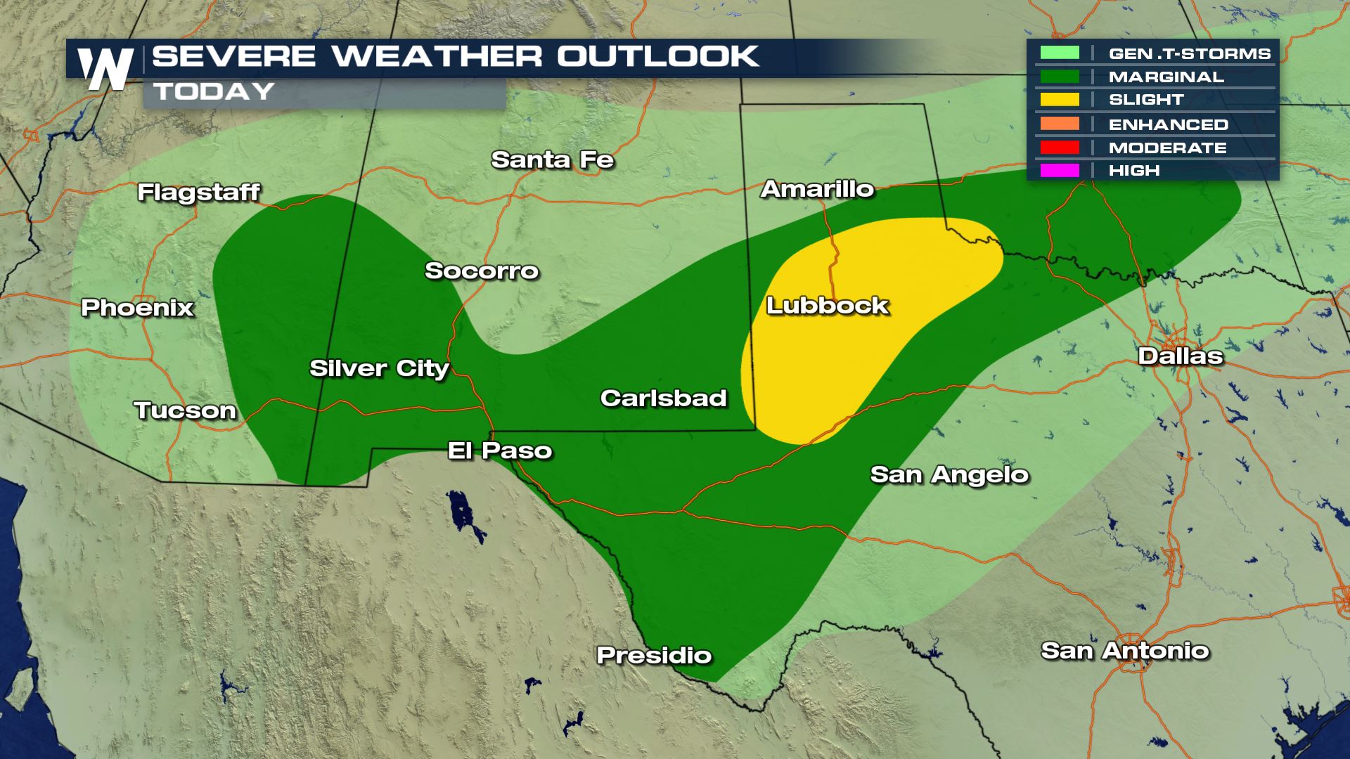 Isolated to scattered severe storms will be possible this afternoon and this evening. The biggest threat of severe weather will be over West Texas for cities like Lubbock. You will
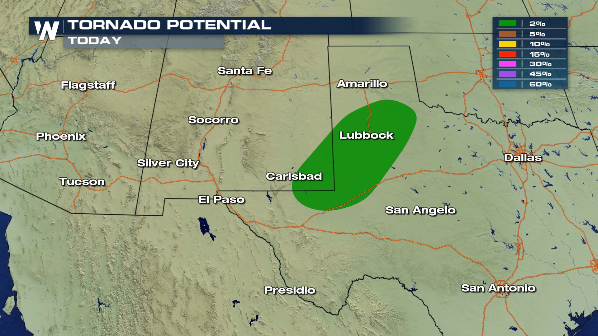 All modes of severe weather are in the forecast Wednesday. The tornado risk will be confined to the Permian Basin in western Texas this evening, but the hail and damaging wind risk will be more widespread throughout the day. If you have any outdoor plans today, you might want to try and reschedule as the weather could be very dangerous.
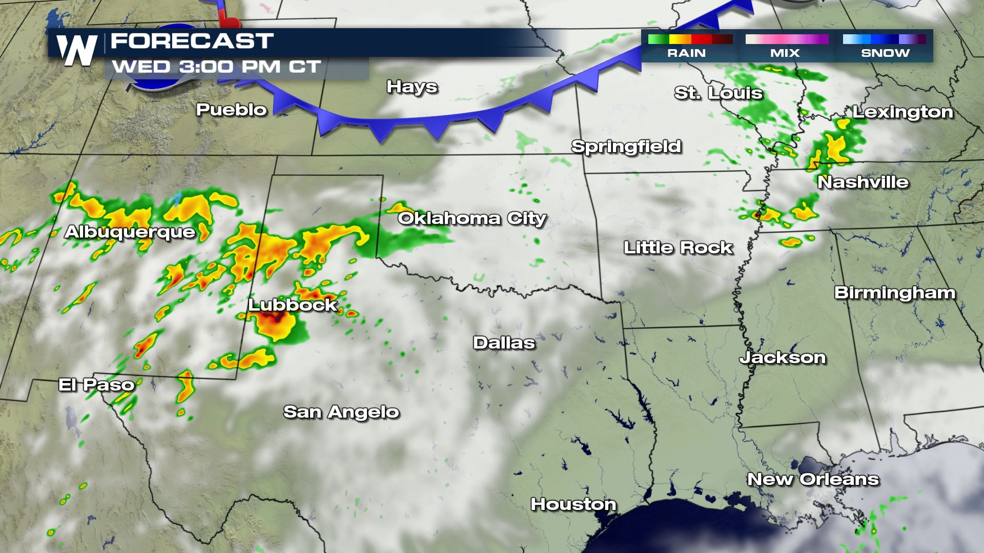

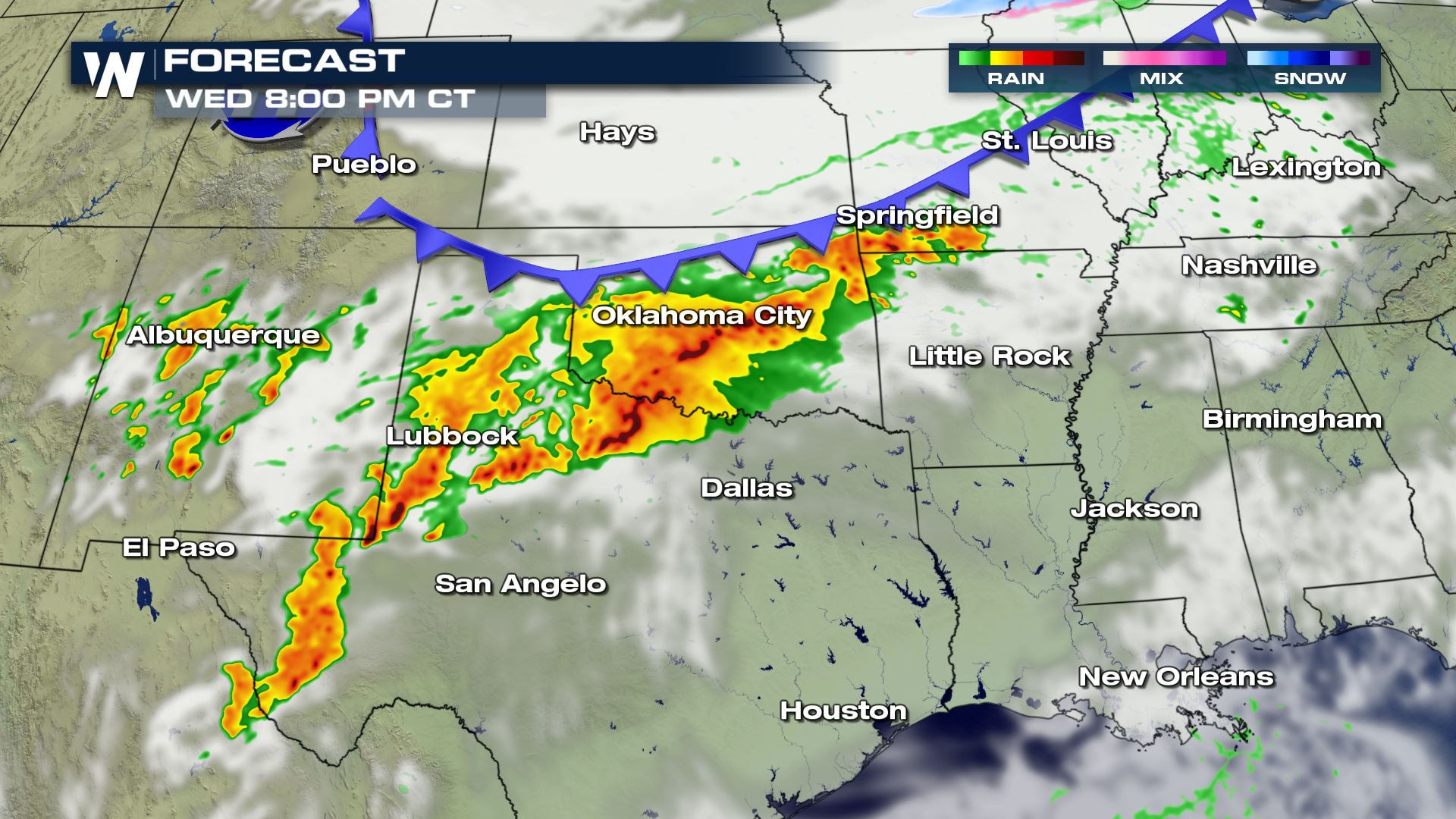
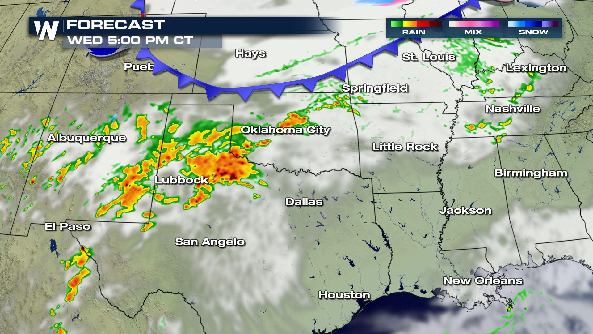
 The showers and storms will be happening all day with the highest risk of severe chances arriving for the afternoon and evening hours. Your evening commute home from work or school could be messy with low visibility and the risk flooded roadways.
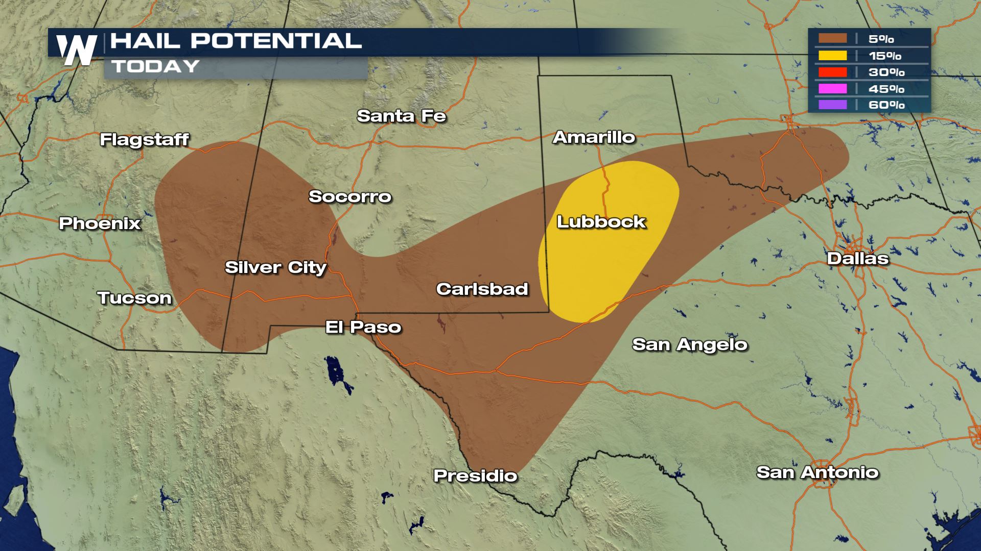
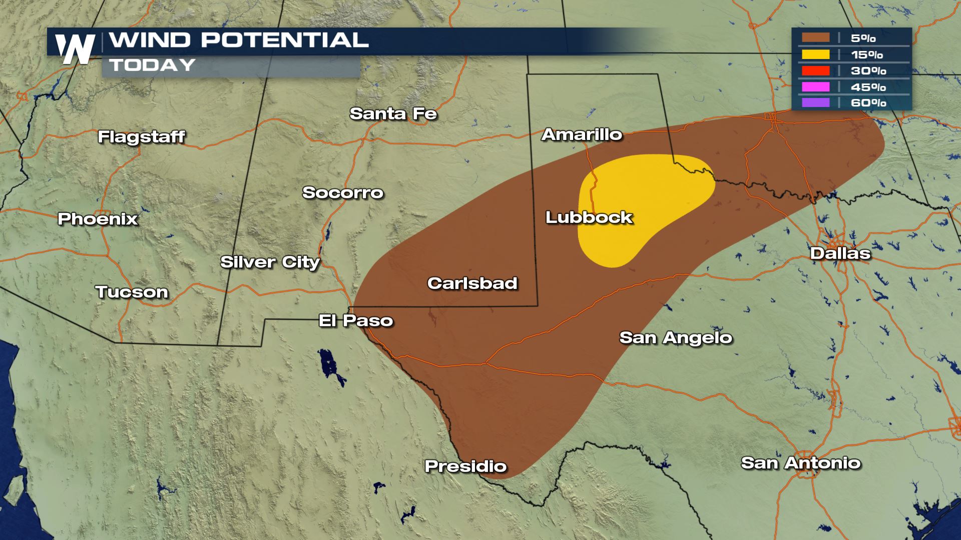
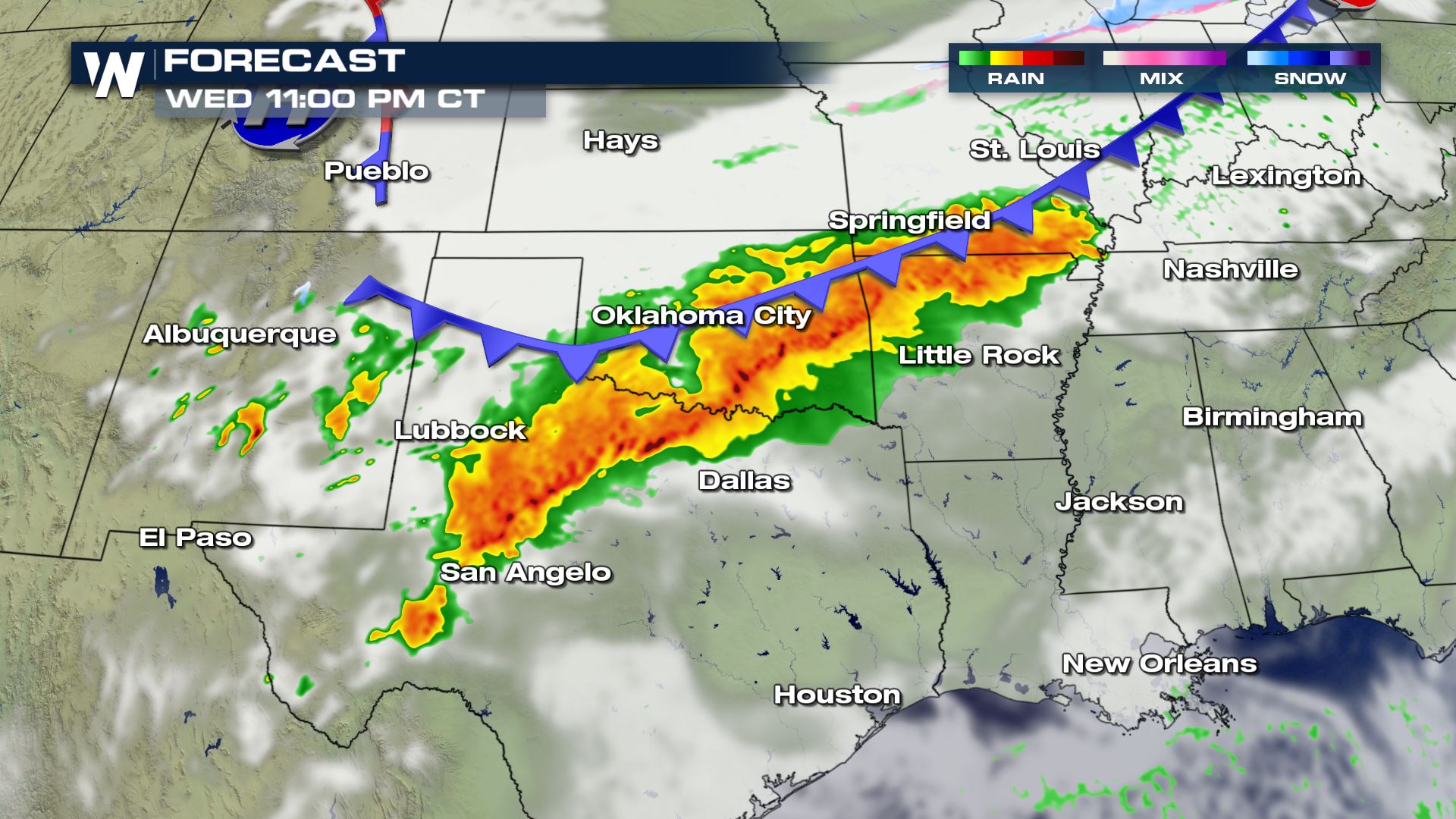
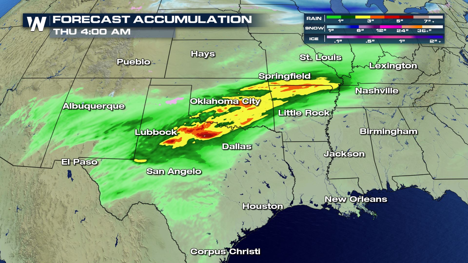 Heavy rain and flash flooding will be possible with all the big downpours that are in the forecast. Texas and Oklahoma could see rainfall totals exceeding 5 inches through early Thursday morning.
Keep checking with WeatherNation for the very latest on today's severe chances.
Heavy rain and flash flooding will be possible with all the big downpours that are in the forecast. Texas and Oklahoma could see rainfall totals exceeding 5 inches through early Thursday morning.
Keep checking with WeatherNation for the very latest on today's severe chances.
Severe Outlook
Isolated to scattered severe storms will be possible this afternoon and this evening. The biggest threat of severe weather will be over West Texas for cities like Lubbock. You will
Severe Risks
All modes of severe weather are in the forecast Wednesday. The tornado risk will be confined to the Permian Basin in western Texas this evening, but the hail and damaging wind risk will be more widespread throughout the day. If you have any outdoor plans today, you might want to try and reschedule as the weather could be very dangerous.
Forecast
The showers and storms will be happening all day with the highest risk of severe chances arriving for the afternoon and evening hours. Your evening commute home from work or school could be messy with low visibility and the risk flooded roadways.
Rainfall Potential
Heavy rain and flash flooding will be possible with all the big downpours that are in the forecast. Texas and Oklahoma could see rainfall totals exceeding 5 inches through early Thursday morning.
Keep checking with WeatherNation for the very latest on today's severe chances.All Weather News
More
Wildfire Outbreak in the Pacific Northwest
SPOKANE, WA - On Saturday, August 1st, the Ol
2 Aug 2026 7:20 PM

More Storms for the East Through Monday
A low-pressure system that moved through the
2 Aug 2026 7:20 PM


After Reaching Category 5, Genevieve Weakens in the Pacific
PacificGenevieve formed on last Friday south
2 Aug 2026 6:25 PM

Flooding, Severe Storms Target the Midwest Again
After an active week of storms across the nor
1 Aug 2026 1:40 AM

Flooding Risk Increases as Heavy Rain Targets the Tri-State Area
Tuesday, heavy rainfall moved across the Nort
30 Jul 2026 12:25 AM

Severe Weather: Energy From the Midwest Now in the Southeast
UPPER MIDWEST - Through Monday, dangerous tor
29 Jul 2026 10:30 PM