Weekend Severe Threat in the Plains
Special Stories
8 Aug 2020 10:45 AM
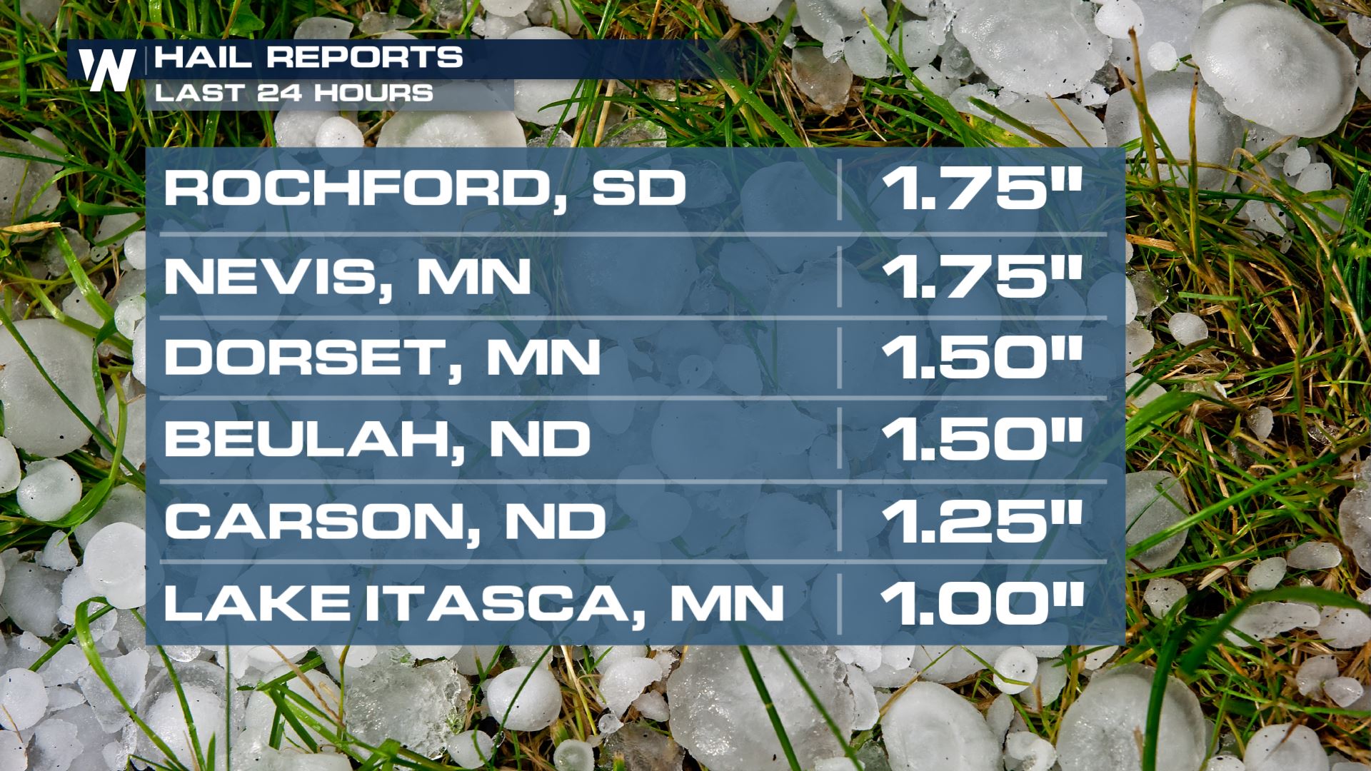
Severe storms have returned to the Plains and more are possible this weekend. A mid-level trough, which is a wave of jet stream energy, is moving out of the Pacific Northwest and into the Northern Rockies. This system will aid in the development of severe storms. On Friday, there were reports of heavy rainfall and large hail from the Dakotas to Minnesota.
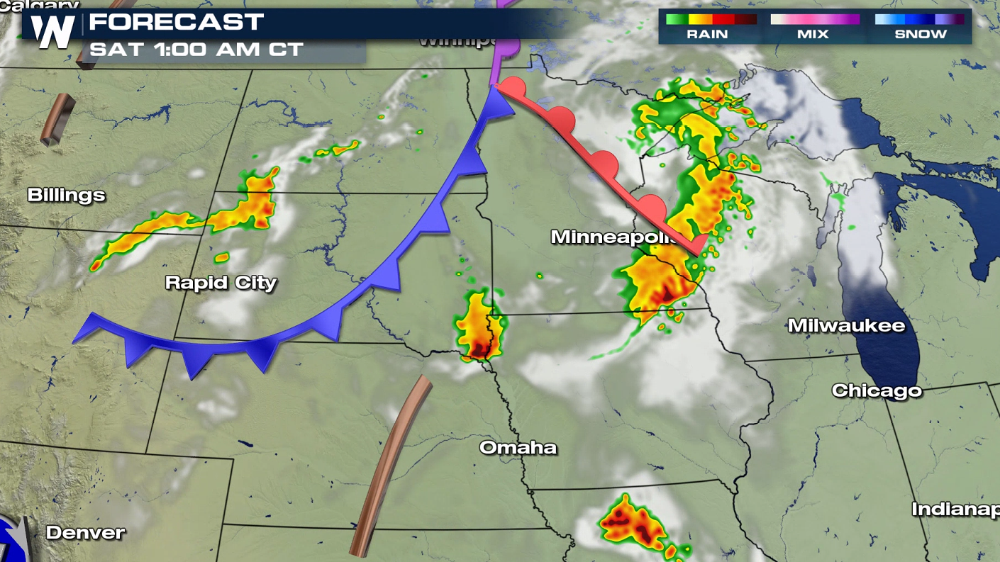
 Friday's front moves through the Dakotas and helps initiate and carry storms. Warm, humid air along with strong wind in the mid and upper levels of the atmosphere will carry these storms through the overnight.
 One of the factors working in favor of storm development, aside from the lift from the Rockies and low pressure system, is daytime heating. As warm air builds, rising hot air can help break the "cap", allowing storms to ignite. Over the next few days we are looking at warm temperatures and increasing humidity that will create instability, aiding storm development as seen in the image below:
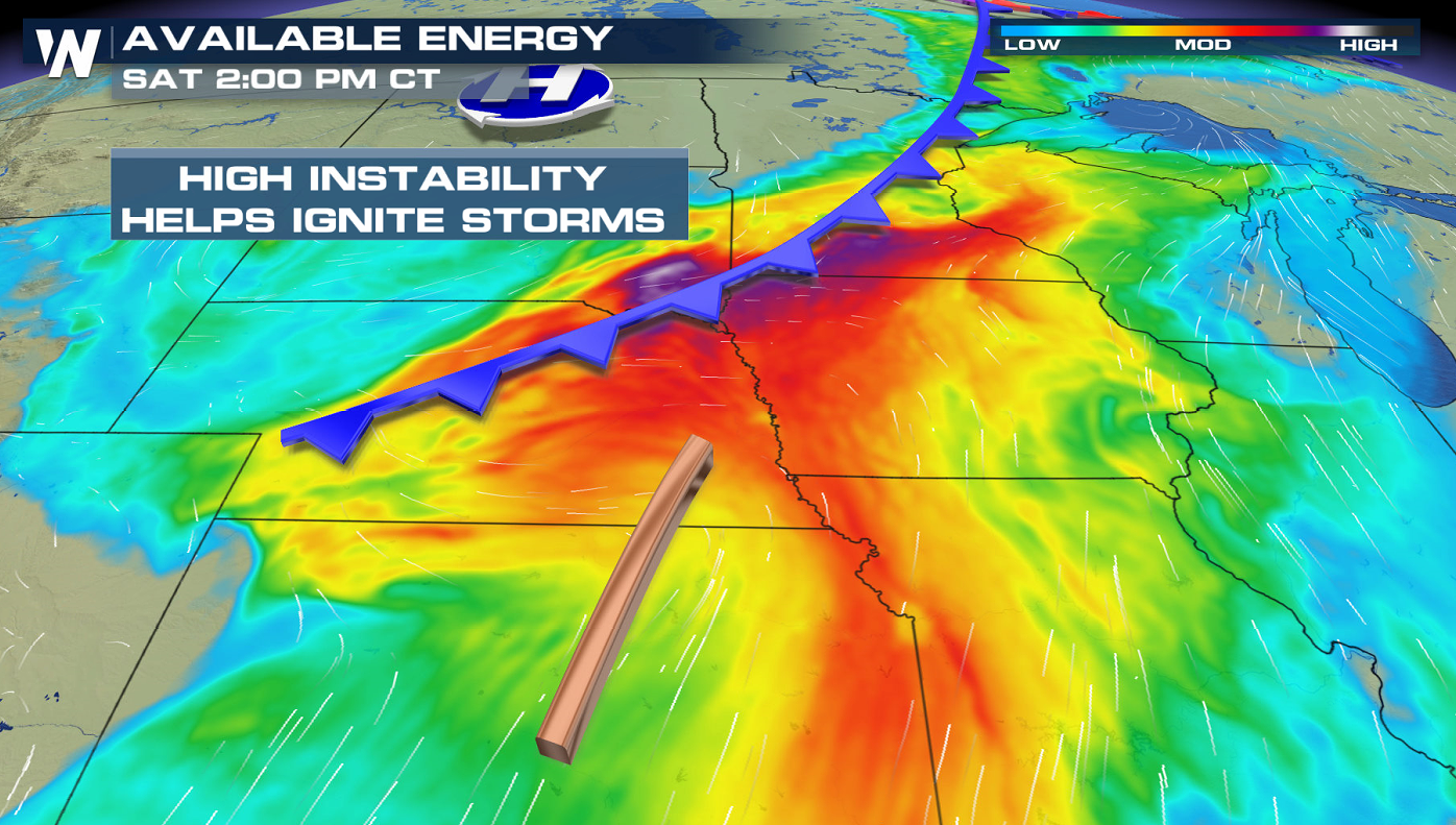 The darker reds and oranges represent more instability and energy, which will help storms initiate this weekend.

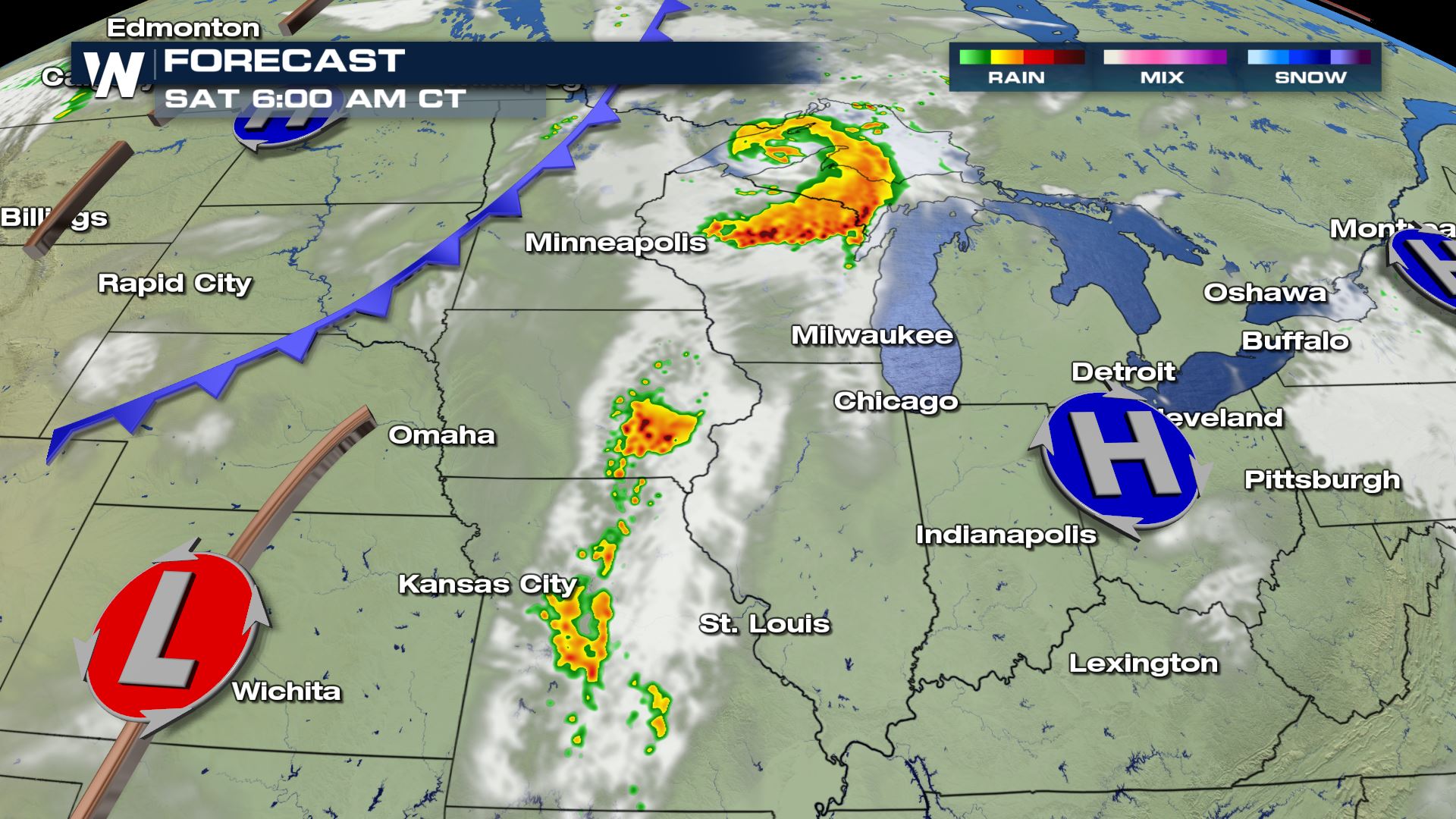
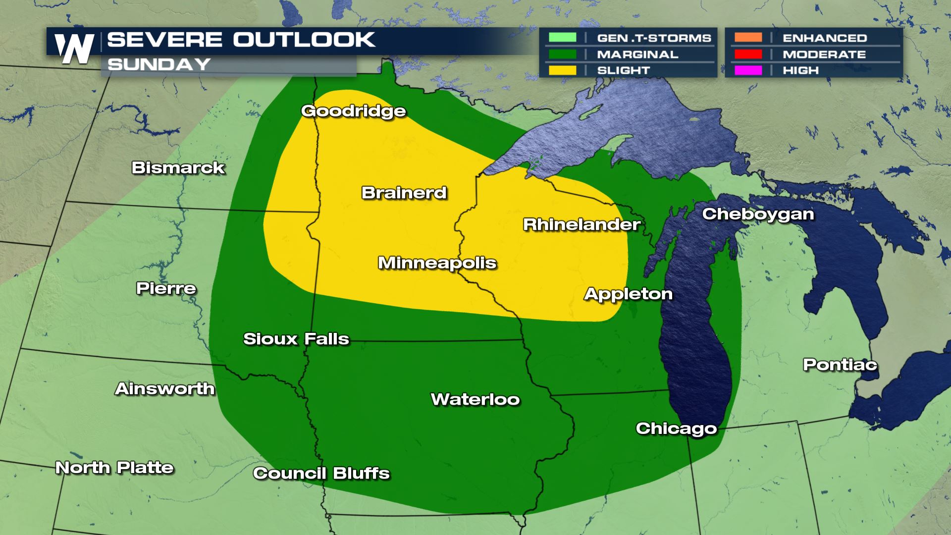
 On Sunday, the risk for severe storms returns to the Upper Midwest. Areas from the Canadian Border and Lake Superior to Siouxland in Nebraska and Iowa may see severe weather.
 For more details on our late week severe threat, tune into WeatherNation.
Friday's front moves through the Dakotas and helps initiate and carry storms. Warm, humid air along with strong wind in the mid and upper levels of the atmosphere will carry these storms through the overnight.
One of the factors working in favor of storm development, aside from the lift from the Rockies and low pressure system, is daytime heating. As warm air builds, rising hot air can help break the "cap", allowing storms to ignite. Over the next few days we are looking at warm temperatures and increasing humidity that will create instability, aiding storm development as seen in the image below:
The darker reds and oranges represent more instability and energy, which will help storms initiate this weekend.
SATURDAY / SUNDAY
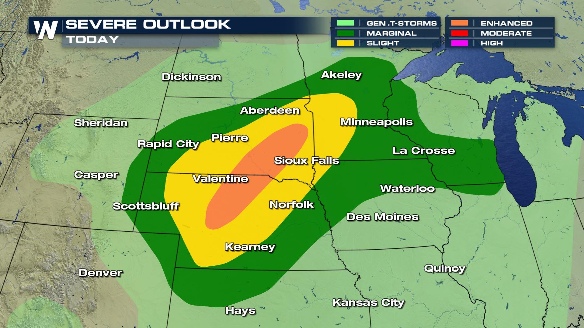
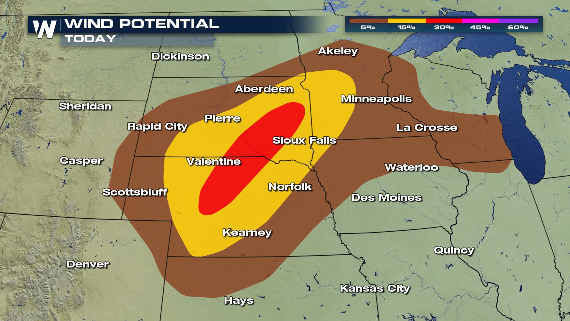
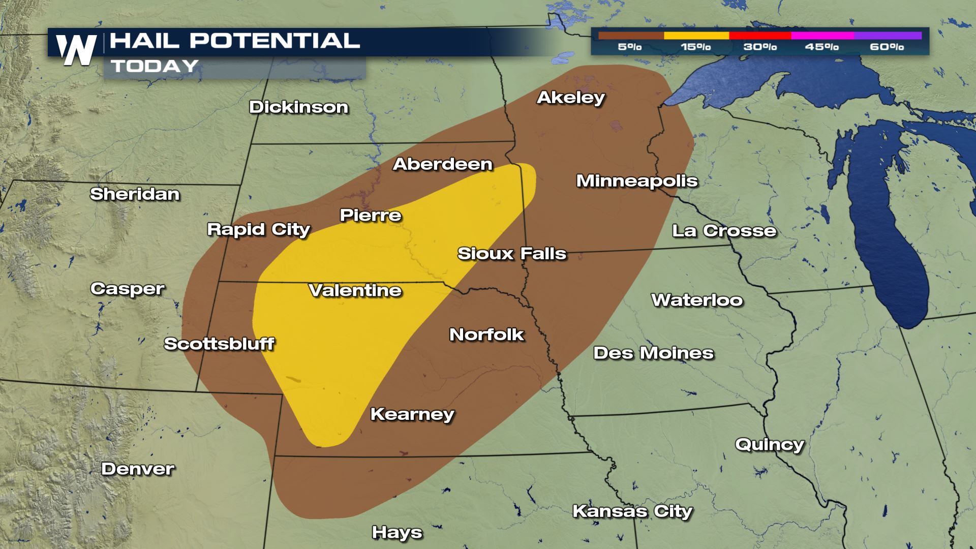
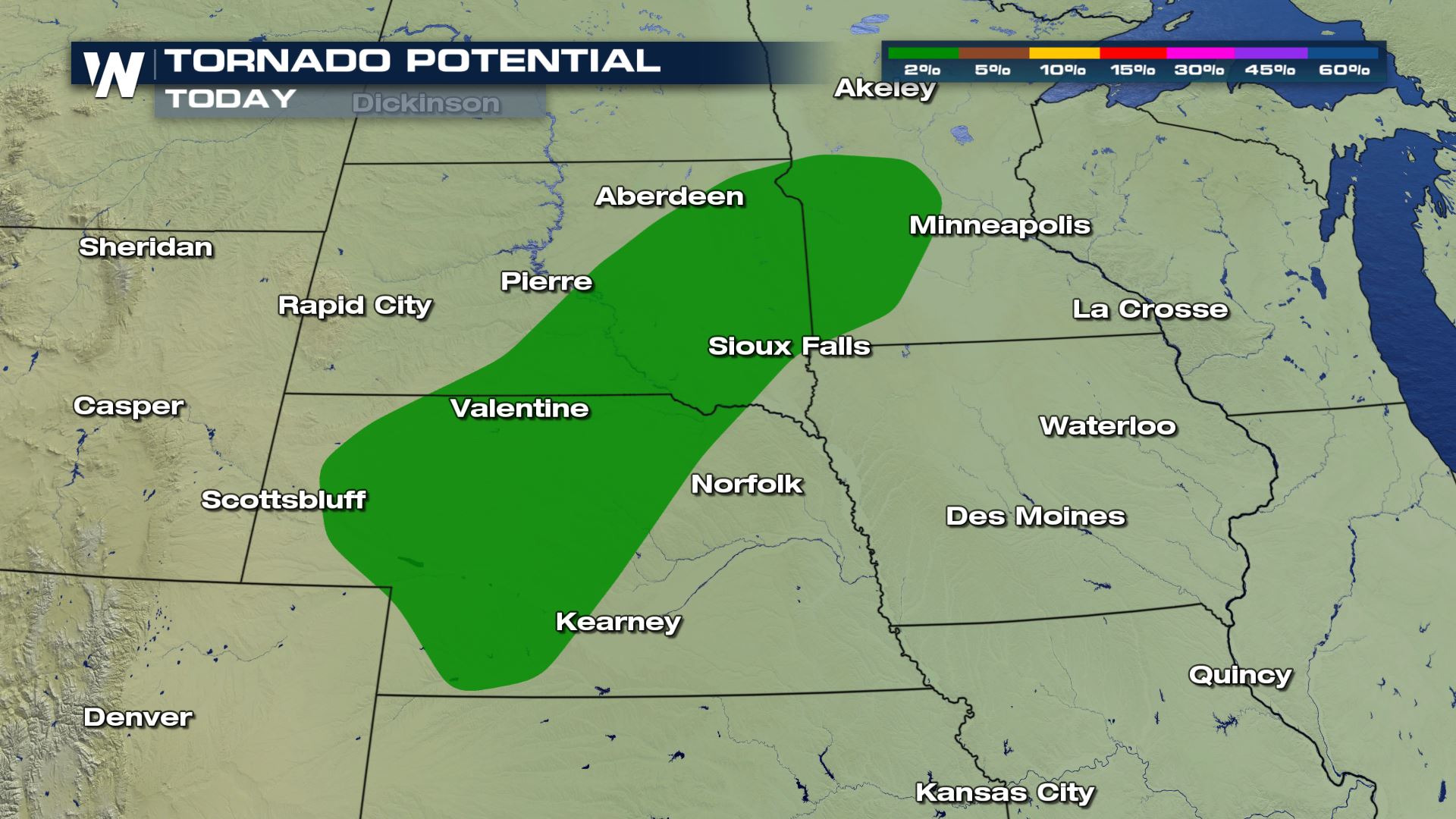
The Storm Prediction Center has also issued risk areas this weekend for severe storms. On Saturday, there is an enhanced risk (level 3 on a scale of 1 to 5) in South Dakota and Nebraska. Strong wind gusts are the biggest concern but there's also a threat for large hail and isolated tornadoes.
On Sunday, the risk for severe storms returns to the Upper Midwest. Areas from the Canadian Border and Lake Superior to Siouxland in Nebraska and Iowa may see severe weather.
For more details on our late week severe threat, tune into WeatherNation.All Weather News
More
Southeast Flood Risk Lingers Near Stalled Front
A stalled boundary over the Carolinas will ke
24 Jul 2026 12:35 PM

Severe Chances Return for the Midwest
The upcoming stretch of hot temperatures will
24 Jul 2026 12:25 PM

Tropics: Fausto Heads to Hawaii, Bertha Breaks Apart
BerthaBertha has dissipated after moving inla
24 Jul 2026 11:50 AM

Hot & Smoky w/ a Chance of Lightning
Conditions have been really dry out west. We'
24 Jul 2026 11:15 AM

Very Hot Temperatures For the Western and Central United States
Are you over the summer heat yet? Well, more
24 Jul 2026 9:20 AM

Another Round of Storms Targets the Northeast
Tuesday brought severe weather again across p
23 Jul 2026 1:15 AM

Another Round of Severe Weather for the Upper Midwest and Great Lakes
The upper-level low train continues to keep t
21 Jul 2026 1:45 AM