Northwest U.S. Gets Leftovers of California's Systems

While California gets slammed by nearly non-stop precipitation Sunday to Wednesday, the Northwest & Northern Rockies will get the leftovers of each of these weather systems and waves of energy. As a result, winter weather alerts have been issued for the potential impact to life and property through Monday morning, President's Day.
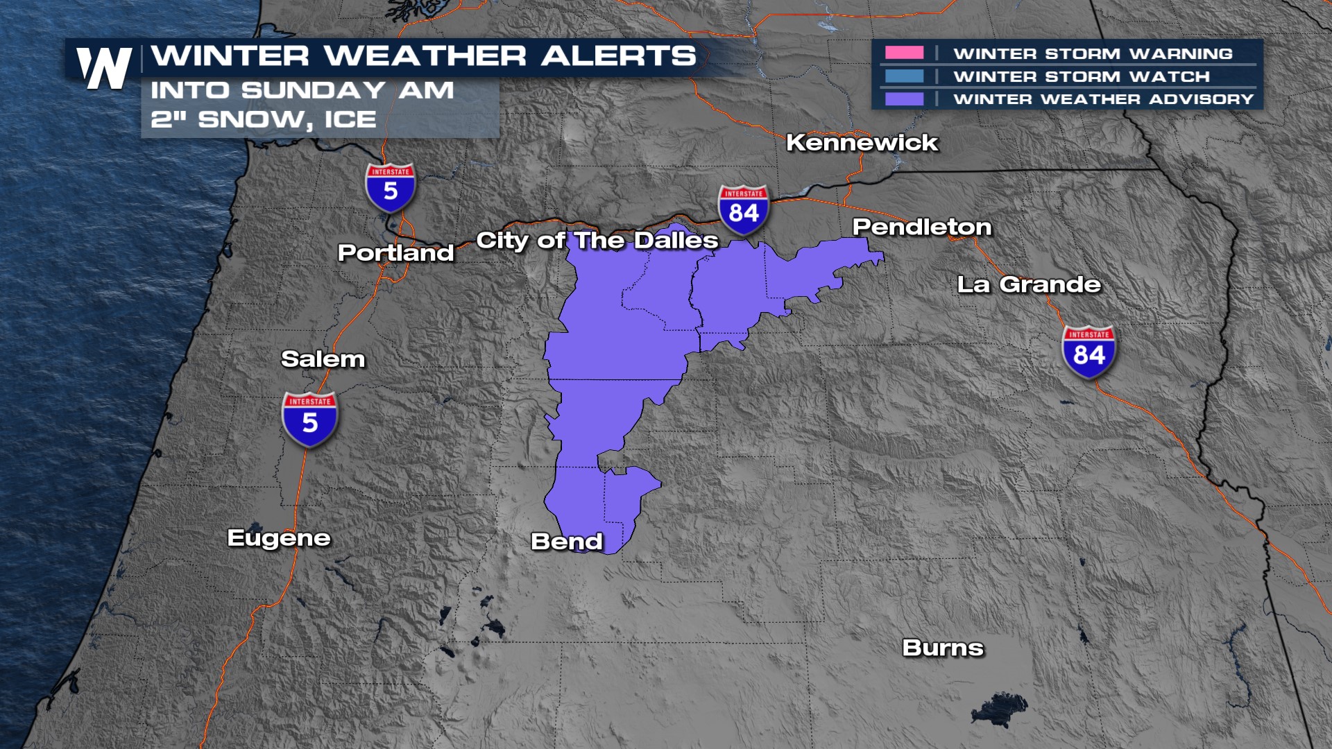 A winter weather advisory continues for parts of Oregon, to the south of Interstate 84 and the City of The Dalles and southward to Bend through Sunday morning for the potential of a wintry mix of 2" of snow and light ice accretion. Use caution traveling I-84 between Portland and Pendleton in Oregon through Sunday morning!
Rounds of rain and snow will continue across the greater Idaho region on Sunday morning, while the Pacific Northwest gets on-and-off showers through the day on Sunday. Another wave, leftover from California, will push through on President's Day Monday and will result in wind, rain, and mountain snow through Monday afternoon. There will be some sunny breaks in between, so the rest of our holiday weekend won't be ruined by a washout.
Total snow accumulation above 5,000 feet elevation will range from 6 to 12 inches across Oregon, Washington state, and Idaho. Some snow will reach Wyoming and Montana, but only the far western parts of each state.
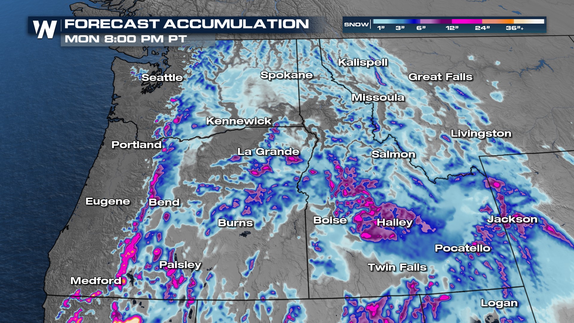 Travel on parts of Interstates 15, 84, and 90 could be tricky during the next couple of days. Lower elevations with larger cities will generally get a rain/snow mix, or just rain, with snow amounts less than a couple of inches.
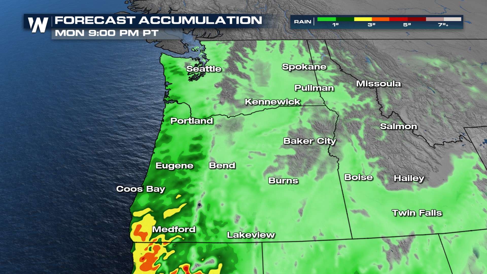 Rain could be locally heavier in southwestern Oregon, closer to the main source of these California weather systems. Here, two to three inches of rain is forecast around Medford and the coastline. Be prepared for slower travel speeds in the Northwest as these weather systems pass.


