Pacific Storm to Bring Ice and Heavy Snow from the Plains to Appalachians
Special Stories
7 Dec 2018 8:40 AM
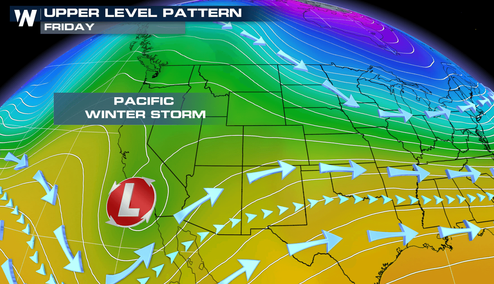
An area of low pressure, with origins from the Pacific Ocean, is currently bringing rain and snow to parts of the West. The storm will move into the southern Plains this weekend and the Appalachian Mountains into early next week. It will produce a round of ice and heavy snow.
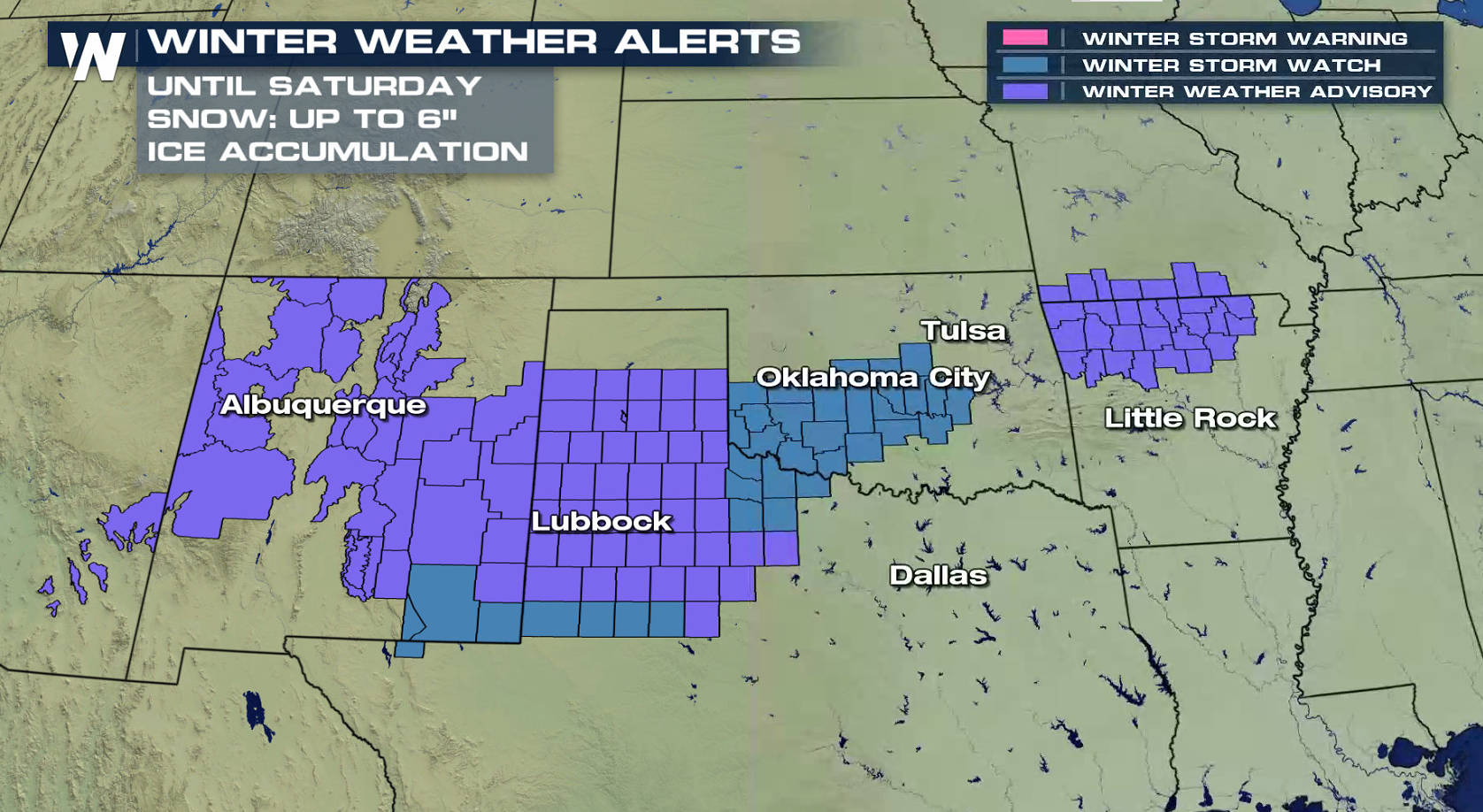
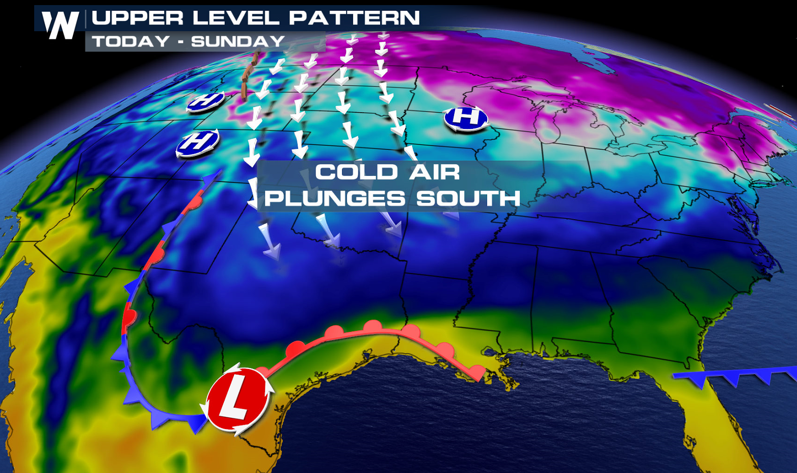 As the low dives south, it will pick up more moisture from the Pacific and eventually the Gulf of Mexico as it barrels farther east. Winter weather alerts have been issued from New Mexico to North Carolina for the potential of heavy snow and ice.
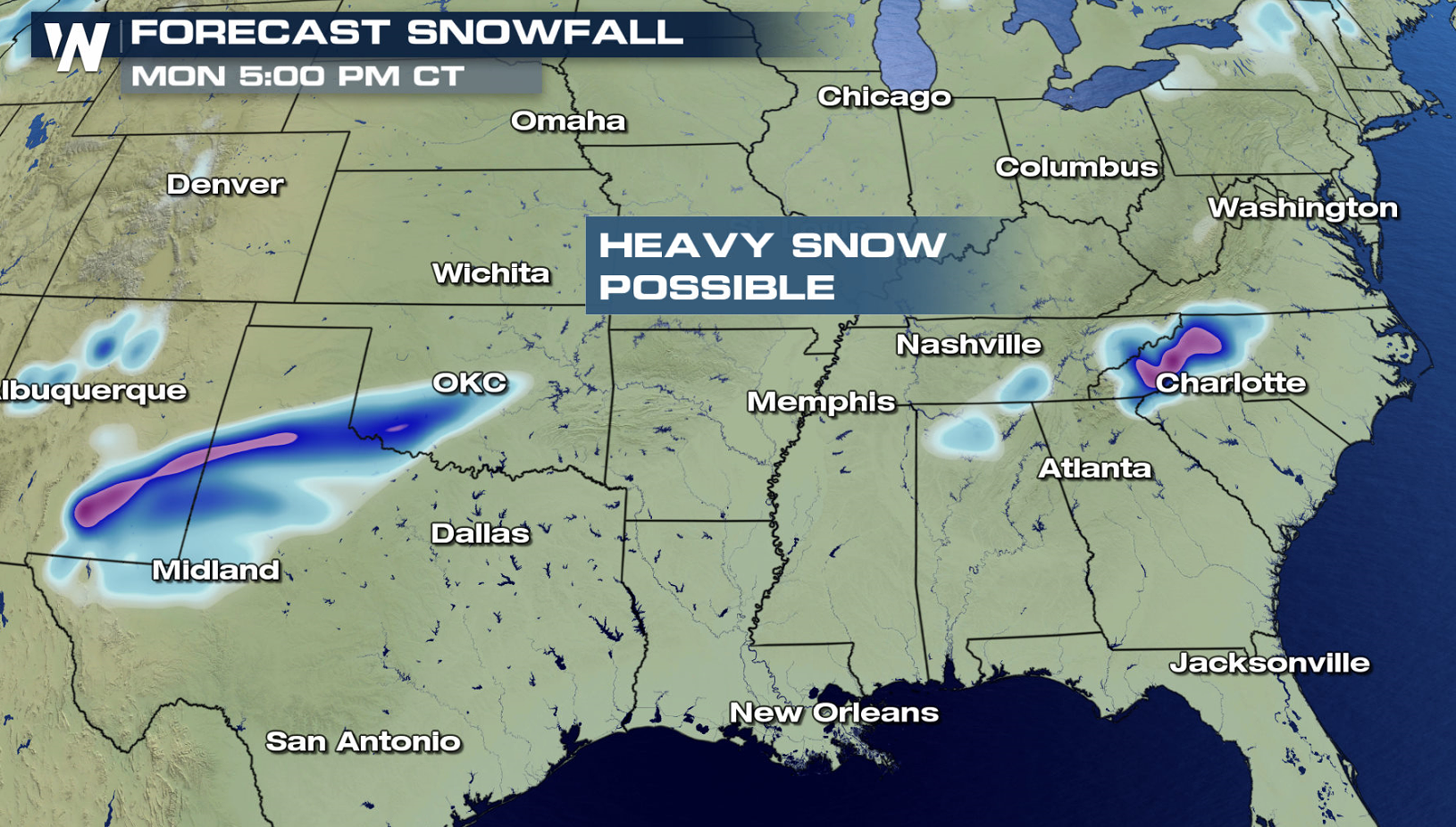
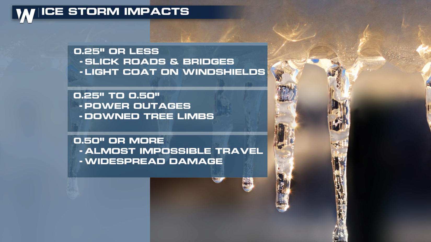
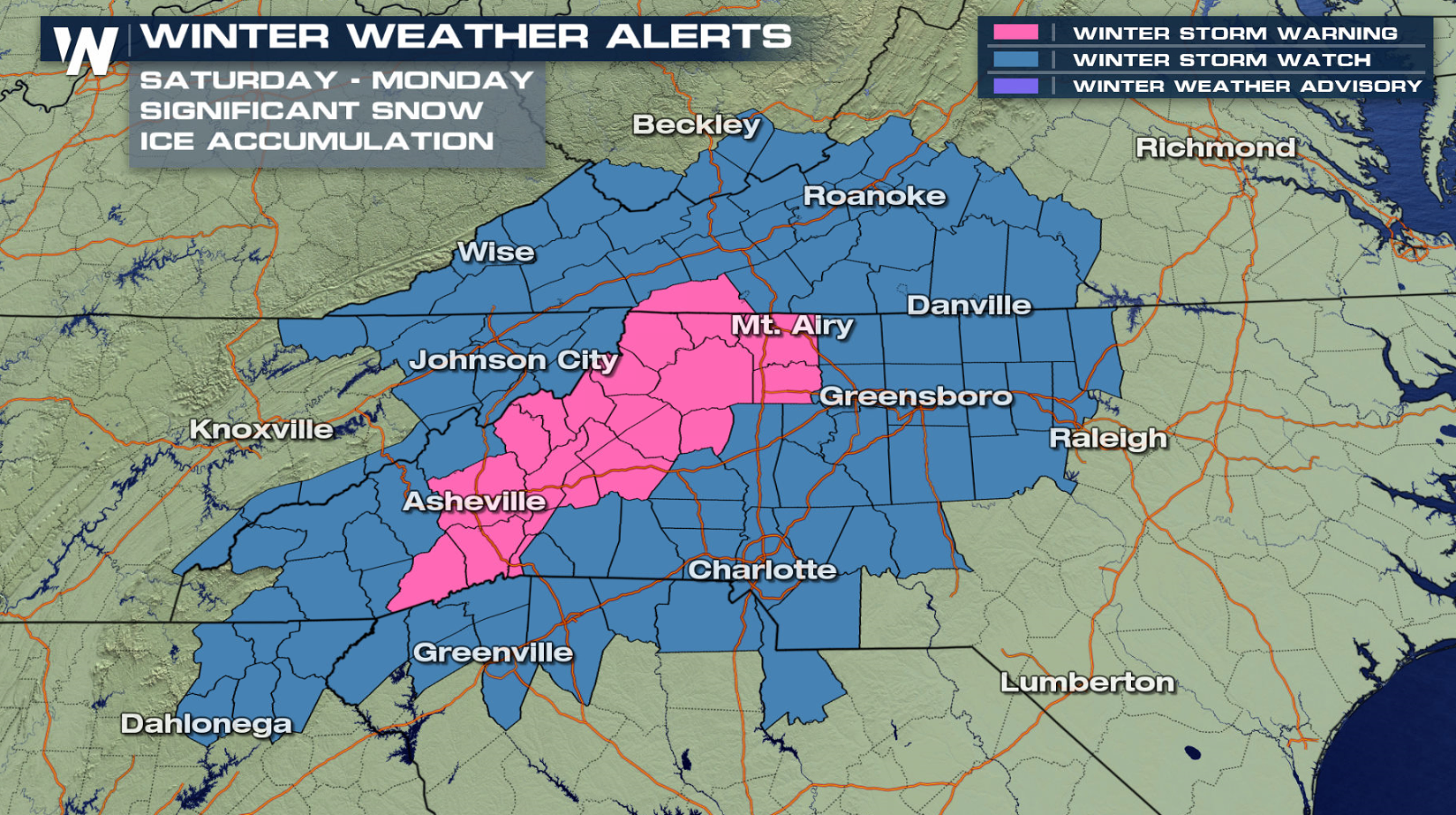 Travel conditions will become difficult, if not impossible at times. Snow accumulations may reach above a foot in some locations into early next week. Significant ice accumulations will also occur.
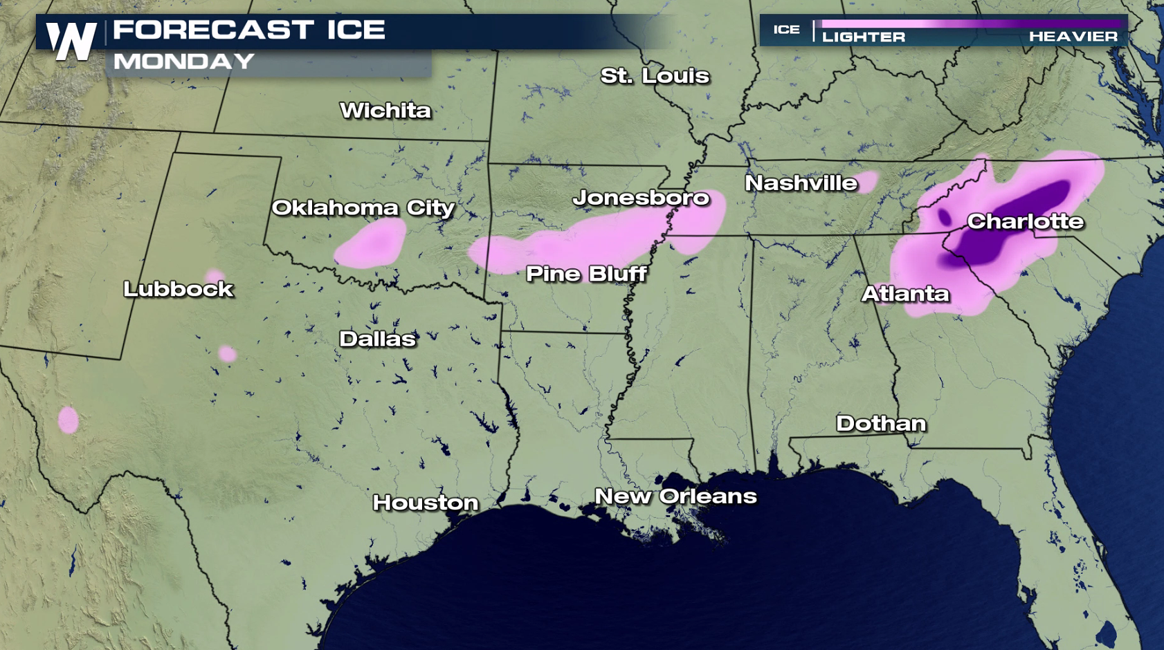
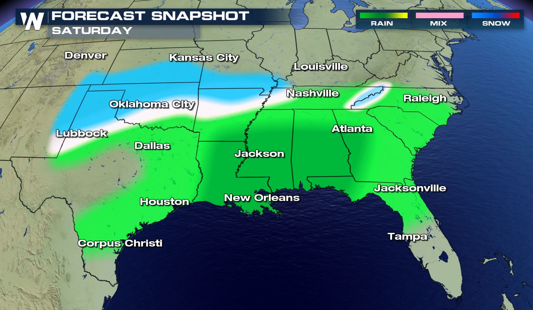
 The southerly track not only means encountering more moisture, but also some warm air from the south. If the forecast materializes, this could mean a period of significant ice accretion before a changeover to all snow for parts of Texas, Oklahoma, Kansas, Arkansas, and Missouri.
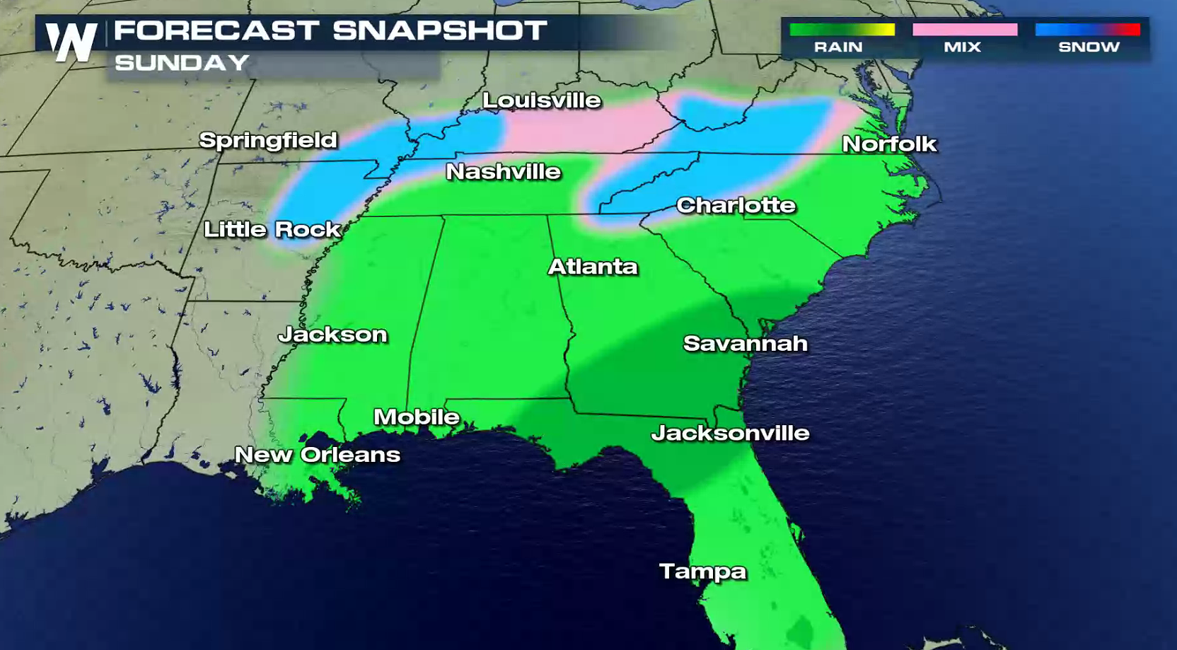
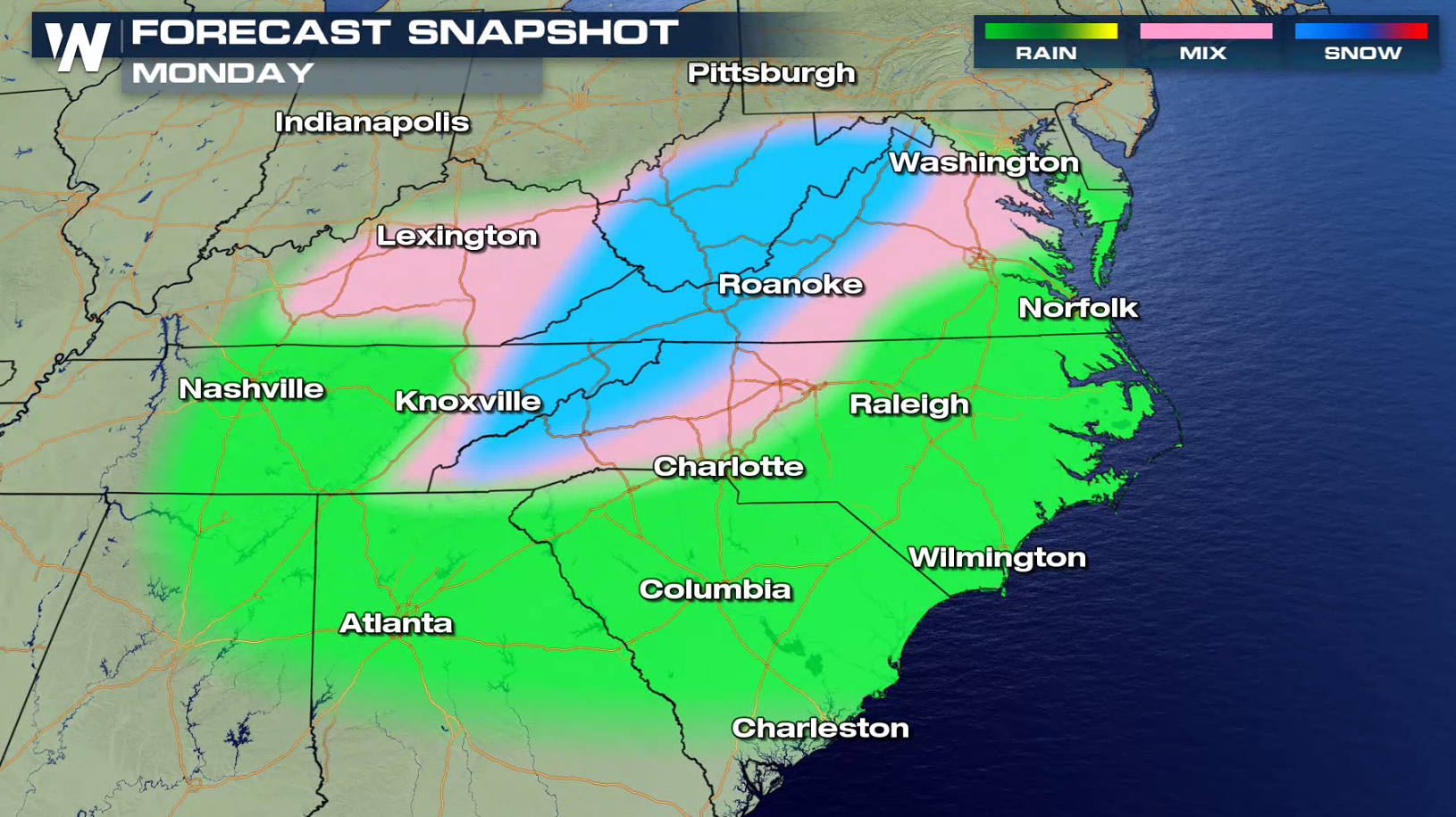
 The storm will move east Sunday into Monday. It will bring heavy rain to parts of the Gulf Coast and Southeast with the likelihood of snow and ice into the Appalachians and the Ozarks.
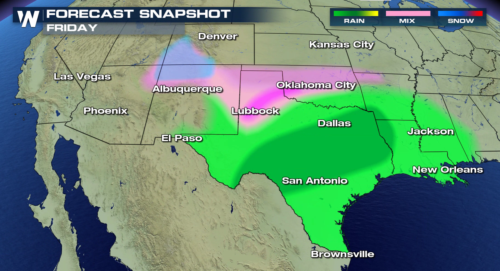
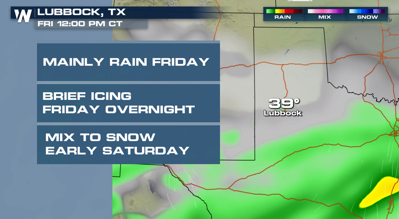
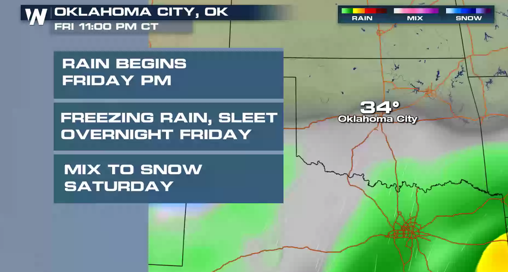
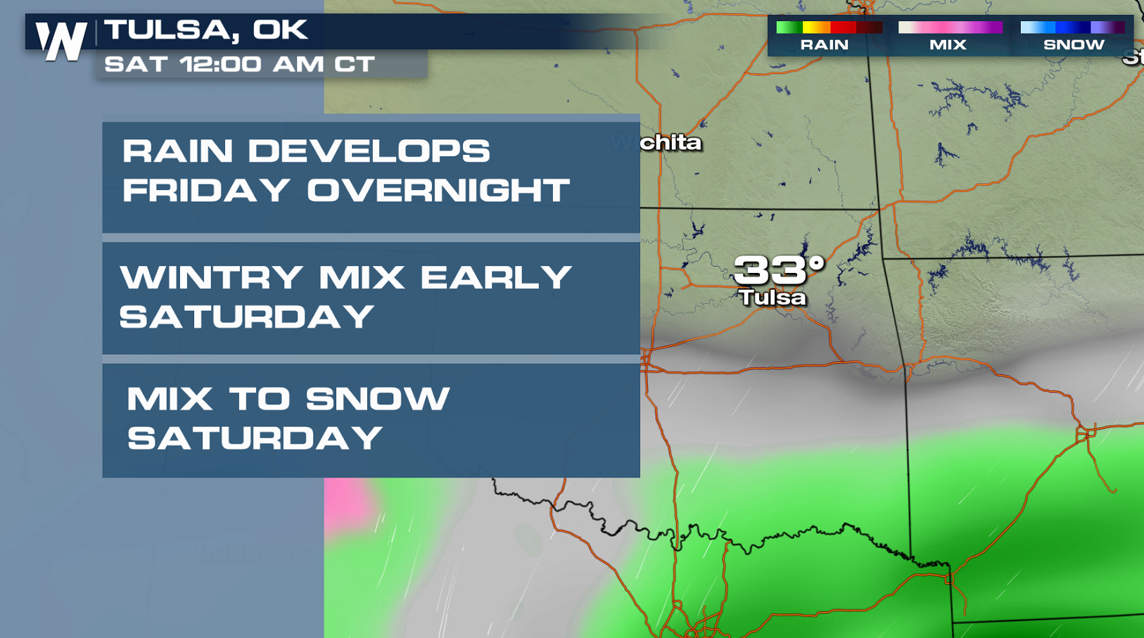
 In Texas and Oklahoma, warm air will be in place today (Friday) to keep the precipitation mainly rain. As the cold air arrives in the evening, frozen precipitation will begin, making for tricky travel.
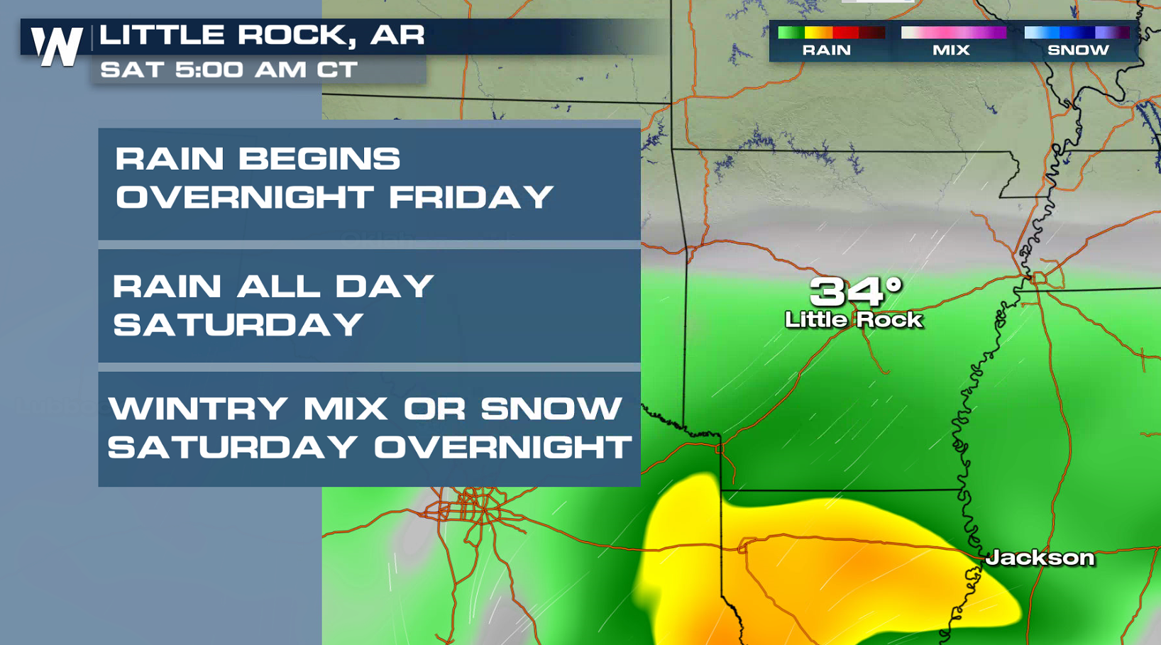
 Further east into Arkansas, the cold air will arrive Saturday. Wintry travels will arrive later in the day and continue for Sunday.
 Stay tuned to WeatherNation on-air and online for updates on the impending winter storm.
Meteorologist Merry Matthews
Stay tuned to WeatherNation on-air and online for updates on the impending winter storm.
Meteorologist Merry Matthews
As the low dives south, it will pick up more moisture from the Pacific and eventually the Gulf of Mexico as it barrels farther east. Winter weather alerts have been issued from New Mexico to North Carolina for the potential of heavy snow and ice.
Travel conditions will become difficult, if not impossible at times. Snow accumulations may reach above a foot in some locations into early next week. Significant ice accumulations will also occur.
The southerly track not only means encountering more moisture, but also some warm air from the south. If the forecast materializes, this could mean a period of significant ice accretion before a changeover to all snow for parts of Texas, Oklahoma, Kansas, Arkansas, and Missouri.
The storm will move east Sunday into Monday. It will bring heavy rain to parts of the Gulf Coast and Southeast with the likelihood of snow and ice into the Appalachians and the Ozarks.
In Texas and Oklahoma, warm air will be in place today (Friday) to keep the precipitation mainly rain. As the cold air arrives in the evening, frozen precipitation will begin, making for tricky travel.
Further east into Arkansas, the cold air will arrive Saturday. Wintry travels will arrive later in the day and continue for Sunday.
Stay tuned to WeatherNation on-air and online for updates on the impending winter storm.
Meteorologist Merry MatthewsAll Weather News
More
Wildfire Outbreak in the Pacific Northwest
SPOKANE, WA - On Saturday, August 1st, the Ol
3 Aug 2026 1:55 AM

More Storms for the East Through Monday
A low-pressure system that moved through the
3 Aug 2026 1:50 AM


After Reaching Category 5, Genevieve Weakens in the Pacific
PacificGenevieve formed last Friday south of
3 Aug 2026 12:30 AM

Flooding, Severe Storms Target the Midwest Again
After an active week of storms across the nor
1 Aug 2026 1:40 AM

Flooding Risk Increases as Heavy Rain Targets the Tri-State Area
Tuesday, heavy rainfall moved across the Nort
30 Jul 2026 12:25 AM

Severe Weather: Energy From the Midwest Now in the Southeast
UPPER MIDWEST - Through Monday, dangerous tor
29 Jul 2026 10:30 PM