Possible Alberta Clipper?

Special Stories
14 Nov 2019 12:13 PM
From time to time, you may have heard the terminology an 'Alberta Clipper'. But do you know or have you ever been curious as to what an Alberta Clipper exactly is? WeatherNation takes the time to explain the characteristics of what an Alberta Clipper is and who is likely impacted by it. Below are the typical traits of a fast moving storm or 'clipper'.
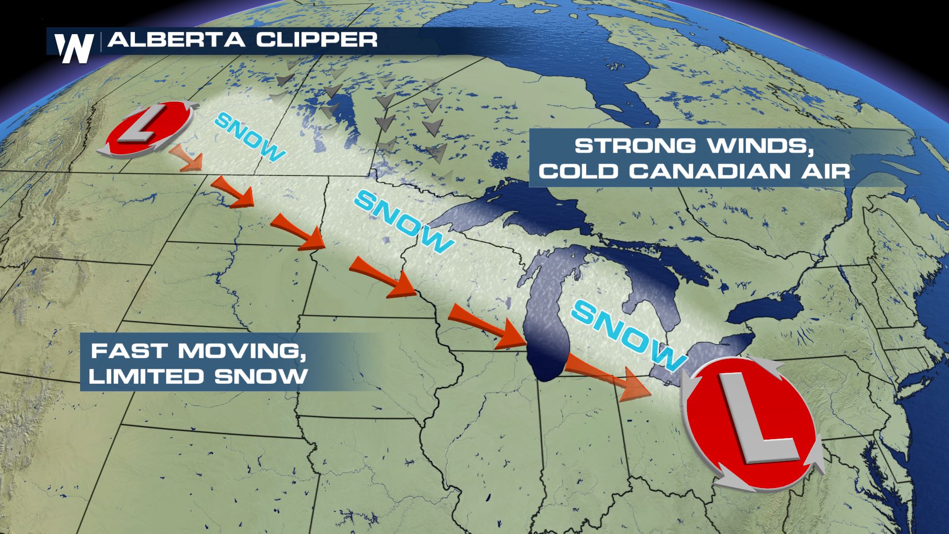
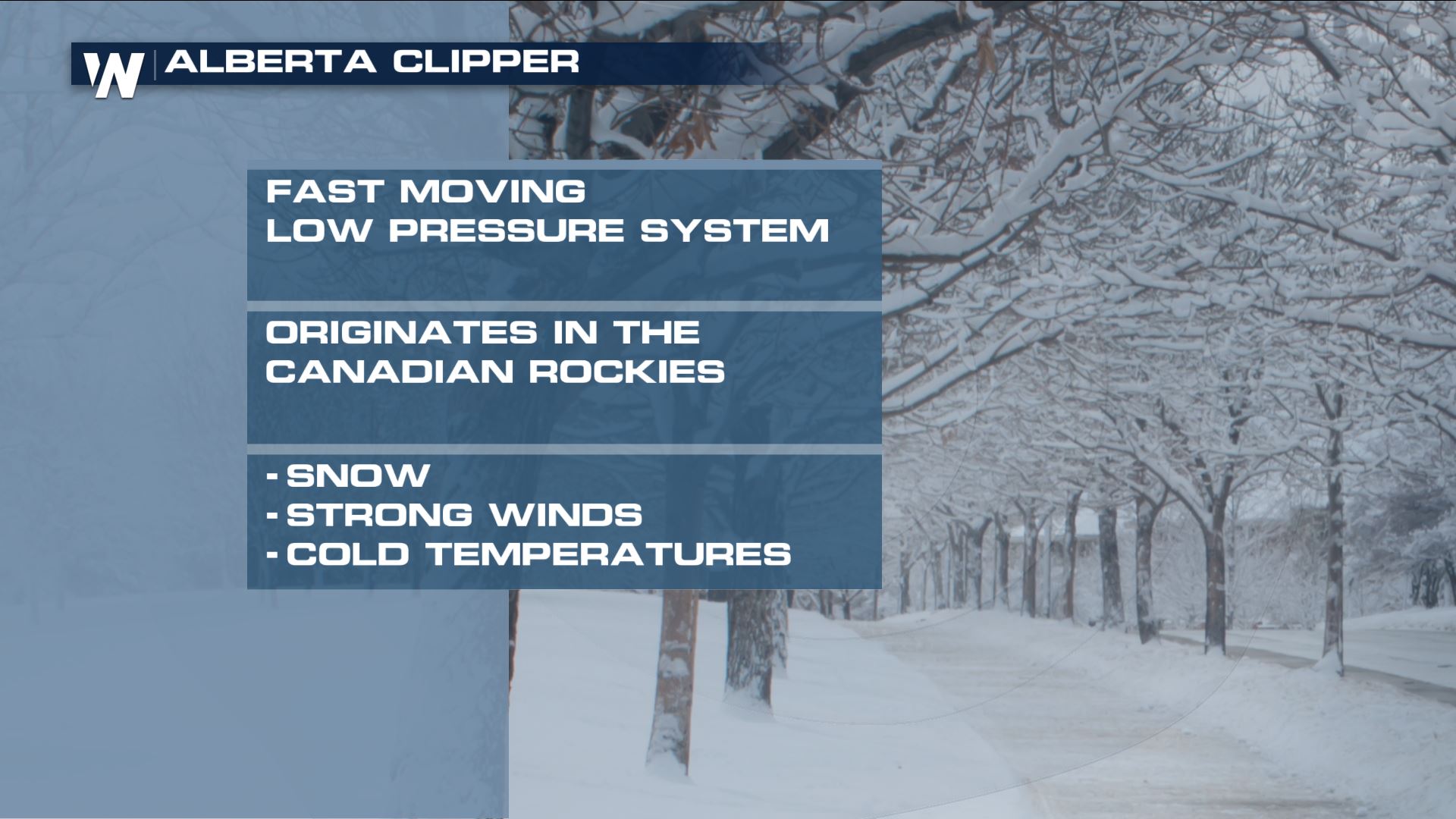 Clippers originate to the north throughout areas in Canada, and bring a fast push of wintry precipitation, windy conditions and much cooler air with it. Due to the speed of an Alberta Clipper, snow accumulations are generally on the light side, ranging from 1-3" / 3 - 6" of snow totals. If the storms were slower, snow totals would greatly increase, however the relative motion and speed of a storm vastly changes the amount of snow from a particular storm, thus a main reason why Alberta Clippers are generally low precipitation storms.
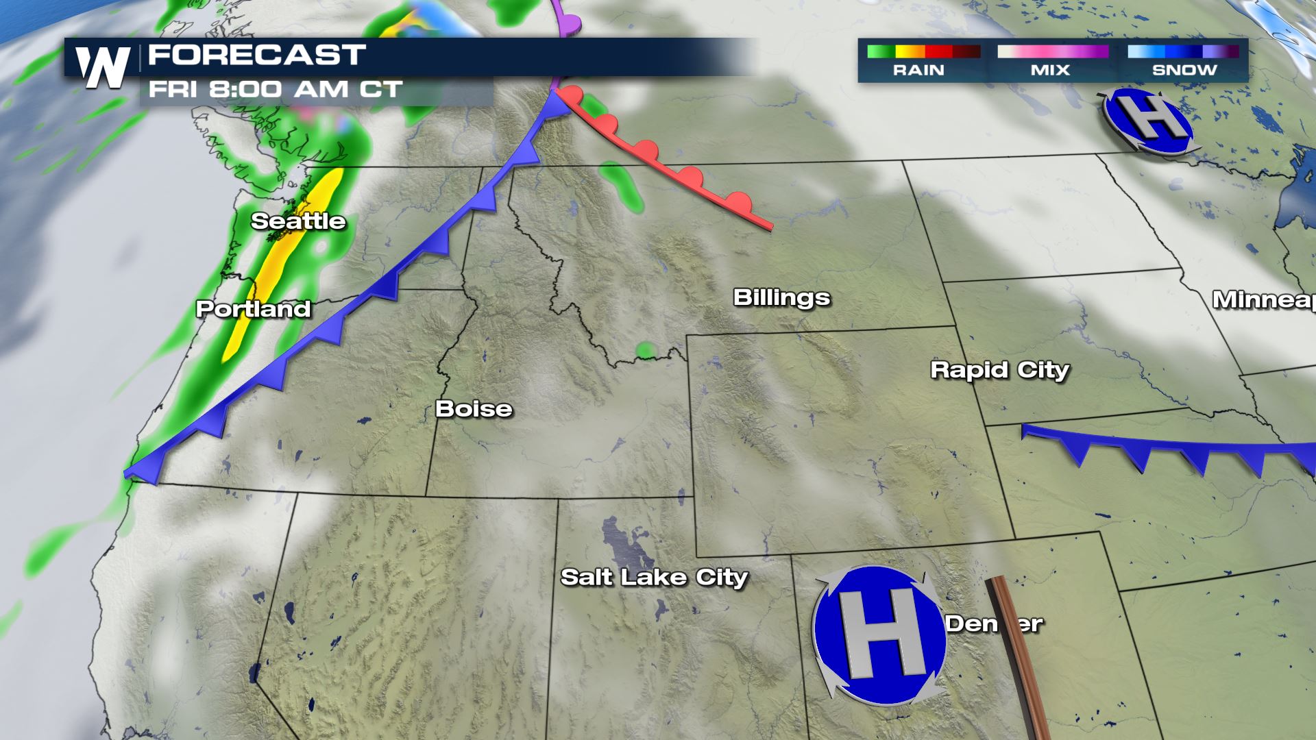
 Here is the forecast for our next clipper that will impact areas from the Pacific Northwest, the High Plains and through the Upper Mid-West.
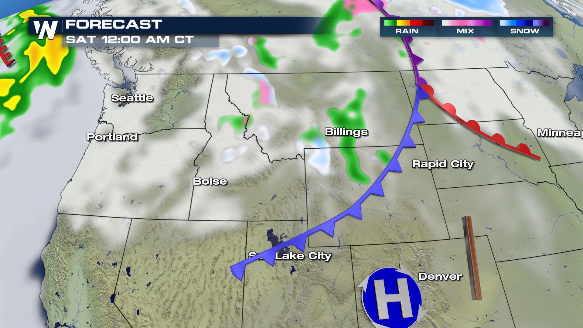
 Note how fast the clipper transitions from the Northwest to the High Plains within a 24 hour period. Snow totals will likely remain on the lighter side as the system races towards the east.
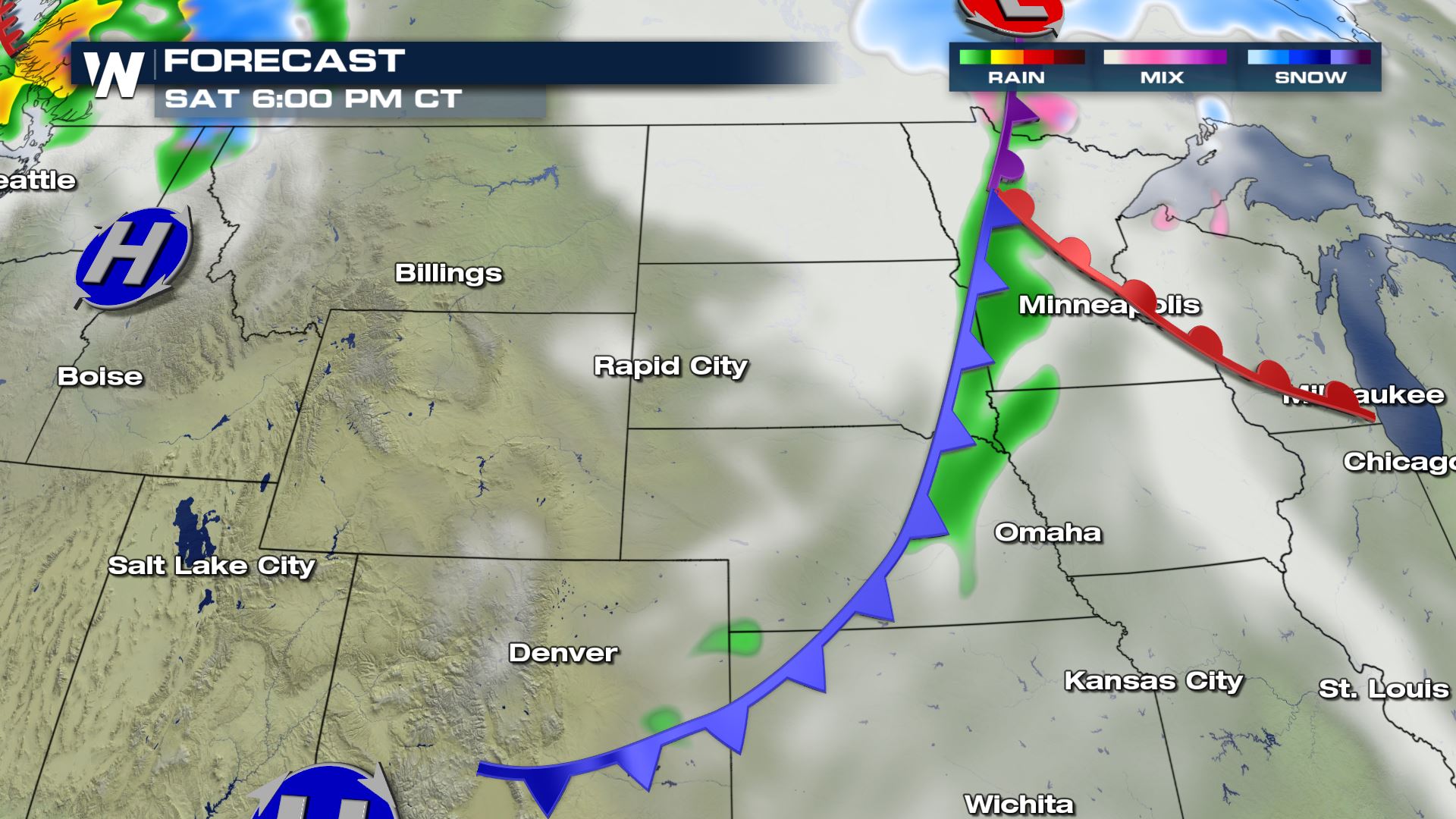
 By 6 PM Saturday, the storm is already impacting areas in the Upper Mid-West as light rain and snow is expected.
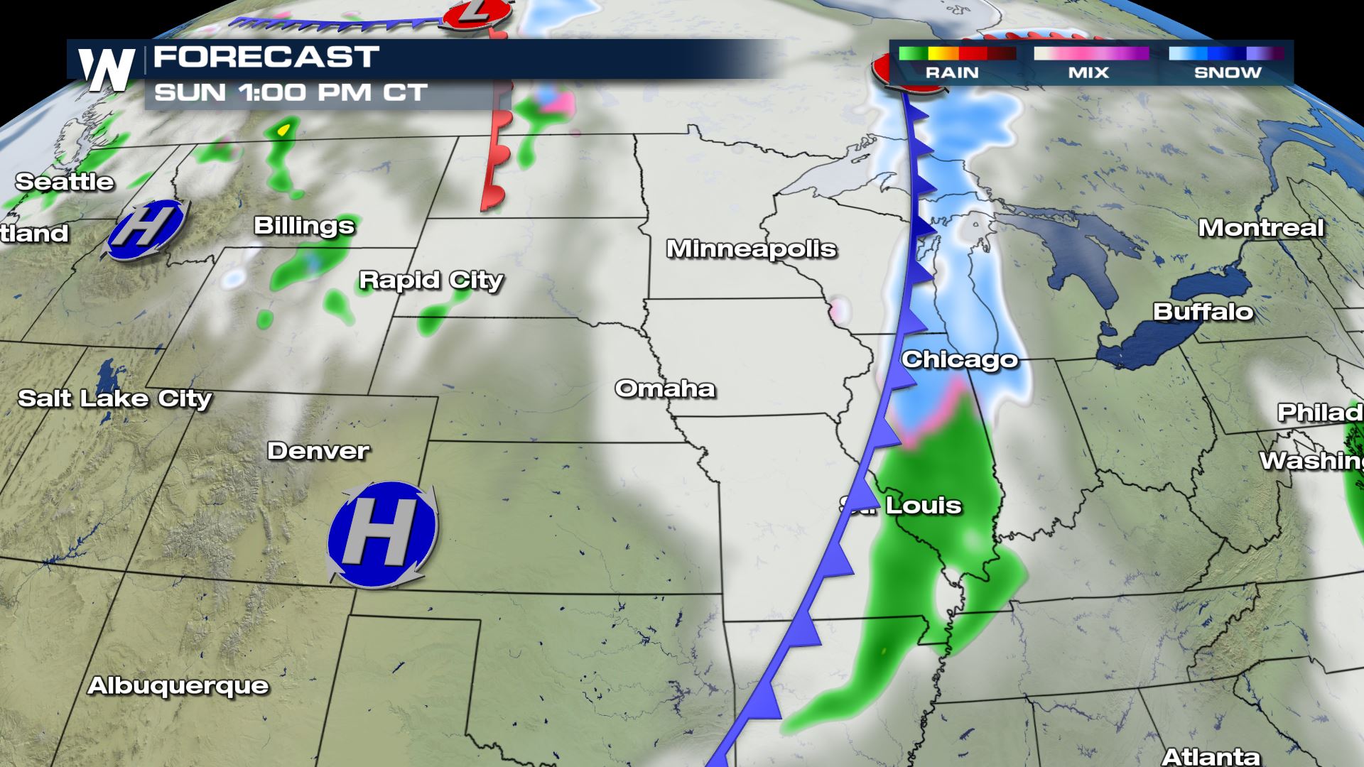
 By 1 PM Sunday afternoon, precipitation will become more widespread, but snow totals will likely not exceed a few inches.
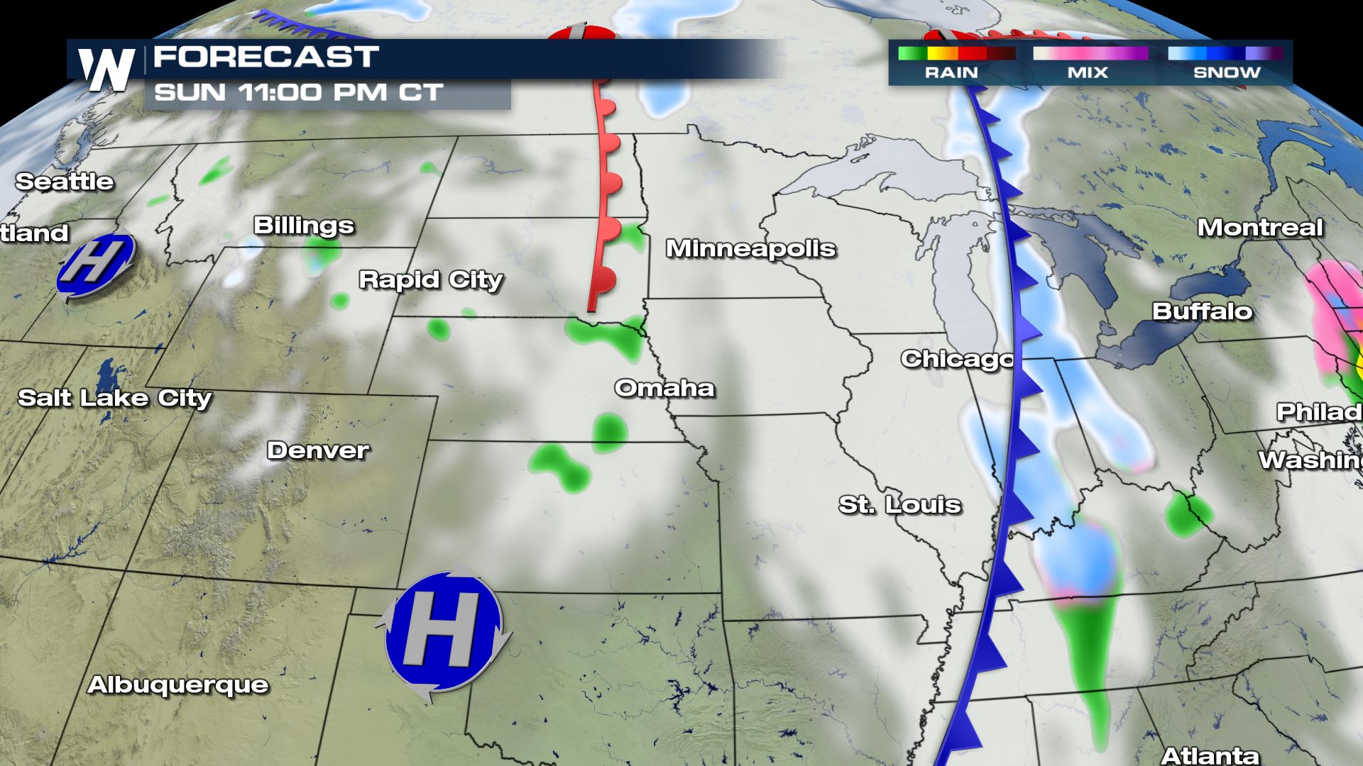
 By Sunday night and into early Monday morning, the clipper will have moved through the area, with only a few light snow showers anticipated into early next week.
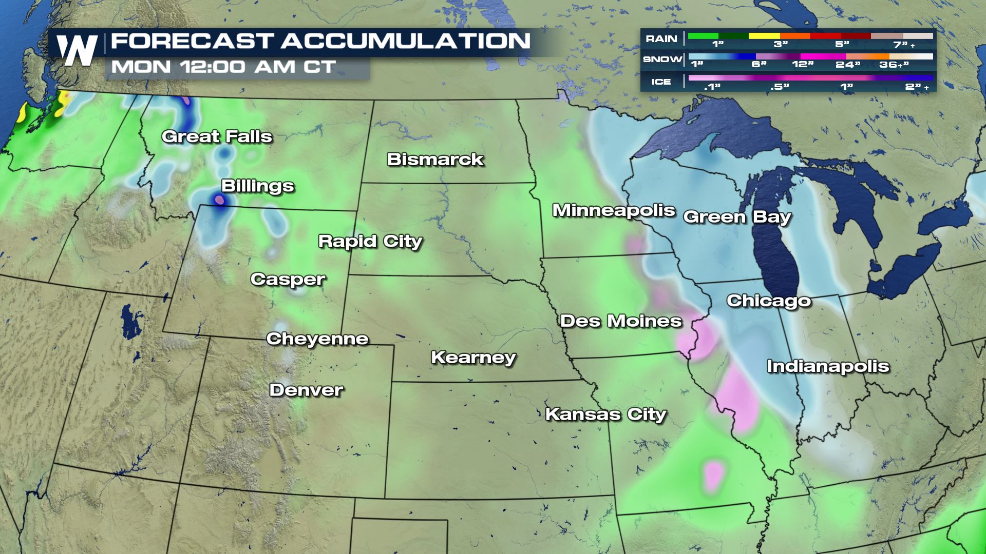
 Here are the anticipated snow and rain totals from Friday through early next week. As described earlier, accumulations will be on the minor side, with only a few inches expected with the fast moving storm system.
Clippers originate to the north throughout areas in Canada, and bring a fast push of wintry precipitation, windy conditions and much cooler air with it. Due to the speed of an Alberta Clipper, snow accumulations are generally on the light side, ranging from 1-3" / 3 - 6" of snow totals. If the storms were slower, snow totals would greatly increase, however the relative motion and speed of a storm vastly changes the amount of snow from a particular storm, thus a main reason why Alberta Clippers are generally low precipitation storms.
Here is the forecast for our next clipper that will impact areas from the Pacific Northwest, the High Plains and through the Upper Mid-West.
Note how fast the clipper transitions from the Northwest to the High Plains within a 24 hour period. Snow totals will likely remain on the lighter side as the system races towards the east.
By 6 PM Saturday, the storm is already impacting areas in the Upper Mid-West as light rain and snow is expected.
By 1 PM Sunday afternoon, precipitation will become more widespread, but snow totals will likely not exceed a few inches.
By Sunday night and into early Monday morning, the clipper will have moved through the area, with only a few light snow showers anticipated into early next week.
Here are the anticipated snow and rain totals from Friday through early next week. As described earlier, accumulations will be on the minor side, with only a few inches expected with the fast moving storm system.
All Weather News
More

Severe Storms, Flash Flooding Overnight In Midwest
WHAT TO EXPECTIt was a very active day across
22 Jun 2026 1:50 AM


Summer Solstice Kicks Off Father's Day Sunday
Fathers across the country will have to share
21 Jun 2026 5:20 PM

Flood Risk Continues This Weekend for the Gulf Coast States
Numerous flash flood warnings were issued as
21 Jun 2026 1:15 PM

Dry T-Storms & Fire Danger in the West
A weak low-pressure system moving through the
20 Jun 2026 1:40 PM

Tornadoes Tear Through The Midwest, Isolated Severe Storms in the South
EARLIER THIS WEEKMONTROSE, IL - A dangerous t
20 Jun 2026 1:30 AM