Record Highs in the 80's Warm the Southeast

Special Stories
7 Feb 2019 3:45 PM
A week after the polar vortex brought all-time record cold to portions of the central U.S., temperatures once again reached reached record levels. This time, it was record warmth.
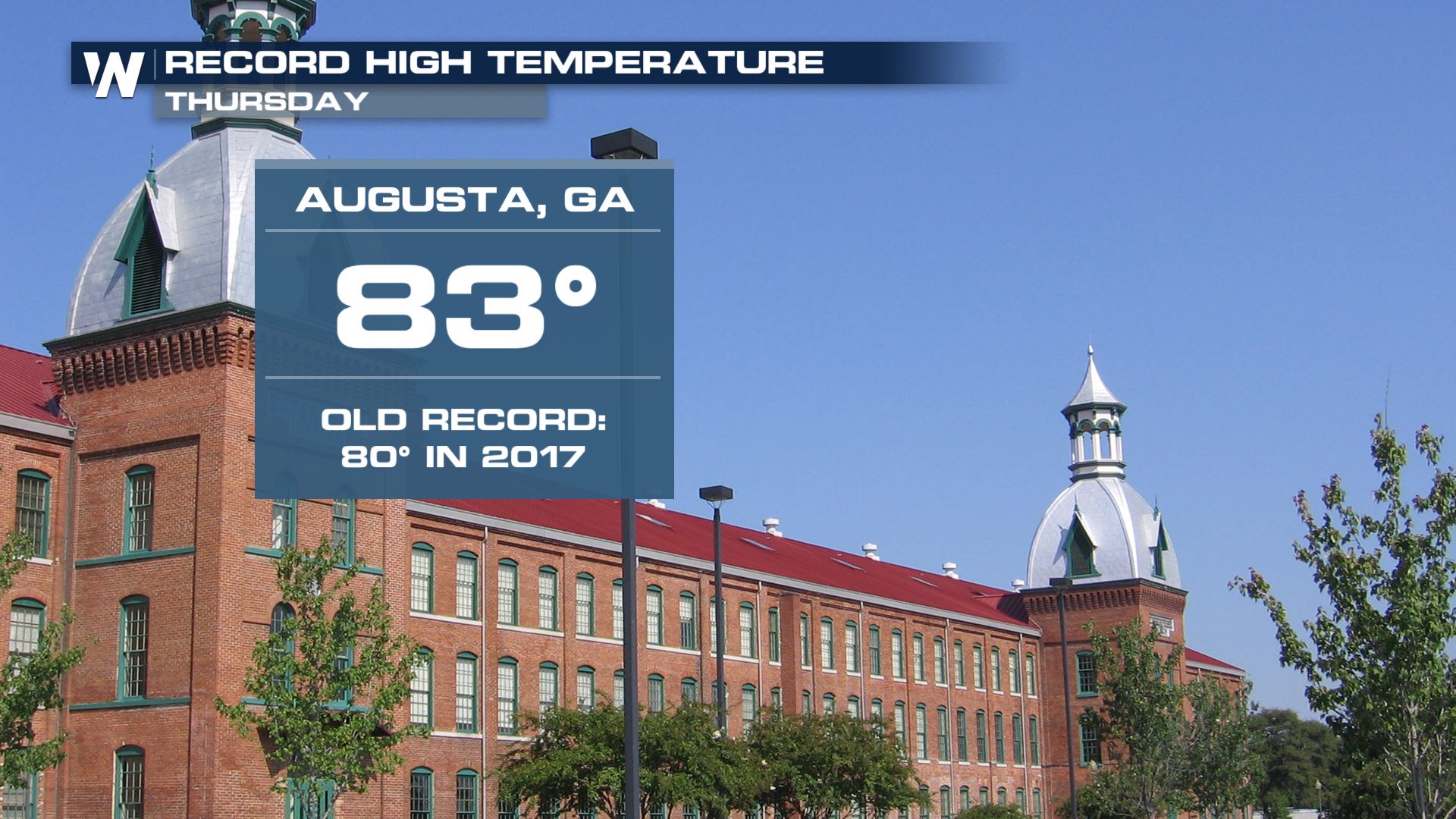
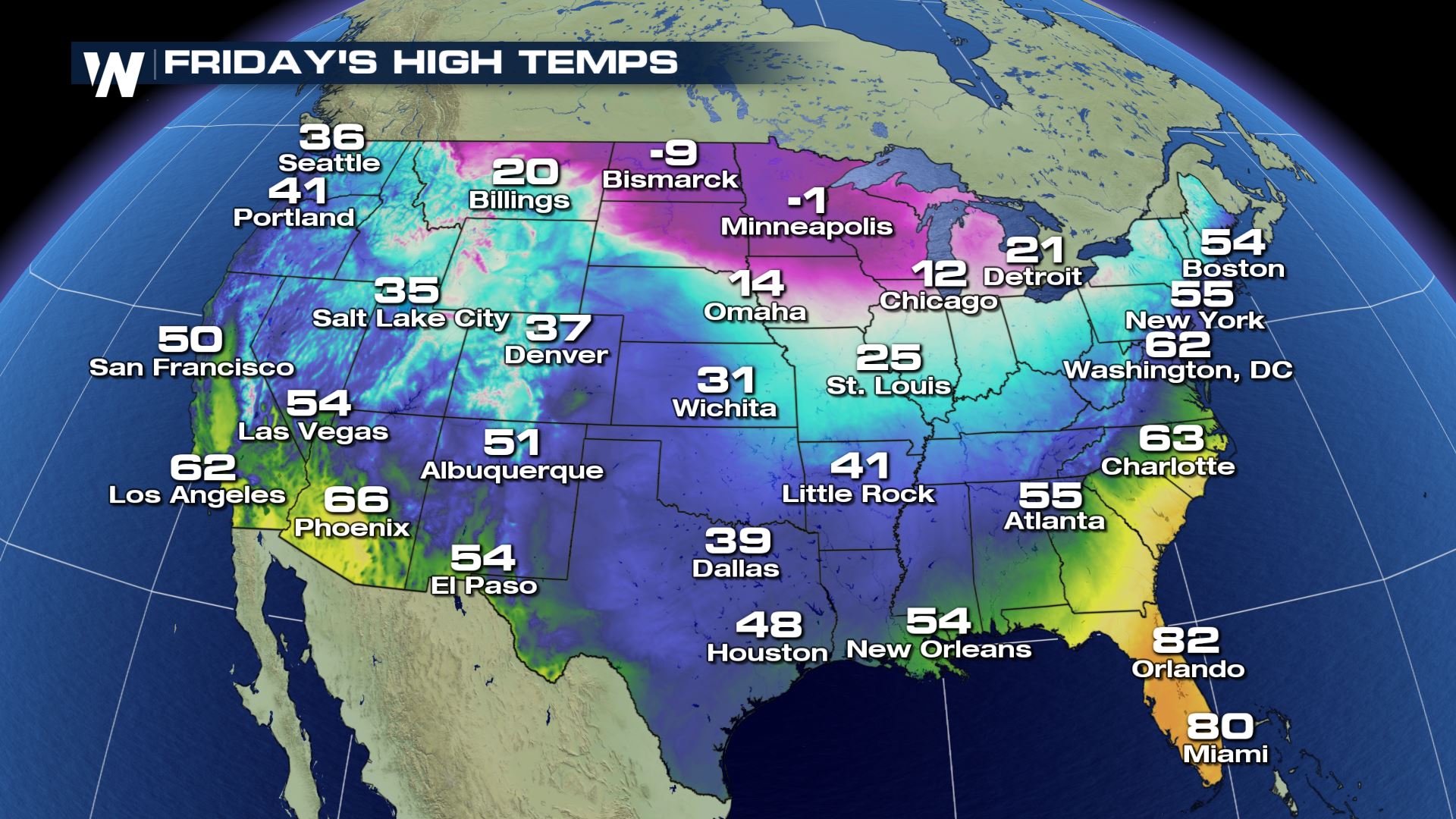
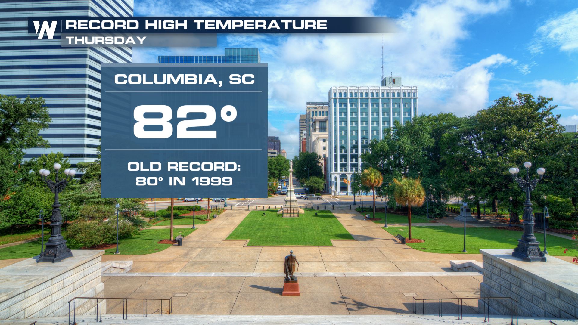 August and Columbia were merely a couple of cities that reached record-warm temperatures on Thursday. Other noteworthy record daily highs for February 7 were Lumberton, NC and Florence, SC reaching to 83 degrees each, meanwhile Dubois, PA getting up to 57 degrees and qualifying for a daily record high!
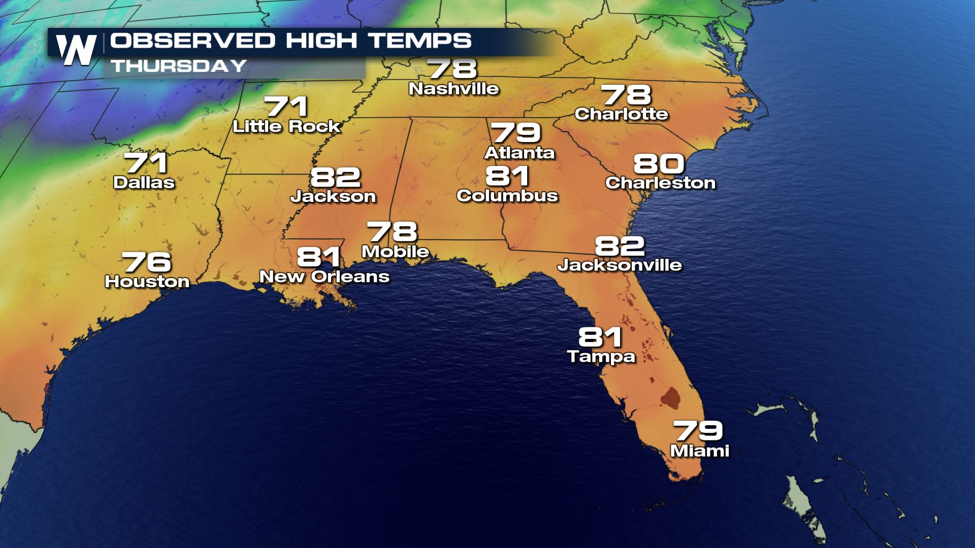 What's the deal? A strong area of high pressure parked over the southwestern Atlantic Ocean has helped to turn the surface, mid-level and upper-level winds to flow from the southwest. This is a warm wind direction. Meanwhile, a surface cold front slicing through the Mississippi River Valley helped to strengthen those warm winds.
If you're a fan of the 70's and 80's in early February, say goodbye.
What's the deal? A strong area of high pressure parked over the southwestern Atlantic Ocean has helped to turn the surface, mid-level and upper-level winds to flow from the southwest. This is a warm wind direction. Meanwhile, a surface cold front slicing through the Mississippi River Valley helped to strengthen those warm winds.
If you're a fan of the 70's and 80's in early February, say goodbye.
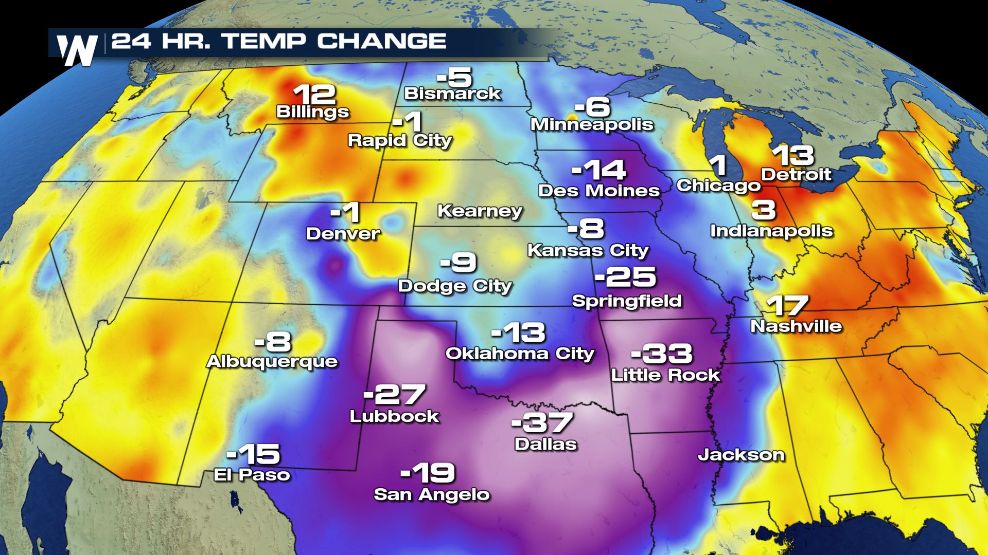 The 24-hour temperature change as of Thursday afternoon showed temperatures plunging 20-40 degrees below where they were just yesterday! That dense, heavy, cold air will make it all the way to the Southeast.
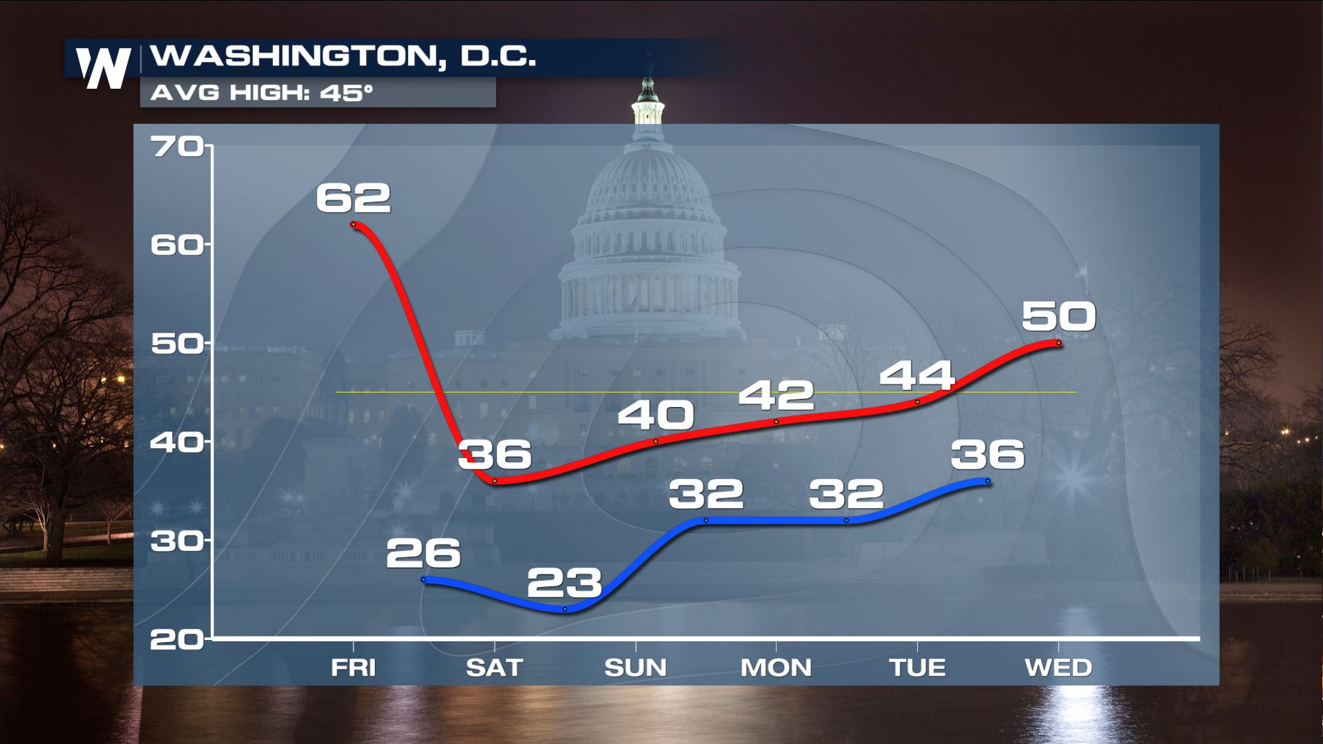 One example of the sharp temperature difference will be felt in Washington, D.C!
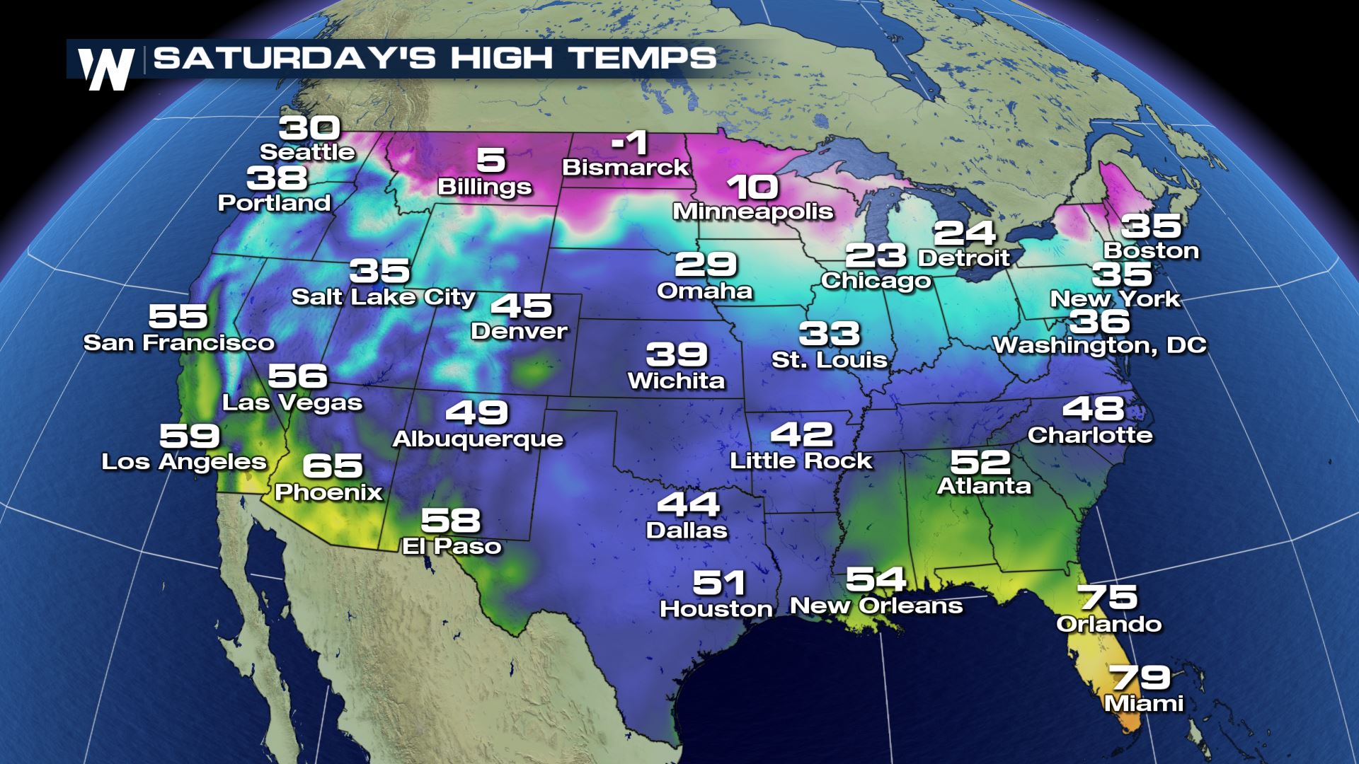
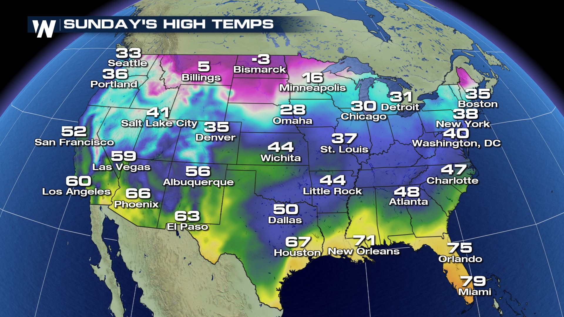 High temperatures will be back to 'normal' Friday and through the weekend. If you get out early enough on Friday, you'll enjoy some of the warmth before it's replaced by colder air. Meanwhile in the north-central United States dangerously cold air will return with feels like temperatures in the 20's and 30's below zero!
For WeatherNation, Meteorologist Steve Glazier
High temperatures will be back to 'normal' Friday and through the weekend. If you get out early enough on Friday, you'll enjoy some of the warmth before it's replaced by colder air. Meanwhile in the north-central United States dangerously cold air will return with feels like temperatures in the 20's and 30's below zero!
For WeatherNation, Meteorologist Steve Glazier
August and Columbia were merely a couple of cities that reached record-warm temperatures on Thursday. Other noteworthy record daily highs for February 7 were Lumberton, NC and Florence, SC reaching to 83 degrees each, meanwhile Dubois, PA getting up to 57 degrees and qualifying for a daily record high!
What's the deal? A strong area of high pressure parked over the southwestern Atlantic Ocean has helped to turn the surface, mid-level and upper-level winds to flow from the southwest. This is a warm wind direction. Meanwhile, a surface cold front slicing through the Mississippi River Valley helped to strengthen those warm winds.
If you're a fan of the 70's and 80's in early February, say goodbye.
The 24-hour temperature change as of Thursday afternoon showed temperatures plunging 20-40 degrees below where they were just yesterday! That dense, heavy, cold air will make it all the way to the Southeast.
One example of the sharp temperature difference will be felt in Washington, D.C!
High temperatures will be back to 'normal' Friday and through the weekend. If you get out early enough on Friday, you'll enjoy some of the warmth before it's replaced by colder air. Meanwhile in the north-central United States dangerously cold air will return with feels like temperatures in the 20's and 30's below zero!
For WeatherNation, Meteorologist Steve GlazierAll Weather News
More
Wildfire Outbreak in the Pacific Northwest
SPOKANE, WA - On Saturday, August 1st, the Ol
3 Aug 2026 1:55 AM

More Storms for the East Through Monday
A low-pressure system that moved through the
3 Aug 2026 1:50 AM


After Reaching Category 5, Genevieve Weakens in the Pacific
PacificGenevieve formed last Friday south of
3 Aug 2026 12:30 AM

Flooding, Severe Storms Target the Midwest Again
After an active week of storms across the nor
1 Aug 2026 1:40 AM

Flooding Risk Increases as Heavy Rain Targets the Tri-State Area
Tuesday, heavy rainfall moved across the Nort
30 Jul 2026 12:25 AM

Severe Weather: Energy From the Midwest Now in the Southeast
UPPER MIDWEST - Through Monday, dangerous tor
29 Jul 2026 10:30 PM