Record Highs in Pacific Northwest Tuesday; More to Come
Top Stories
24 Apr 2018 2:50 PM
After a cool and wet start to the spring across the Pacific Northwest, the sun and warmth are back, and this time, in the form of record high temperatures and beautiful weather.
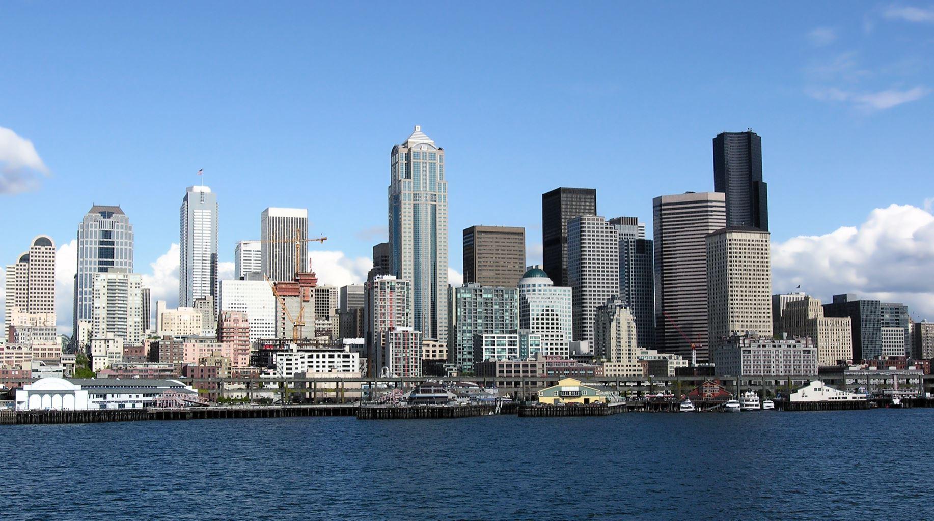
Quillayute and Hoquiam, Washington both broke record highs on Tuesday, with more records expected to be taken down once final numbers come in later on through the day. Both Quillayute and Hoquiam got up to at least 73° on Tuesday, breaking their daily records. Seattle and Portland were close to records as well as of Tuesday afternoon.
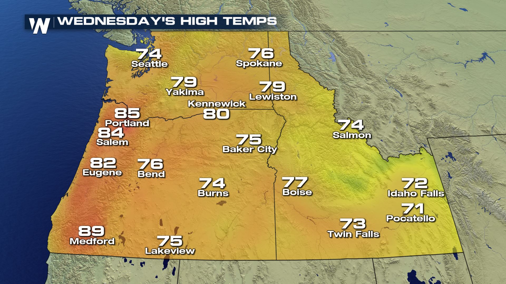
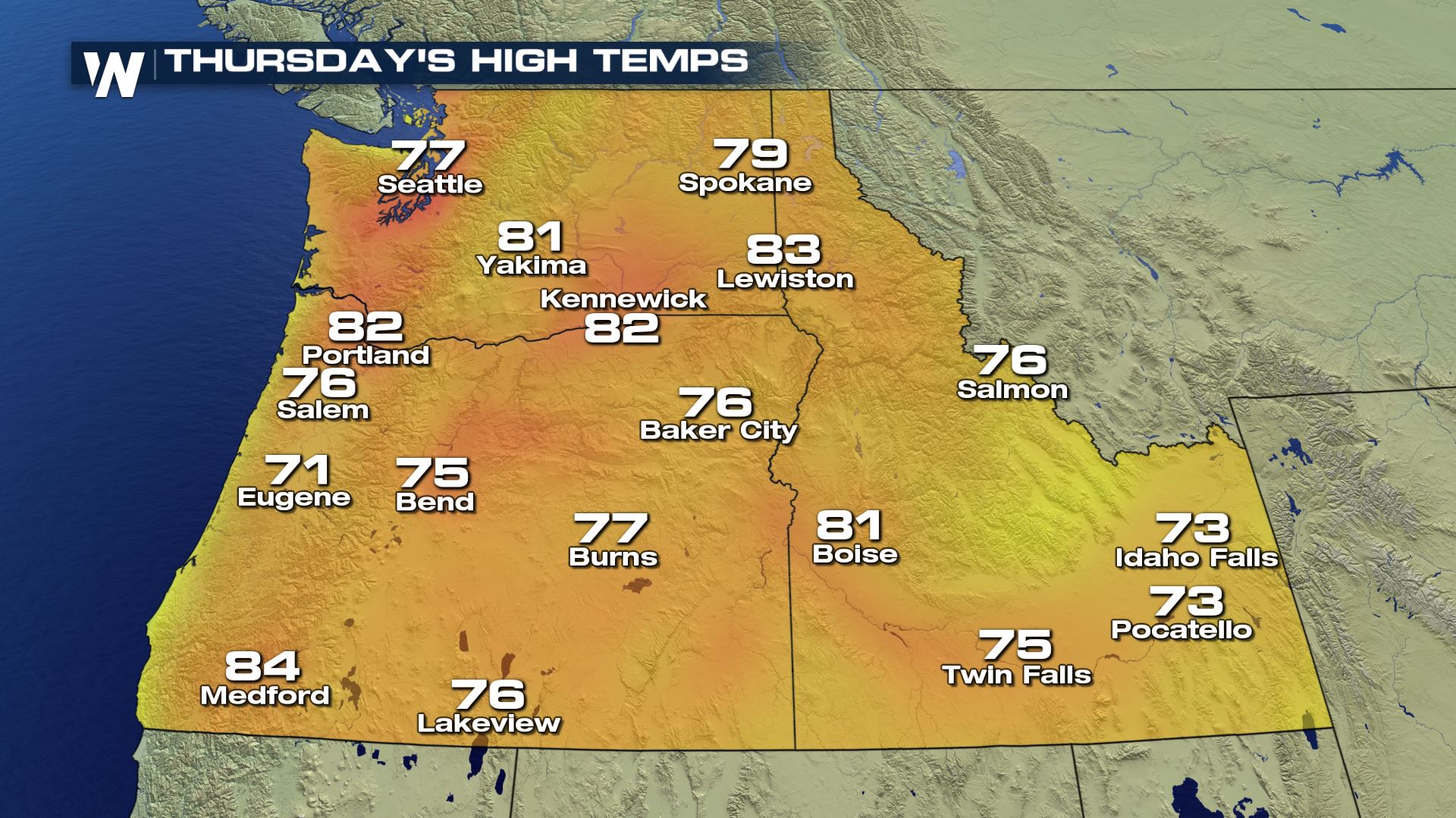
The hottest days, though, look to be on Wednesday and Thursday, with record highs expected all throughout the Northwest on Wednesday in particular.
 The warmth is being buoyed by a strong ridge of high pressure that's dominating the Northwest, allowing warm, offshore winds to warm up typically cooler locations like Seattle and Portland. It all comes after a chilly March and start to April, which featured above average precipitation and below average temperatures.
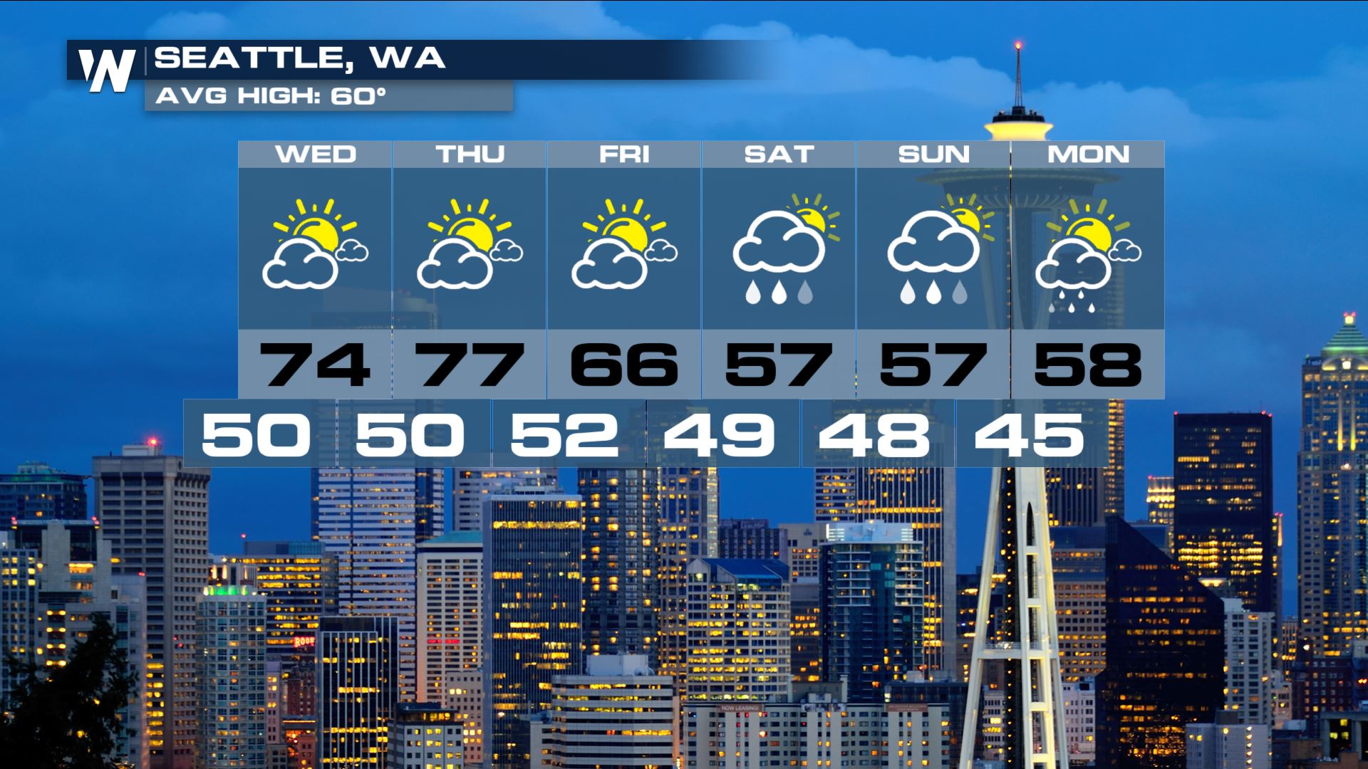
The fun won't last too long, though, so get outside and enjoy the nice weather before it all goes away. A area of low pressure will spin in from the south late on Thursday and into Friday, bringing showers and more seasonable temperatures.
The warmth is being buoyed by a strong ridge of high pressure that's dominating the Northwest, allowing warm, offshore winds to warm up typically cooler locations like Seattle and Portland. It all comes after a chilly March and start to April, which featured above average precipitation and below average temperatures.
The fun won't last too long, though, so get outside and enjoy the nice weather before it all goes away. A area of low pressure will spin in from the south late on Thursday and into Friday, bringing showers and more seasonable temperatures.
 Stay with WeatherNation for the latest on the early taste of summer for the Pacific Northwest.
For WeatherNation: Meteorologist Chris Bianchi
Stay with WeatherNation for the latest on the early taste of summer for the Pacific Northwest.
For WeatherNation: Meteorologist Chris Bianchi
The warmth is being buoyed by a strong ridge of high pressure that's dominating the Northwest, allowing warm, offshore winds to warm up typically cooler locations like Seattle and Portland. It all comes after a chilly March and start to April, which featured above average precipitation and below average temperatures.
The fun won't last too long, though, so get outside and enjoy the nice weather before it all goes away. A area of low pressure will spin in from the south late on Thursday and into Friday, bringing showers and more seasonable temperatures.
Stay with WeatherNation for the latest on the early taste of summer for the Pacific Northwest.
For WeatherNation: Meteorologist Chris BianchiAll Weather News
More
Severe Weather: Energy From the Midwest Now in the Southeast
UPPER MIDWEST - Through Monday, dangerous tor
29 Jul 2026 5:30 PM


Flooding Risk Increases as Heavy Rain Targets the Tri-State Area
Tuesday, heavy rainfall moved across the nort
29 Jul 2026 2:00 PM

Tropics: Fausto Heads towards Hawaii; Genevieve a Major Hurricane
PacificTropical Depression Fausto continues t
29 Jul 2026 10:15 AM


Southeast Flood Risk Lingers Near Stalled Front
A stalled boundary over the Southeast will ke
25 Jul 2026 10:55 AM

Another Round of Storms Targets the Northeast
Tuesday brought severe weather again across p
23 Jul 2026 1:15 AM