Saharan Dust Reaching the Southern U.S.

Conditions are quiet in the tropical Atlantic, in part thanks to plumes of Saharan Dust. Each year, the Saharan Air Layer (SAL) moves off the west coast of Africa following east-to-west trade winds, most common in June, July, and early August. While responsible for creating smoke-like haze across the mid and high levels of the atmosphere, the SAL is also helpful in suppressing tropical development. Dry air mixes into the middle and higher levels of the atmosphere, preventing or substantially reducing the ability for tropical storms and/or hurricanes to develop. The Hurricane Hunters were out flying into the dust to collect valuable data to help answer the question of "Why?"
Thicker plumes of dust can impact visibility and will continue to do so over the southern U.S. this week as multiple plumes of dust arrive from the tropical Atlantic into Texas, Louisiana, and Florida. Because dust is suspended so high in our atmosphere, impacts on air quality will be extremely limited. The biggest noticeable impact will be the haze, mostly at night! Sunrises and sunsets will have a slightly different look, with a slightly reddish hue.
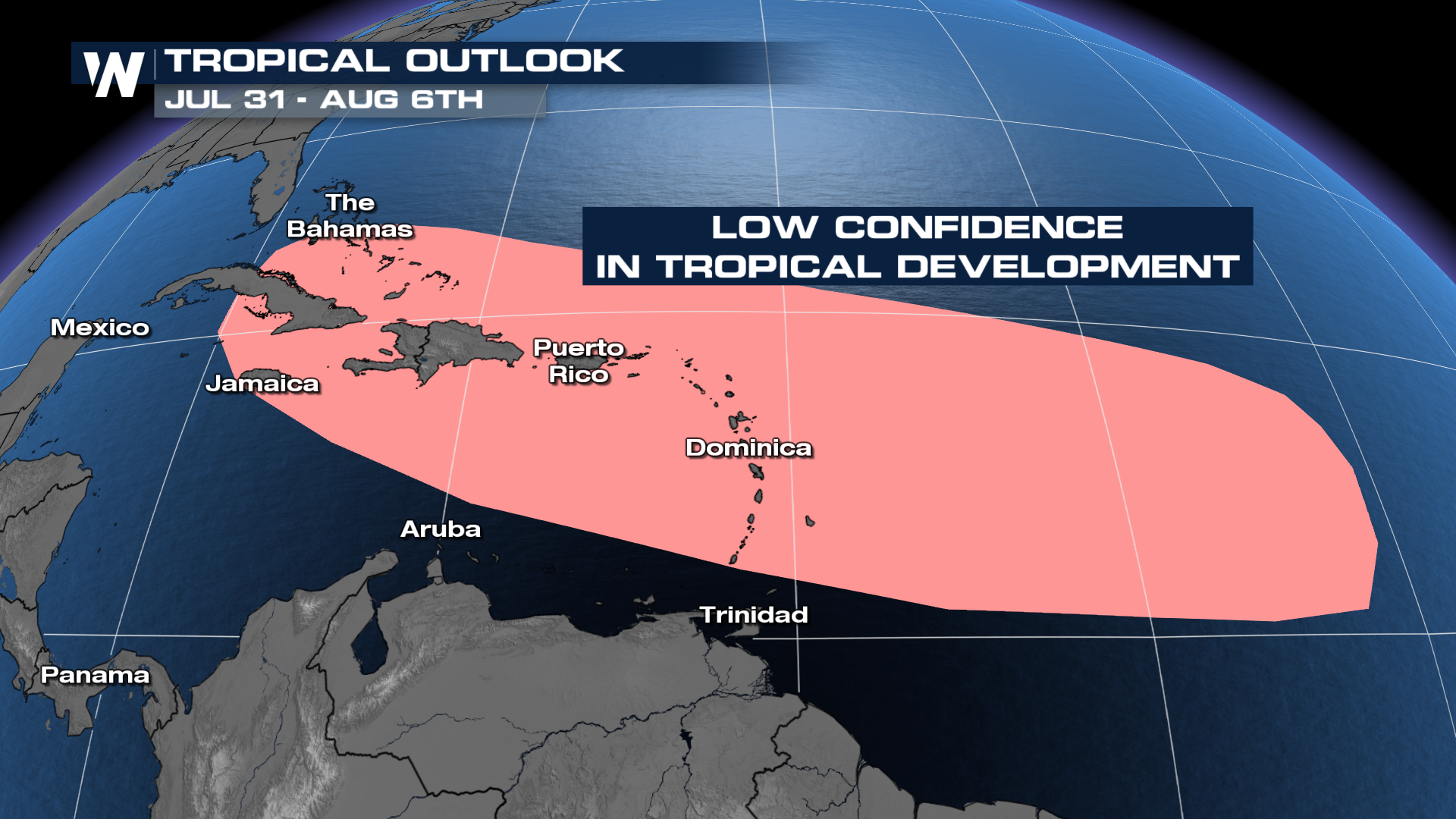
It is typical to have a quiet month during July with the most likely areas of formation and tropical development in the Gulf and along the East Coast. However, towards the end of July and early August, there are indications of potential tropical development in the Caribbean. This is still quite a way away, but keep your eye out for the potential of storm development in the next few weeks. However, there is a tropical wave in the Central Atlantic that has a low chance of development in the next few days and you can read about it here.
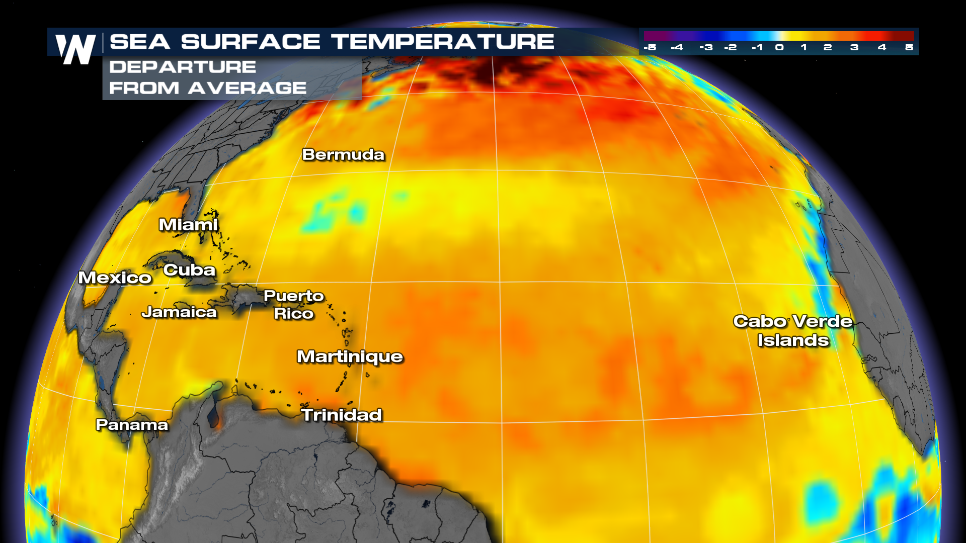
 Ocean temperatures contribute to the threat of an above-average tropical season with ocean heat content much above normal in the Atlantic in 2024. There are some cooler surface temperatures in the western Gulf following Hurricane Beryl, which caused "upwelling" and brought cooler ocean water to the surface. The most above-average conditions are off the coast of New England, roughly 5° above average. It only takes one storm to impact you and the time to prepare is before the storm hits!
The NOAA forecast is aligned with that of Colorado State University which also calls for a well above average season. The official list of names only has 21 total and the higher end of NOAA's forecast calls for up to 25 storms. If forecasts pan out, there is an alternate list to supplement. The last time additional names were needed was during the record-setting 2020 season when La Niña conditions were also present. Below is the list of hurricane names we will go through first before we head into the alternative names list.
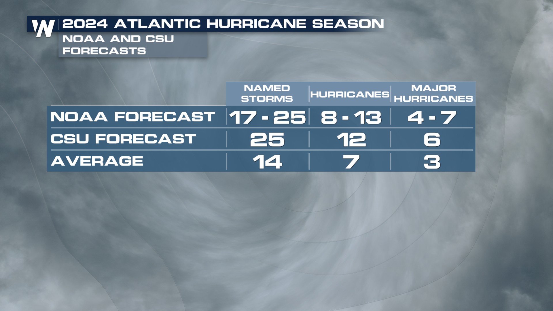 This year is expected to be above average thanks to warm sea surface temperatures and La Niña conditions returning just in time for the peak of Hurricane season. La Niña is categorized by cooler-than-average sea surface temperatures in the equatorial Pacific Ocean, typically resulting in less wind shear over the Atlantic and Caribbean oceans. Less wind shear means hurricanes can thrive, rather than be torn apart by strong upper-level winds. In the Eastern Pacific, a La Niña Pattern typically spells below-average activity, which is what NOAA is predicting in 2024.


