Severe Chances for the Northern and Central High Plains Tuesday
Top Stories
16 Jul 2019 8:20 AM
Strong mid-level winds out of the Southwest will lead to the chance for strong to severe storms today across the Plains. Hail and damaging winds are the main weather risk, but an isolated tornado can't be ruled out. Here is the very latest.
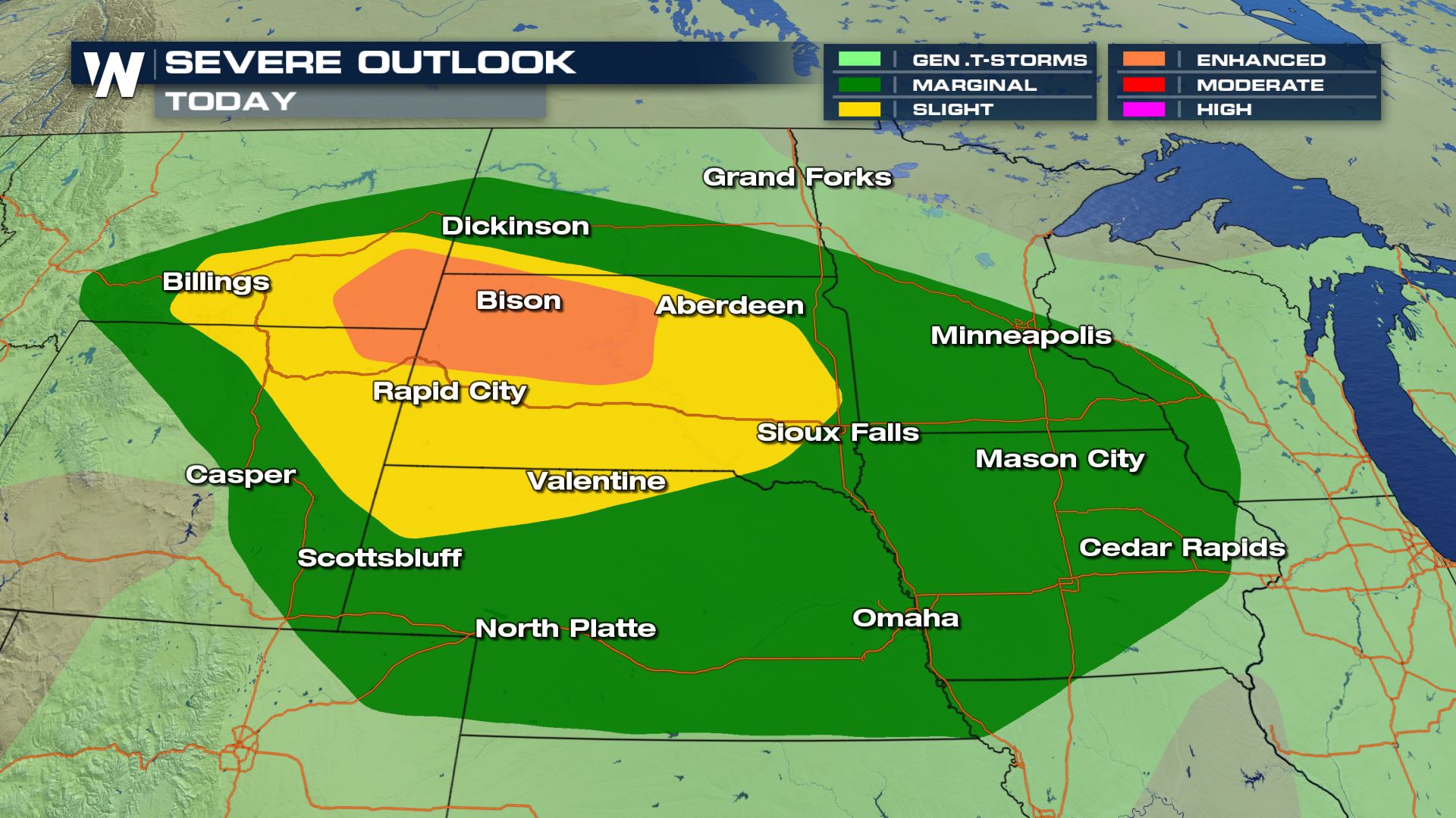 Anywhere from Montana to Iowa could see some severe storms today. This includes cities like Rapid City and Minneapolis. The highest chance for severe storms will be over South Dakota and Wyoming later today.
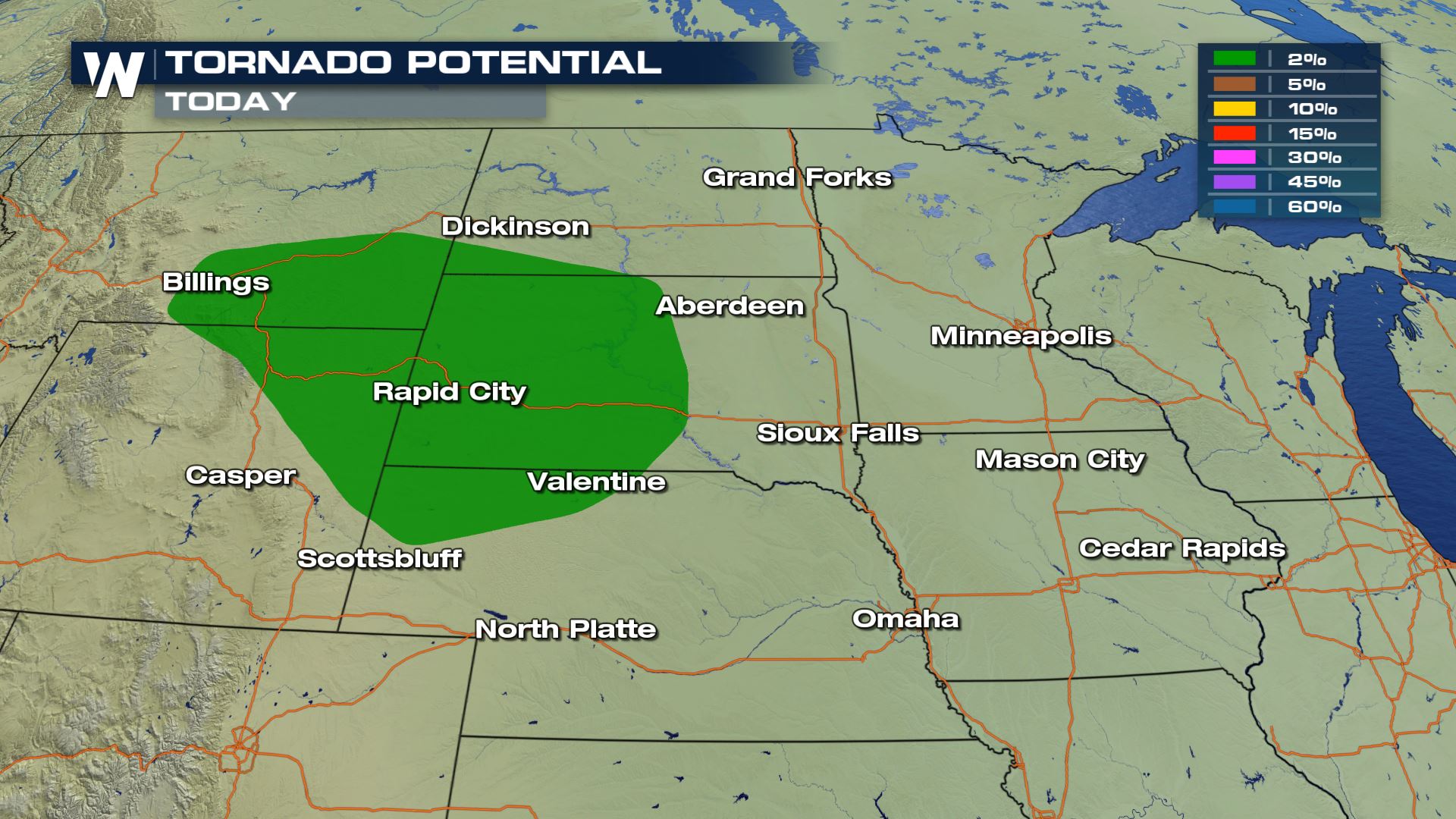
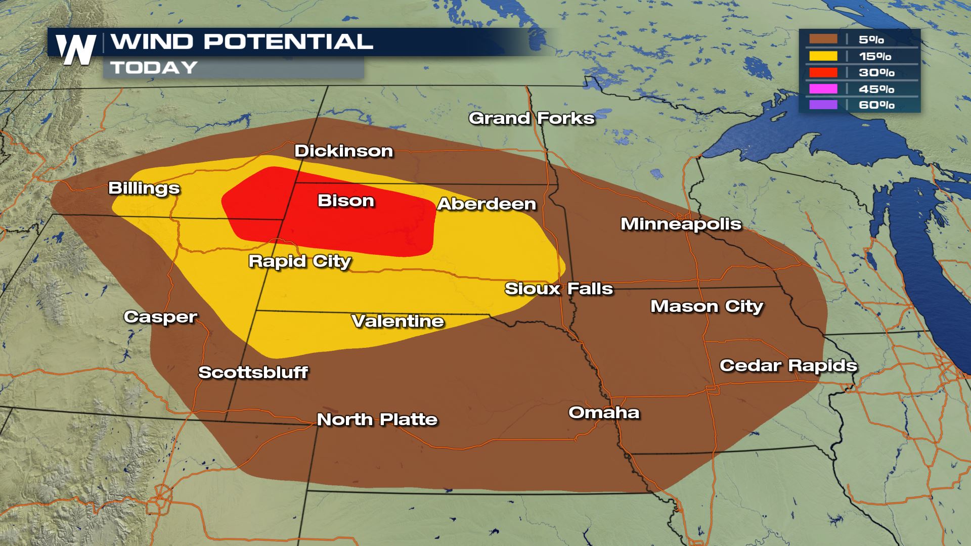
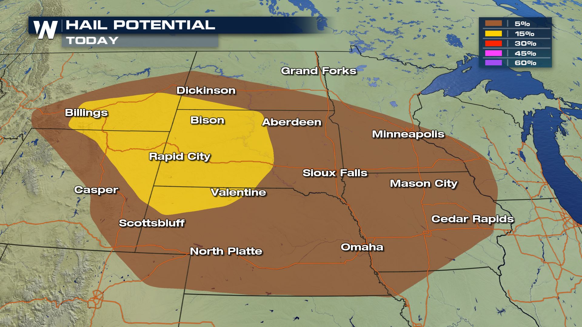 All modes of severe weather will be in play today, but hail and damaging winds will be the main severe risks. Cities like Rapid City will have the highest chance of severe weather today with the risk of large hail, damaging winds and tornadoes.
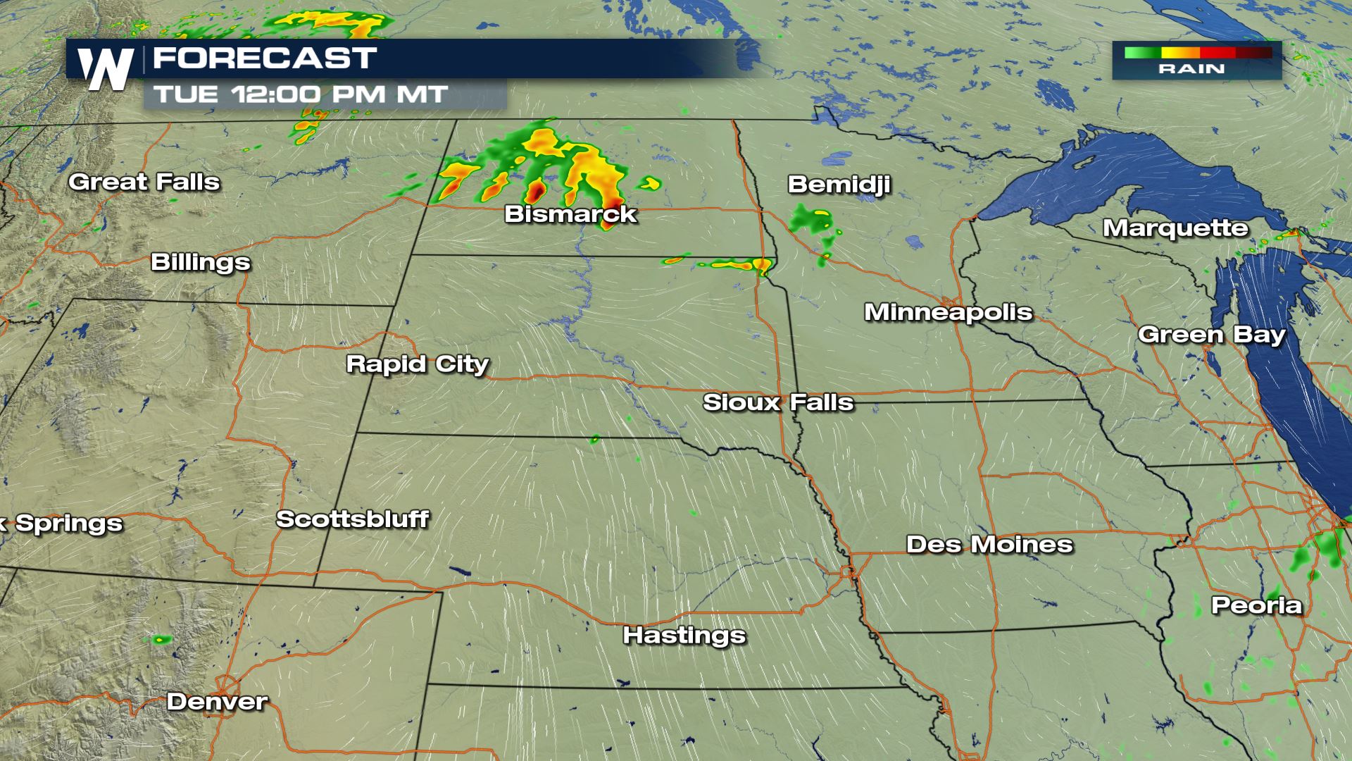
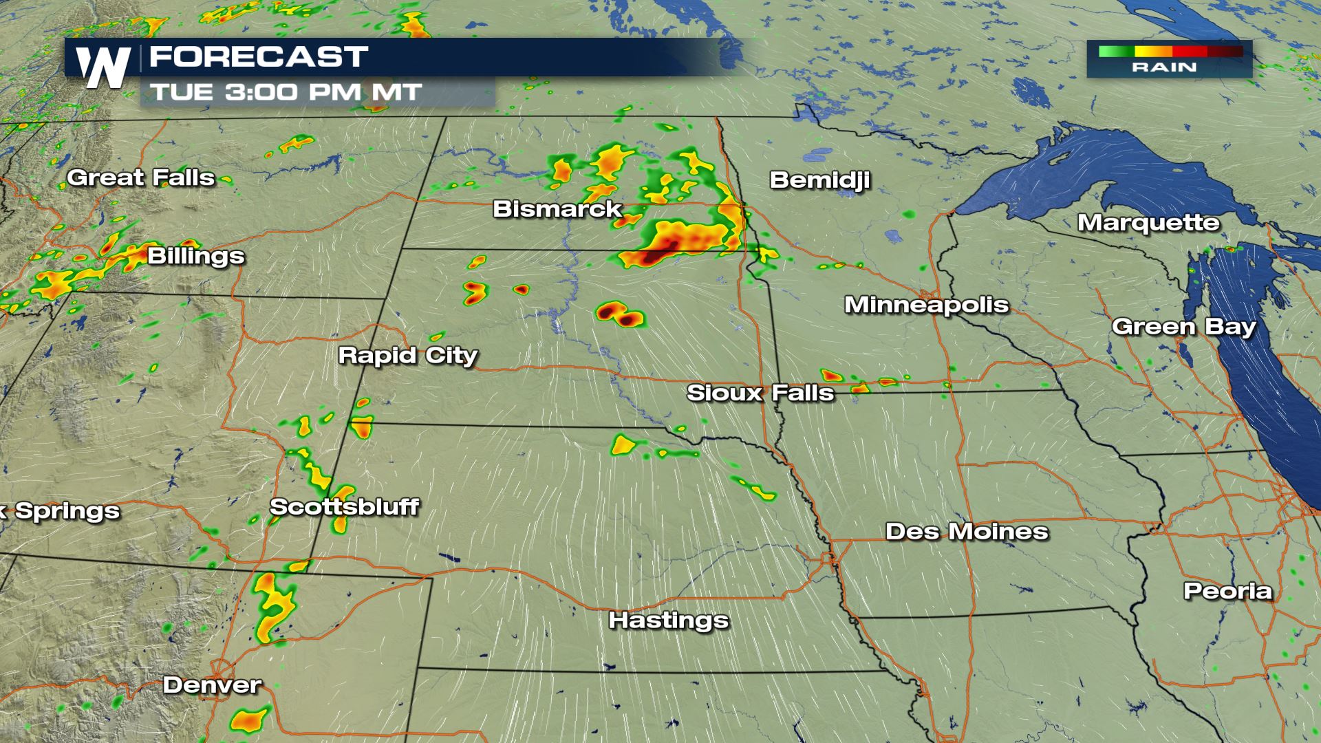
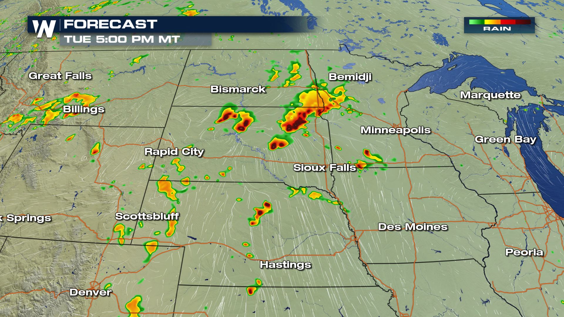
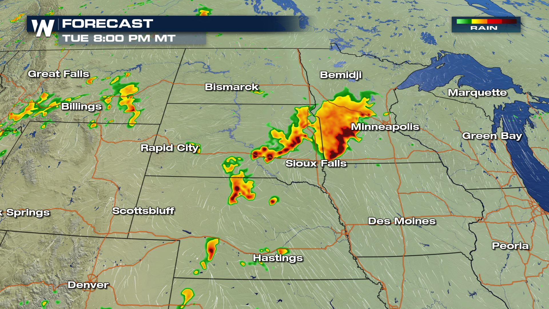 The timing for today's storms should be during the afternoon. Some storms could linger through the evening with the strong mid-level winds in the forecast. You will want to be weather alert in theses areas and be ready to take shelter should a severe storms strike. Keep checking with WeatherNation for more severe weather updates.
Severe Outlook
 Anywhere from Montana to Iowa could see some severe storms today. This includes cities like Rapid City and Minneapolis. The highest chance for severe storms will be over South Dakota and Wyoming later today.
Severe Risks


 All modes of severe weather will be in play today, but hail and damaging winds will be the main severe risks. Cities like Rapid City will have the highest chance of severe weather today with the risk of large hail, damaging winds and tornadoes.
Forecast


 The timing for today's storms should be during the afternoon. Some storms could linger through the evening with the strong mid-level winds in the forecast. You will want to be weather alert in theses areas and be ready to take shelter should a severe storms strike. Keep checking with WeatherNation for more severe weather updates.
All Weather News
More