Severe Threat Upgraded for Sunday
Top Stories
22 Apr 2018 2:47 PM
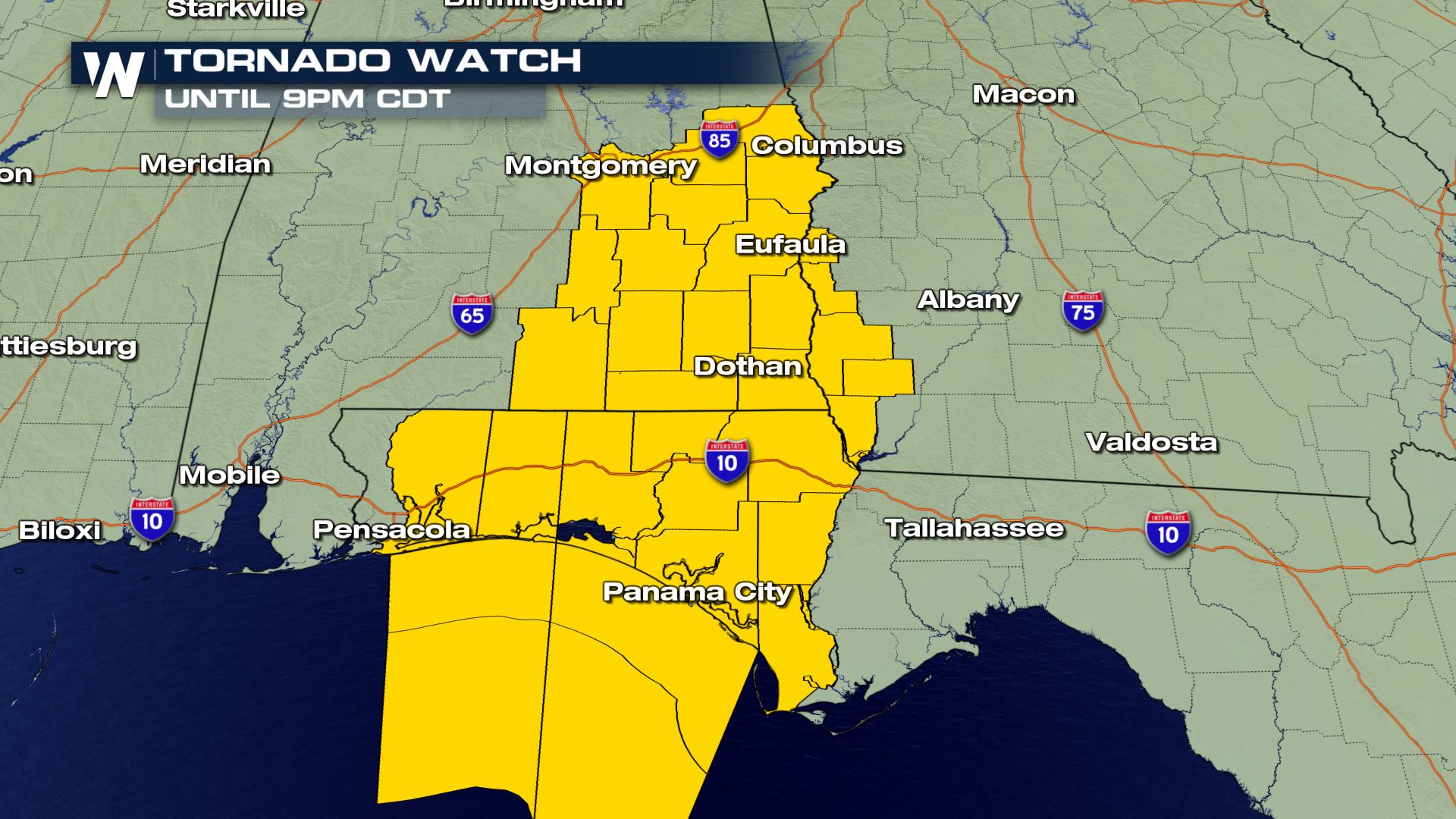
A new Tornado Watch has been issued for portions of Alabama, Florida and Georgia through 9pm Central Daylight Time on Sunday.
Several tornadoes had already been reported across parts of the Southeast on Sunday, including some damage south of New Orleans with a possible tornado earlier on Sunday.
 Now, the threat has shifted further off towards the east, with the main area of concern in parts of Alabama, Georgia and Florida, where several Tornado Warnings were issued on Sunday afternoon. A Tornado Watch means conditions are favorable for tornadic development. Have a plan ready to go in the event that a Tornado Warning is issued for your location.
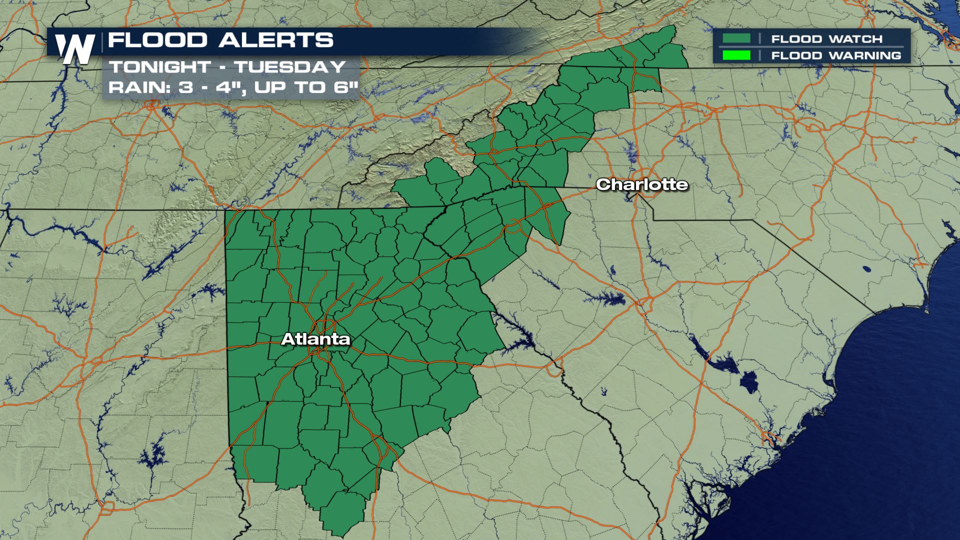
Heavy rain will also bring an increasing threat for flooding, especially into the Appalachians as the night wears on. A Flood Watch has been issued through a wide swath of the Southeast as well
 .
The storm system responsible for the severe weather moves east quickly on Monday, mostly impacting the Carolinas and the Mid-Atlantic before moving north by Tuesday and Wednesday. The severe weather threat is expected to rapidly diminish by Tuesday as the storm moves into cooler air in the Northeast.
Stay with WeatherNation for the latest on this round of severe weather and possible flooding.
For WeatherNation: Meteorologist Chris Bianchi
 Now, the threat has shifted further off towards the east, with the main area of concern in parts of Alabama, Georgia and Florida, where several Tornado Warnings were issued on Sunday afternoon. A Tornado Watch means conditions are favorable for tornadic development. Have a plan ready to go in the event that a Tornado Warning is issued for your location.
Heavy rain will also bring an increasing threat for flooding, especially into the Appalachians as the night wears on. A Flood Watch has been issued through a wide swath of the Southeast as well
 .
The storm system responsible for the severe weather moves east quickly on Monday, mostly impacting the Carolinas and the Mid-Atlantic before moving north by Tuesday and Wednesday. The severe weather threat is expected to rapidly diminish by Tuesday as the storm moves into cooler air in the Northeast.
Stay with WeatherNation for the latest on this round of severe weather and possible flooding.
For WeatherNation: Meteorologist Chris Bianchi
.
The storm system responsible for the severe weather moves east quickly on Monday, mostly impacting the Carolinas and the Mid-Atlantic before moving north by Tuesday and Wednesday. The severe weather threat is expected to rapidly diminish by Tuesday as the storm moves into cooler air in the Northeast.
Stay with WeatherNation for the latest on this round of severe weather and possible flooding.
For WeatherNation: Meteorologist Chris BianchiAll Weather News
More