Significant Icing Event for the Carolinas, Mid-Atlantic

A significant icing event is expected Saturday across the Appalachian Mountains, including the Blue Ridge and Smoky Mountains. Freezing rain and sleet will be possible from northern Georgia through the Ohio Valley. Closer to the I-95 corridor and the coast, this will be a rain event as temperatures are too far above freezing for anything wintry. This energy then moves into the Northeast, where it is shaping up to be a major winter storm.
Related Articles - What is Cold Air Damming and First Winter Storm of 2024 for the Northeast
There are widespread winter storm warnings and winter weather advisories in effect for the spine of the Appalachian mountains from North Carolina through Maryland. According to the National Weather Service, "Untreated roads and sidewalks will become slick and hazardous. Bridges and overpasses will be most susceptible to ice. Ice accumulations on trees and power lines may result in downed tree limbs and scattered power outages." Up to half an inch of ice could fall, with snowfall on top of the ice on Saturday.
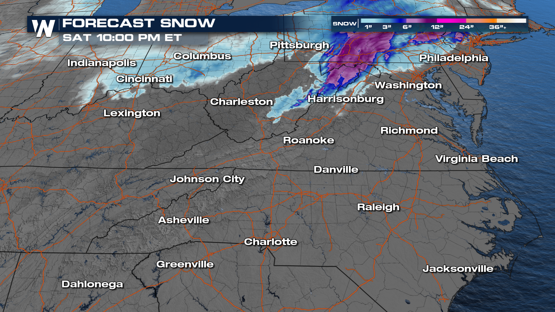
 Rain moved out of Tennessee and north Georgia overnight, spreading north and changing over to snow (in northern Ohio, Indiana) and ice as temperatures drop. Heavy icing is expected through the first part of the day on Saturday, especially for elevations in western Virginia, North Carolina and West Virginia.
Clearing will start from south to north in the second half of the day on Saturday as the low pressure system responsible for the messy weather tracks into New England.
Most of the precipitation with this system will be freezing rain, or plain ol' rain where temperatures are warm enough. Snow is possible in the higher elevations of West Virginia and western Maryland where temperatures are well below freezing. A coating of snow is likely in the Ohio Valley as well.