Texas Snow

Special Stories
12 Dec 2018 7:26 AM
Last Saturday, parts of west Texas endured a winter wallop! The Panhandle city of Lubbock picked up 10 inches of snow, setting a record for December 8th.
https://twitter.com/WeatherNation/status/1071607171123634176
Well, here we go again! Thanks to cold air filling in from the north, snowflakes were flying as early as Thursday morning in the Midland-Odessa area of west Texas.
https://twitter.com/WeatherNation/status/1073254782263939072
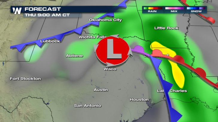
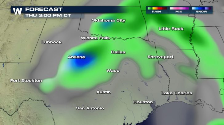
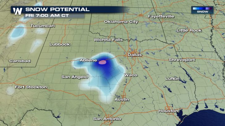
A Winter Storm Watch was upgraded to a Winter Weather Advisory for parts of the Lone Star State near Abilene. Areas west of the Dallas-Fort Worth Metroplex can expect rain mixing with and changing to snow. The chance for snow will linger until around 6am or so Friday morning.
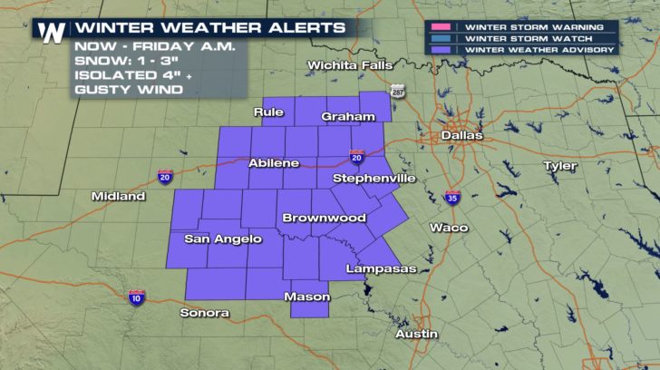 Snow will accumulate between 1 and 3 inches. A few locations may pick up closer to 4 or 5 inches. In addition to snow, wind gusts may top 50 mph. This will certainly set the stage for hazardous driving conditions.
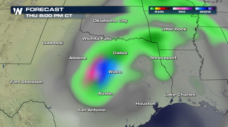
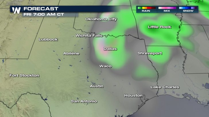 Dallas and Austin may potentially see a few flakes mixing in on Friday morning, although accumulations will be light, if any.
 This is the same storm system that will bring the risk of severe weather and flooding elsewhere across the South. Be sure to follow WeatherNation on Facebook and Twitter for the latest forecast information.
- Meteorologist Joe Astolfi
This is the same storm system that will bring the risk of severe weather and flooding elsewhere across the South. Be sure to follow WeatherNation on Facebook and Twitter for the latest forecast information.
- Meteorologist Joe Astolfi
Snow will accumulate between 1 and 3 inches. A few locations may pick up closer to 4 or 5 inches. In addition to snow, wind gusts may top 50 mph. This will certainly set the stage for hazardous driving conditions.
Dallas and Austin may potentially see a few flakes mixing in on Friday morning, although accumulations will be light, if any.
This is the same storm system that will bring the risk of severe weather and flooding elsewhere across the South. Be sure to follow WeatherNation on Facebook and Twitter for the latest forecast information.
- Meteorologist Joe AstolfiAll Weather News
More
Wildfire Outbreak in the Pacific Northwest
Conditions have been incredibly dry out west.
2 Aug 2026 12:20 PM


More Storms for the East Sunday and Monday
A low-pressure system crashing through the Mi
2 Aug 2026 2:20 AM

After Reaching Category 5, Genevieve Weakens in the Pacific
PacificGenevieve formed on last Friday south
2 Aug 2026 1:30 AM

Flooding, Severe Storms Target the Midwest Again
After an active week of storms across the nor
1 Aug 2026 1:40 AM

Flooding Risk Increases as Heavy Rain Targets the Tri-State Area
Tuesday, heavy rainfall moved across the Nort
30 Jul 2026 12:25 AM

Severe Weather: Energy From the Midwest Now in the Southeast
UPPER MIDWEST - Through Monday, dangerous tor
29 Jul 2026 10:30 PM