EF-4 Tornado Hit Oklahoma Monday, May 6

The town of Barnsdall, OK took a direct hit from a confirmed tornado in the evening hours. Sights like this are truly heartbreaking, and unfortunately, daylight brought more images of destruction in Barnsdall, roughly 40 miles north of Tulsa. Initial surveys from the National Weather Service office in Tulsa, confirm EF-4 tornado damage in the town with much of the area seeing EF-3. The storm was on the ground for 39 miles from Barnsdall to Bartlesville.
A tornado emergency was issued as the storm was moving through the town, which is the highest level of tornado warning that the National Weather Service can issue. Sadly, one person was killed by this storm.
Our field crews were some of the first on the scene in the town to help people escape from their collapsed homes. This is the second EF-4 tornado to hit Oklahoma in less than 2 weeks - an EF-4 touched down in a tornado outbreak April 27-28 hitting the town of Marietta, OK closer to Oklahoma City.
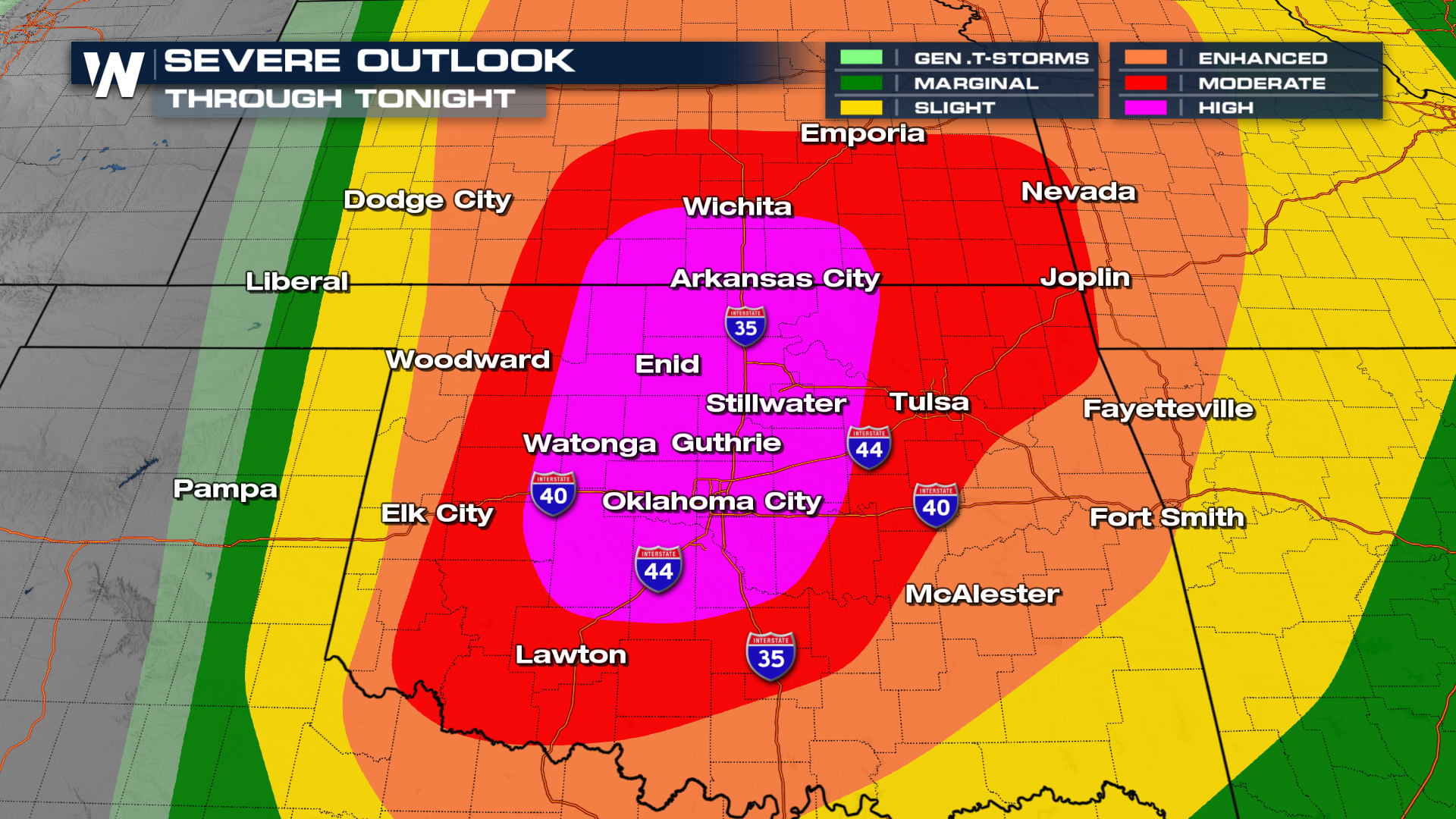
The Storm Prediction Center issued a HIGH risk for severe weather on Monday. The risk is the highest threat level the severe weather outlook goes up to (level 5 out of 5). The last time a storm threat of this magnitude was issued was on March 31, 2023. It covered much of the I-35 corridor including Oklahoma City and Guthrie. Later in the evening, it was expanded east to include the Tulsa metro.
Related article: Severe Storms Push East through Thursday
 Storms had incredible structure over the Plains on Monday night, fueled by large amounts of energy, spin in the atmosphere and ample moisture.
The severe storm reports from Monday primarily came out of Kansas and Oklahoma. It lined up very well with where the high risk was issued between the two states. Most of the reports were from large to giant hailstones and strong, damaging winds showing up in the yellow and blue dots below. A few tornadoes touched down in the Plains, indicated by the reports in the red dots.
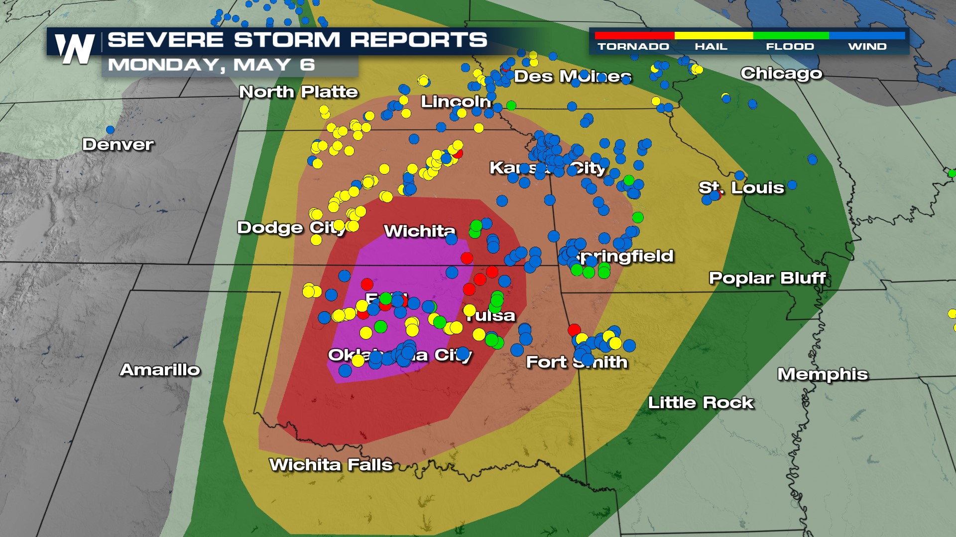 Hailstones the size of SOFTBALLS fell in Moonlight, Kansas on Monday. We didn't stop there though, even Canton, OK, and Riley, KS had to deal with baseball-sized hail from some of the supercells that formed in the second half of the day.
 Please continue to stay weather-aware as the severe threat doesn't disappear, it pushes to the east.


