Tuesday's Severe Weather Forecast
Top Stories
18 Sep 2018 4:53 AM
A chance of more severe weather today for parts of the High Plains and Upper Mississippi Valley. Large hail and damaging winds will be possible along with intense rain. Here is the very latest.
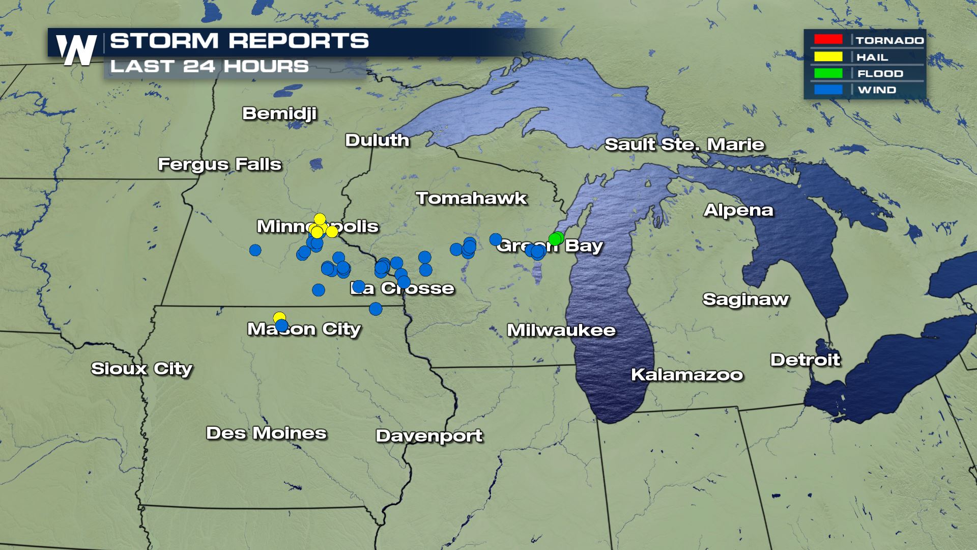 A lot of the same areas that have had severe weather over the last 24 hours could be looking at more again this afternoon and evening.
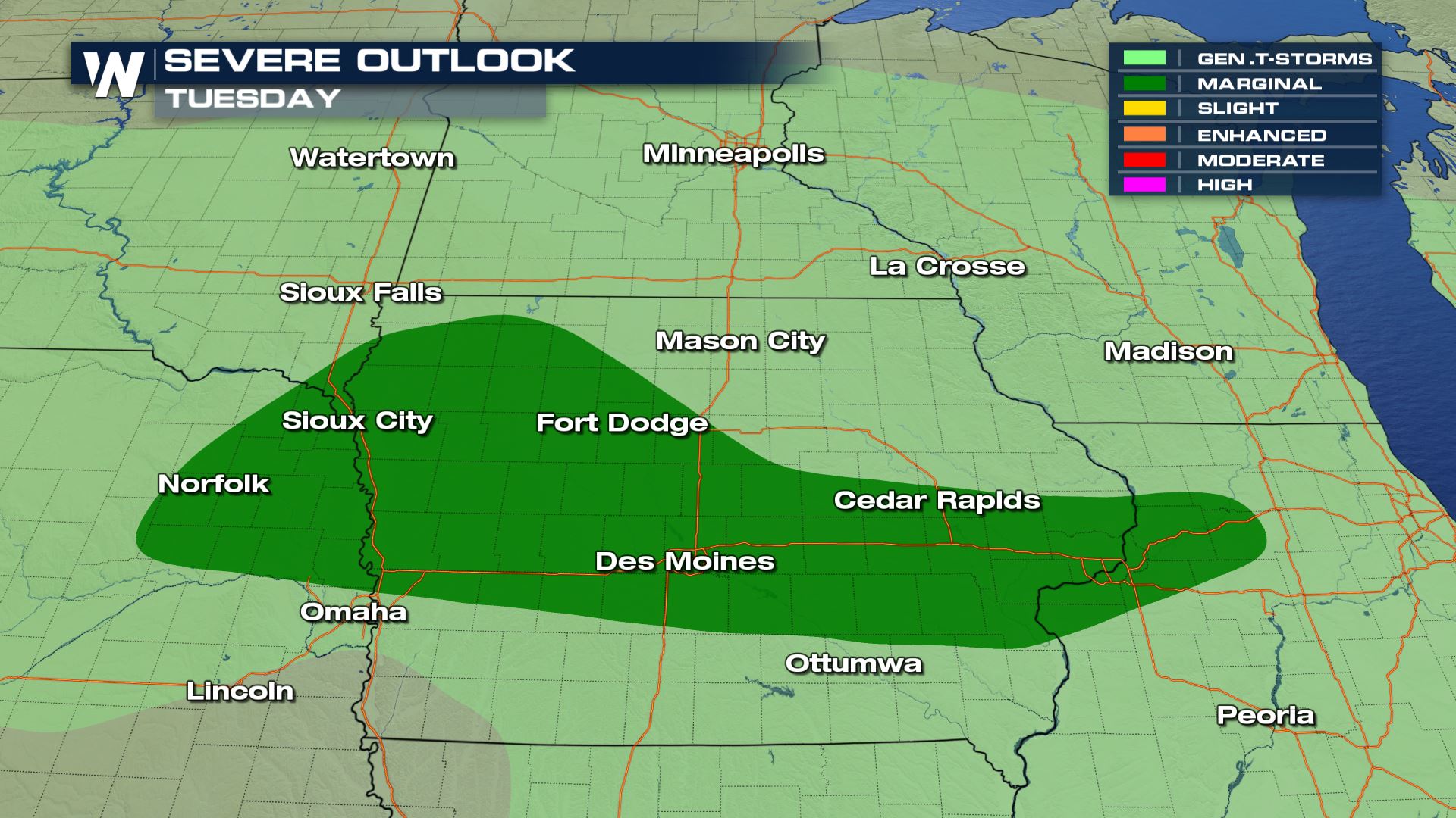 A marginal risk of severe weather has been issued from the Storm Prediction Center for South Dakota, Iowa and southern parts of Illinois. This means isolated severe storms will be possible.
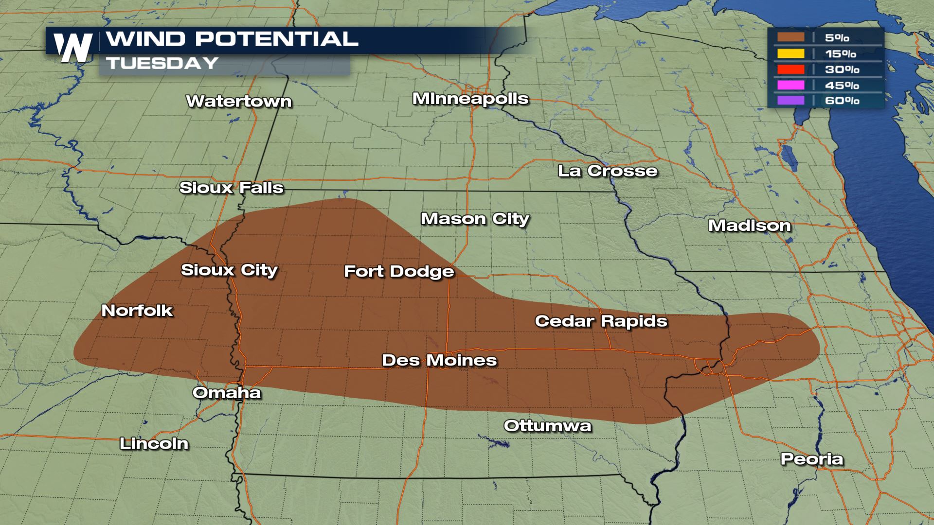
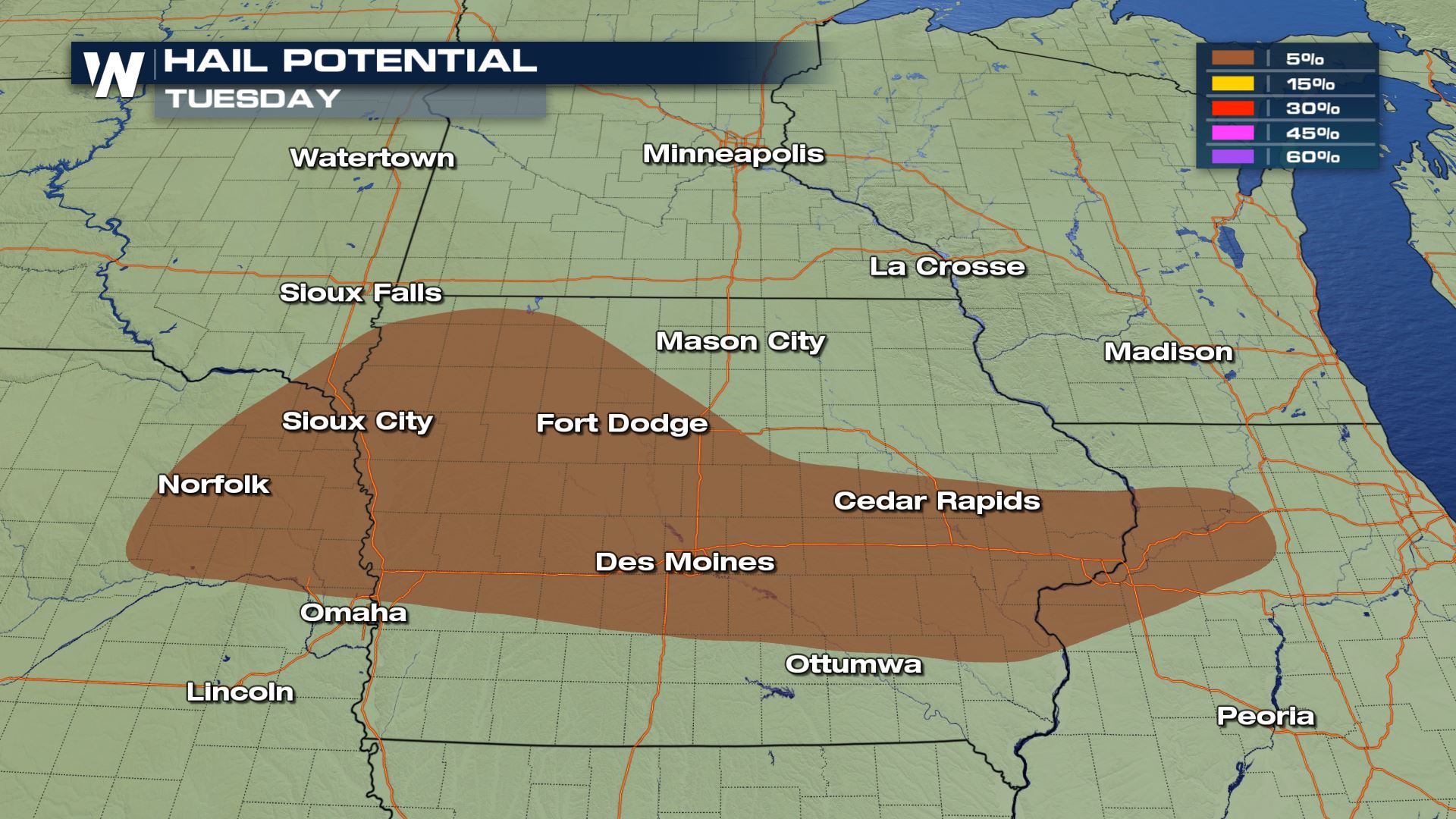 Hail up to 1" in diameter and wind gusts over 58 mph will be possible. Definitely need to be weather aware in these areas.
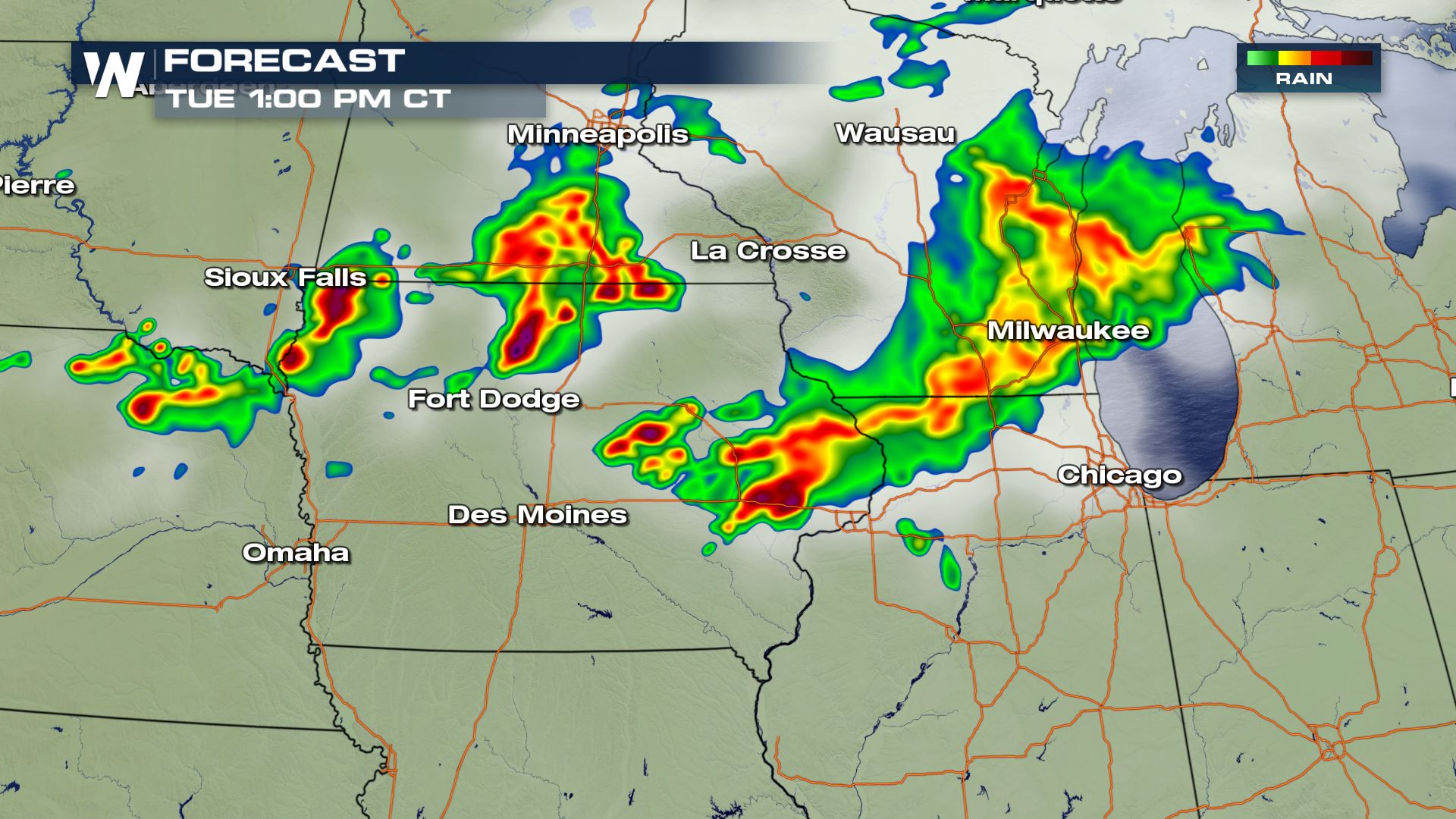

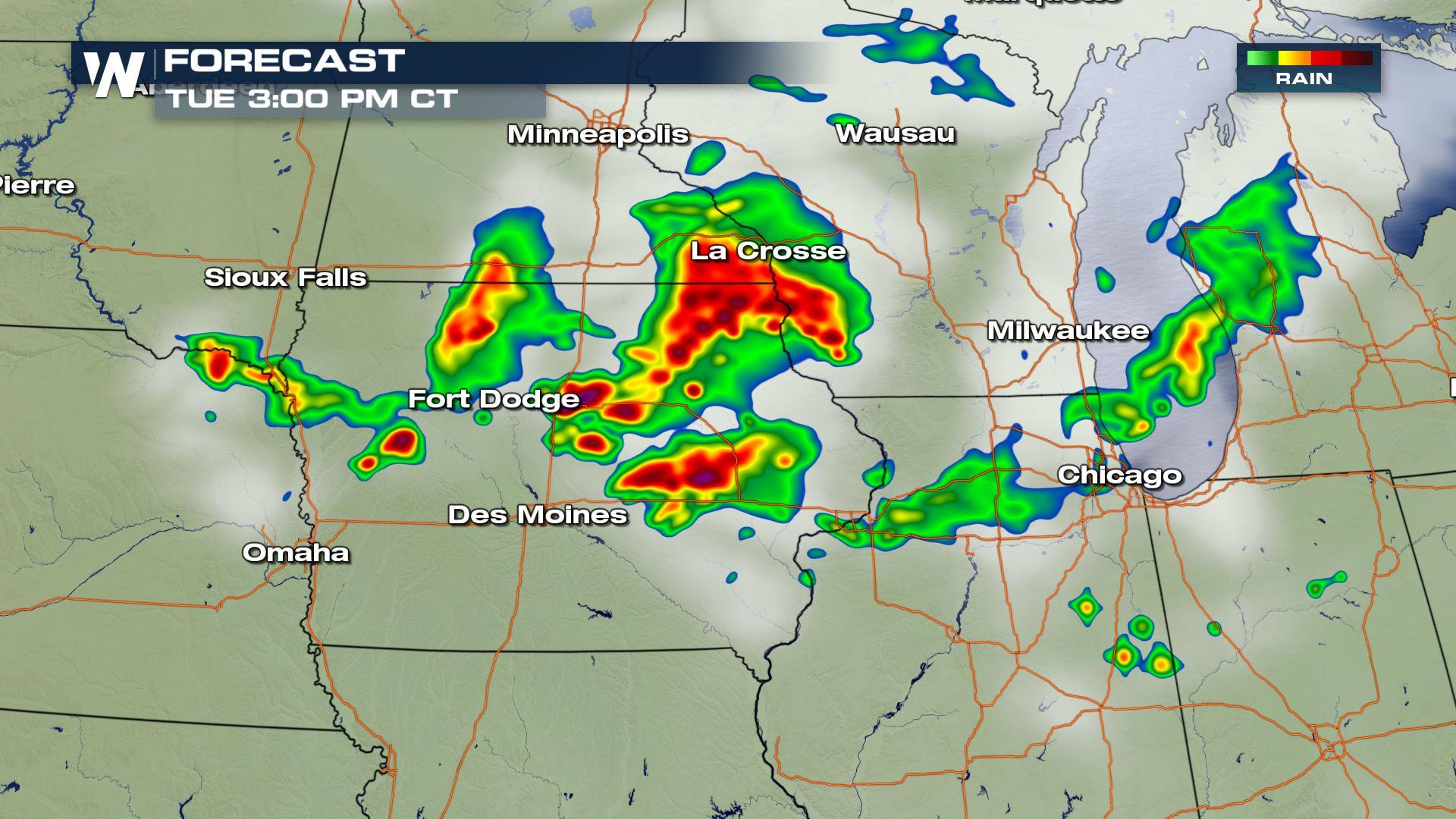
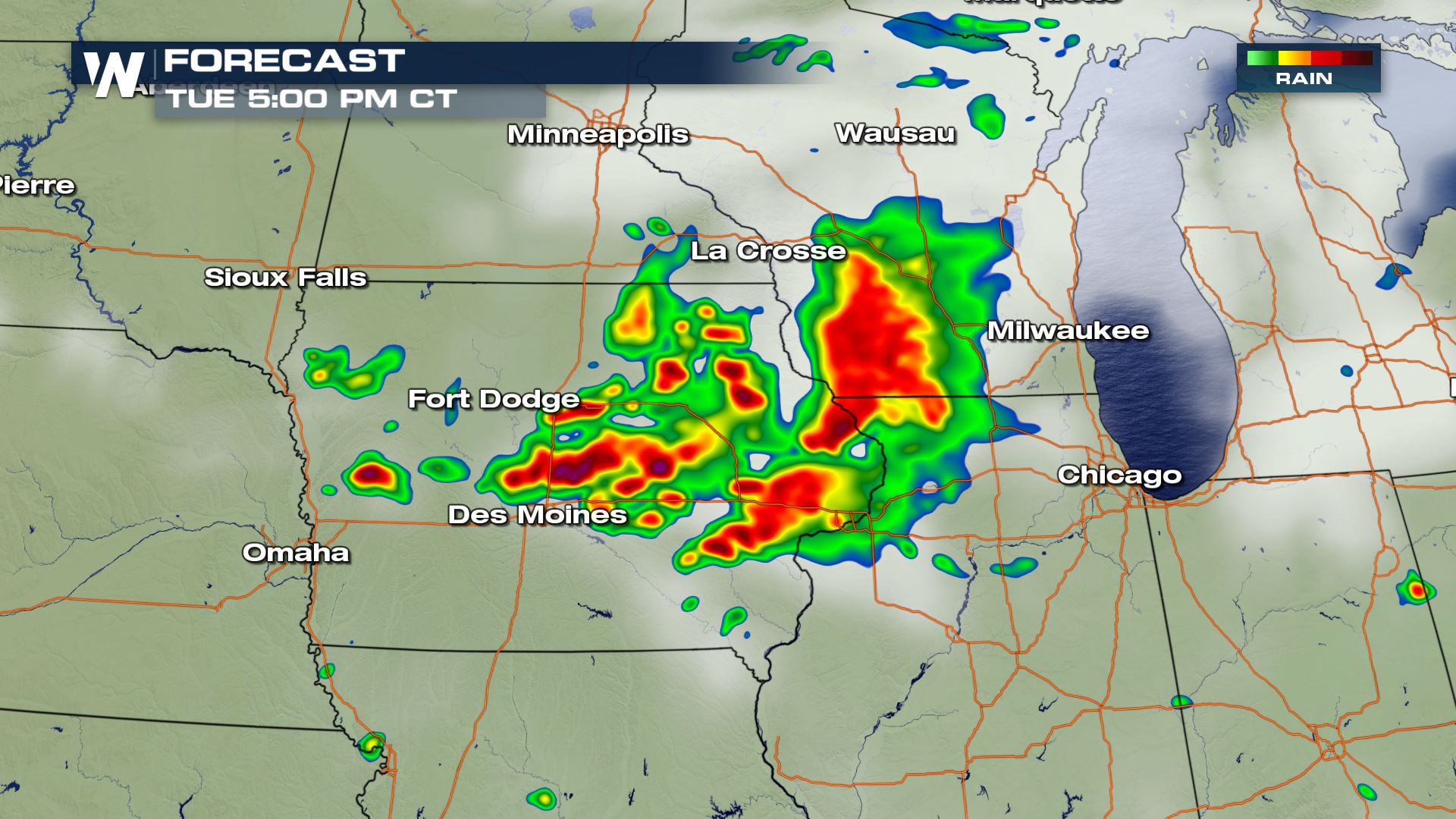 You can see the timing for today's severe storms will be during the afternoon and the early evening hours. Keep checking WeatherNation for the very latest updates.
Storm Reports
A lot of the same areas that have had severe weather over the last 24 hours could be looking at more again this afternoon and evening.
Severe Outlook
A marginal risk of severe weather has been issued from the Storm Prediction Center for South Dakota, Iowa and southern parts of Illinois. This means isolated severe storms will be possible.
Severe Risks
Hail up to 1" in diameter and wind gusts over 58 mph will be possible. Definitely need to be weather aware in these areas.
Forecast
You can see the timing for today's severe storms will be during the afternoon and the early evening hours. Keep checking WeatherNation for the very latest updates.All Weather News
More
More Storms for the East Through Monday
A low-pressure system that moved through the
2 Aug 2026 10:40 PM

Wildfire Outbreak in the Pacific Northwest
SPOKANE, WA - On Saturday, August 1st, the Ol
2 Aug 2026 10:35 PM


After Reaching Category 5, Genevieve Weakens in the Pacific
PacificGenevieve formed on last Friday south
2 Aug 2026 6:25 PM

Flooding, Severe Storms Target the Midwest Again
After an active week of storms across the nor
1 Aug 2026 1:40 AM

Flooding Risk Increases as Heavy Rain Targets the Tri-State Area
Tuesday, heavy rainfall moved across the Nort
30 Jul 2026 12:25 AM

Severe Weather: Energy From the Midwest Now in the Southeast
UPPER MIDWEST - Through Monday, dangerous tor
29 Jul 2026 10:30 PM