Mountain Snow and Flooding Rain for California
Many places across California have already seen a fair amount of rain this year. For example, in January alone, San Diego accumulated over one-third of its yearly rainfall. With more rain in the forecast, saturated soils are a concern that could lead to excess runoff (flooding) and downed trees.
Related Article - More Rain and Snow this Weekend
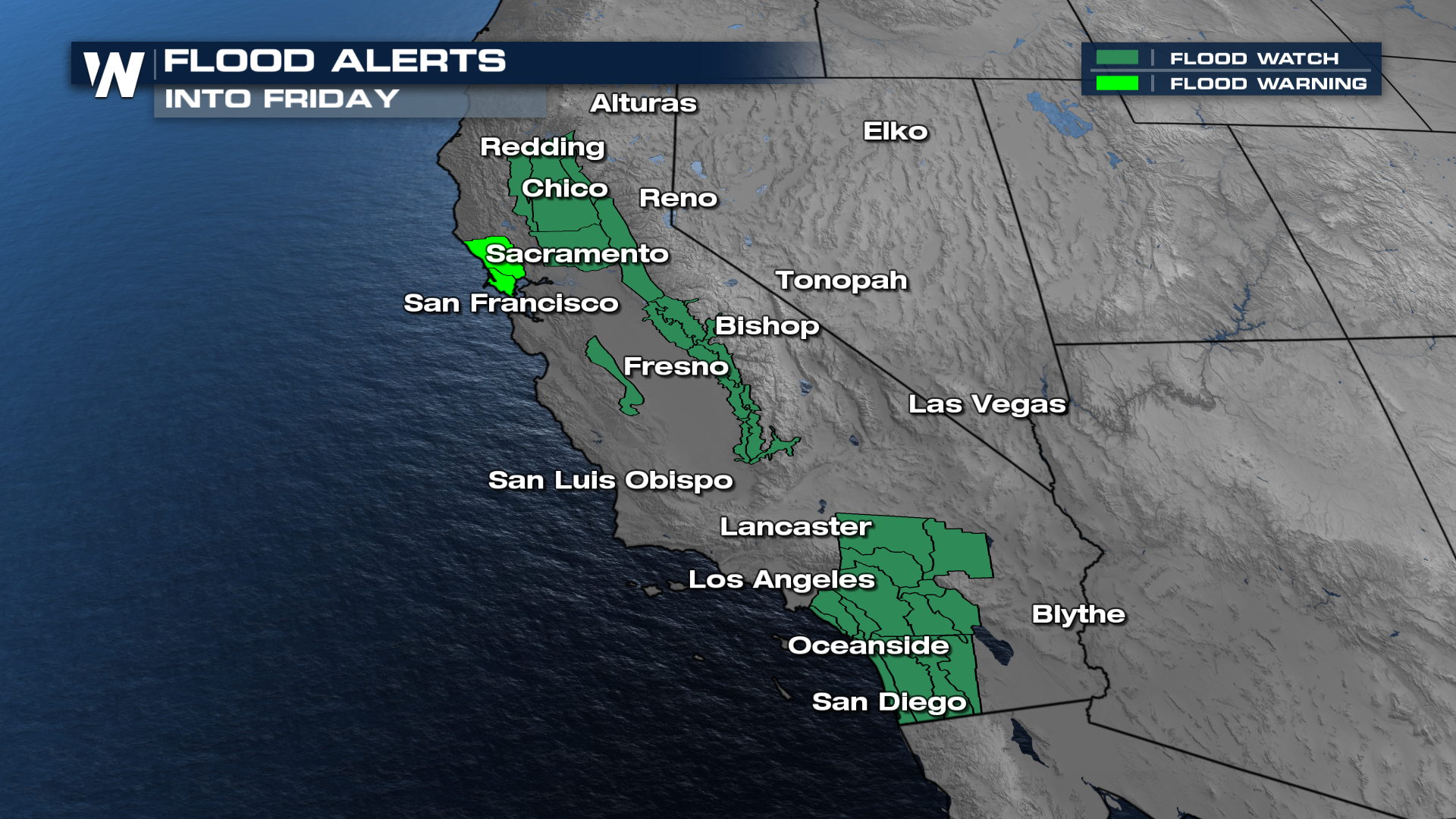
Flooding concerns are going to be prominent in many spots, but especially along and near the coastline. Flood alerts are in effect for cities including Sacramento and San Diego for additional rain and flooding possible overnight. Low-lying areas, streams, creeks, and rivers will all be prone to flooding. Please make sure to be safe when driving, and never attempt to drive through flood waters.
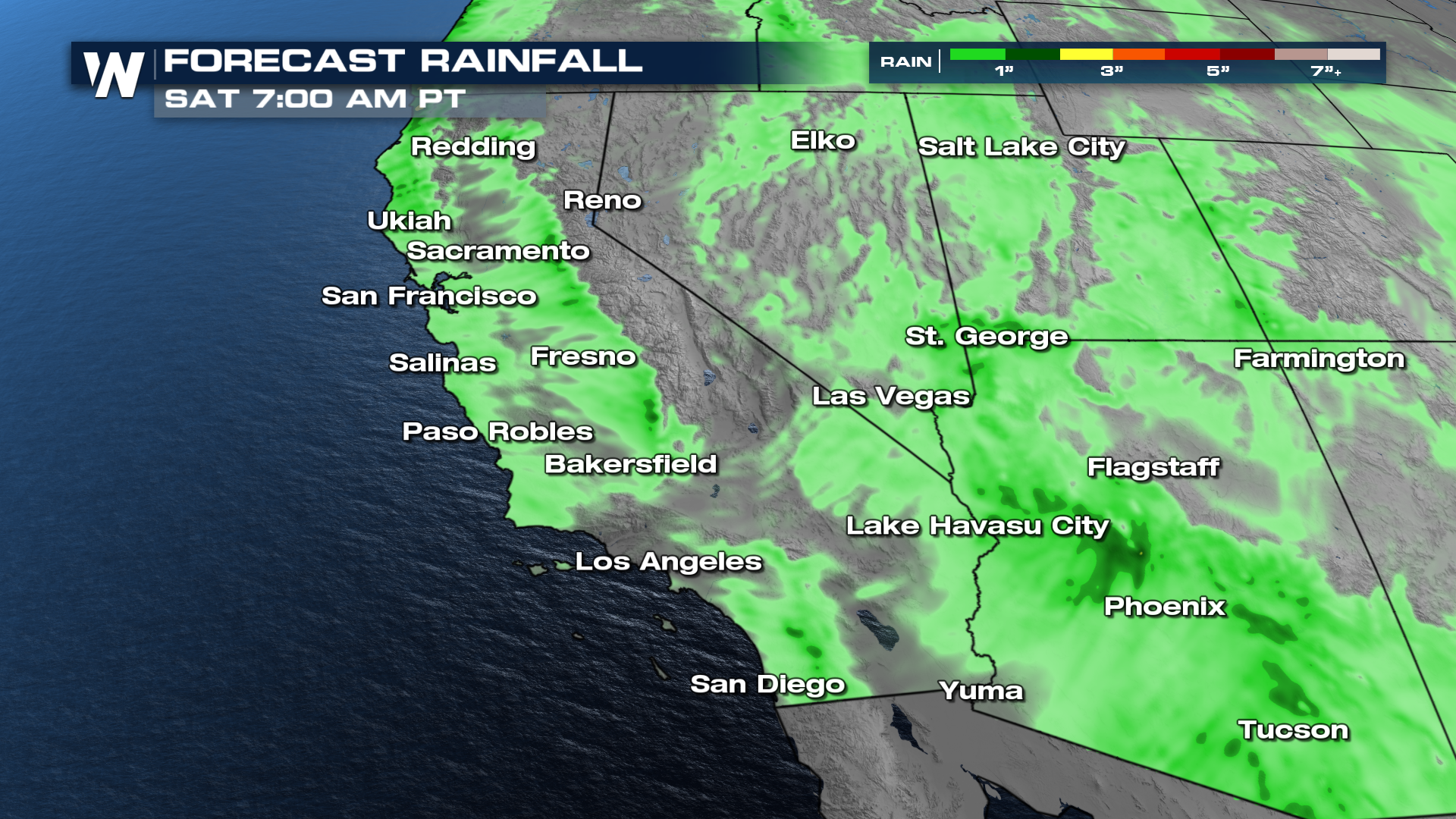
The heaviest rain continues in Southern California shifting east into the Mojave (east of SoCals mountains) and Sonoran Deserts through the afternoon where it turns to heavy rain and snow for the 4 Corners region. Cold air behind the front will still create steady snow for the Sierra, with scattered showers and even a few thunderstorms for lower elevations through Friday into early Saturday.
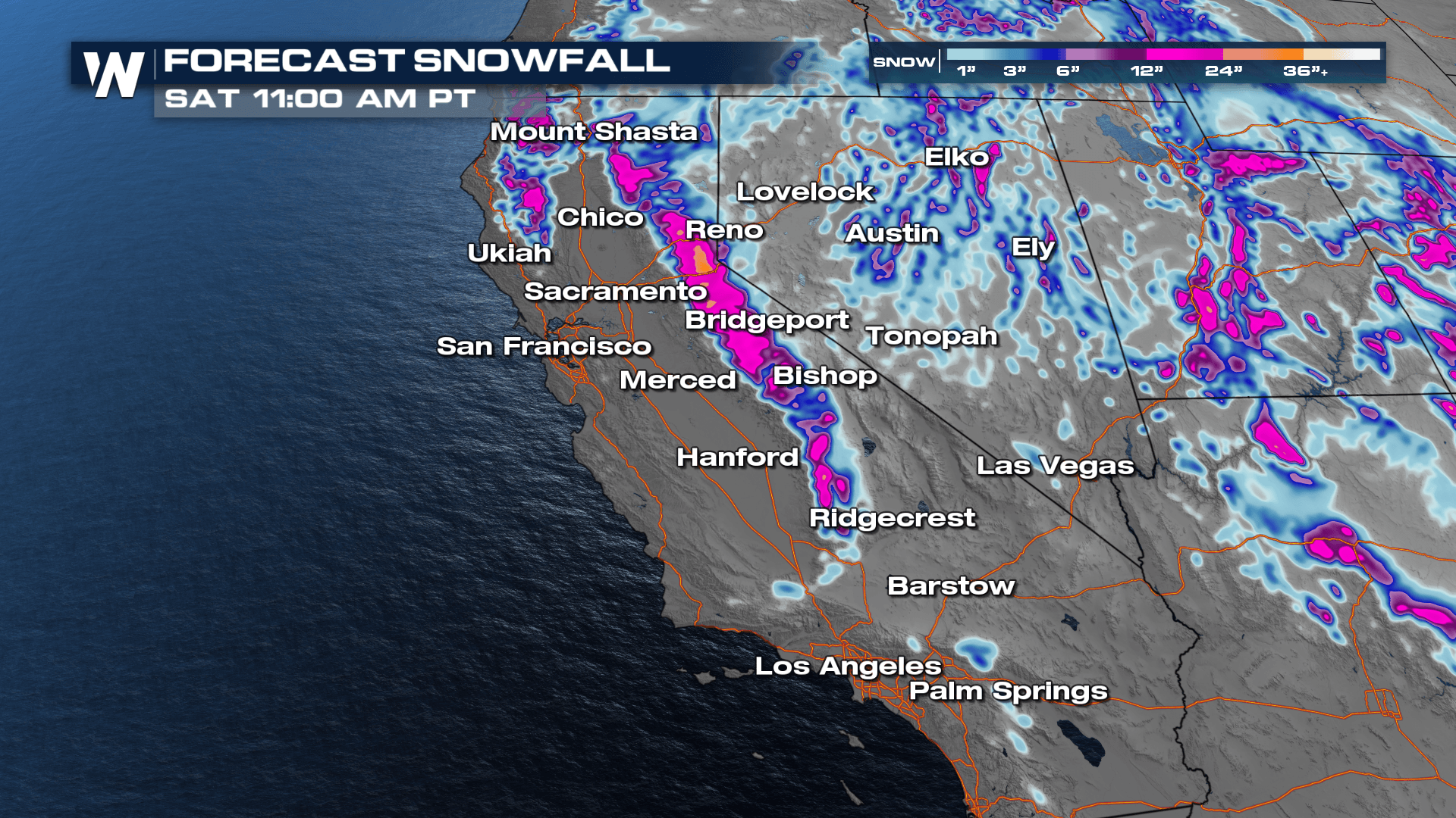
We have the potential to accumulate significant amounts of snow in the Sierras with upwards of a foot to possibly three in some locations. Winter weather alerts continue through the end of the week for up to three feet of snow for the highest peaks in the Sierras, along with gusty winds that could reduce visibility and make travel difficult to impossible. Highway 395 along the foothills of the Sierra will be extremely difficult to travel on at times.
 The Sierras aren't the only place expected to see heavy snowfall. Areas in and around the San Gabriel, San Bernadino, and San Jacinto Mountains have already been upgraded to a winter storm warning. Many peaks over 7,000 feet have the potential of seeing 12-18" of snow. Elevations less than 7,000 feet have the possibility of seeing 6-12".

There will be another storm system entering the California region Sunday and Monday. This particular weather event has the potential to bring record rainfall and high impacts to the state. Stay with us as we get closer to the 4th and 5th of February!


