Thunderstorms Now in Appalachia, East Coast
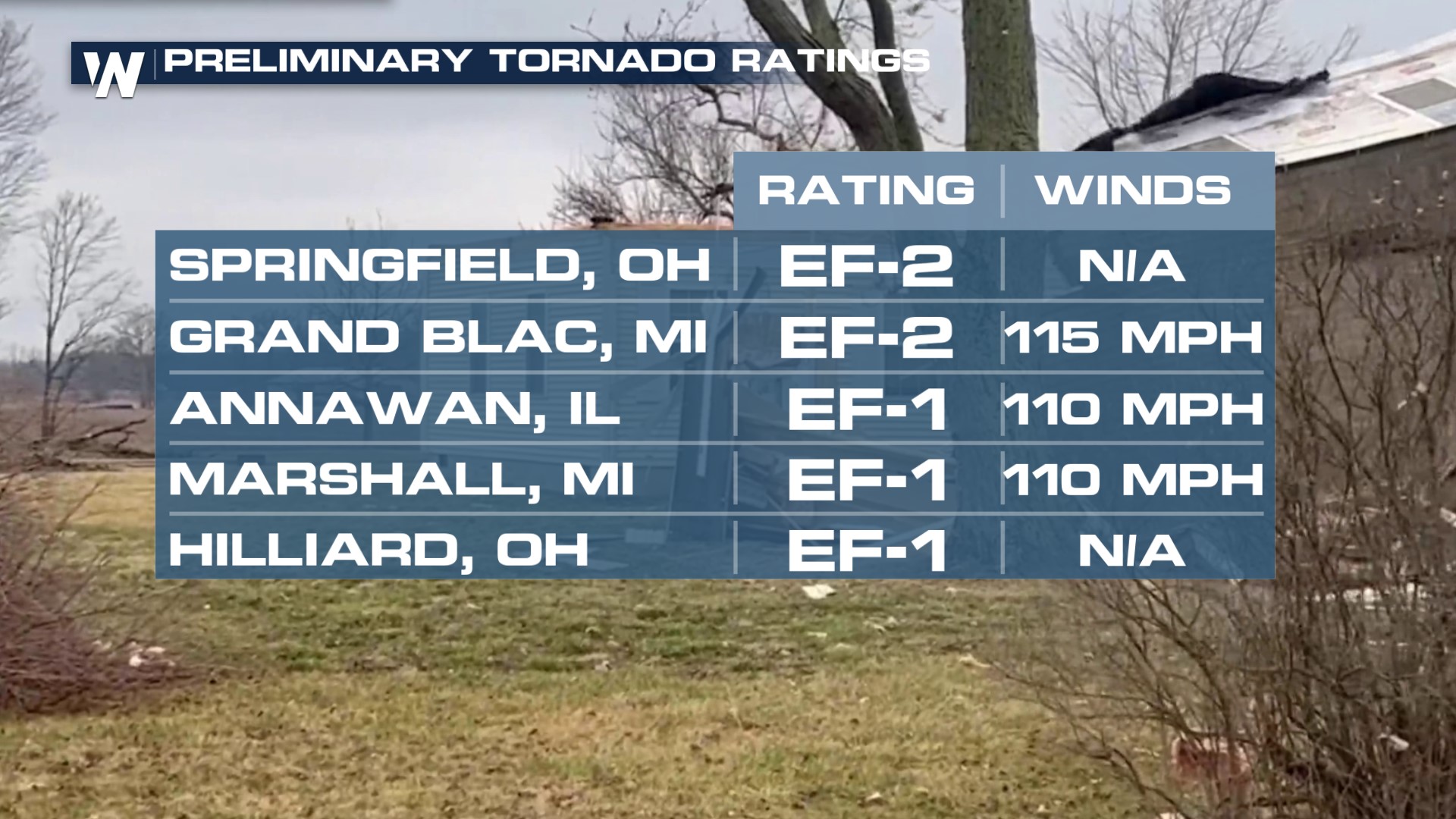
The same system that moved through the Midwest with a severe threat is hitting the Northeast with heavy rain and cold air. For the rest of the night, showers and thunderstorms are likely into New England! We've already seen numerous confirmed tornadoes from this line of storms back into the Ohio Valley.
 Temperatures plummet quickly behind the front as cold air meets the moisture to produce snow by Wednesday night. Right now the snow looks to continue through the earliest morning hours on Thursday. As temperatures drop overnight, rainfall on the roads could quickly freeze into black ice.
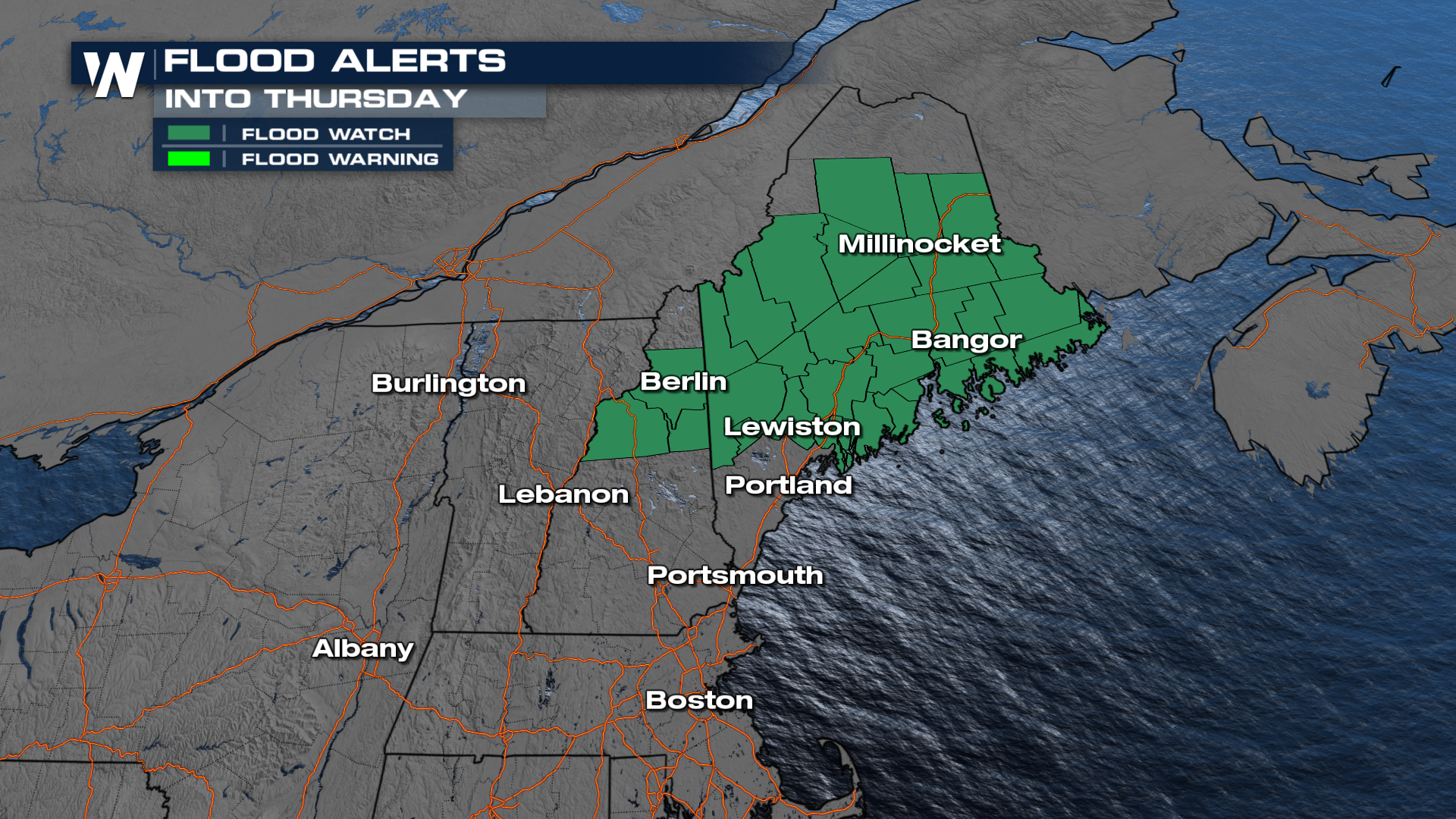
Flood Watches are in place through early Thursday for parts of New Hampshire and most of Maine. Remember, Do not drive through flooded roadways.
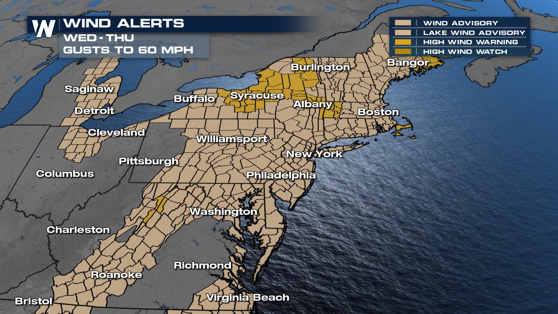
 It will be very windy before and after this cold front moves through the eastern U.S. Wind alerts remain in effect into Thursday morning for the Appalachian Mountains, DelMarVa, mid-Atlantic, and New England regions. Wind gusts may reach up to 40-50 mph!
